Travels with Dick and Karen
Glacier Fall 2012
Part 3
More Mountains
(Jasper to Baker) |
 |
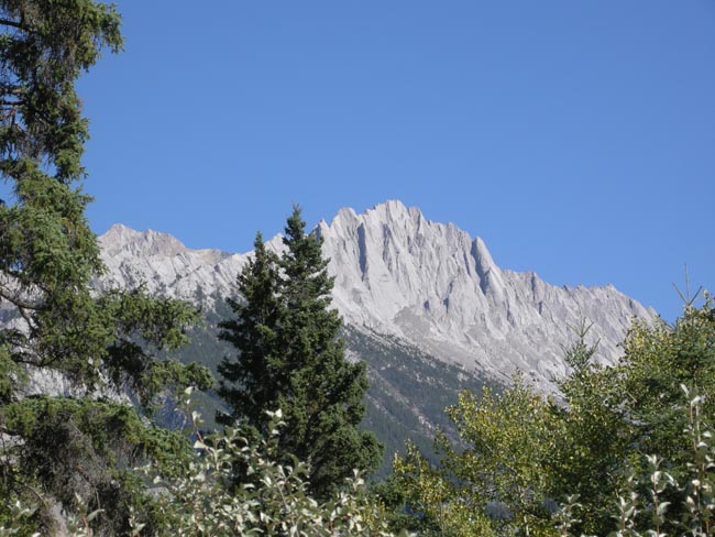
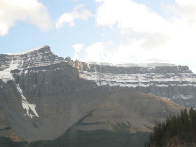
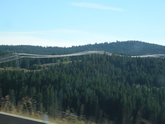
| 150 miles or so west from Edmonton we began to re-encounter the Rockies. |
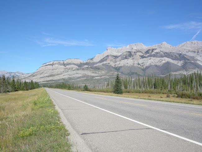 |
With people almost walking on the water (the Snaring River near Jasper was notably wide and shallow at this time of year -- but it DOES still come from melting snow). |
 |
Pedestrians are a traffic hazard. |
 |
| Sometimes the idea of a "Continental Divide" becomes crystal-clear |
 |
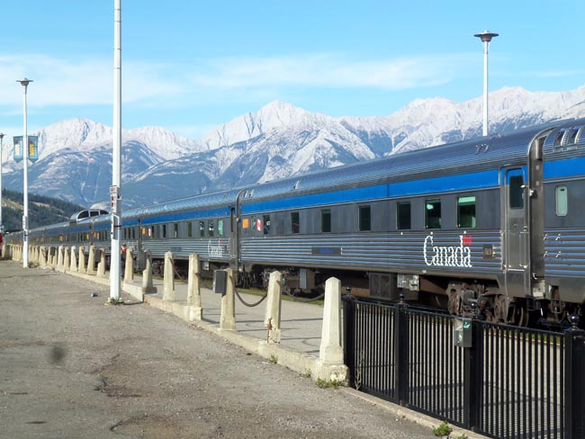
| As in the US, two competing railway companies spanned Canada. The Canadian Pacifc line routed through Banff, and the Canadian Northern (CN) routed through Jasper. Both built hotels and lodges to attract tourists to use their lines. CN has been renamed to Canadian National.
Jasper is still a Canadian National Railroad stop for their "Canadian" (shown) cross-continent and Jasper-to-Prince Rupert ("Rocky Mountaineer") services. |
 |
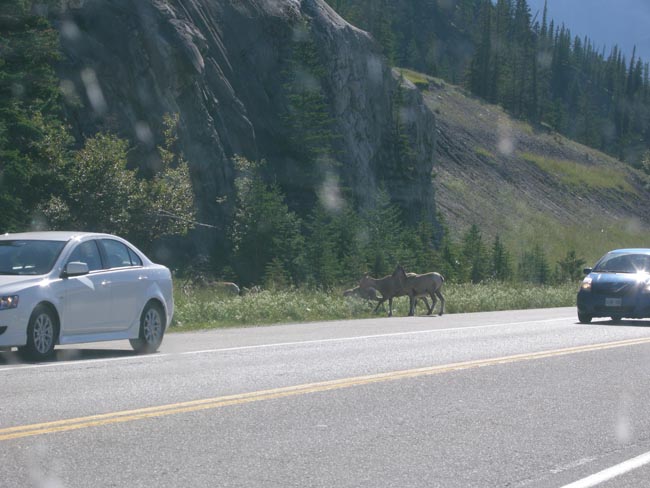
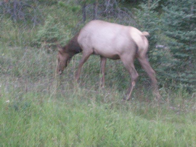
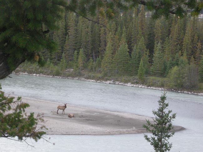
| Elk graze through too... |
 |
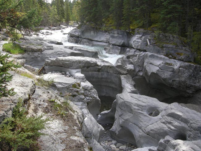
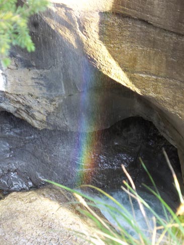
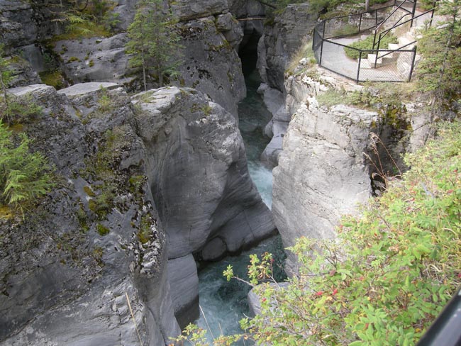
| A little bit east from Jasper, along the Maligne Valley Road, is a pleasant trail that closely follows the water-carved gorge of the Maligne River. |
 |
Replete with rainbows... |
 |
| ...protected overlooks... |
 |
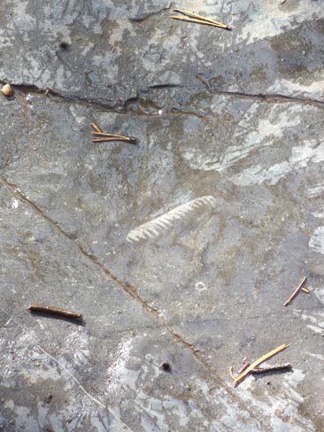
...fossils... |
 |
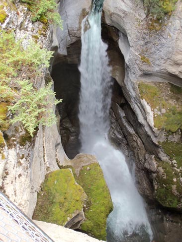
... and falls. Once more bears intruded upon our plans... the trail we were following was closed due to bear activity just below the developed portion. |
 |
| Elk laze on an island at a wide spot in the Snaring River. |
 |
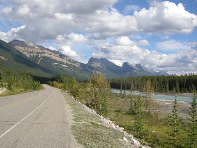
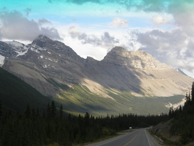
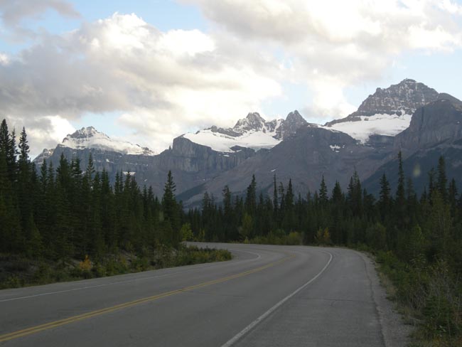
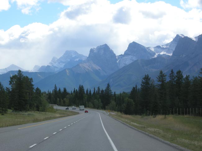
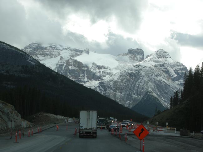
After the hike, we drove back through Jasper for lunch, then headed south on the Icefield Parkway.
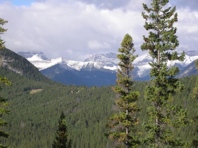
The 144-mile long Icefield Parkway connects Japser and Banff by driving between two parallel ridges of the Rocky Mountain chain.
It is, in a word, spectacular. This trip marks Dick's 6th time along it, and Karen's 4th. It definitely
has our votes for the most magnificent mountain scenery you can easily drive through.
(We do admit to a slight bias for the north-to-south direction)
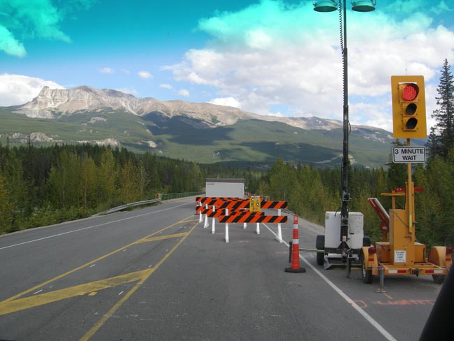
(despite the inevitable summer roadwork) |
 |
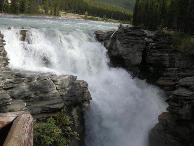
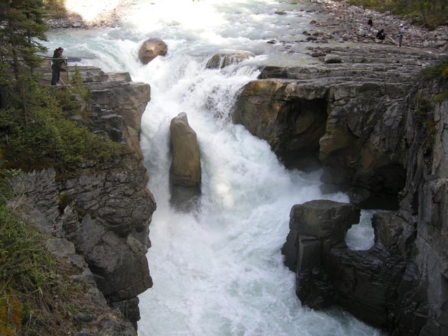
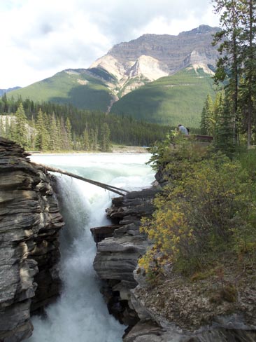
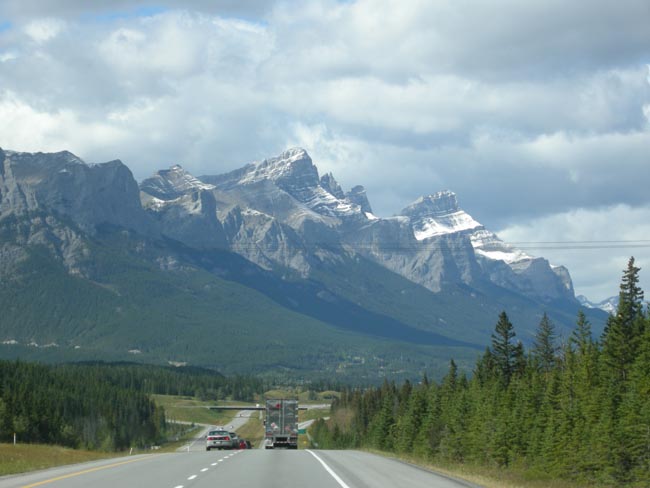
| There are many turnoffs and to-the-side trails and scenic spots. Many involve thundering watercourses, like Athabasca Falls...... |
 |
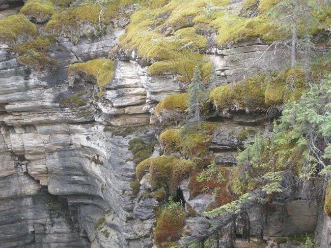
| ...and the deeply-cut channels they run through. |
 |
| There are mountains passing by on the right (west, in this direction), across the Athabasca River... |
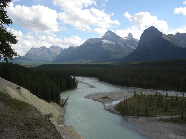 |
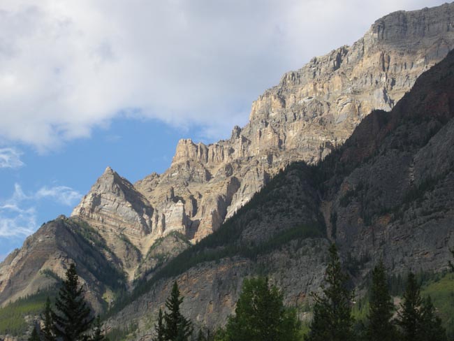
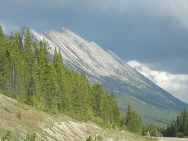
| Sheer faces of uplifted crust... |
 |
| ...continuing as far as we can see on the left, too. |
 |
| Sunwapta Falls |
 |
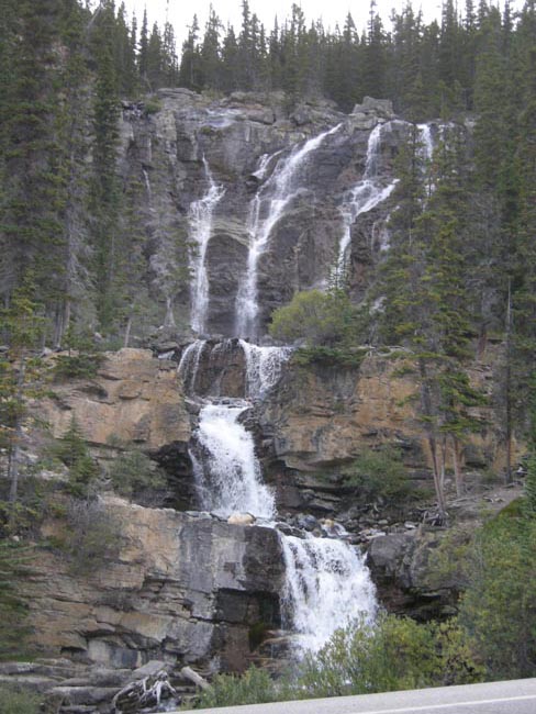
| (OK,OK... falls too numerous for us to recall which is which...) |
 |
| On the far side is the face of the lifted crust... this side was once level ground. |
 |
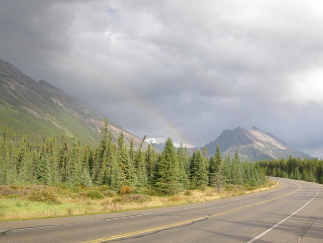
| As the day wore on, the sky filled and lowered. Snow flurries were forecast. |
 |
| ...but where there's rain, there are frequently rainbows. |
 |
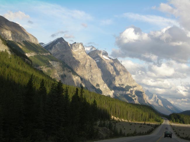
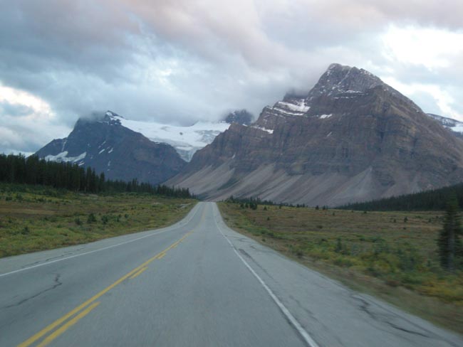
| Snowfields and glaciers lined the western faces as the road gradually climbed to its highest pass. |
 |
| |
 |
| Sometimes the waterfalls came to us, only needed a pull-off to the side of the highway. |
 |
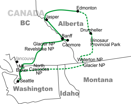
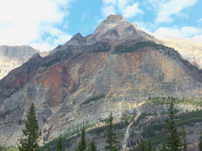
The peaks and the road continue to rise (looking back over our right shoulder).
Vegetation gives way to the gravel fields of glacial moraines. |
 |
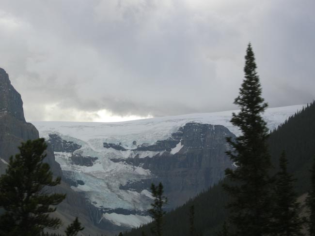
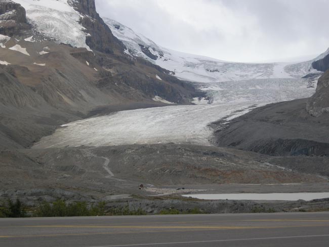
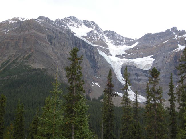
And finally a tongue of the Columbia Icefield meets the road as the Athabasca Glacier.
When Dick first took this road in 1974, the Glacier was touching the level of the lakeshore.
It's currently ending 300 feet behind the crest of the hill with the path. |
 |
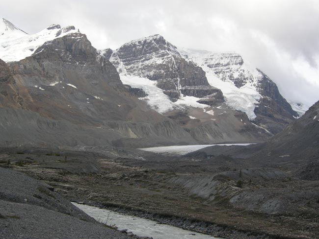
| Although the Glacier is a local "high point", it's not the highest point of the highway.
For a while, we drop into the high basin that serves as the source of the North Saskatchewan River. |
 |
| |
 |
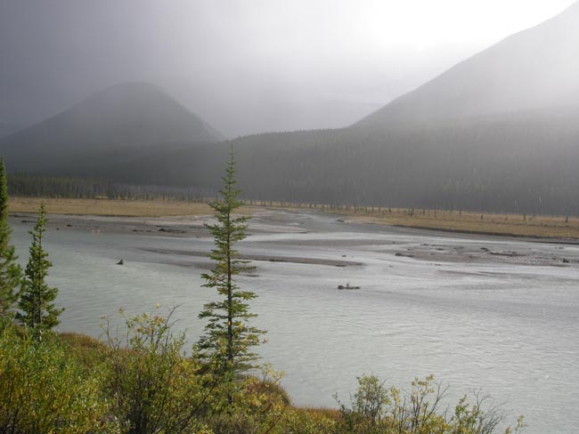
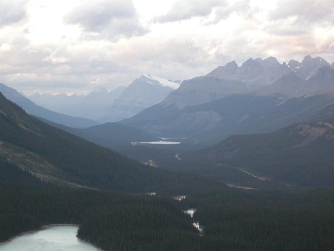
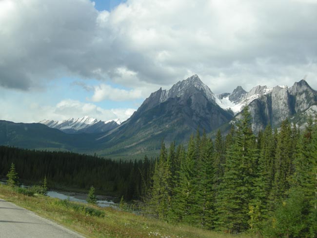
At the south end of this ridge three rivers meet to head off eastward as the Saskatchewan. We follow the southern Mistaya (Great Bear) River uphill towards it sources.
You may have noticed that all of the photos to this point don't show any other traffic on the road with us. That made stopping and gawking very easy. |
 |
| Note the thickness of the snow cap on top and this is late summer! |
 |
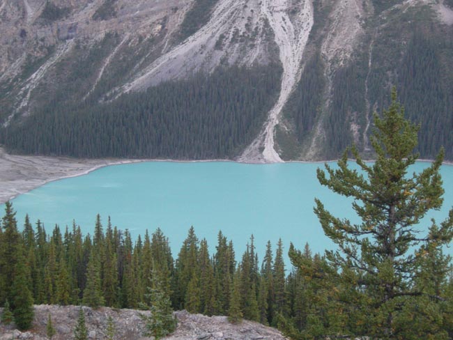
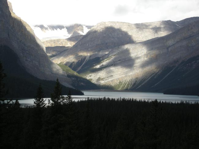
High snowfields and glaciers... |
 |
| ...occasionally send fingers down... |
 |
| ...where the glacial till turns the meltwater lakes to jade. |
 |
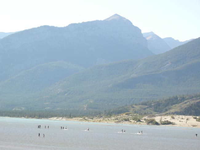
Bow Summit... we've finally hit the high point (6849 feet) of the highway... and we're about to go down a steep section with a broad hairpin at the bottom.
We'll pause for the view... That's Bow Lake hiding among the trees, and Hector Lake in the distance. |
 |
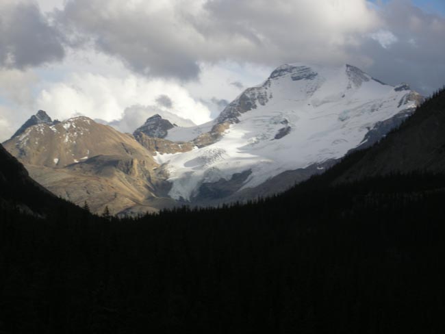
We're down... kind'a. That's the Crowfoot Glacier dead ahead.
Evening's coming on, so we'll stop at the Mosquito Creek Campsite. While we were there, a Sprinter-based RV drove in (they're rare, we take note). It had Washington license plates. It lives 6 blocks away from us in Seattle. Small world (yet again). |
 |
The next morning we start off, heading for Lake Louise for coffee.
But we're always ready to Stop for Scenic |
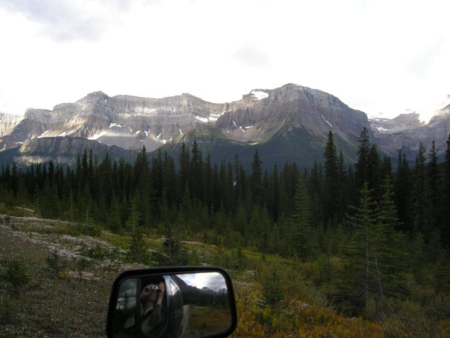 |
| The highway never stops being stunning. |
 |
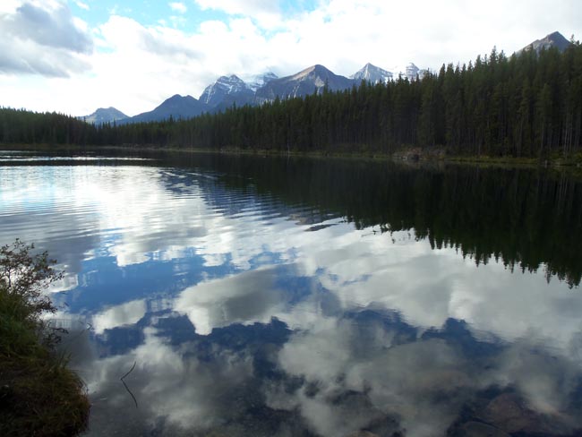
| Tranquil Herbert Lake... a very short detour from the highway. |
 |
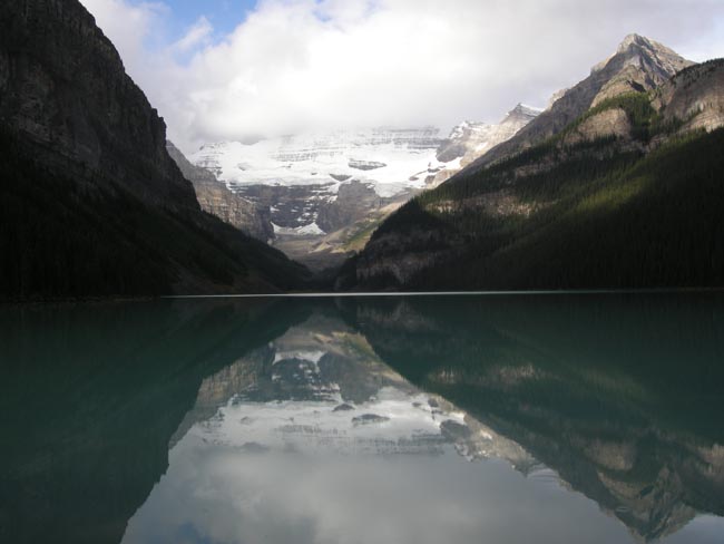
At the junction of Trans-Canada Highway 1 and the Icefield Parkway lies the town, and a bit up in the hills,
Lake Louise. |
 |
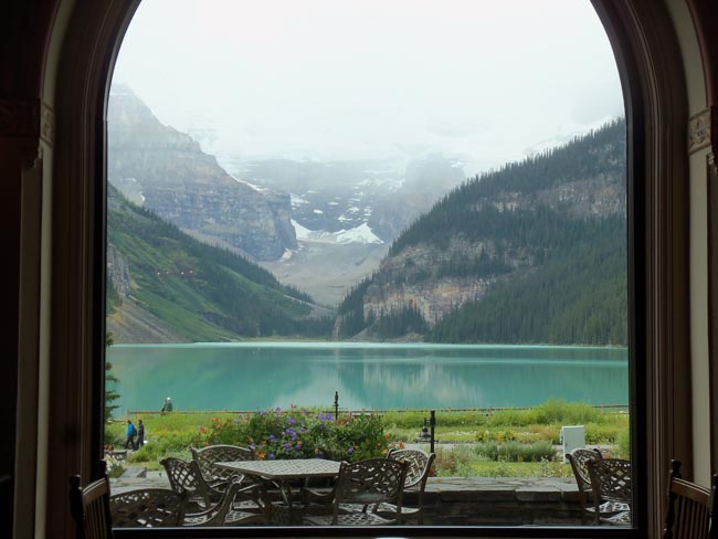
| Lake Louise had an Empress-like hotel at this accessible end, but expansion sprawl has diffused its classic shape. As we explored the now diffused lobbies, the weather outside closed in and it started snowing. |
 |
We now moved on to the resort/tourist/skiing town of Banff. Like Jasper, its fame came from being a railway stop.
Also like Jasper, the discovery of hot springs inspired the Canadian Pacific Railways' construction of the grand Banff Springs Lodge.
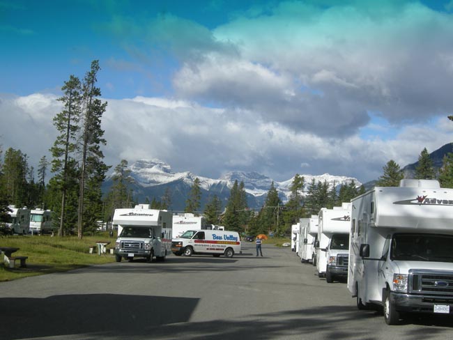
Unfortunately, we don't tend to stay in Grand Hotels... we end up in municipal campgrounds.
This was by far the busiest and most-packed campground of our entire trip. Its 1000-site combined acreage was close to the size of the entire Banff business district (which ain't tiny). |
 |
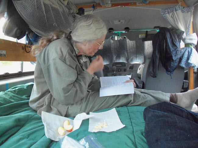
| Our Master Suite, enjoying our usual dinner of apple and cheese and late afternoon's entertainment. |
 |
| Something we'd never explored in previous (short) visits to Banff were some of the hiking trails on its outskirts. |
 |
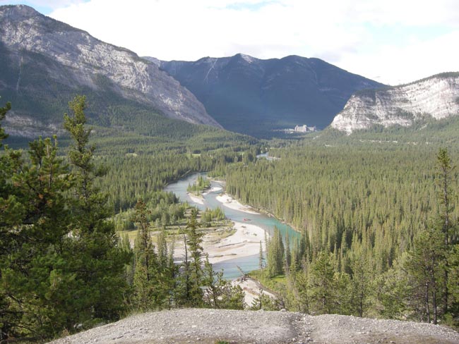
This is the Tunnel Mountain trail, which leads to some Hoodoos overlooking the meanders of the Bow River.
That's the Hot Springs Lodge in the distance. |
 |
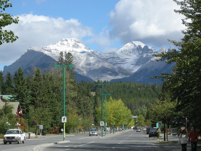
Downtown Banff does have its attractions (and a laundromat!)
|
 |
| Then, since we'd never been, we took a short jaunt East on the Trans Canada to visit the smaller resort town Canmore. |
 |
| The town was far smaller than Banff, but the scenery of the trip to and fro was well worth the excursion. (we'll spare you the joy(?) of the 50-odd mountain photos we took on just this 22-mile round trip) |
 |
| But the time had finally come to turn our noses Westward and start towards home. |
 |
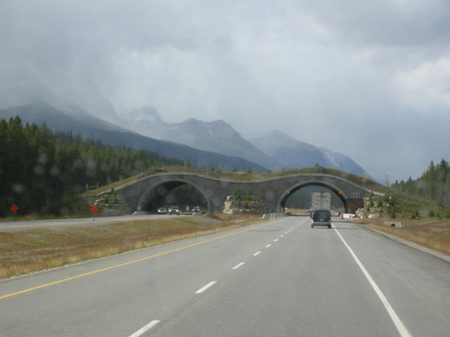
| Between Banff and Lake Louise they've built turf-covered wildlfe bridges across the highway for migrating animals. |
 |
| We're now on the Trans Canada, heading for the Kicking Horse Pass, British Columbia and Yoho National Park. |
 |
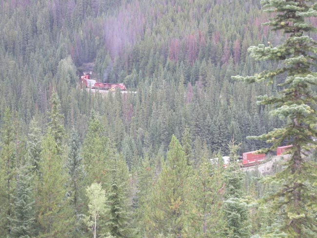
One of the roadside attractions in Yoho is the pair of spiral railroad tunnels at Field.
As trains climb from the west towards the east they pass through tunnels which form almost full circles while under the earth.
The engines emerging from the tunnel at the top of the photo is pulling the lower set of cars which haven't entered yet. |
 |
Approaching Field, we're treated to views of the Horne Range, which forms the western boundary of Canada's Yoho National Park.
That's the Kicking Horse River beside us. |
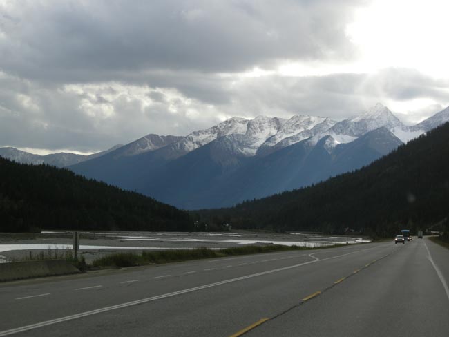 |
| Coming out of Yoho, we spent the night in Golden BC, in the midst of the Columbia River valley (which is flowing North as it parallels the Rockies). |
 |
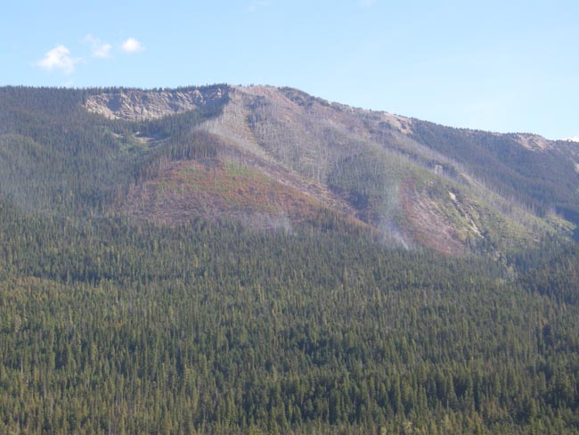
The next morning we climbed up into Canada's Glacier National Park, located in BC, far from the US Park of the same name. Across the way we spotted this fire -- when we reported it a few minutes later, the rangers said that it had been smoldering for a couple of weeks |
 |
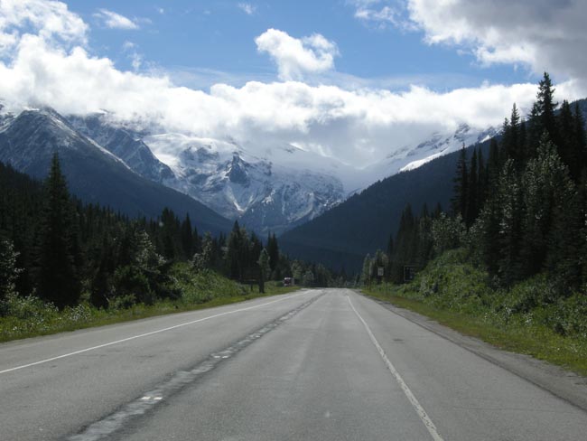
Immediately west of the Rogers Pass Visitors Center, we were faced with some of the cloud-enshrouded glaciers that give the park its name.
The Illecillewaet Neve is supplying most of the ice you're seeing. |
 |
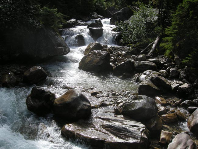
| A few minutes later we stopped to hike up some of the run-off: Asulkan Brook. |
 |
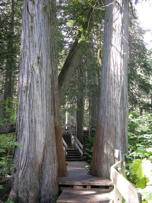
| From Canada's Glacier National Park we crossed the 10-mile wide Albert Canyon to the beginning of Mount Revelstoke National Park, where we again stepped out of the Sprinter to take the Giant Cedars Trail. |
 |
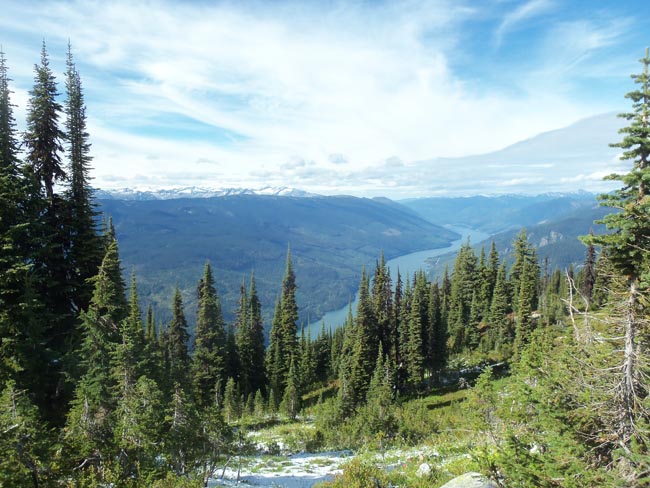
The Trans Canada Highway skirts the southern flank of Mt Revelstoke. At the southwest corner, you can drive up a 16-mile switchbacky road to a parking lot, and then take a free shuttle van the final kilometer to the summit. We did. Wandering around the summit provides a superb 360 degree view.
The river is the Columbia, masquerading as Lake Revelstoke. After we left it in Golden, it flowed north and then west to circle Mt Revelstoke on the north. Now it's finally flowing south towards the US.
We had started and ended last spring's Eclipse Trip camped near the mouth of the Columbia, about 800 miles downriver. |
 |
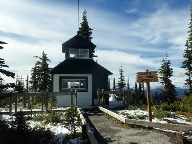
| The old fire lookout station on Mt Revelstoke. Note the fresh white stuff on the ground. |
 |
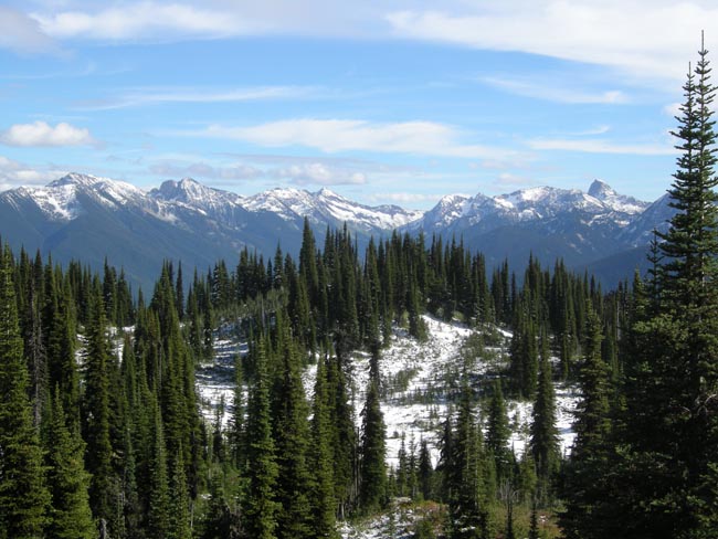
| Looking to the northwest, back towards the Rockies |
 |
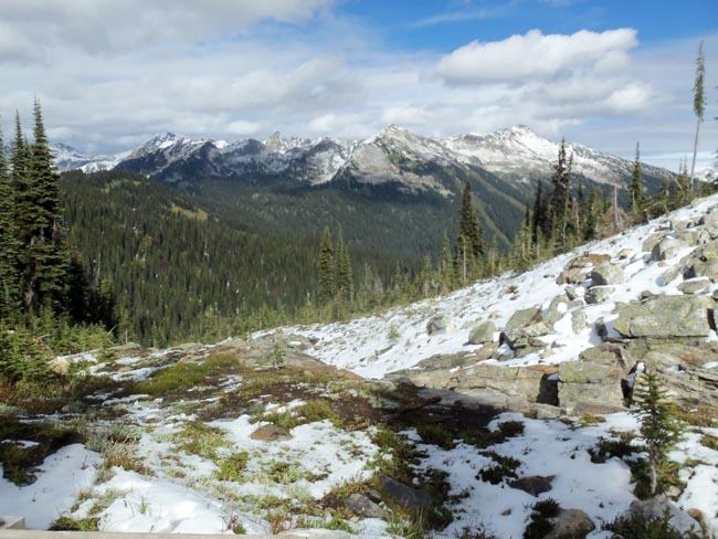
| ...and due west, towards Glacier Park's peaks. |
 |
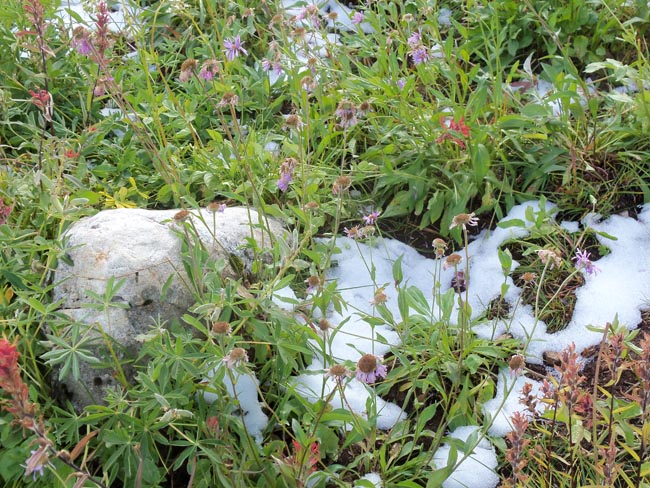
| They said the previous day's snow had gotten most of the wildflowers, but there will still a few. |
 |
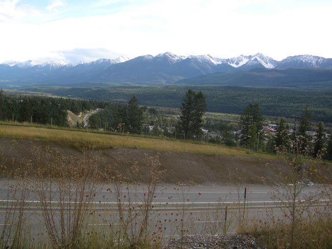
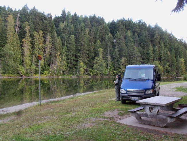
Dropping down into the town of Revelstoke, we sought out the Williamson Lake Campground.
Not shown in the view was the small fleet of rented RVs driven by German-speaking tourists a couple of hundred feet away. The lakeside sites didn't have "full hookups", so were less crowded. And cheaper. And (we thought) nicer. |
 |
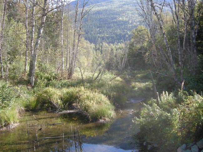
| Surrounding the campground were pleasant trails, leading to treats such as this stream feeding the lake |
 |
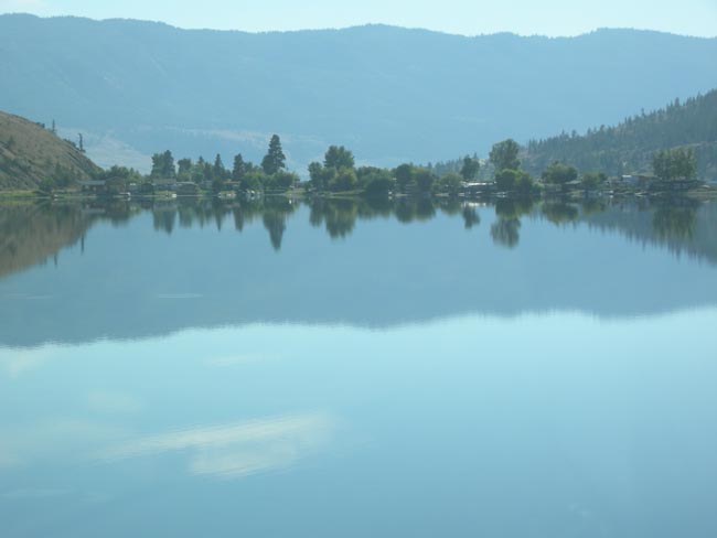
| Back on the Trans Canada, first skirting the complicated shape of Shuswap Lake, and then paralleling the South Thompson River towards Kamloops (seeking another coffee shake) |
 |
At Kamloops we three choices: continue on the Trans Can, take the new Coquihalla Highway toll road, or squiggle our way down the "back way" that wandered among the farms and ranches due south of Kamloops.
Would it surprise you that we took the rural option? Which led to sights such as the afternoon light turning the wires to silver and gold as we drove along |
 |
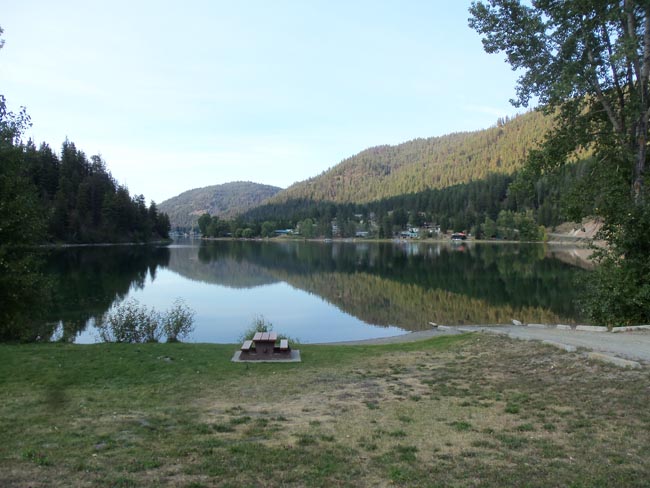
| Camping at the tiny Allison Lake Provincial Park was across the street from this shore-side picnic area |
 |
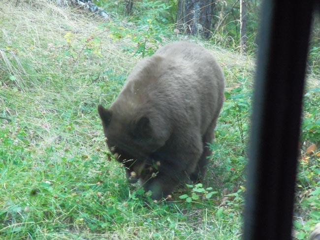
| In the morning a bear joined us for breakfast -- he had the clover. |
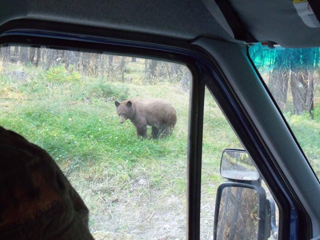 |
| Short videos of breakfast can be seen here and here (a second window will open). |
 |
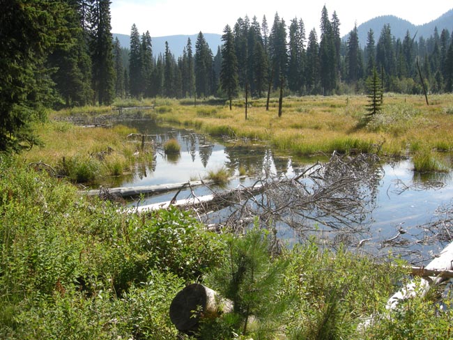
| Continuing south to nearby Princeton, BC, we then skirted the US border by going into Manning Provincial Park. A wayside nature trail took us walking alongside an old beaver pond |
 |
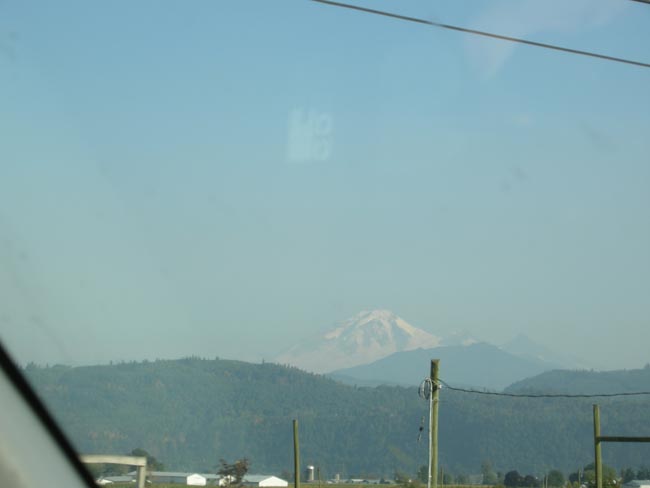
After lunch in Hope, we rejoined the Trans Canada for a quick zoop to Abbotsford, where we turned left and entered the US at Sumas. As we waited in the Customs line, we see Mt Baker.
It turned out that Karen had never visited Mt Baker, so we turned left and headed that way.
Being now "off season" the campground at the entrance to the National Forest was full, and the ones further in were closed. We made use of National Forest "distributed camping" policies (drive on a National Forest road until you find a spot that someone else has used in the past, off the road, and you can camp there), outside of the more-protected Mt Baker area. We had used this technique just outside of Yosemite during our Eclipse trip. |
 |
| The next morning we drove up the 24 mile access road to Mt Baker's ski and visitor's area. |
 |
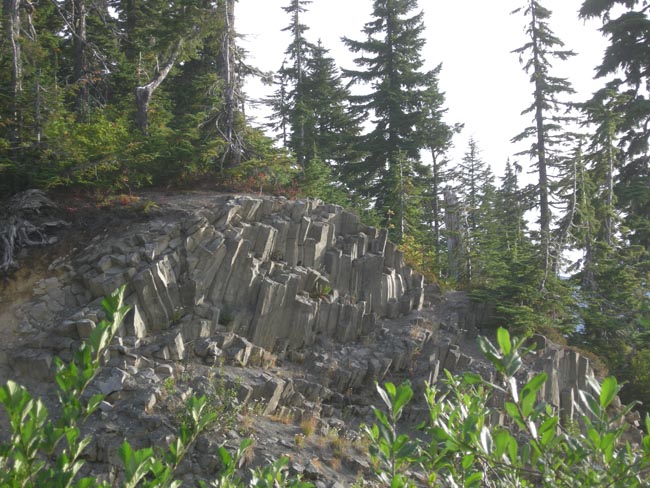
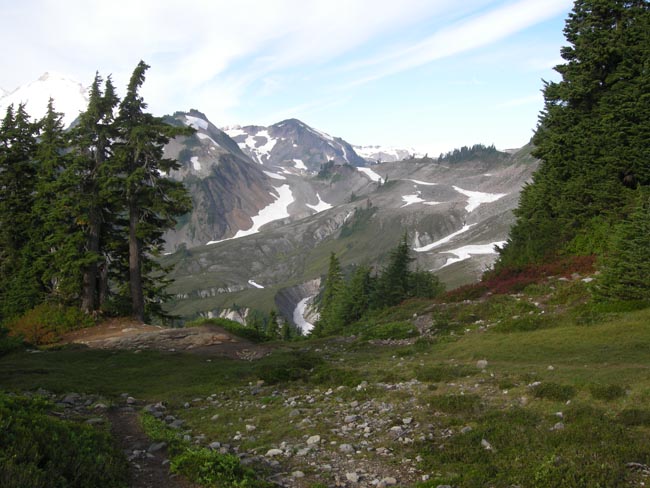
| Being volcanic, the views featured many basalt columns... |
 |
| ...some across from this lovely, much photographed alpine lake |
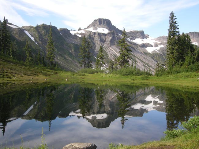 |
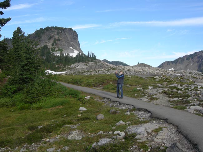
| Easy hiking trails led to many views of the adjacent North Cascades |
 |
| ... with fairly few photo-snapping tourists |
 |
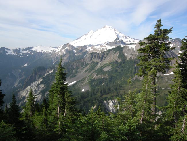
Mt Baker's glacier-clad summit is 6 miles away, as the eagle soars.
The volcano wasn't actively steaming.... today. |
 |
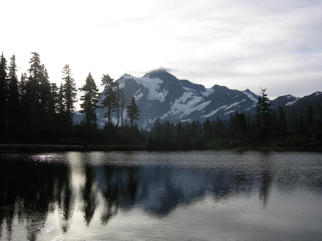
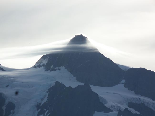
| As the clouds formed and streamed around nearby Mt Shuksan, we decided that it was finally time to go home. |
 |