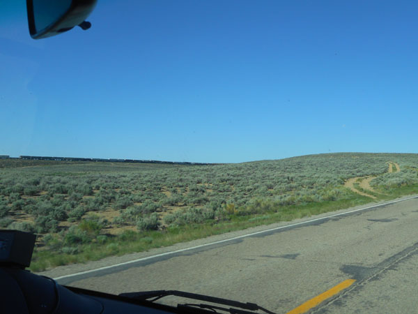
From Green River/James Town we head north on Wyoming 372 ... this has been a trip frequently using "the roads less traveled". For the next hour or so we'll see fewer than ten other vehicles. Our morning starts by going through more rolling flat sage.
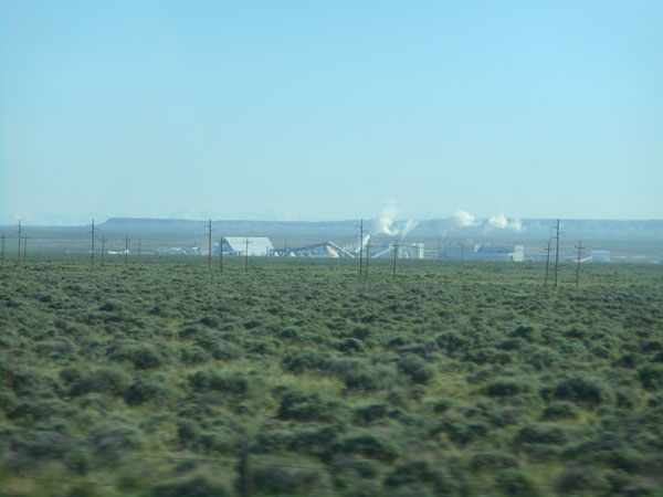
... occasional mines...
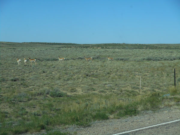
and prong horn antelope.
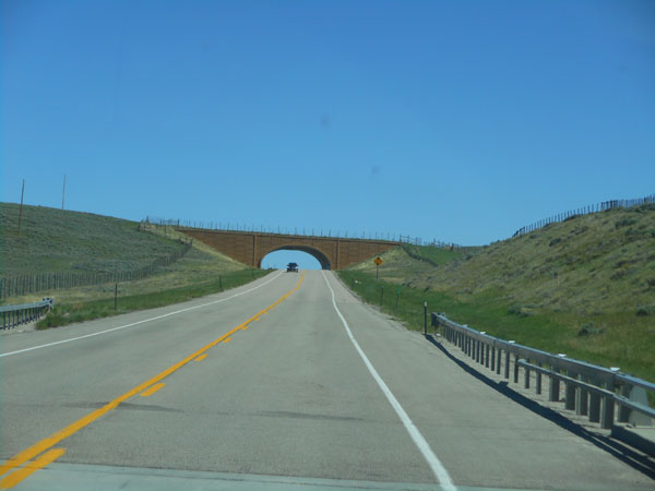
Now we've swung on to US 189, where we find some wildlife walkways over and under the highways.
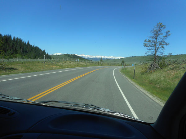
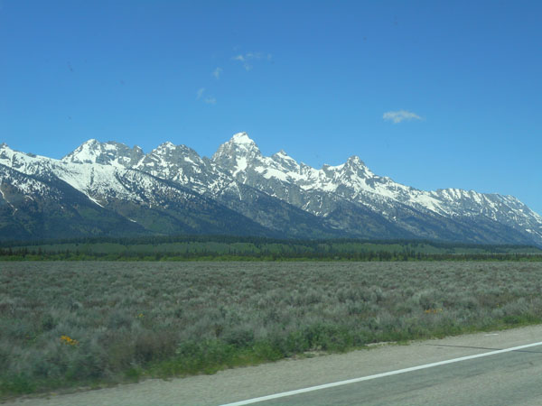
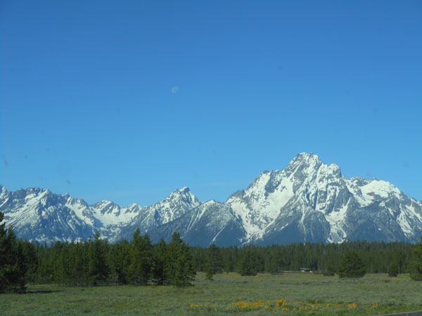
In the distance we start to see the Tetons.
Once we enter the Grand Teton National Park we hurry north to ...
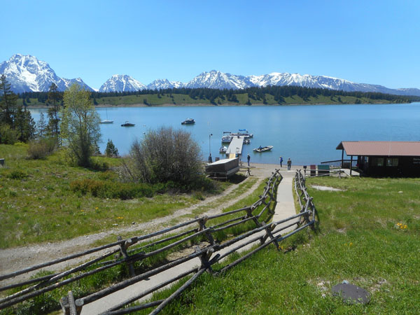
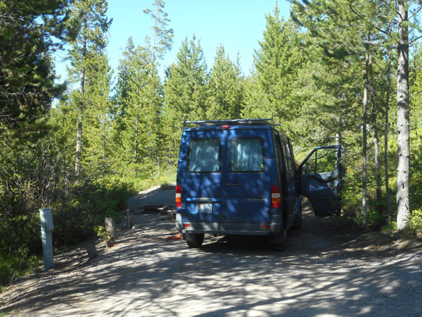
... get a camp spot at Signal Mountain campground (a bit south of the Lodge's hub-bub).
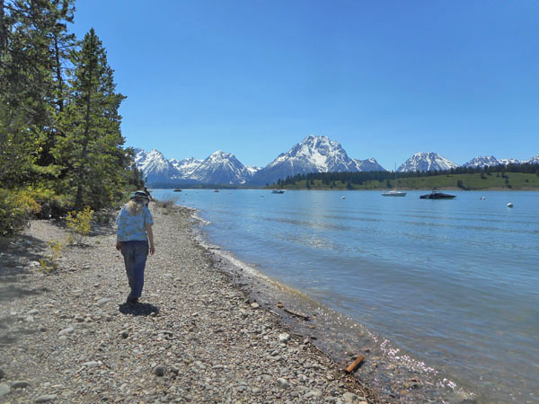
...and spend the rest of the day walking around.
Despite the Teton Range to our immediate west, Jackson Lake's water is part of the Snake River ... the same river we camped beside on our second night of the trip.
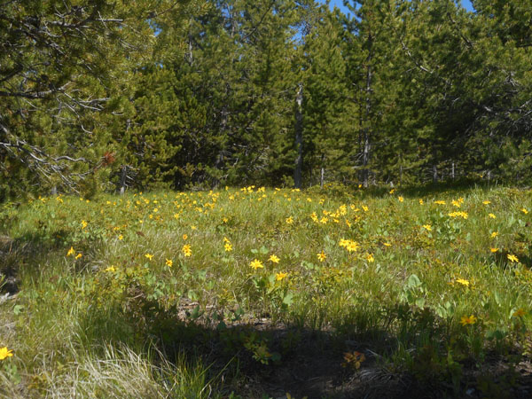
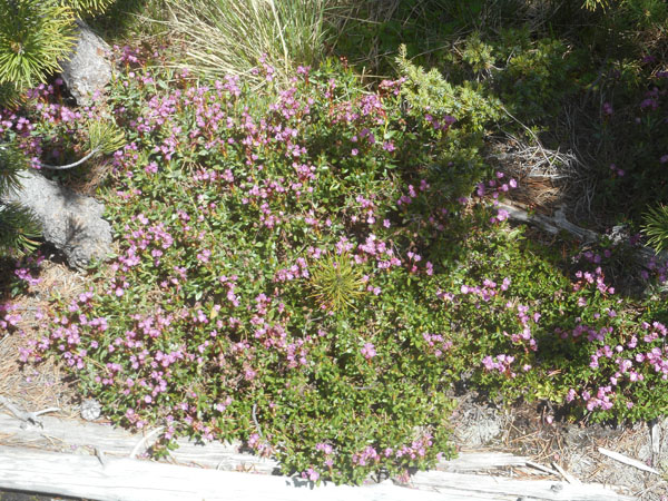
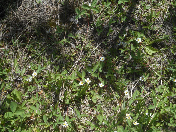
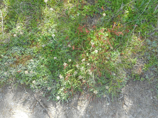
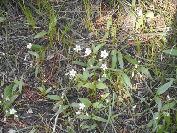
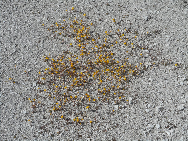
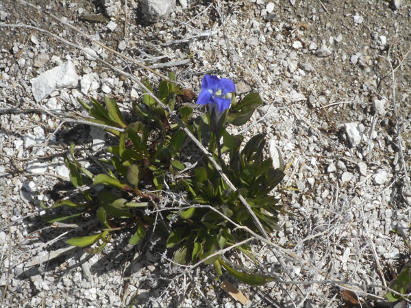
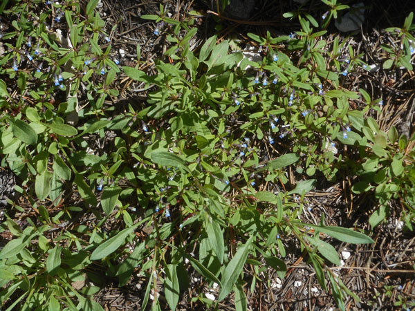
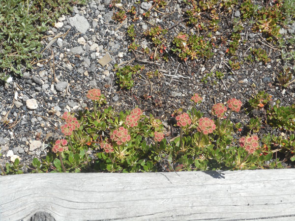
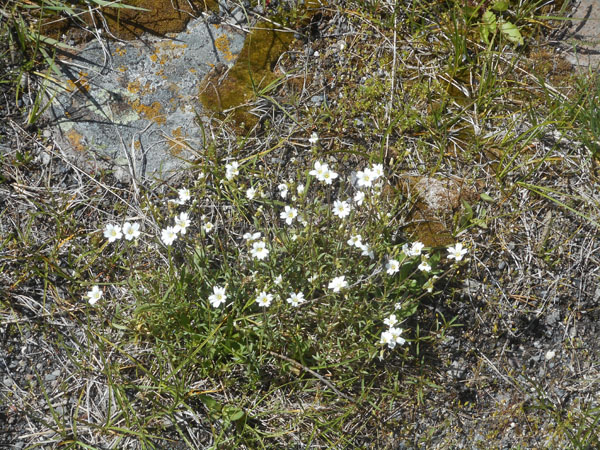
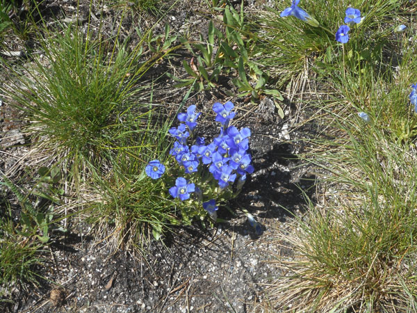
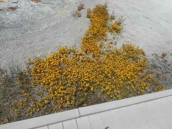
We wander through shady paths and fields of flowers
(heart-leaf arnica)
Then back to the van for a rest, shade, and to get away from the campfire smoke.
In the morning we're off before moonset
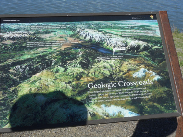
Just to confuse things, this map (satellite photo) has southwest at the top. Our north-bound path to Yellowstone runs off the center right.
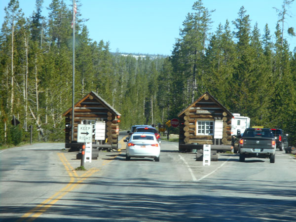
Yellowstone National Park's south entry has the old buildings in a very changing landscape.
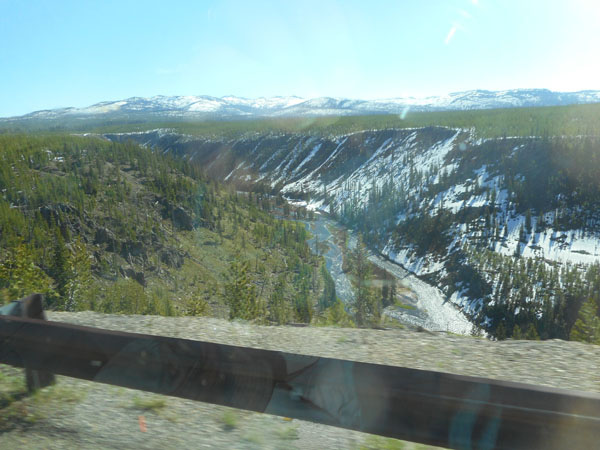
Across the Lewis Canyon, we could see it was still very snowy. We're glad we're not any earlier in the year. We were told it had snowed in Canyon campground the night before.
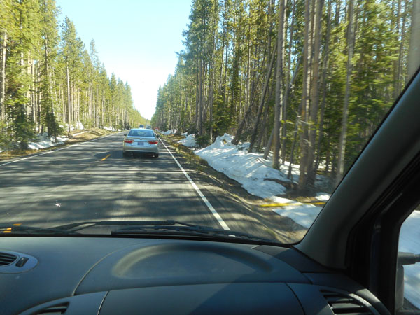
The south entrance road stays fairly high, 7500 to 8000 feet.
With a signed reminder just north of Lewis Lake.
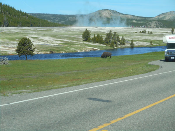
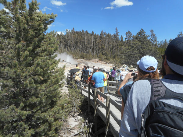
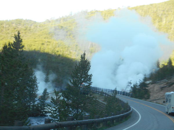
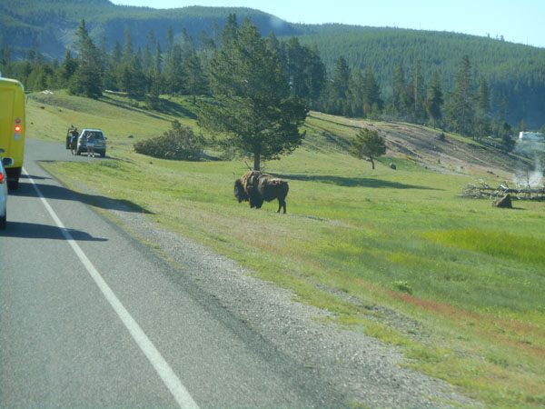
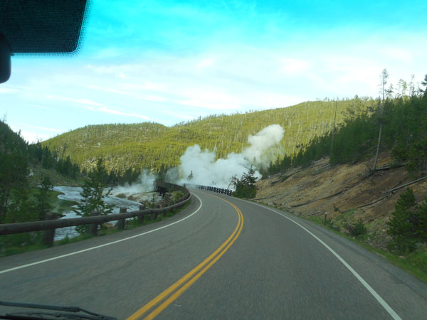
How Yellowstone: steaming landscape with bison (and stopped tourists).
We experienced only one full-blown "buffalo jam" on the way to Norris Campground.
Since we didn't have reservations, we were trying to arrive early in the day in hopes of an available spot. Yellowstone isn't in full swing in early June, with a couple of the larger campgrounds still closed. We lucked out, and booked in for three nights. Having a short Sprinter helps. Subsequent mornings found a long line at the check-in door an hour before they opened.
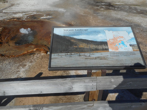
While we're getting organized, here's some Yellowstone Background:
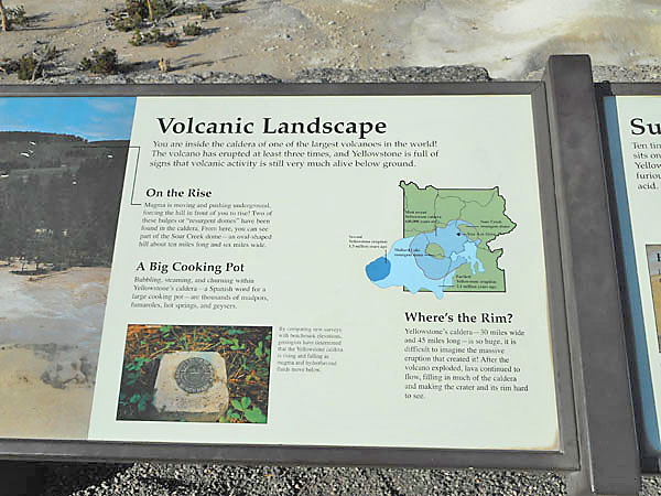
Yellowstone is sitting on, or just plain is a very large volcano.
The three colors are the three different calderas of Yellowstone's significant huge eruptions. The oldest one (light blue) was 2.1 million years ago.
Then the second one was 1.3 million years ago on the western edge of the first, shown as dark blue.
The most recent, only 640,000 years ago, is the intermediate blue. It spit out 240 cubic miles of debris. The floor of the volcano collapsed, forming the caldera.
The green areas within the caldera are "resurgent domes", areas of the ground rising up relative to the rest of the caldera's floor. Mammoth Hot Springs, up at the northwest of the park, is completly outside of the calderas. Likewise, Norris Basin, the first "hot spot" we'll visit, is also outside, but only by about 2 miles.
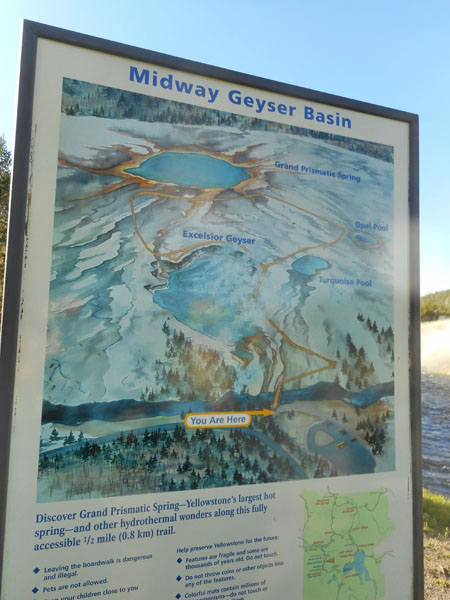
(p.s. please ignore the You Are Here in the photo ... we simply didn't find a sign with this info until Mud Volcano on our 3rd day)
We now return to the trip as it happened...
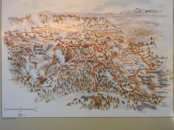
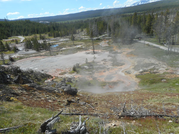
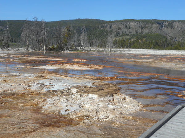
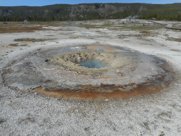
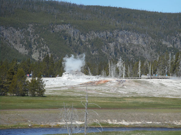
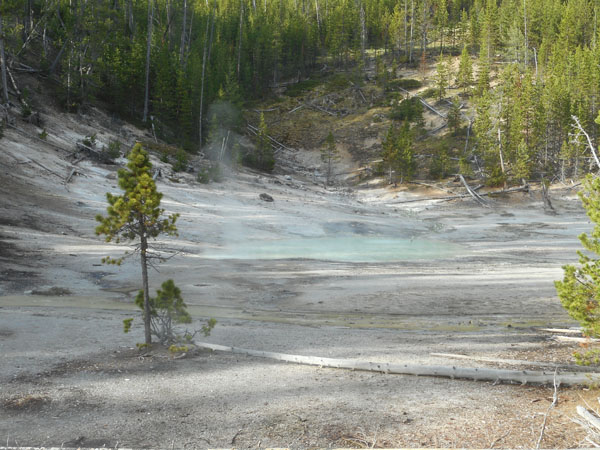
We spent the rest of our first day walking the nearby Norris Basin geyser paths.
Norris is the Park's oldest, hottest and "most changeable" geothermal area. For a rough sense of scale, the line on the lower left is 1/4 mile.
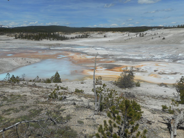
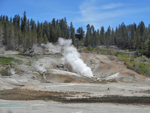
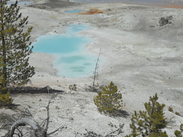
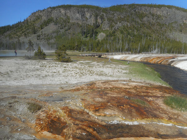
As we enter the area, we're facing Porcelain Basin.
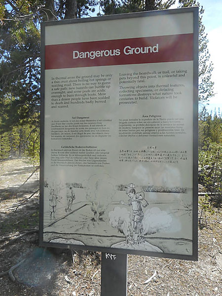
Lots of warning signs but tourists still get scalded by walking off path. Despite the translation to Chinese on the lower right, we saw, and in a couple of cases cautioned, folks heading off the walkways to get closer to the hot features.
Instead of naming everything we decided to just give photos of our experience of the various basins and geothermal features therein.
The geology we've seen so far demonstrates that the earth is always changing. In Yellowstone it just happens at a closer to human perceivable rate. Things will be different every time you visit. You won't feel them but the area has lots of small tremors and a few medium to large ones. Shifting earth, different amounts of trickling water means some features go dormant and some become more active.
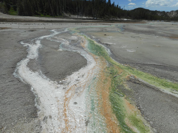
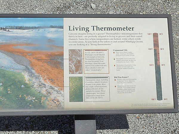
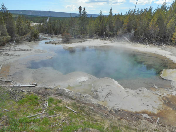
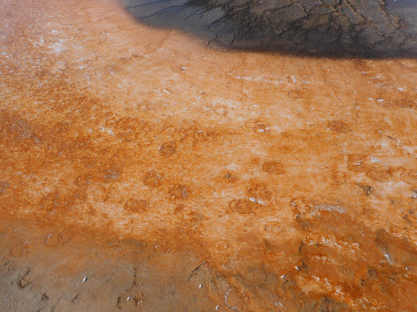
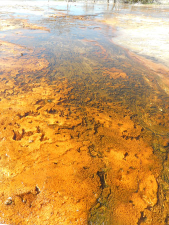
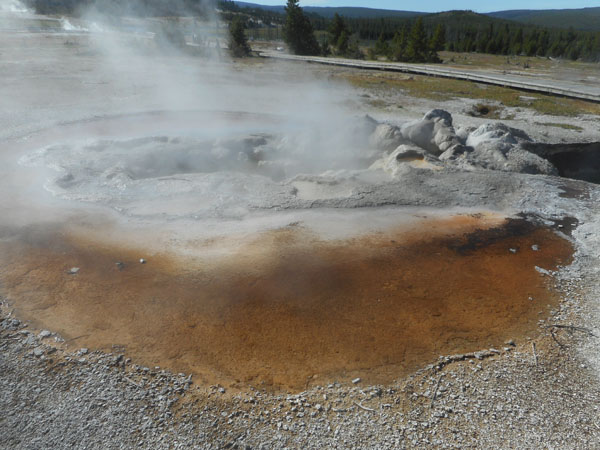
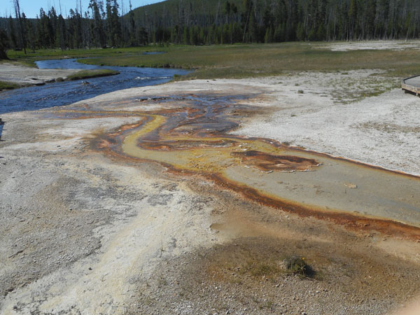
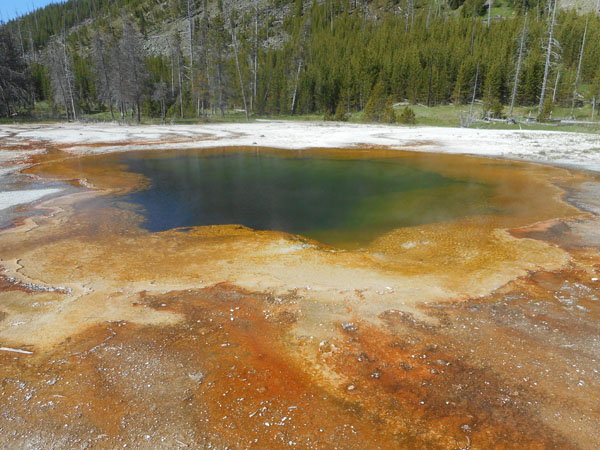
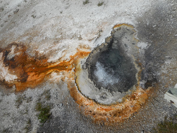
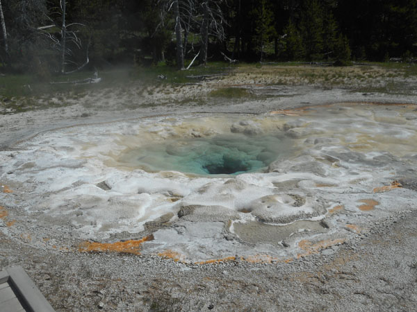
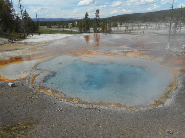
The colors are amazing: most are due to different kinds of thermophillic organisums.
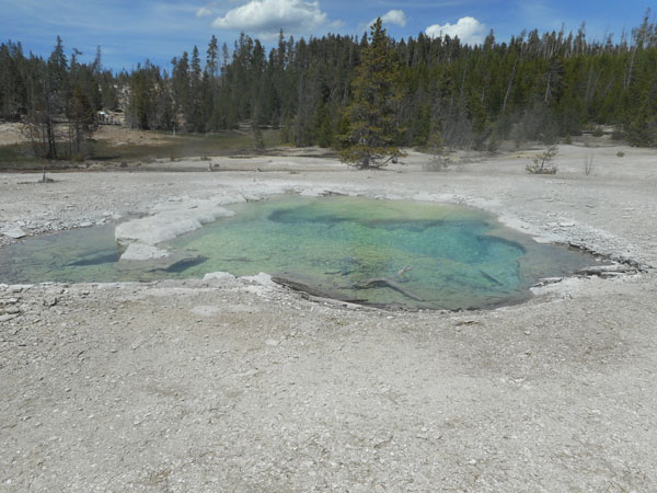
In fact, the color can sort of tell you what the water temperature is (as well as how acid or alkaline it is).
The reddish "chemotrphs" are getting their energy from iron dissolved in the water ... their preferred temperature is between 122 and 140° F. The greens are thermophilic algae. They get their energy from sunlight and prefer 100 to 133° F.
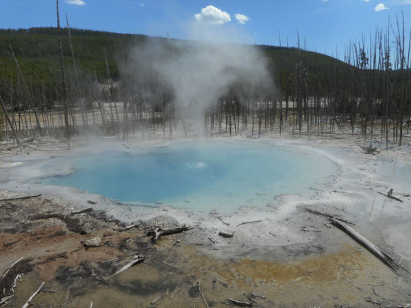
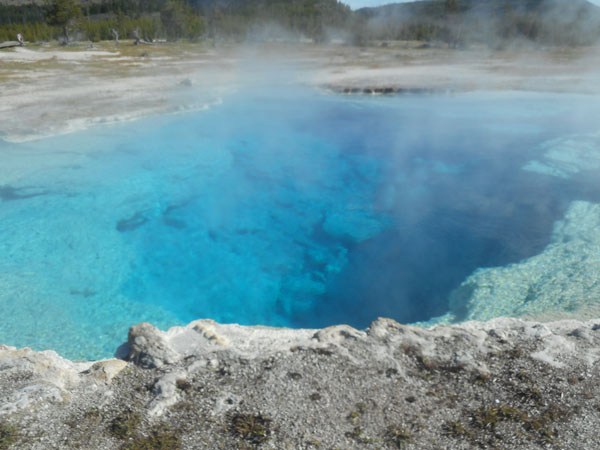
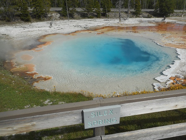
The light blue is dissolved silica.
Some areas we recalled as being quite active on our previous visits had calmed down a bit.
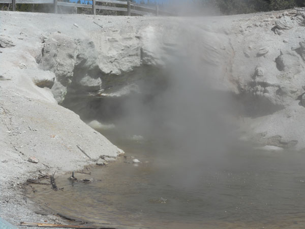
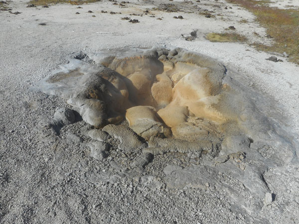
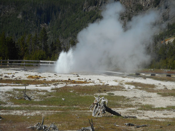
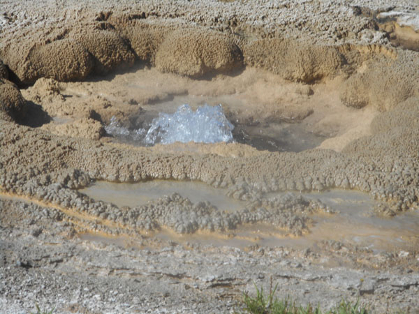
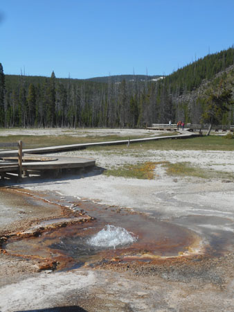
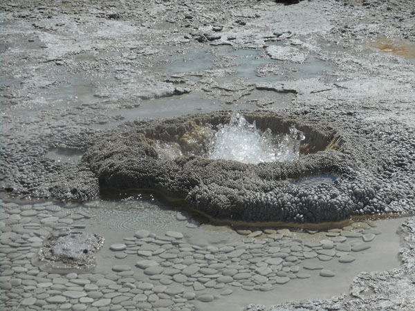
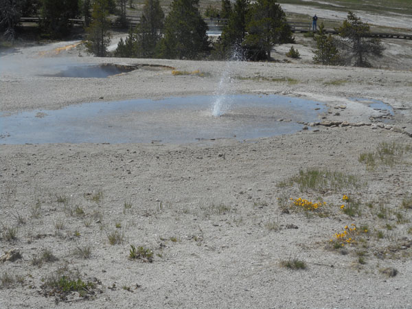
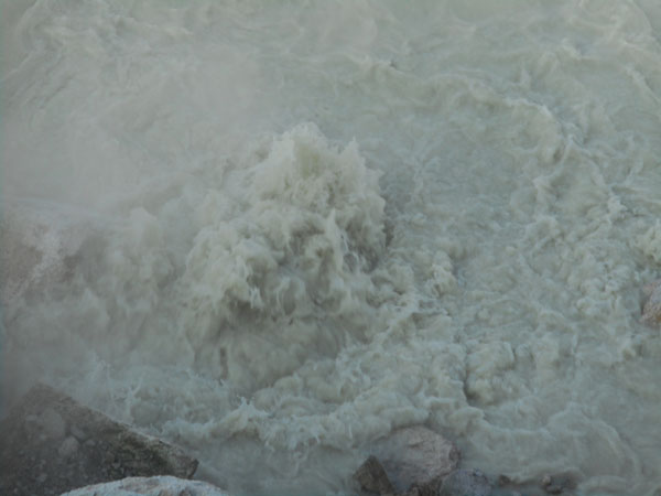
Watch it bubble...
Back Basin's features are more spread out. The forest is recovering from a 1988 fire.
We stand in the hot bright sun and debate where to go next.
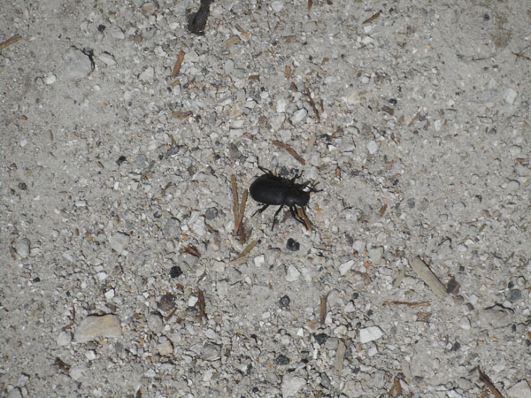
This large beetle was wandering along the path. Not many other critters are visible at this time of day.
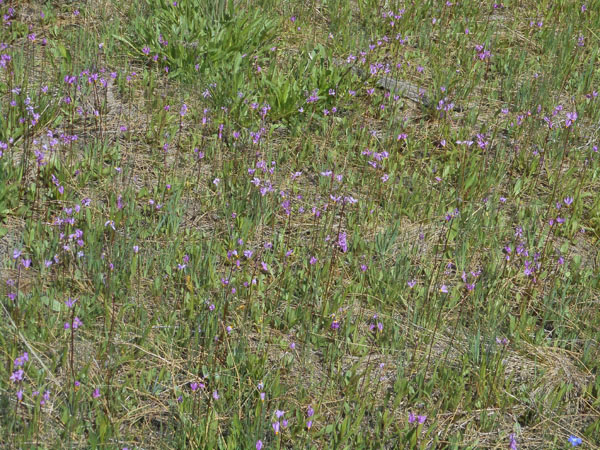
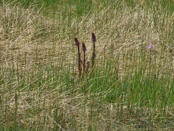
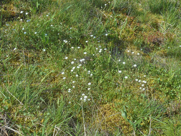
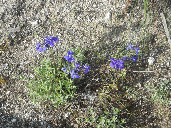
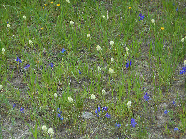
There were lots of plants in bloom along the more shaded paths connecting the hot zones.
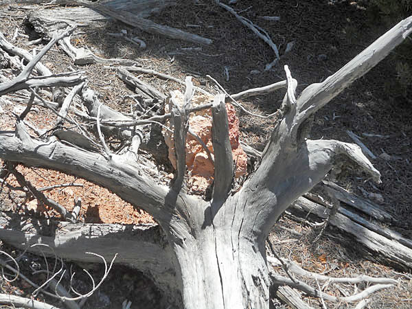
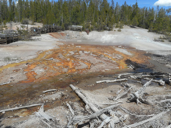
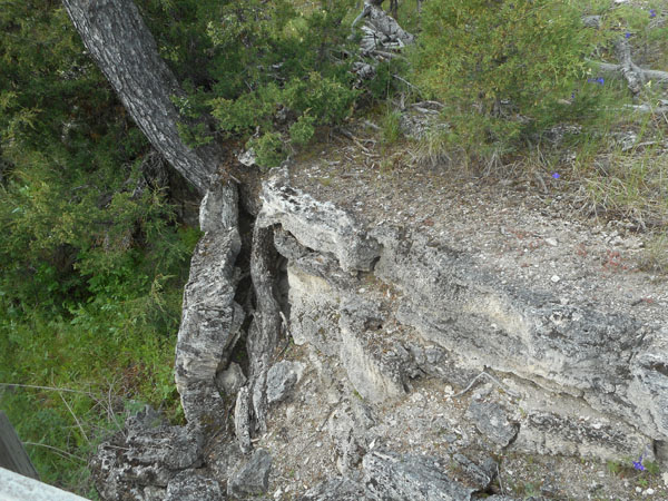
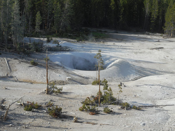
But where it gets too hot the plants die. Growing around a rock didn't help this tree once the ground got too hot.
At some spots we noticed lots of dead trees. This indicated that the ground was cool enough and the air un-fumed enough for them to grow sometime in the recent past. At least within the decay time of wood in this climate: the Park Service keeps experimenting with new materials in making walkways because they have to replace the wooden ones so often.
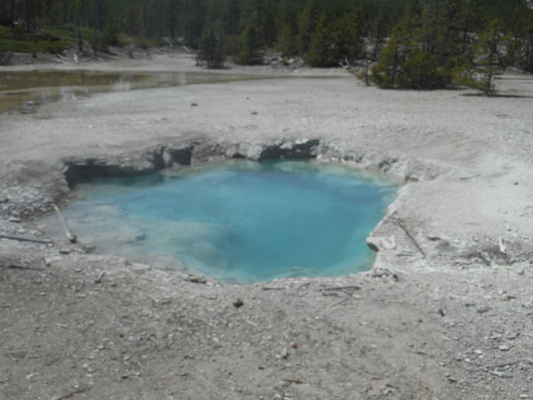
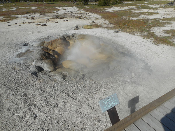
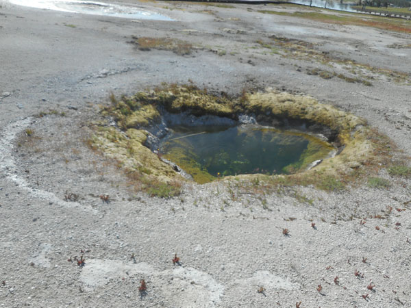
This pool isn't surrounded by dead trees so this hot area hasn't probably expanded recently.
A veritable traffic jam. Steamboat Geyser is the world's tallest geyser. It's mostly unpredictable but goes over 300 feet high. We saw it go off on a previous visit. There was a rumor that it might go off soon so lots of folks were camped out with chairs and cameras just in case -- we heard that it did go off the next morning. Its wet eruption lasts between 3 and 40 minutes, usually followed by hours of thundering steam.
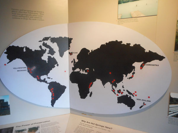
A stop through the small visitor center had this map of other hot areas of the world -- we haven't been to all of them yet.
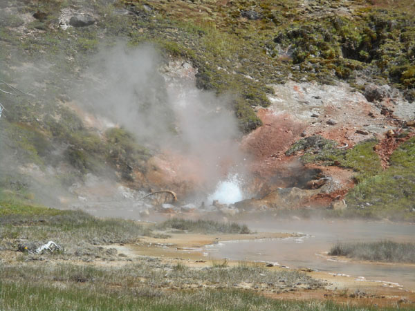
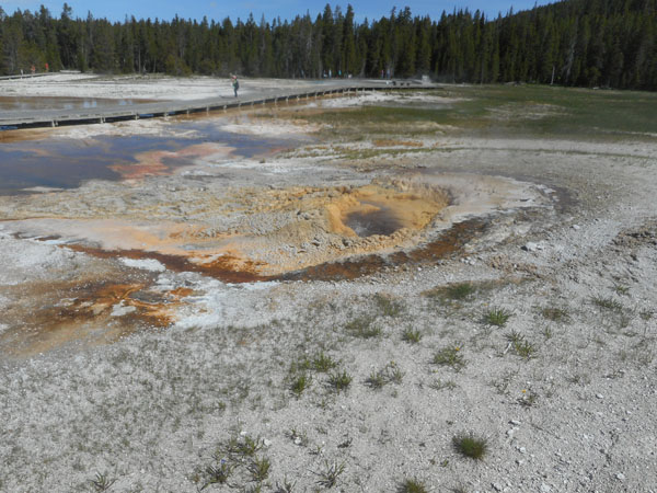
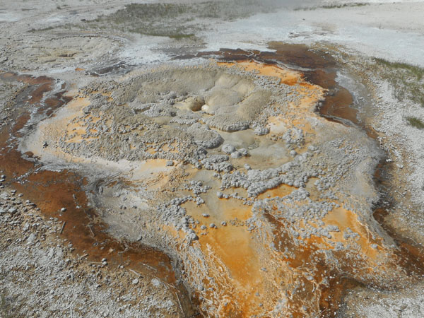
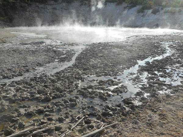
From the Norris Basin, we move a bit south down the road to the Artists Paintpots.
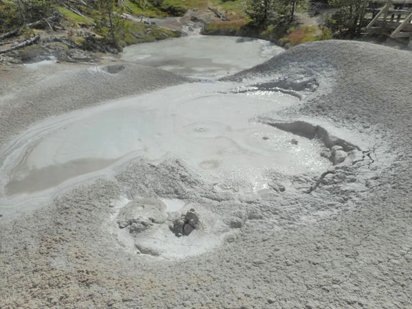
Bubbling Mud
... will always draw Karen's fond attention. (but none of the voices are hers)
Feeling the heat, we climbed the rise above the boiling mud.
Then came back down to the shady relief of walking between plants and flowers on the way back to the Sprinter.
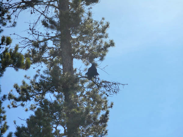
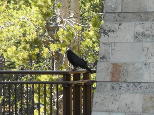
A raven was scolding us as we left.
The next morning was cool so everything steamed.
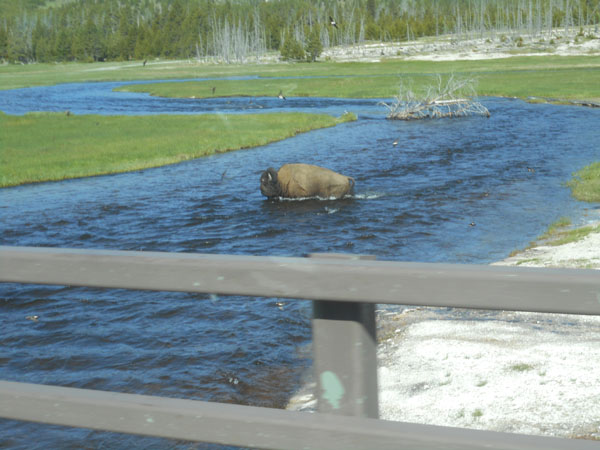
We're headed south...
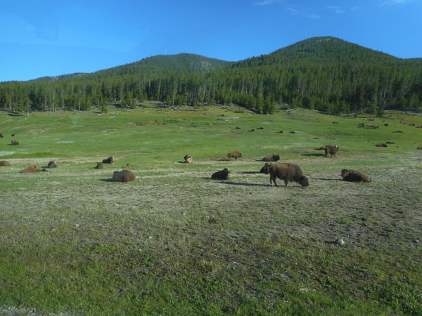
The bison were lying around digesting but with so few tourists up and about this early there were no traffic jams ... yet.
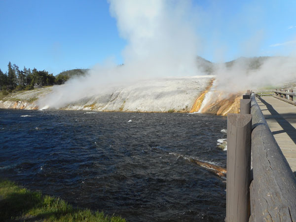
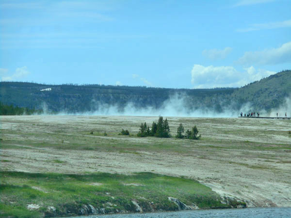
Our first stop is Midway Geyser basin
... Excelsior Geyser steaming ...
... flowing hot water ...
... into the Firehole River.
Sink holes appear, may steam for a while, then nearby earthquakes shift the flows.
Looking back at Excelsior...
... across the water pan separating it from ...
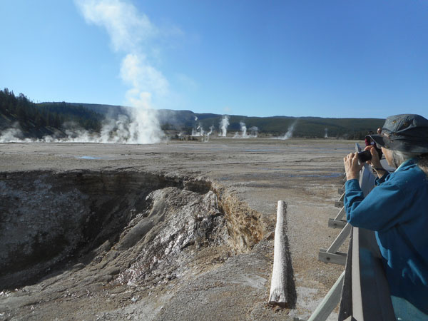
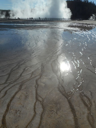
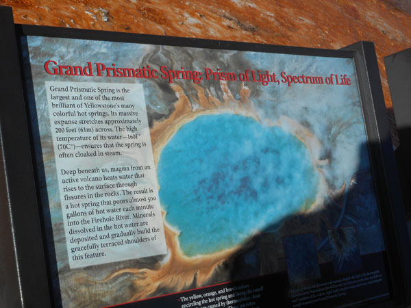
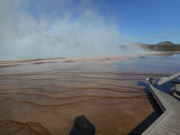
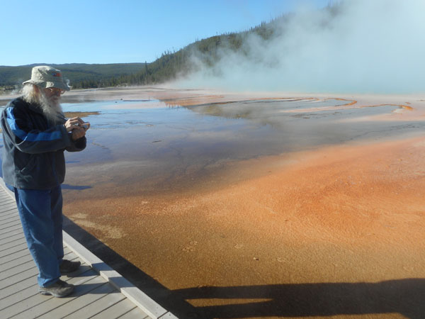
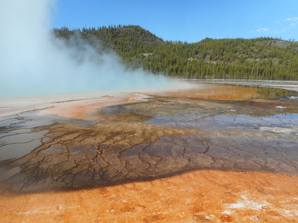
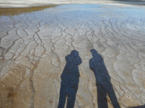
... the much-photographed Grand Prismatic Spring
>From the ground you can only get pieces of the picture...
So we'll look at the buffalo tracks: they hang out in the warm areas during the winter.
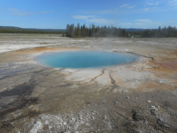
Smaller Opal Pool is easier to capture in a glimpse
Back on the road, it's now late enough for buffalo-jams
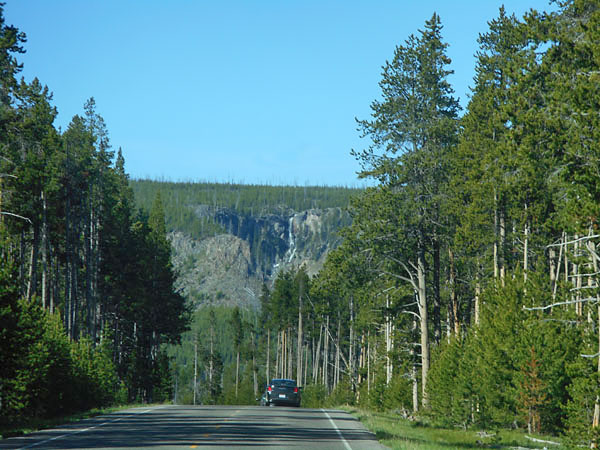
We saw many distant waterfalls coming off the rim and lava mounds of Yellowstone's volcanic caldera.
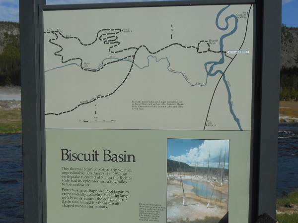
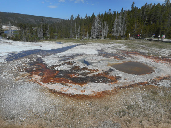
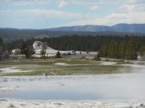
Biscuit Basin is quite small, but busy.
In August 1959, a magnitude 7.5 earthquake struck just a few miles to the northwest. Four days later Sapphire Pool began to erupt violently, throwing large rock "biscuits" around its crater. Hence the name. We'll be seeing more of the quake's effects later in the Park... and on our way home.
The small inset photo on the sign is speaking of "bobbysox" trees ... killed by being saturated by silica when the local water flows shift.
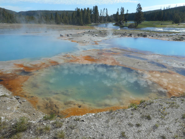
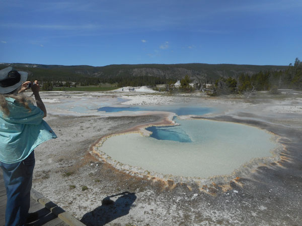
The basin has a number of colorful pools (with reflections of clouds)...
... and little bubblers
The tell-tale colors of iron-metabolizing bacteria and archea ... with bison prints.
Sapphire Pool.
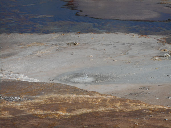
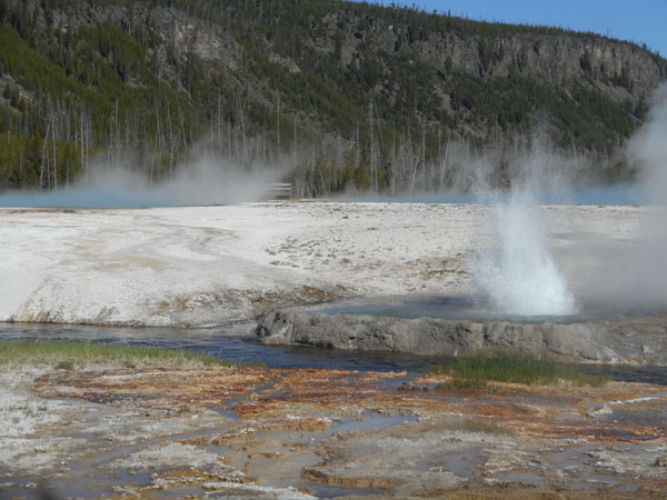
As we walked into the basin, this was dry ...
... seven minutes later, it started going off
so we ran back to catch it just winding down.
... but it was still cute ...
... lots of pools...>
... and throats ...
... and craters ...
... and bubbles.
This monkeyflower can grow where other things can't
Bison roam at will.
Even the river banks are colorful
Here at Black Sand Basin, we are again reminded that Yellowstone is considered an "active" volcano ... even though the last eruption was 630,000 years ago. The ash fell as far away as Nebraska and Texas, as well as covering most of the western US. There's still a lot of magma waiting below the surface.
Black Sand's Emerald Pool was Karen's second favorite pool.
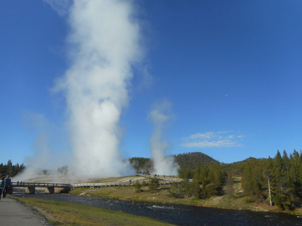
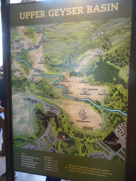
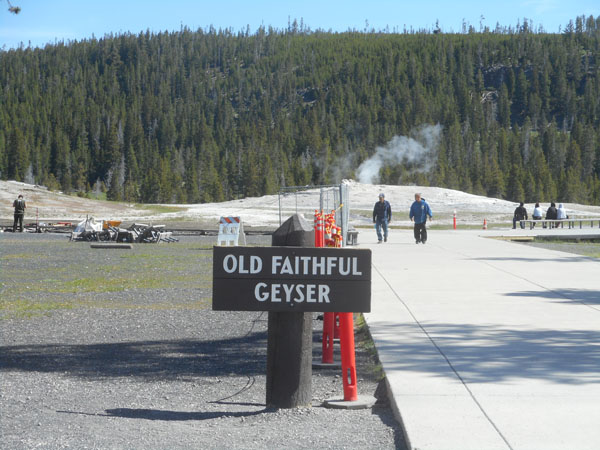
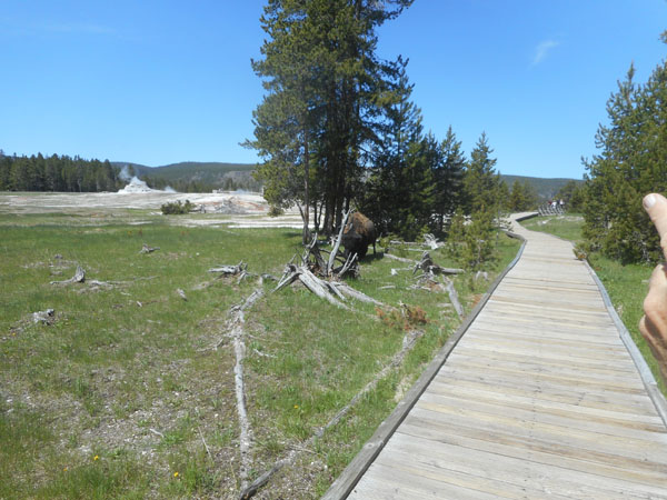
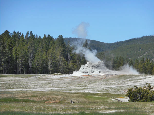
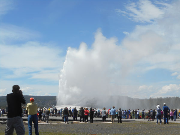
On to the Upper Geyser Basin
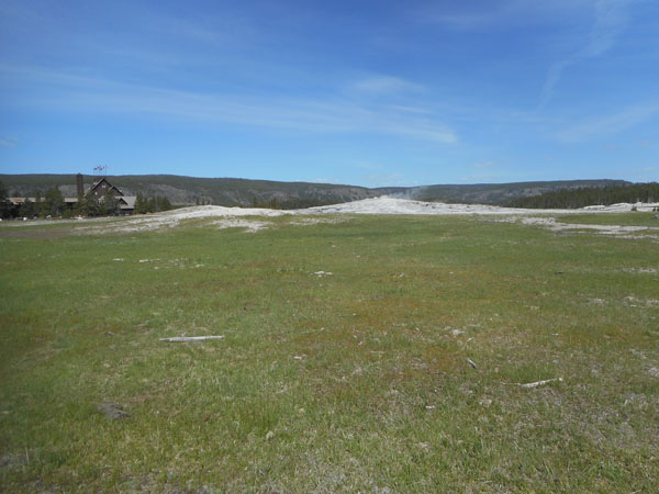
Otherwise known as Old Faithful and company.
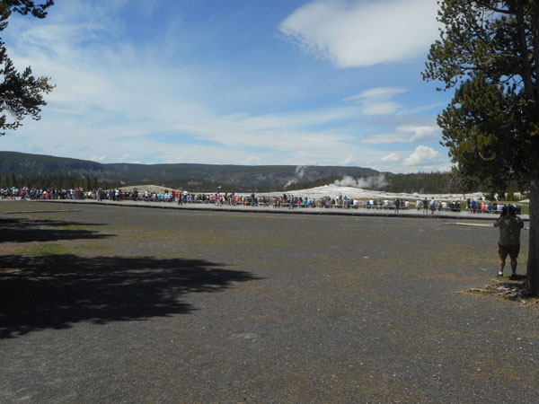
Since we "just missed" an eruption, we decide to take a counter-clockwise route around Old Faithful to explore the rest of the area.
Here's the distance they take you from the back side.
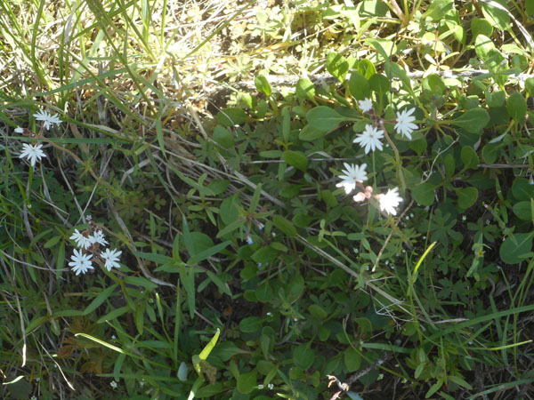
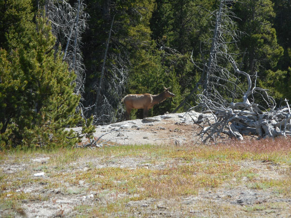
Back against the edge of the forest, we pass through vegetation ...
... with elk
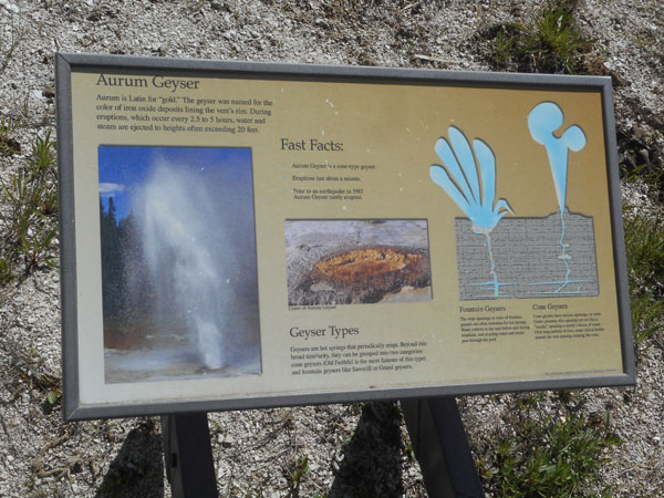
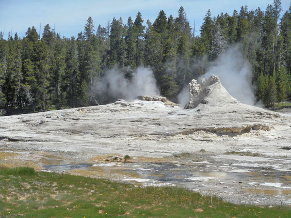
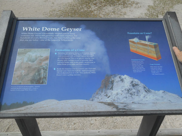
The shape of the blow-hole determines what sort of spray pattern you get, fountain or cone.
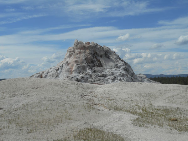
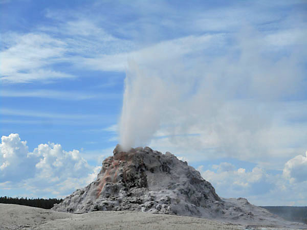
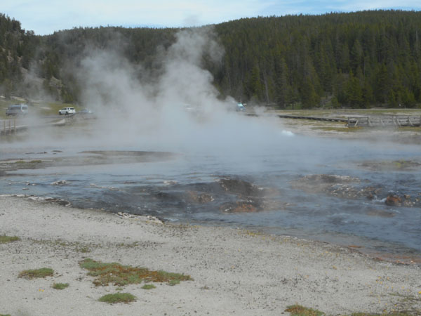
Most were just bubbling this morning
The build up of deposits on this were especially interesting.
Another interlude of plants and shade
with bison -- we had to wait until it wandered farther from the path.
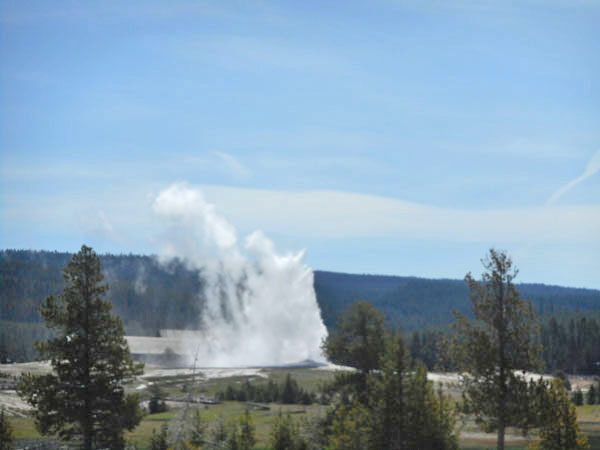
In the meantime Old Fathful went off in the background.
Let's see... .the last eruption was at ... er ... ummm ... "smudge".
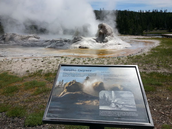
Grotto started going off just as we turned to go
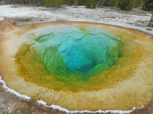
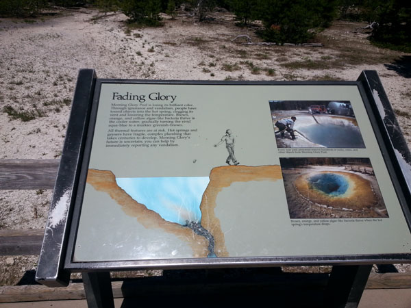
Famous Morning Glory pool is back to being colorful
because of all the work they did to fish tourist muck out of it.
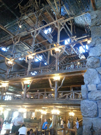
We walked back to the lodge for lunch.
And finished just before
Old Faithful blew again
We now headed back north towards our campground, but still had a couple of places to visit along the way. Our first meander was Firehole Lake Drive, a 3-mile leisurely bypass paralleling the main road.
Firehole Spring, Karen's favorite pool: the white in the center is a large gas bubble that rises to the surface. We stood and watched for several minutes.
...actively bubbling away...
Looking across the pool of Great Fountain Geyser towards...
... sitting quietly ...
... until we were climbing back into the car.
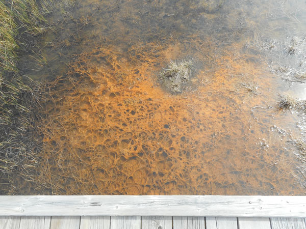
Firehole Lake itself is hidden by the steam from Black Warrior Springs, which in turn feeds into Hot Lake.
Large mats of warm water thermophilic bacteria lie underneath, creating the unusual brown color
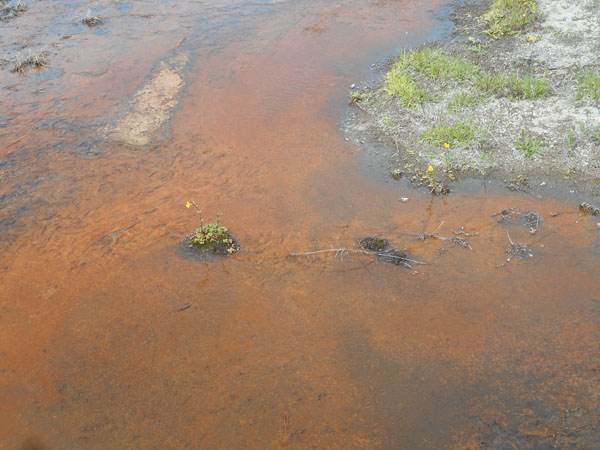
The thermophilics waving in the flow...
The green living in water a few degrees cooler than the red.
Plants growing at the edge of their tolerance range
Fascinating mineral-encrusted vents
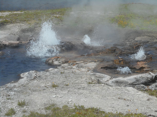
Young Hopeful Geyser (not "a", but "the") ...
... as the video proves...
Wildlife! A beetle the color of the brown areas of the pools -- we wondered if that was where it usually hung out.
Why did Dick and Karen cross the road?
To cross from Firehole Lake Drive's one-way exit to the Lower Geyser Basin and Fountain Paint Pots area on the west side of the Grand Loop Road.
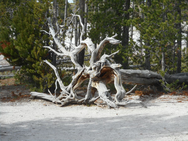
Karen found lots of photogenic tree roots here...
...and trees that hadn't tipped over yet.
(some with bobbysox)
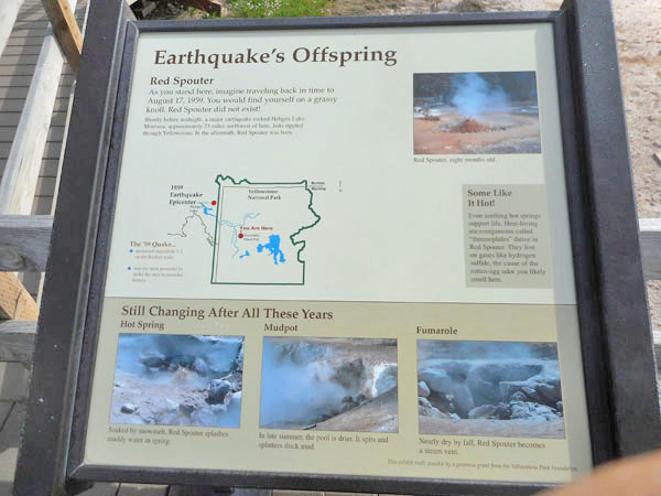
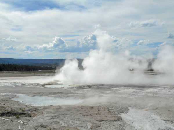
"Red Spouter" is a very recent and very noisy mud pot
Very active...
Red Spouter was born in August 1959 as a result of an earthquake 25 miles northwest of here. This is the same quake that kicked Biscuit Basin's Sapphire Pool into tossing biscuits. We didn't know that we'd be visiting the quake's epicenter after we left the Park.
... alive ...
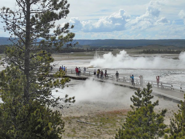
One last view of Lower Basin as we went back to camp.
Beryl Spring had its own little pull-off. It was another feature that became much more active after the 1959 earthquake. Averaging 190° F (plus or minus 2 degrees), it's one of the hottest springs in the park. The bubbles are volcaninc gasses, mostly steam.
Our second morning dawns... if you think of the Grand Loop Road as a clock face, yesterday we did "9:00 to 6:00 to 9:00" ... today we'll try for "11:00 to 4:00", and then backtrack to 3:00 to short-cut directly across to 9:00 (and bed).
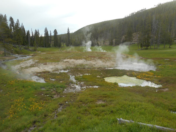
The plans immediately suffer a minor de-rail by spotting a picturesque pull-off a couple of miles up the road from the campground. Let's call it "9:15" (at 7:40am).
It was early, the air was cool, everything was steaming nicely....
Frying Pan Bowl ....
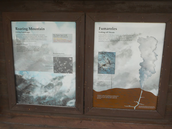
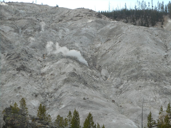
A bit further north is Roaring Mountain...
With an appropriately noisy feature (no video, sorry...)
... and Clearwater Springs.
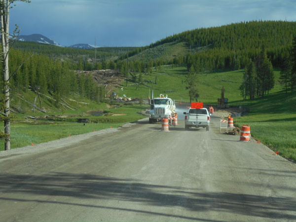
Then came the 20-minute wait for the guide car to lead us through six miles of roadwork.
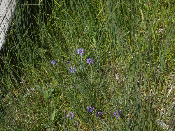
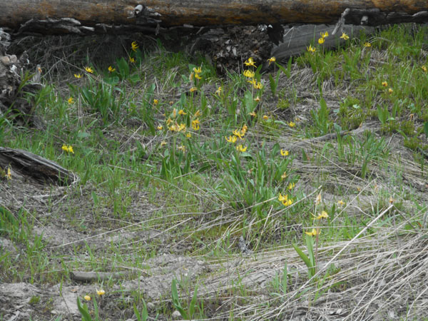
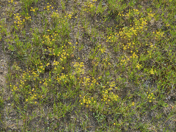
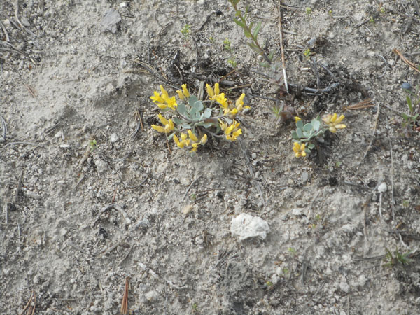
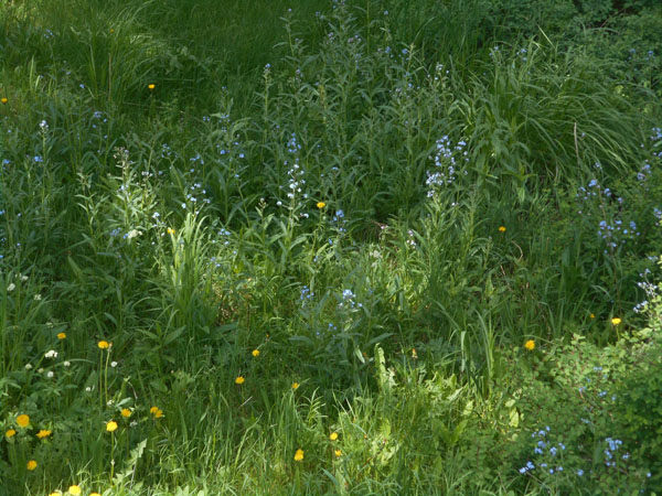
... so Karen botanized.
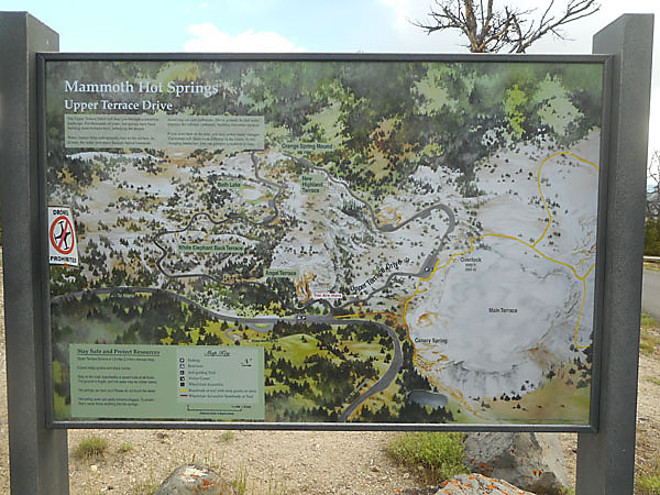
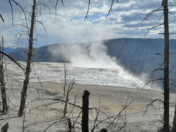
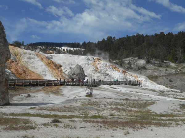
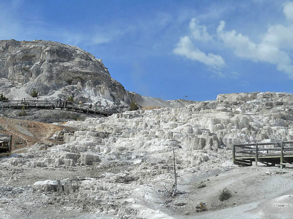
Our goal for this morning: the terraces of Mammoth Hot Springs.
(you might notice the little "No Drones!" sticker on the left)
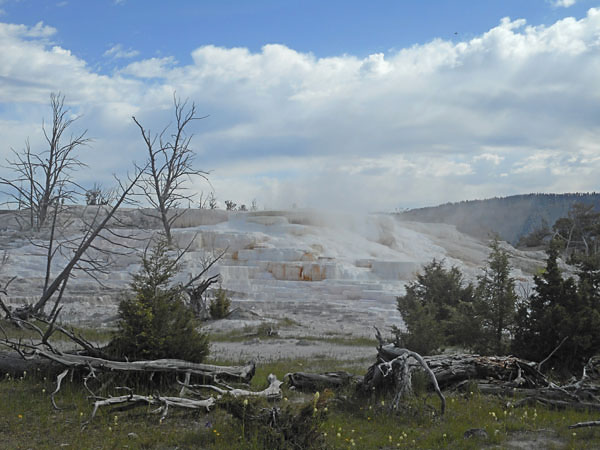
The less-visited Upper Terrace Drive loops around on the (mostly) flat area above the well-known hot terraces. There are numerous stop-and-walk points, so we did.
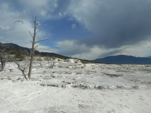
Here the dead vegetation indicating moving hot areas is very noticable.
new vegetation in areas that are not as hot as they had been
And trees that are just hanging on for other reasons.
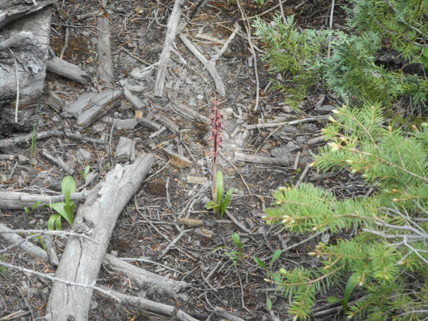
An Orchid just putting up flowers
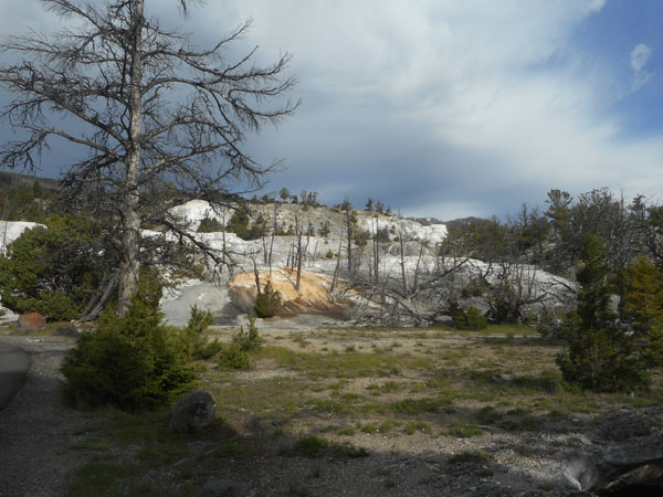
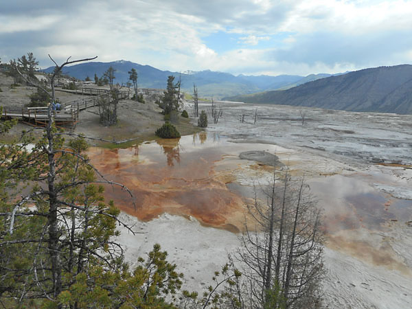
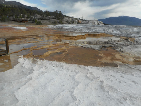
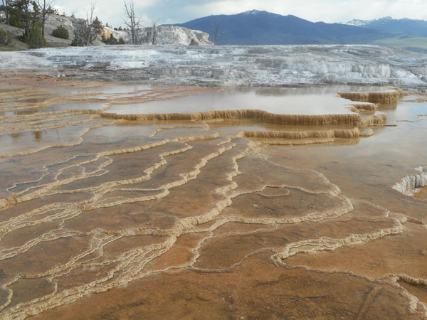
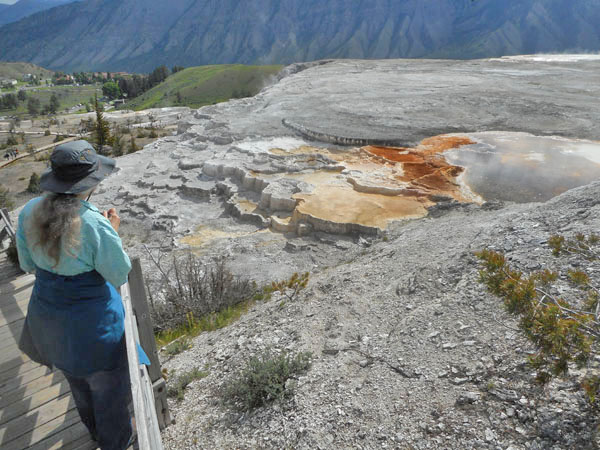
An overvew of the top of the main Mammoth Hot Springs terrace from the west side
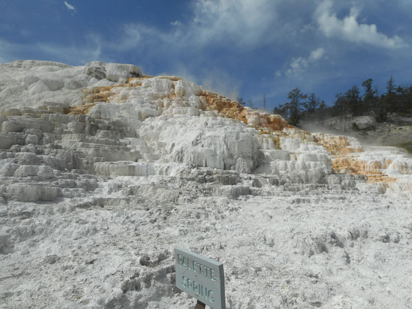
cooler areas are brown with bacteria and algae growth
New hot areas are the bright white of calcium carbonate ... travertine.
the center is dry and gray.
with isolated streams
the west side has more water again
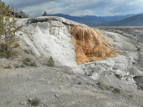
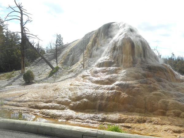
Higher behind the main terrace there is a drive to isolated colorful domes
This is "Orange Spring Mound" ... underground pressure forces volcanically-heated water up through buried limestone, dissolving calcium carbonate as it goes. When it emerges the water cools and evaporates, leaving the calcium carbonate behind. Thermophilic bacteria and algae populate and color the outer surface
It's about 25 feet tall.
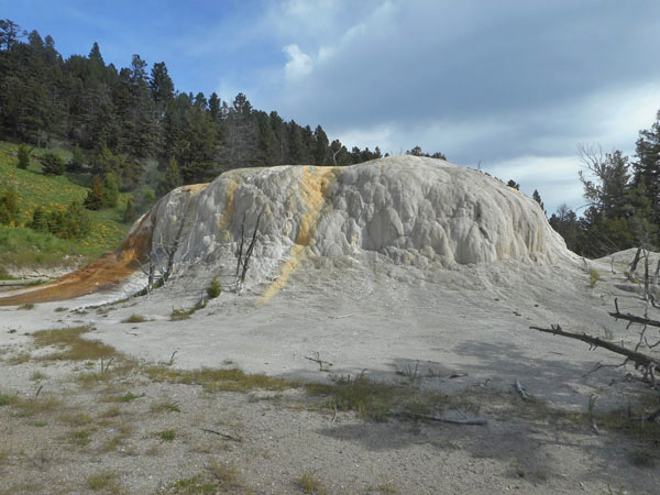
There are smaller terraces up here, too...
... gradually taking over the forested neighborhood.
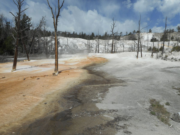
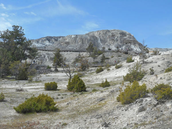
We drive down to Mammoth's "ground level".
The edge of the upper terrace area we just came from is that white slash waaay above the intervening trees.
Many areas are named ... Palette Spring here ...
... although the ever-changing nature of the water flow, accumulating mineral deposits, changes of temperature and thermophile populations sometimes diminishes their former glories.
Mammoth Hot Springs Terrace is large and has lots of walkways but, at this level, not much water except at the edges
We strolled the flowered paths to the lodge for lunch
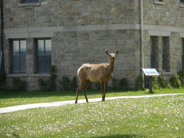
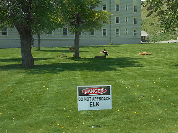
And came out to find the elk were also having lunch
... and siestas. (Rangers scurry over with temporary warning signs)
We now drive east to the Tower/Roosevelt complex.
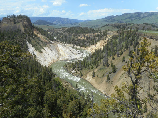
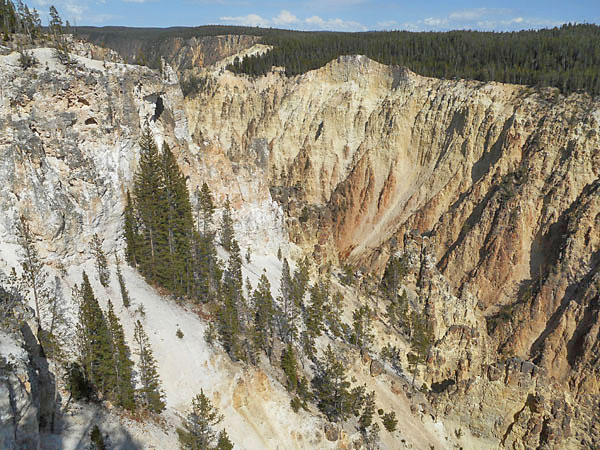
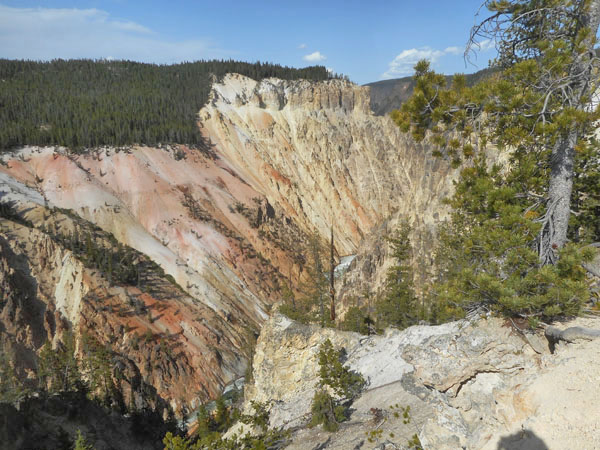
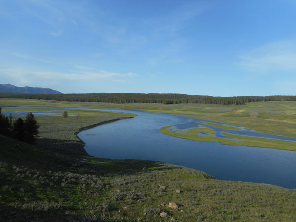
We meet the Yellowstone river which has carved a colorful canyon
The Yellowstone River is rushing north to eventually drain into the Missouri at the Montana/North Dakota border.
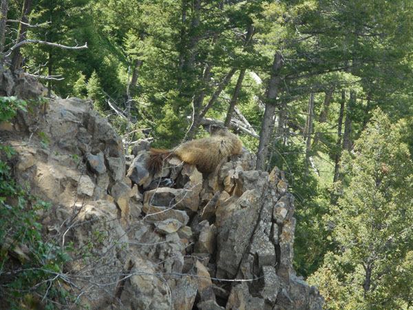
At the overlook there was a mother marmot (the white striped object under her tail is one of the babies
Oh, let's go ooohh and ahhh over the cute beasties ...
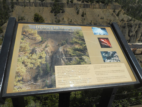
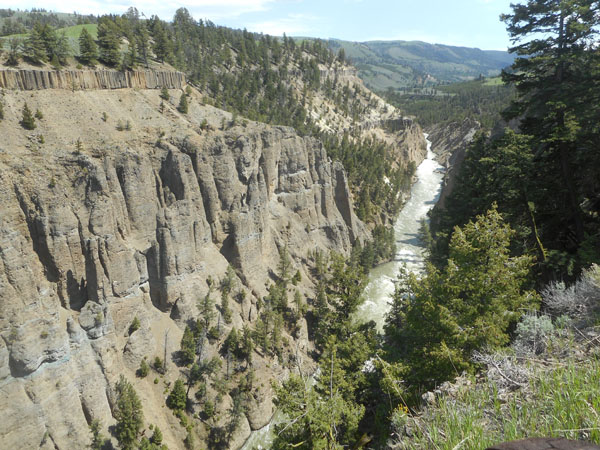
Columnar basalt caps the softer stone at the top of the canyon. The "towers" are welded tuff which often forms such hoodoos
The columns are the layer just below the grass and trees.
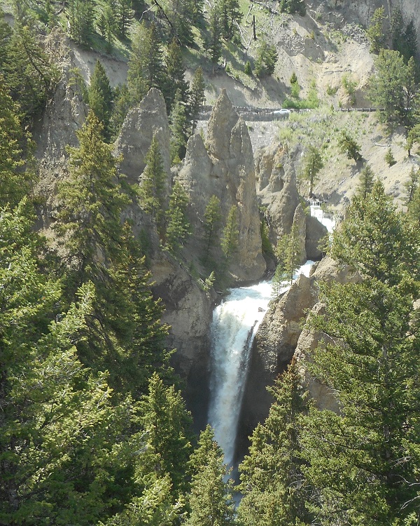
Tower Creek joins the Yellowstone at Tower Falls ...
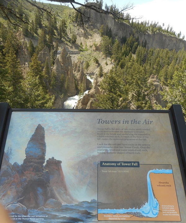
How the Towers and the Falls came to be ... once more the result of softer and harder stone being eroded by water
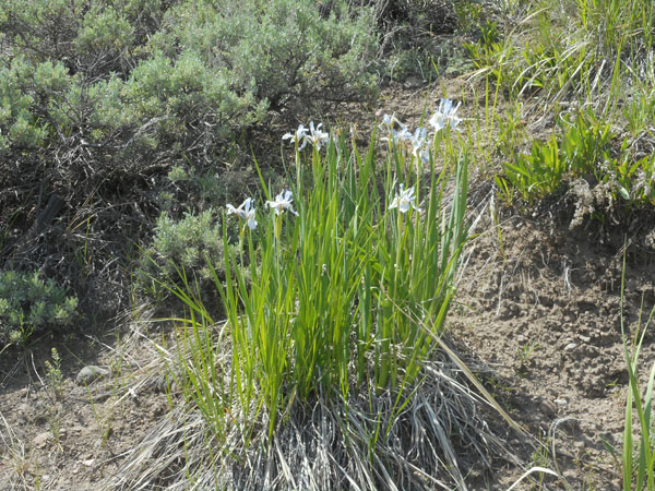
The area is moist enough and spring late enough that we saw iris.
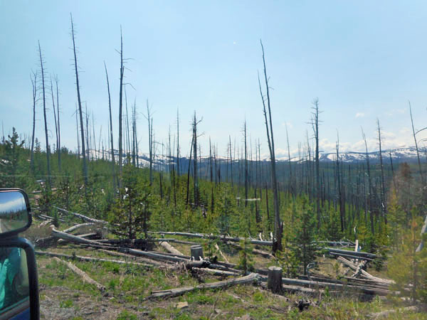
New-growth in a burnt-over area. Last time we were here was soon after the devastating fire of 1988. Now policy has shifted from stifling all fires till fuel builds up to catastrophic levels to burning debris in rotating selected areas so the fires don't burn so hot and kill the older trees.
A raven at the next stop scolds us
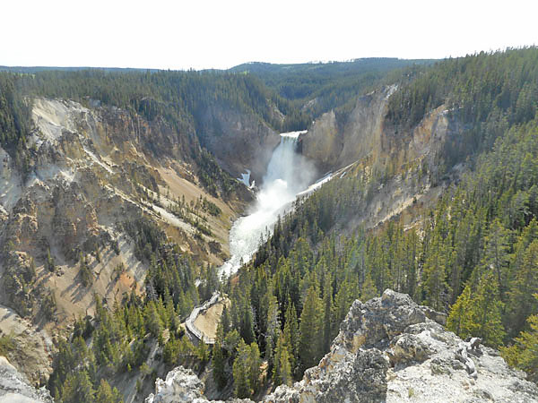
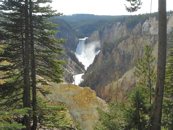
as we wander down for our turn at the much-photographed and painted Upper Falls of the Yellowstone
and colorful canyon
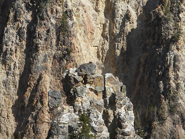
Osprey nest
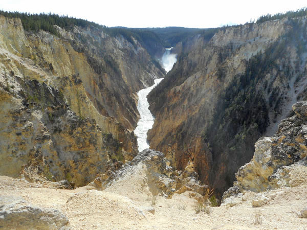
We drive to the south rim for another viewpoint
"Inspiration Point" viewpoint on the north rim was closed. Here's a maximum zoom shot from the south rim.
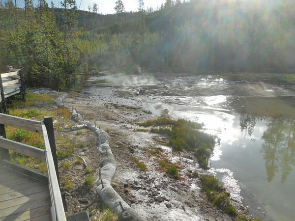
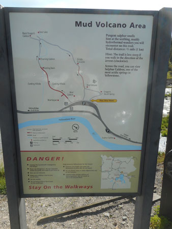
We still had a bit of the day left so we went even further south to the Mud volcano area.
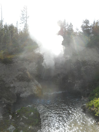
Dragon's Mouth Spring...
... quite ferocious.
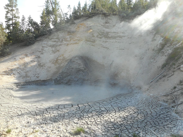
Mud Volcano itself... in 1870 it had a termendous eruption that coated the nearby trees with mud. But the eruption blew its crater apart. Over the next two years it settled down to this roiling, boiling pool...
... still merrily bubbling away.
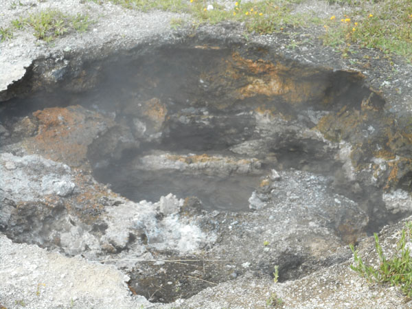
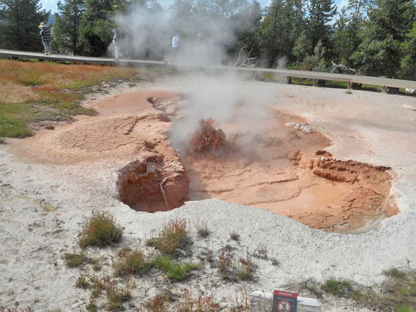
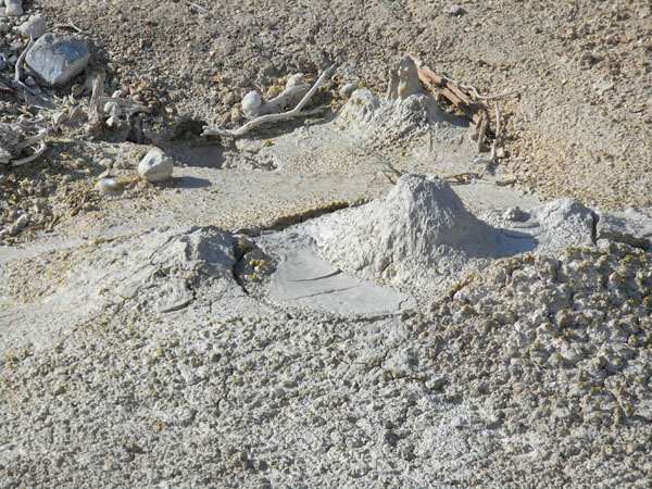
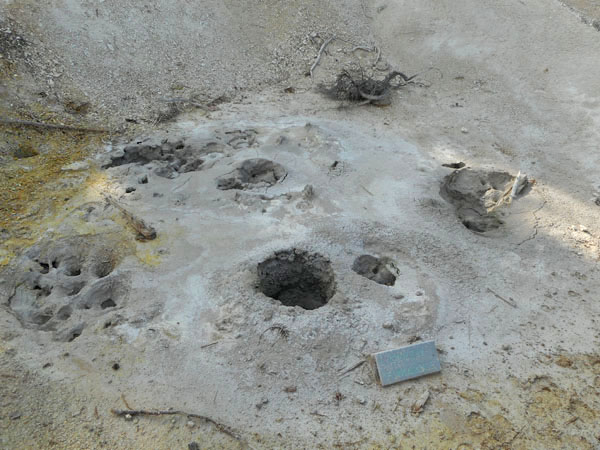
Grizzly Fumarole changes from day-to-day ...
During dry weather, it just steams. With recent rain or snow, the steam vent becomes a bubbling mud pot. All driven by the Yellowstone Volcano's underground magma chamber.
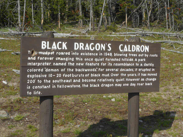
A couple of hundred feet above the Mud Volcano is the upper plateau.
Like so much of Yellowstone, it has a History.
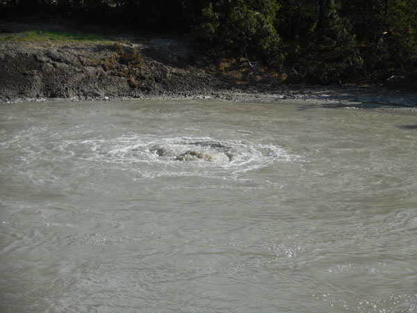
One end of the cauldron was continuously roiling...
...mesmerizing...
Panning from the headwaters to the rest of the Cauldron. The body of water beyond is called Sour Lake.
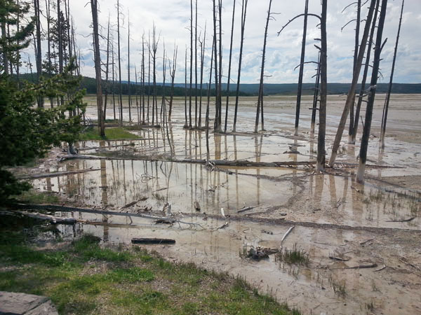
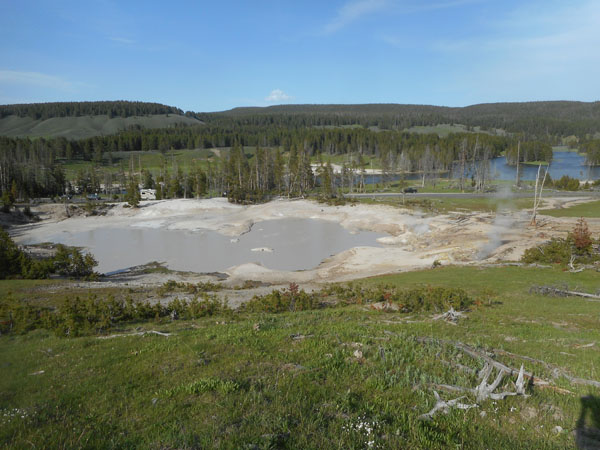
Looking down from the Mud Volcano Area's upper plateau to the large Mud Cauldron on the left and the steaming Mud Geyser on the right. During the late 1800s, Mud Geyser erupted every few hours. By 1927, the eruptions had ceased. The 1959 earthquake caused the soil temperatures to increase, killing the surrounding trees.
The lowering sun over Mud Cauldron.
Meanwhile, across the street... Sulphur Cauldron
Sulphur Cauldron. The sun is getting low, so the camera is a bit slow (but gets there) changing exposure as we see the boiling well of sulphur-rich fluids (hence the yellow stains). As we pull back to the wider view, the black flickers that are crossing the screen are swallows swooping and chasing insects.
The Sulphur Cauldron area is a fairly broad expanse of historic vents and unhappy vegetation.
We drive back to camp through peaceful rolling high meadows.
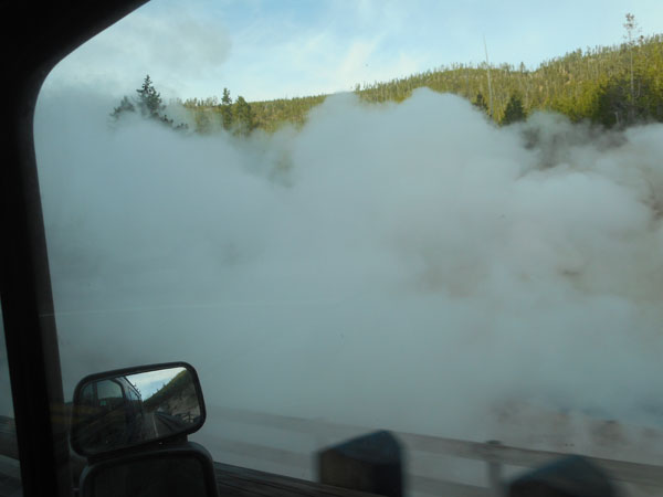
The next morning we're heading out of the park via the West exit. First the short run to the south ...
... for our morning steam bath.
Resuming our "road less travelled" habit, we take US 287 (roughly) northwestward instead of the more usual due-north US 191.After an hour or so of driving, we pull off for a break.
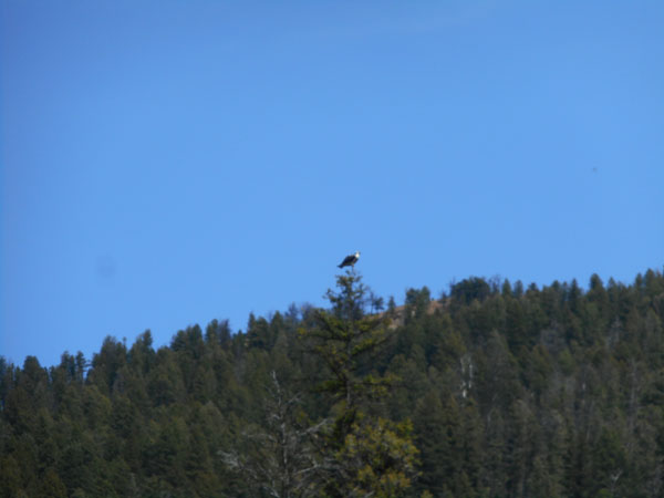
We're watched by an osprey.
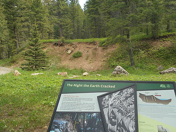
Remember the earthquake in 1959 that had such a great effect upon Yellowstone's geothermal areas?
Here's where it happened...
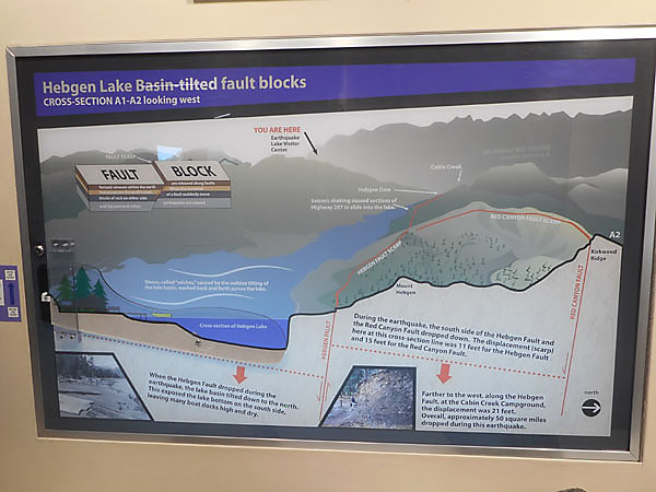
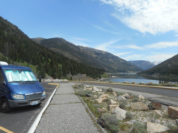
We're at a campground on the north shore of Hebigan Lake. What looks like backhoe work is actually a fault scarp. One night in August 1959 the earth moved up to form this ridge.
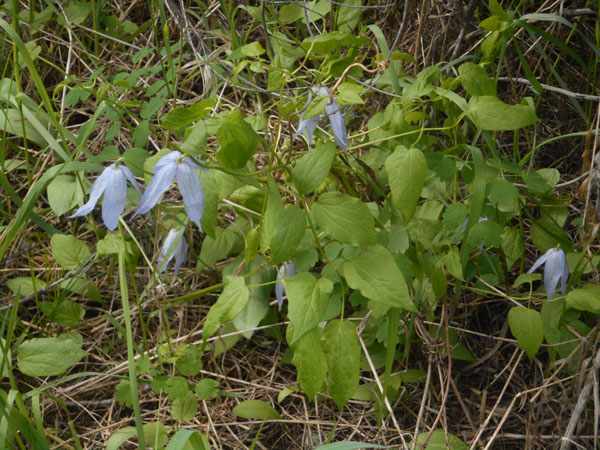
The campground had clematis flowers ...
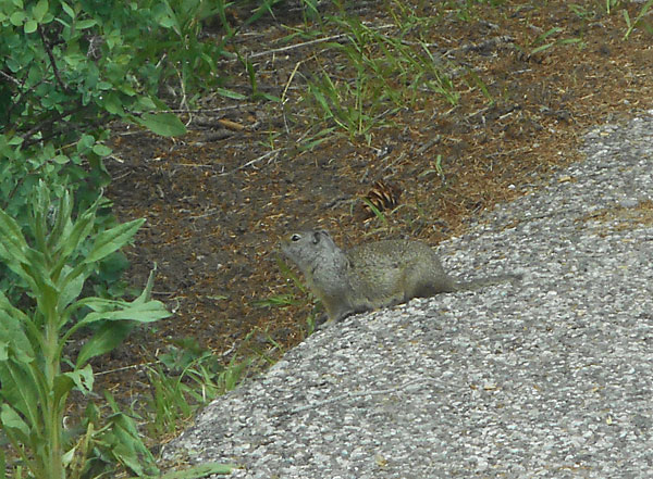
... and a Ground squirrel (?)
(a mantra for the trip was "chipmunks have stripes at their eyes")
The osprey watched us leave.
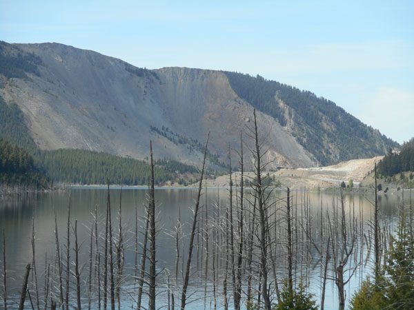
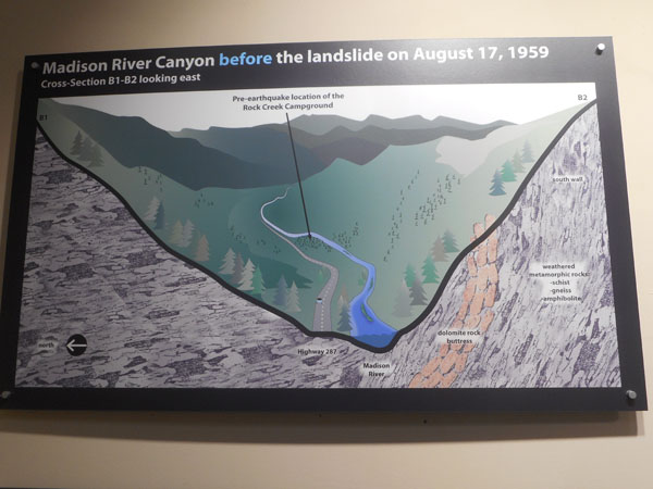
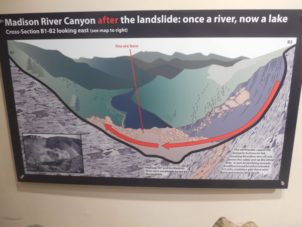
Hebgen Lake is a dammed section of the Madison River, this is its valley. Further west the fault goes under the lake. When the earthquake happened there was a huge landslide that blocked the river. The water rose and killed the trees. The resulting pool is now officially "Quake Lake".
Those mountains are on the south side of the lake... they rose 15 feet. Waterfront cabins on Hebgen became 20 feet above the shore. Waves (seiches) resonated along Hebgen's length and cracked its dam. The dam held, but a large slosh of water went down the river valley. The cleared face of the mountain fell down and ended up "sloshed" over 400 feet up the northern bank and wall.
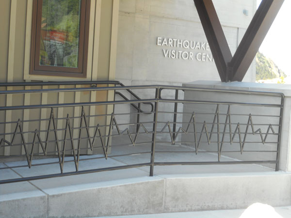
There's a comprehensive visitor center perched on top of the debris pile (the light-colored shelf in the previous photo). We admired the seismograph-inspired railing.
It had good signage and lots of historic and human-interest displays and artifacts.
There had been 250 people occupying the canyon when the quake struck near midnight. There was a full campground where the landslide happened. An estimated 28 people were killed, 19 of which are assumed buried under the rubble.
Geologists have evidence that the Madison Range has risen at least 5000 feet in the last two million years (marked by Yellowstone's ash falls). A fault-slip like the one that made this magnitude 7.1 earthquake every 6000 years would account for the rise.
But it's peaceful now.
A bit further along US 287...
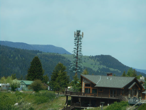
Have you ever noticed that some cell towers are built to (try to) look like trees? Do you think there's cell coverage in the valley?
(we met some in South Africa, too ... we met at least 2 of them along the southern coast)
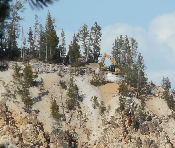
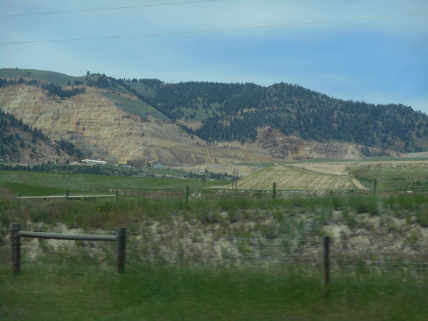
For a long distance we saw a gold-colored mountain: they mine the sandstone for building.
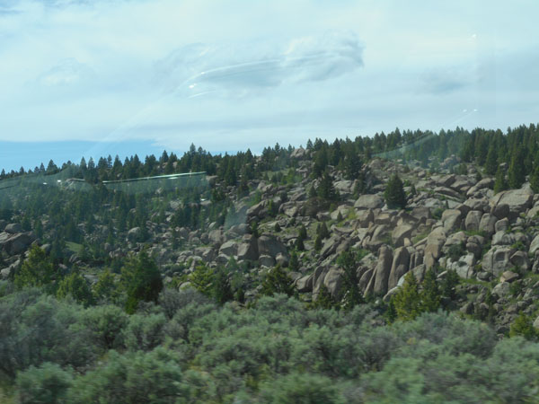
Then there's the high terrain where the sand has all washed away from between the rocks.
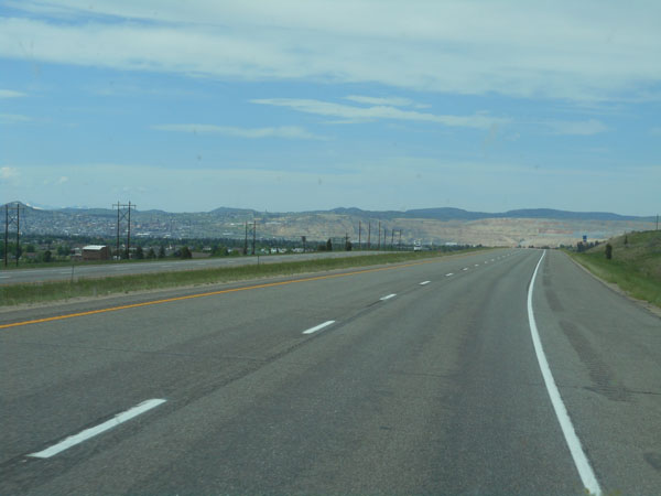
An 80-mile dash along I-90 took us past Butte but the copper mine was visible from a long way away.
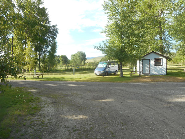
We camped for the night in Garrison, Montana ... with showers and laundry.
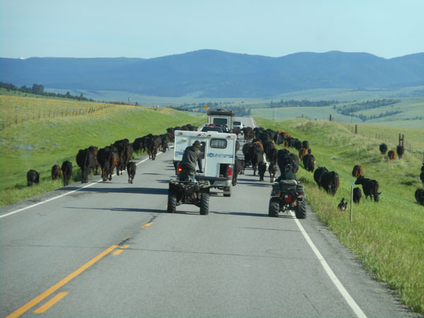
The next morning it's back to the back roads... Montana 121 lets us see how modern cowboys herd cows.
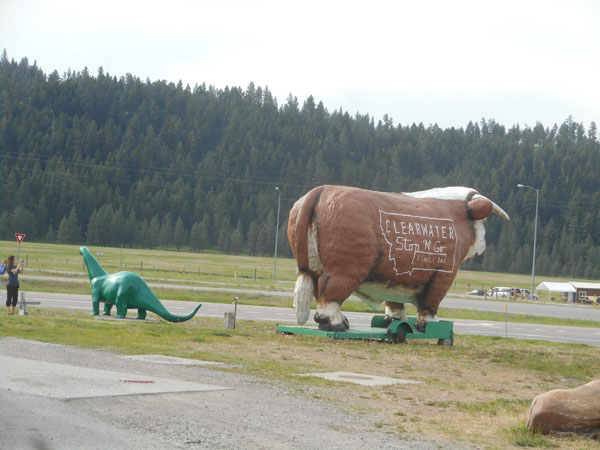
This part of the country still has the habit of putting out large-scale cement beasties to attract tourists to the business. Karen remembers from her family roadtrips in the 50's ... they seem to work (that's another tourist snapping a photo)
(intersection of Montana 200 and Montana 83 ... there's no town here, just the gas station)
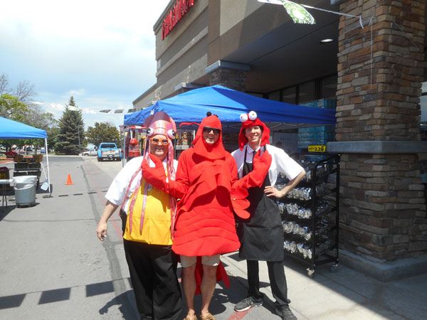
At the grocery store in Kalispell we find the more modern version: Pacific Seafood roadtour employees trying to get folks to buy more seafood.
(Dick thinks these crustaceans may have been out in the sun just a bit too long...)
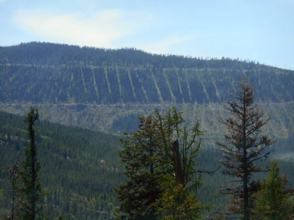
We're into the area where trees are raised as a crop on private land. This is a whole mountainside.
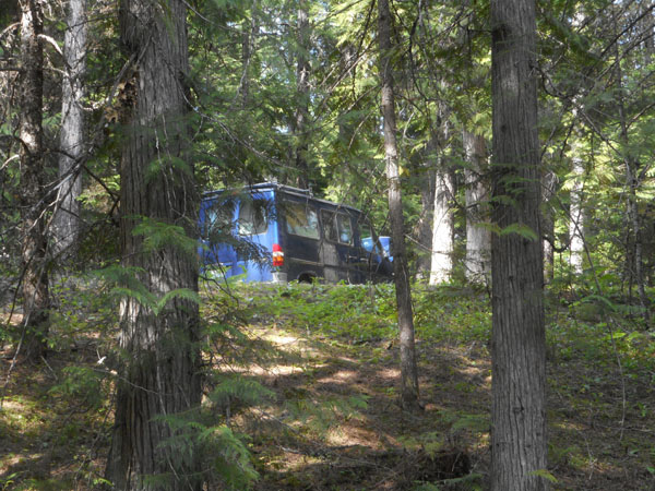
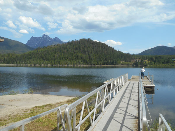
We camp at "Bad Medicine" National Forest campground on Bull Lake (off Montana 56 for the puzzled)
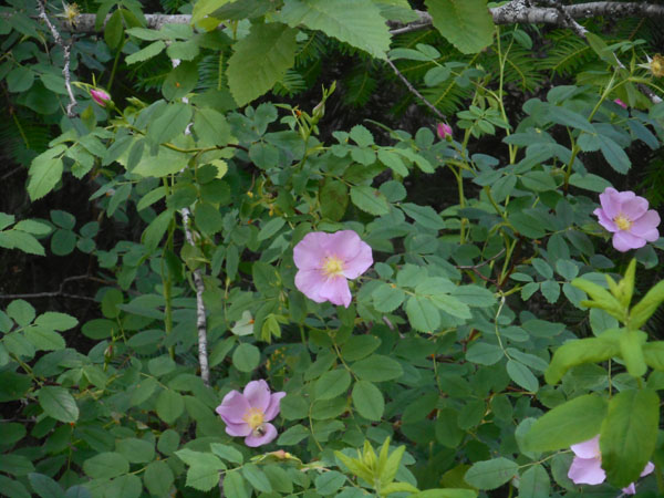
full of roses
(and mosquitoes (hard to photograph))
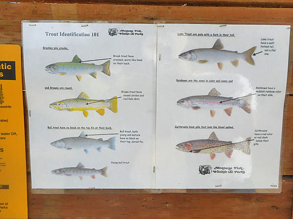
They want anglers to be sure not to catch the endangered native Bulltrout.
We avoid the problem by enjoying the dock but not fishing at all.
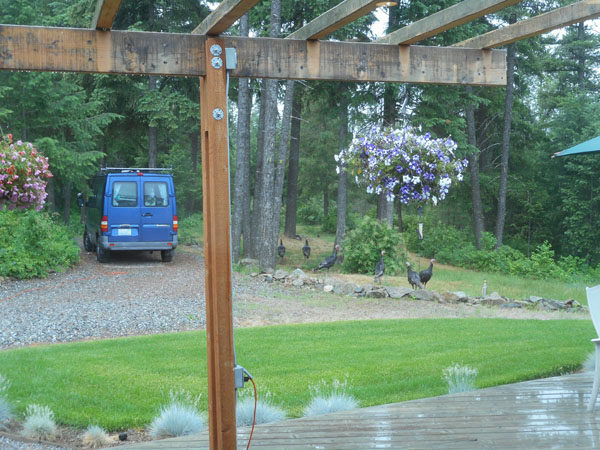
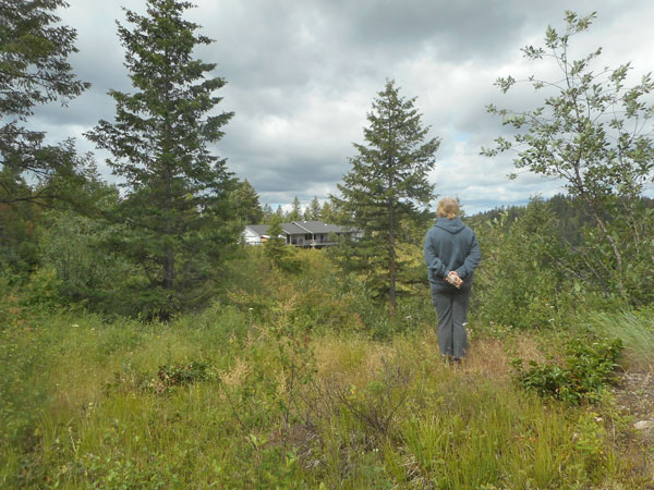
The next couple of (egad! is that rain??) days we spend at our friend's new home in Elk Washington.
They moved from very suburban Issaquah Washington. It was fun hearing their experiences..
...as they settled into their new home in this very rural area.
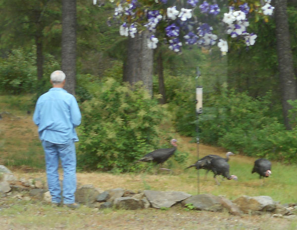
Replete with turkeys ...
... and a lavender farm
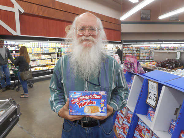
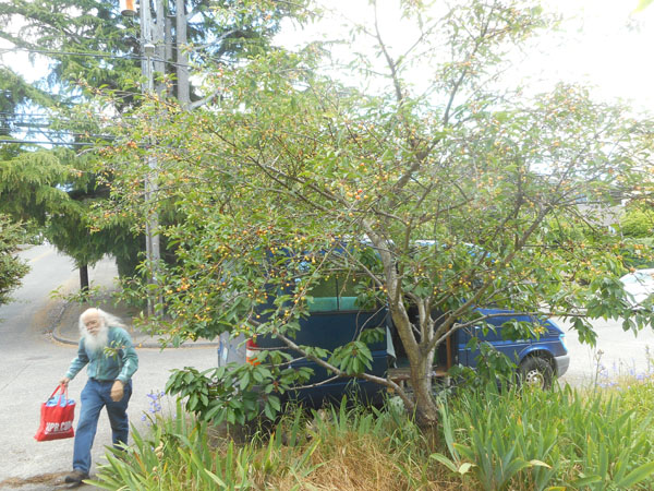
Restocking our larder Dick found something even he wasn't going to eat.
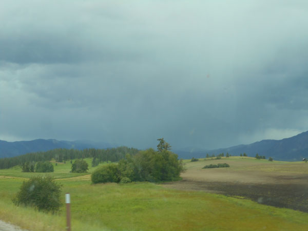
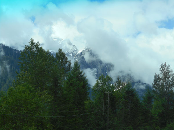
As we headed home the skies were loweing to the north so we took Hwy 2 instead of coming through the north Cascades.
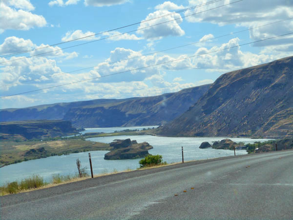
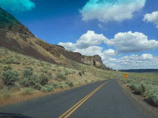
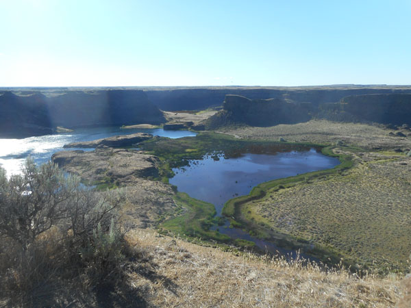
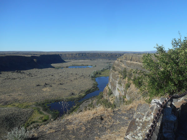
We thereby got to enjoy the channeled scablands once again
(note lack of rain clouds)
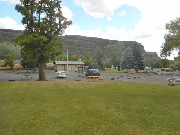
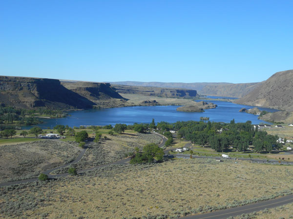
... and camped at Dry Falls State Park.
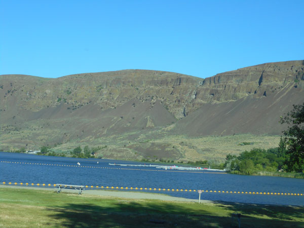
Located on little Park Lake, south of Coulee City.
... at the north end of the "Chain of Lakes"
The visitor center was still closed when we left but the view from the parking lot is always spectacular.
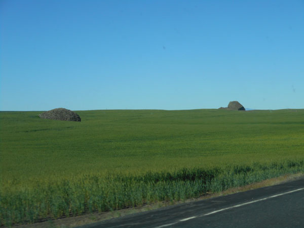
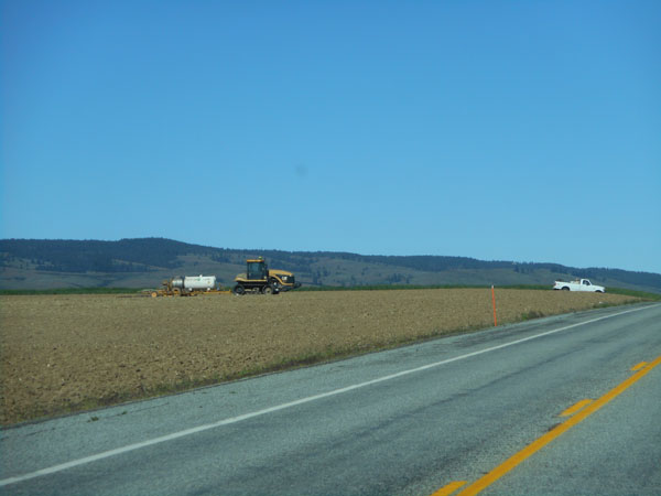
Back on US 2, crossing the high plateau, driving west through the crops ...
...you see the people working to grow your food.
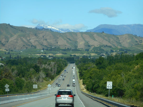
Traffic tickens in the vicinity of Cashmere as we head toward the Cascades...
... where it even rained on us coming across Stevens Pass.