Travels with Dick and Karen
SouthWest US 2018, Part 2
Glen Canyon
to Dinosaur National Monument
|
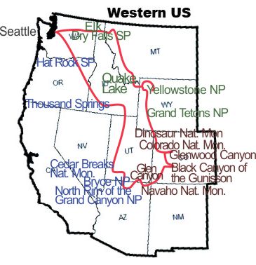 |
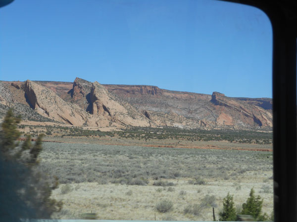
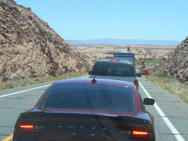
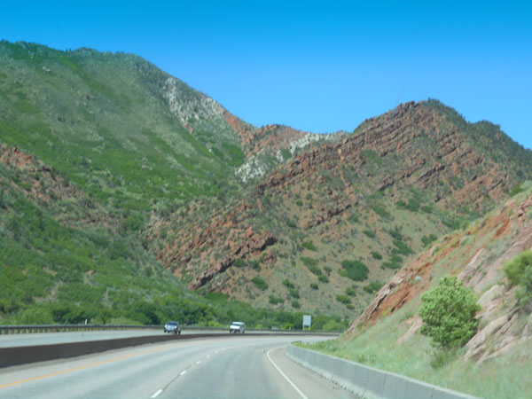
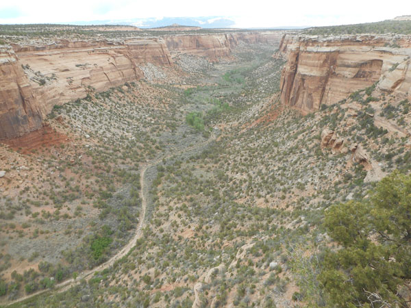
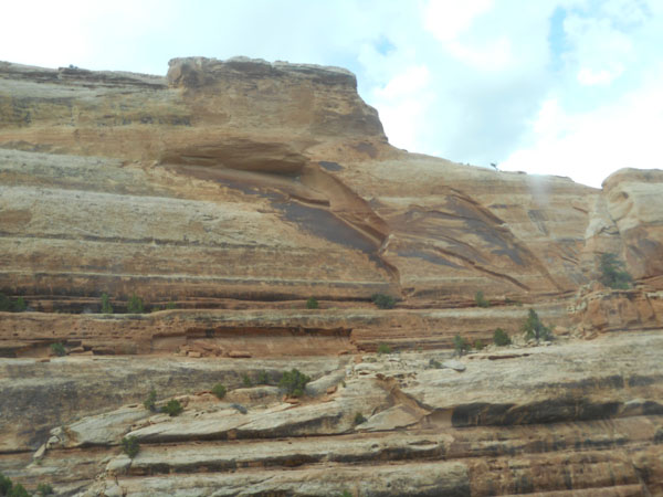
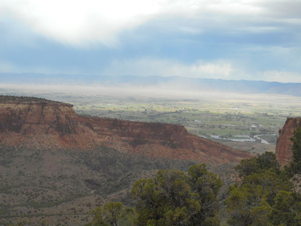
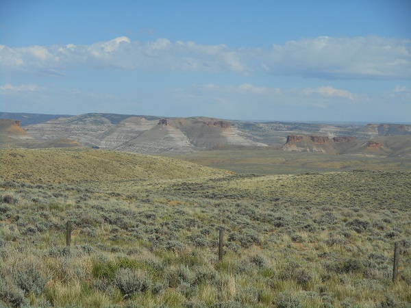
| US Highway Alt89 runs across the top of the Kaibab Plateau at an elevation of about 7500 feet. As we near its eastern edge, we can look across the lowlands to the face of the Vermillion Cliffs.
Hundreds of feet of sediment laid down dust mote by dust mote over millions of years. |
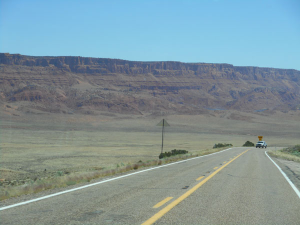 |
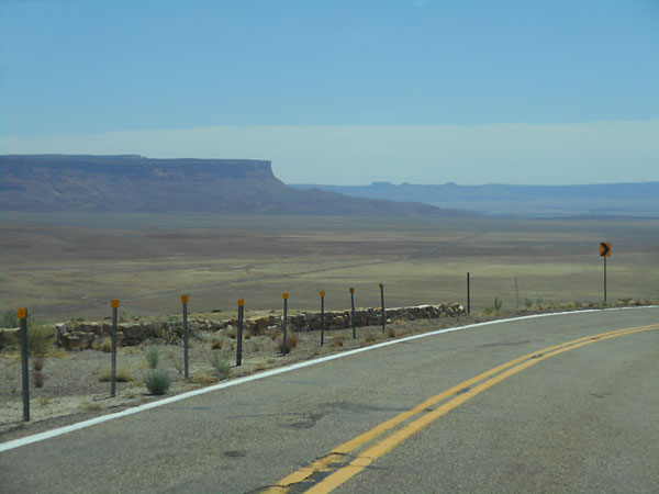
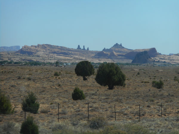
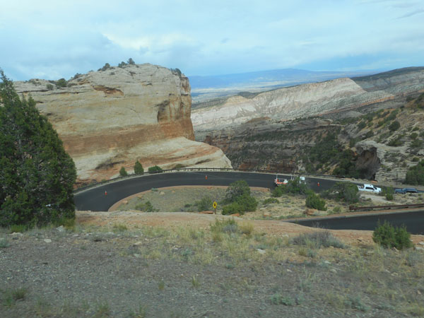
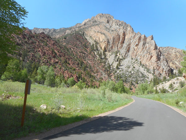
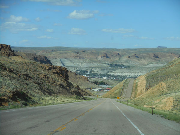
| Then there are a couple of sweeping curves, a plummet and then a double switchback ... and we're down to 5400 feet. This shot is from the first of the curves. Our eventual road can be seen as the straight line slanting through the center of the photo. The most distant plateau on the right is on the other side of the Colorado River. |
 |
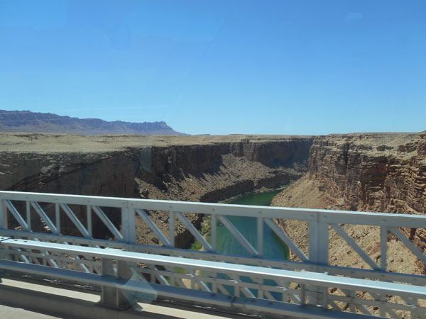
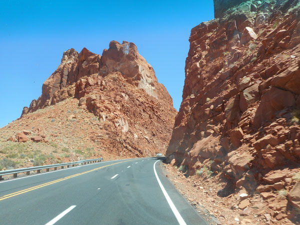
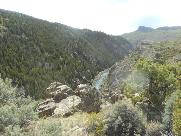
Our first crossing of the Colorado River is at Marble Canyon. This photo is looking south. Grand Canyon Nation Park includes the west wall of this, the Marble Canyon ... but not the east wall nor much of the west's level plain. The river will enter the Grand Canyon about 40 miles downstream. We'll head upriver to Glen Canyon. Those are the Echo Cliffs on the left. |
 |
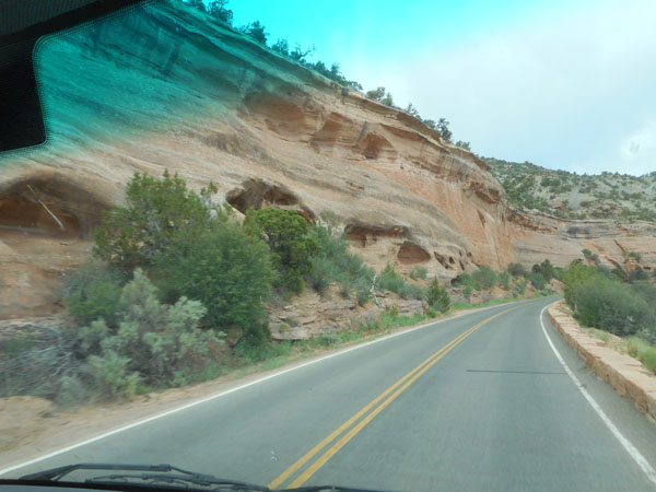
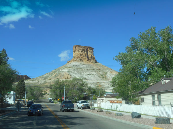
Soon the rock formations become more than occasional as we climb the Echo Cliffs. |
 |
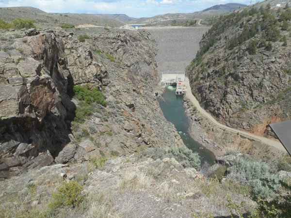
| The Glen Canyon dam slows the river enough that sediment is building up behind it. Someday future geologists may ask "what happened here to fill up a canyon?" |
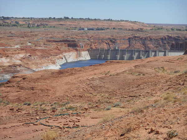 |
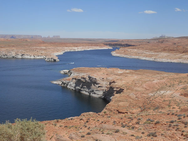
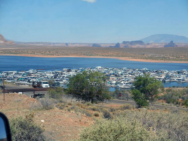
| What was Glen Canyon is now Lake Powell. |
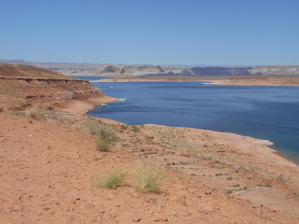 |
When we visited here in 2010, we thought the Lake was low. Looking at the numbers, this visit has the level at about 3611 feet of elevation (479 feet deep at the dam). That's 27 feet lower than our last visit, 22 feet lower than last year, and 89 feet lower than "full". For most of this trip (down through Utah and the weeks after this shot) almost all of the rivers we have been seeing have been quite full ... most of them overrunning their banks or close to it. For the curious, the numbers are here, and the graphs are here. |
 |
The summer houseboating season hasn't really gotten started yet. |
 |
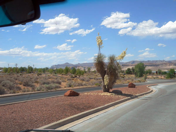
| This looks like a Joshua tree, which is native to southern Arizona rather than here. It seems to be doing well enough to flower. |
 |
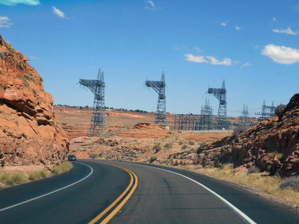
The power towers march away from the dam |
 |
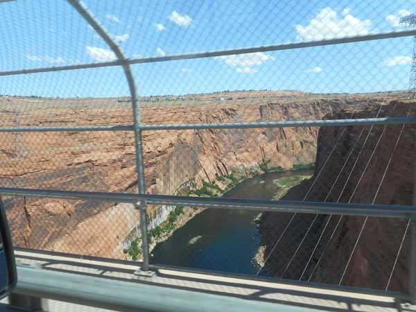
| One more look at the Colorado as we cross it at Page Arizona before we drive east to look at the Gunnison river, one of its tributaries. |
 |
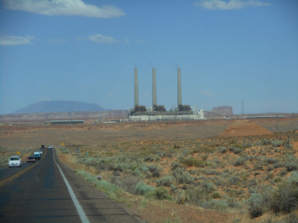
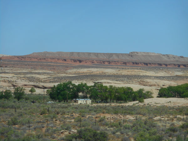
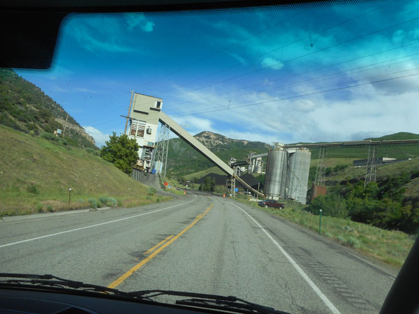
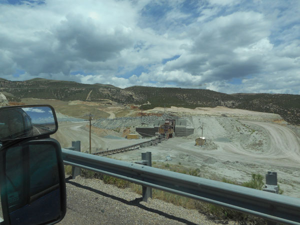
Six miles from the Glen Canyon dam is the Navajo Nation's coal-fired Salt River Project power plant. Due to the lower cost of natural gas, it's scheduled to be shut down after 2019. Coal for this plant comes from a mine 68 dedicated electric railroad miles away. We ended up driving by the other end of that track, without realizing the two ends were connected. The rail line took a different route than the highway for half its length. The plant's smokestacks were visible 5 photos back in the picture of Lake Powell accompanying the "how full was it?" numbers. |
 |
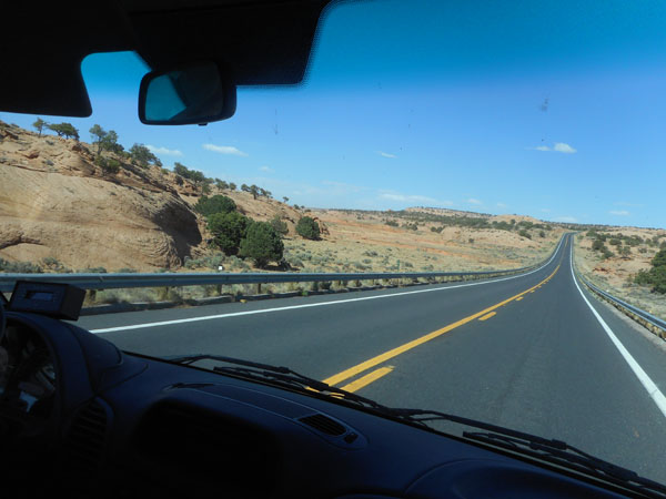
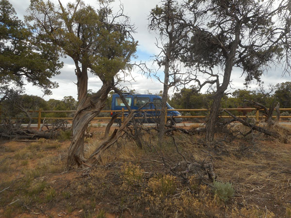
| Back to driving through rolling sage-filled terrain as we cross the Navajo reservation. |
 |
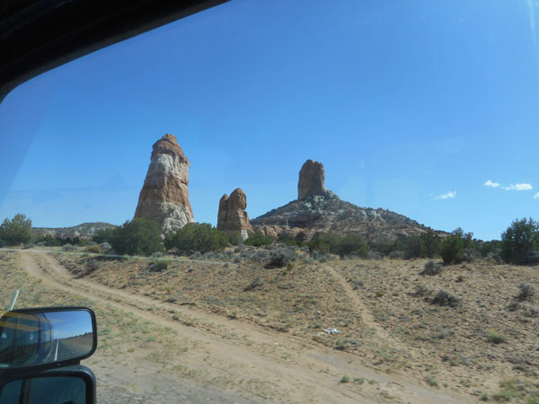
| Small monuments along the way... |
 |
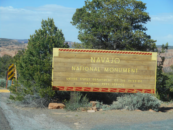
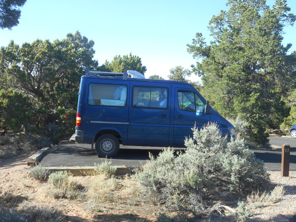
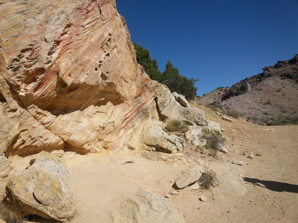
| We stop for the night at Navaho National Monument |
 |
| A very pleasant campground ... |
 |
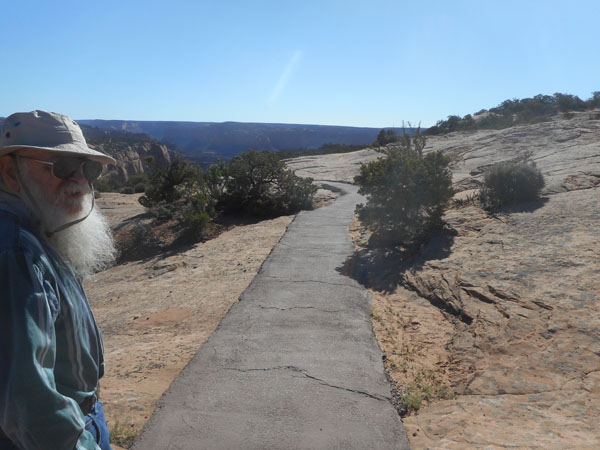
| In the morning we took one of the hikes from the monument's visitor center. |
 |
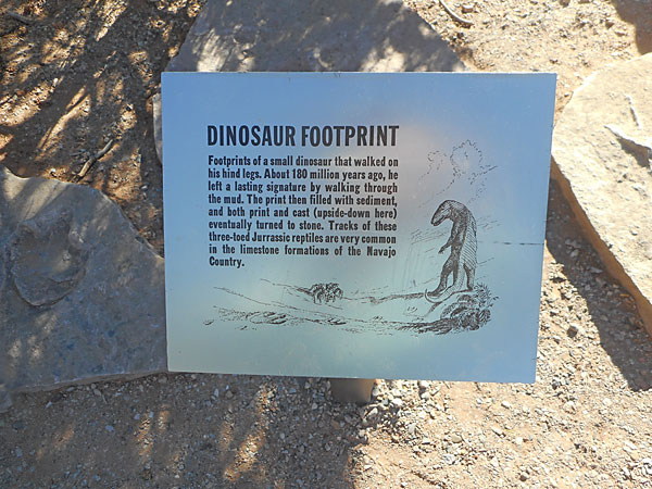
| The trail's signage told us that we were nowhere near the first to walk in this area. The footprint is to the left of the sign. |
 |
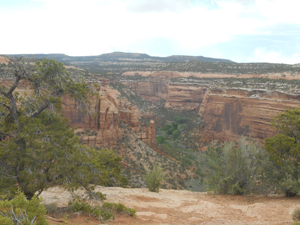
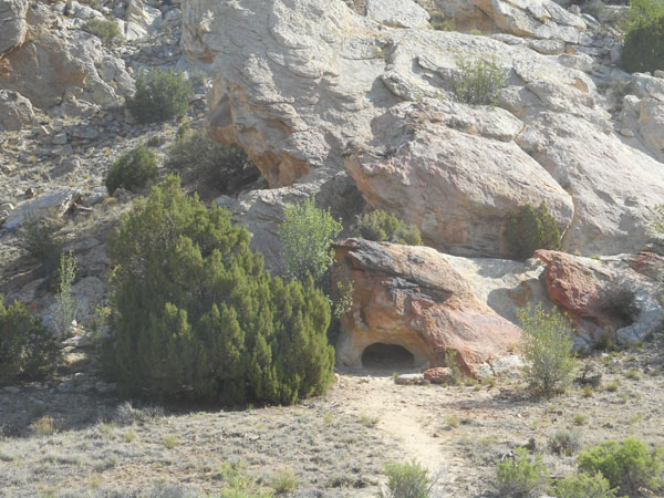
| The trail followed the south rim of Betatakin Canyon. |
 |
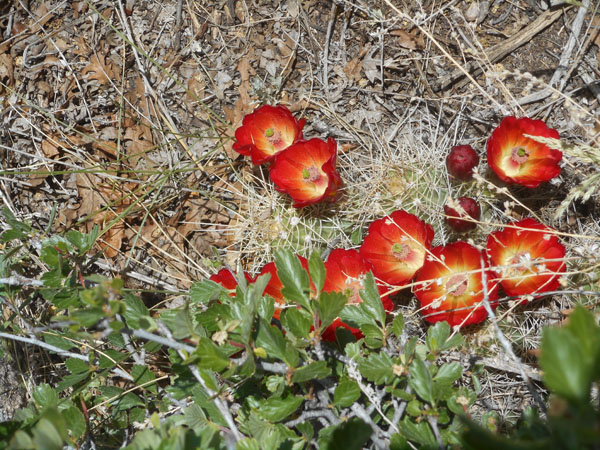
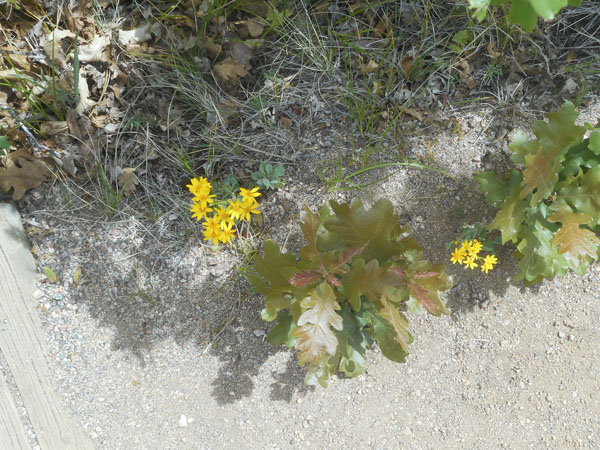
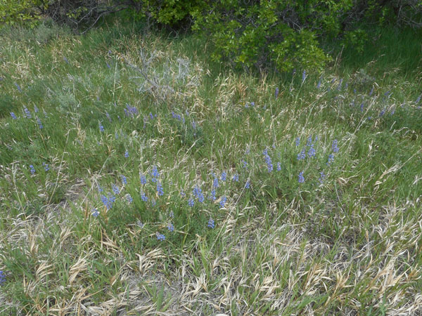
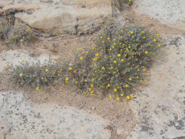
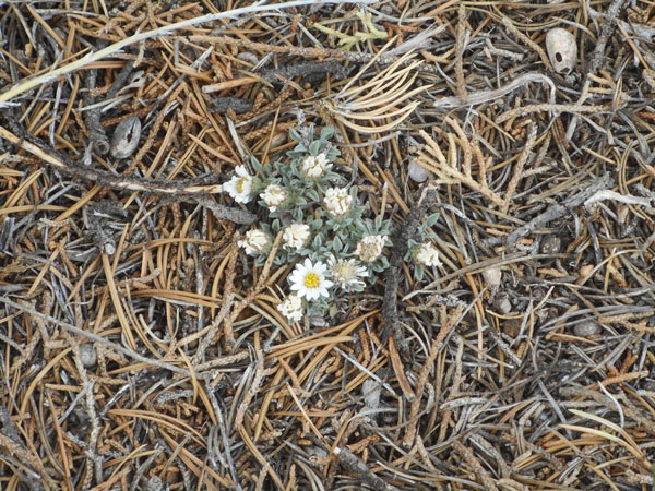
| Even here there are lots of flowers |
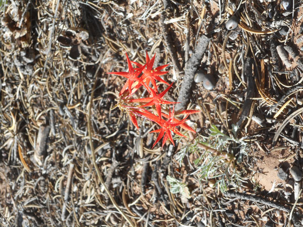 |
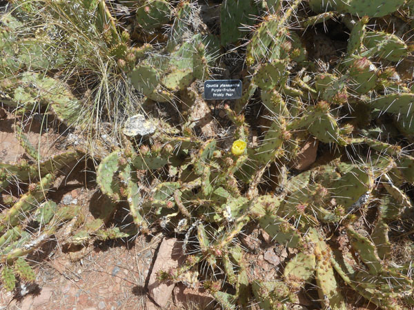
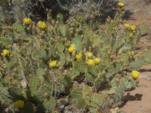
| blooming cactus |
 |
| |
 |
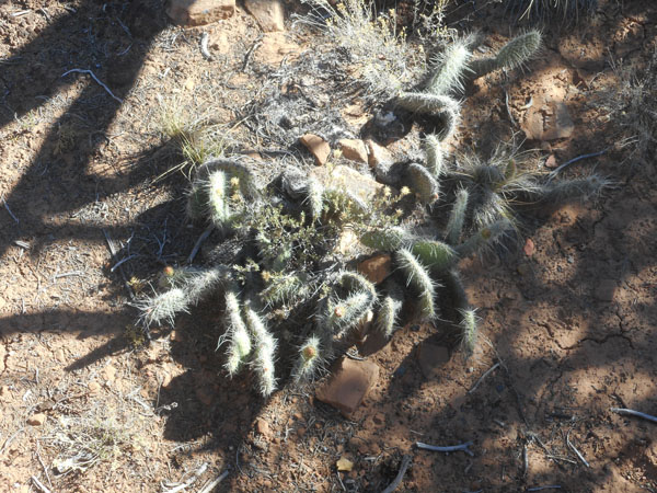
The prickly pear is almost in bloom. |
 |
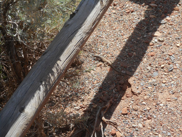
| We shared a bridge with the wildlife. Is it thinking "my head is in the shade so you can't see me"? |
 |
| Life's rough on the edge... |
 |
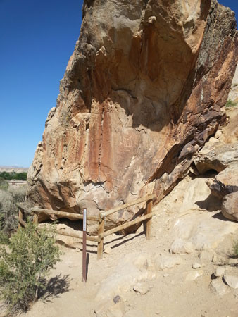
| The end of the path is a view across the canyon ... |
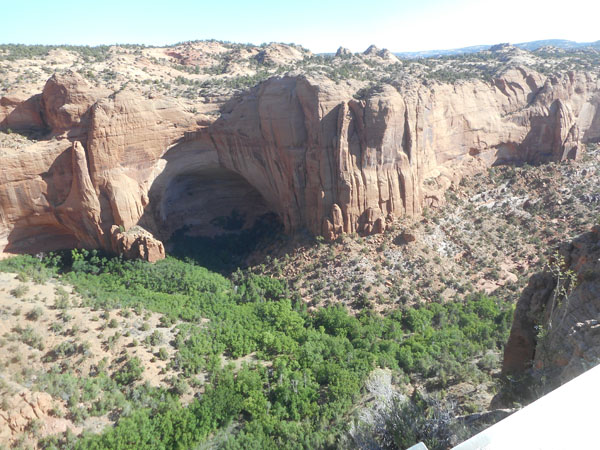 |
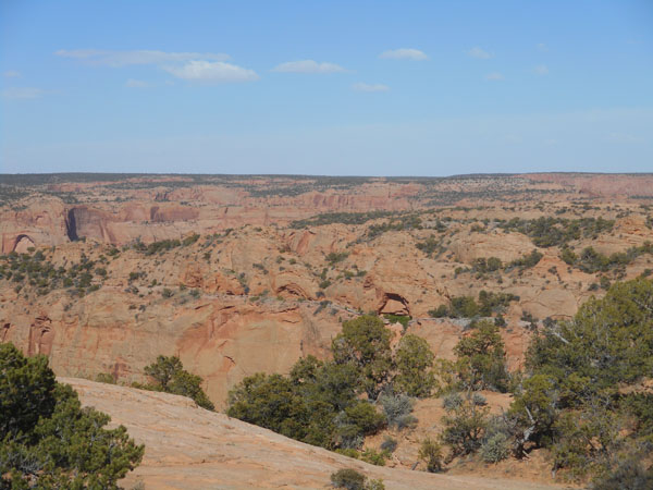
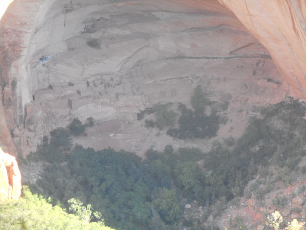
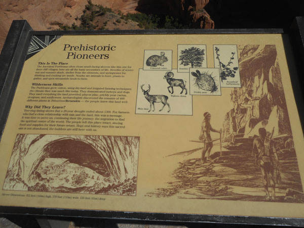
| ... of the ancient Anasazi village Betatakin (Talastima in Navajo), 500 feet below. About 100 people lived in these sandstone pueblo houses from about 1250 to 1300. The alcove faces south, so it was warmer in the winter. Its overhang kept off the rain, and drinkable water seeped out on the layer beneath the Navajo sandstone. It's 458 feet wide. |
 |
They farmed this and the adjacent Tsegi Canyon's floor. Nowadays, the river allows aspen to grow down there, whereas here on the rim it's pinyon and juniper. The village was abandoned at the end of a 20 year drought ... a sign that it was time to move on. Food and supplies were left in the storehouses for their possible return. |
 |
| In the morning we took the access road back out to US 160. |
 |
Remember the power plant's electric railroad? Here at the highway intesection is its other end. Looking like an absolutely huge grain elevator ... |
 |
... fed by a conveyor system that disappeared into the face of the Black Mesa's plateau to the south of us. |
 |
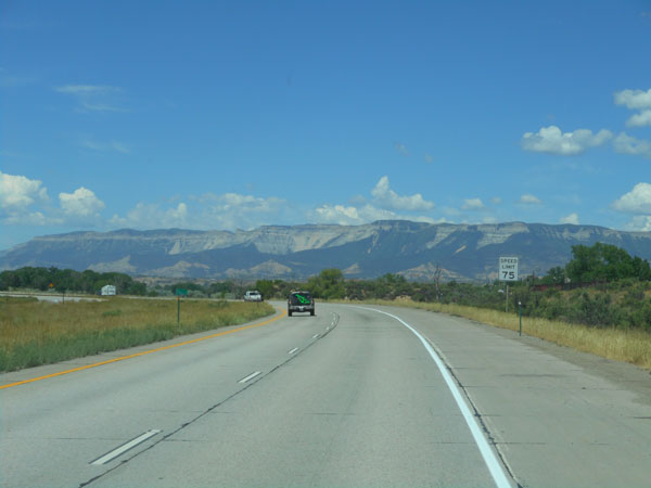
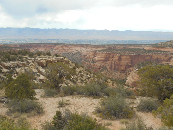
| The large plateaus with cliff edges mostly give way to rock formations. |
 |
| Monument Valley, used as a backdrop for so many westerns, lies north of us, just over the hill on US 163. We had discussed revisiting it, but felt the urge to continue along on US 160 to places we hadn't been. |
 |
| As we continue across the reservation, there are a few houses surrounded by trees |
 |
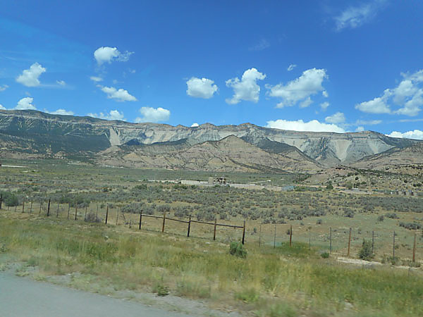
| ... but mostly it is flat and dry. With distant monuments. |
 |
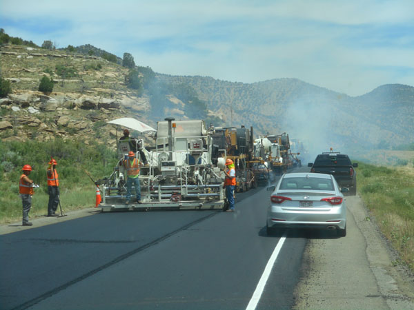
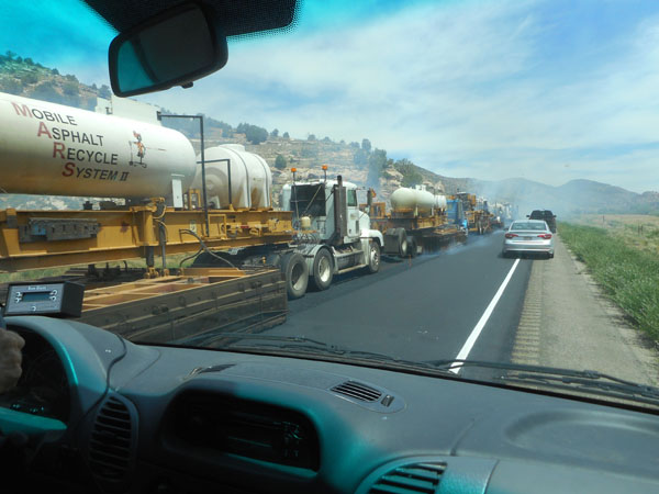
| And occasional road work |
 |
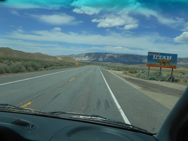
Then we entered Colorado (the state) at Four Corners.
Things started looking up.
Very Up. |
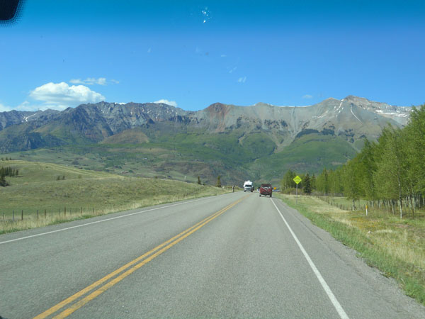 |
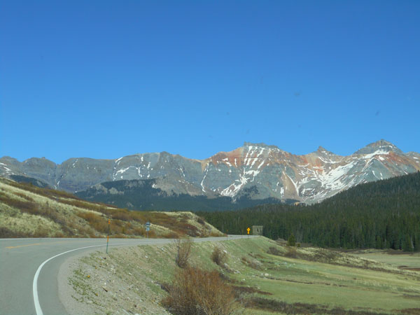
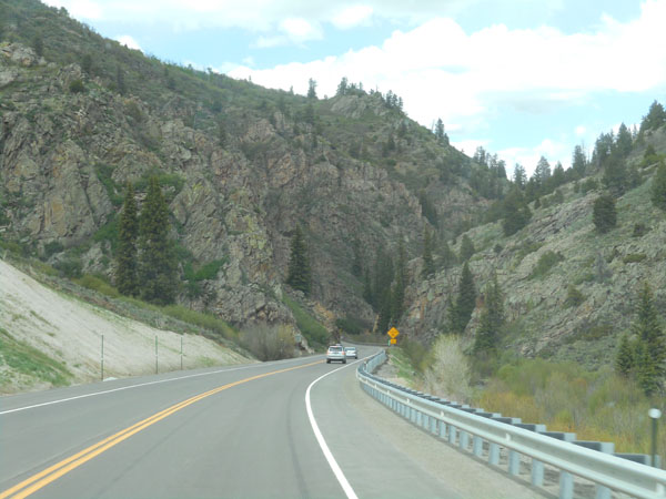
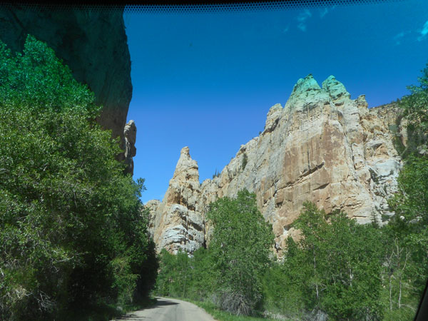
| There's still snow as we cruise through the San Juan National Forest ... we're at about 8000 feet, the mountains are above 12,000 feet. The snow was beside us as we crossed 10,222-foot Lizard Pass. |
 |
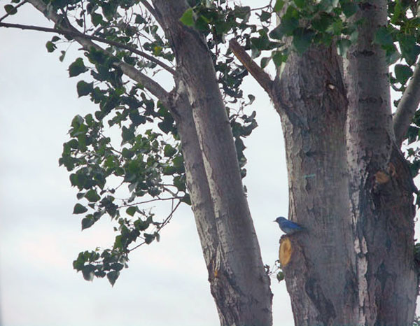
| We spot a mountain bluebird at our pricey commercial campsite in Montrose (it is the Saturday of Memorial Day weekend. The owners have raised their normal prices -- but they have space and we can do laundry and showers). |
 |
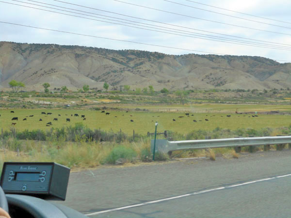
| Out in the morning through fields of cows. |
 |
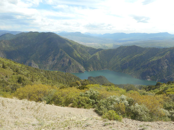
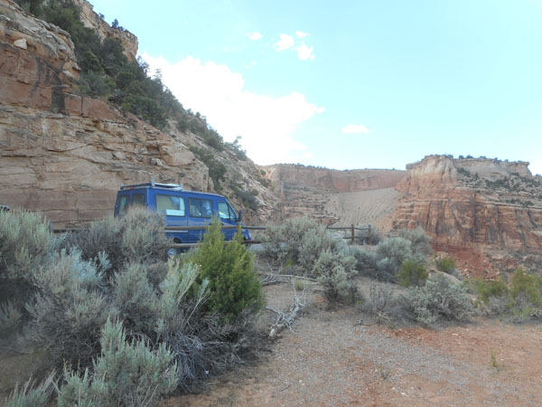
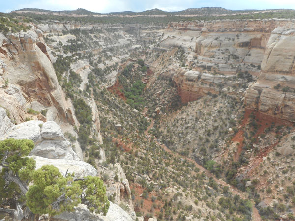
| The Sprinter climbs the hills to the Black Canyon of the Gunnison National Park |
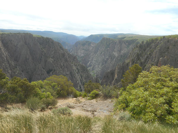 |
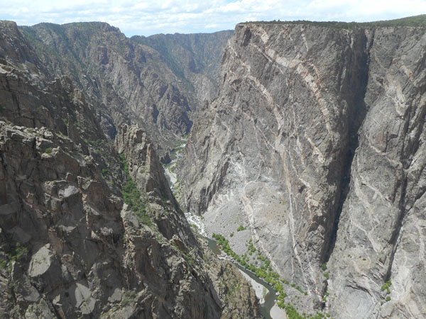
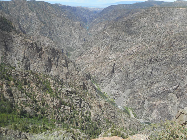
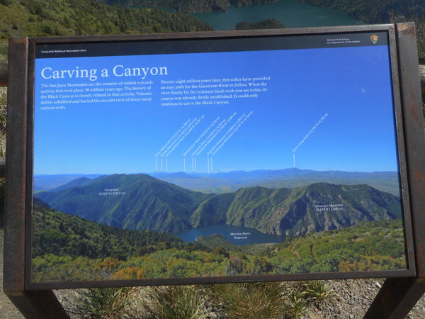
Black Canyon is a very narrow gorge cut by the Gunnison River. First it went through softer volcanic rock, then through the harder crystalline uplifted gneiss below. Unlike Yosemite, glaciers didn't widen that path and smooth the walls. Unlike the Grand Canyon, the lower rocks are hard, not softer sandstone. In the river's 9-mile travel through the park it drops about 900 feet. The flow of the water is from the southeast towards the northwest. It was established as a National Monument in 1933, and gained Park status in 1999. |
 |
Before hitting the hard precambrian gneiss, the river's course wandered north and south as the nearby West Elk and San Juan mountains alternately flooded the area with thousands of feet of lava and ash from 35 to 10 million years ago. Then the underlying rock went through an uplift phase, giving the area its slope. Then came the last two million years of Ice Age glacier melt and rubble to make the final cut into the gneiss. The structures on the near left are called "fins". |
 |
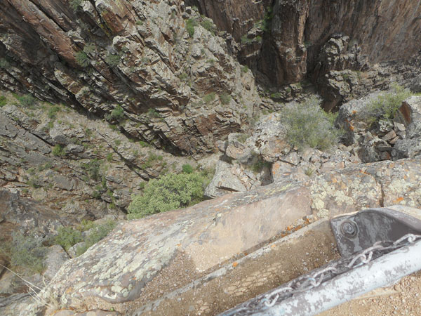
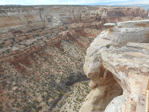
| Some of the viewpoints are out on rocky points. |
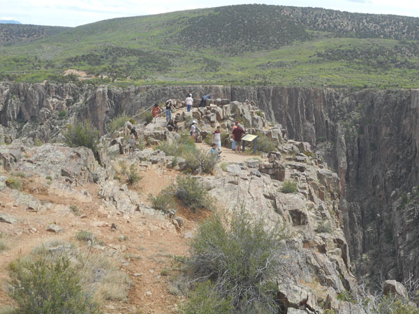 |
Karen doesn't like edges... The rocky points are eroding away under our feet... |
 |
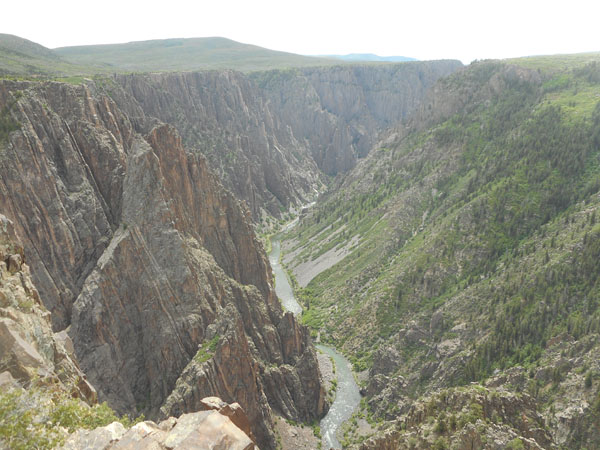
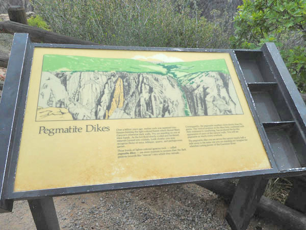
Here the Black Canyon shows its unique topography... over 2000 feet deep, only 1300 feet wide at the top and narrowing to as little as 40 feet wide at the river. The white bandings are pegmatite dikes... billion-year-old hard crystallized igneous intrusions through the far older gneiss. As the gneiss erodes away, it's the pegamtite that forms the "fins" mentioned earlier. |
 |
| ... at least, that's what they said... |
 |
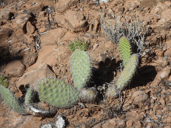
| Karen kept her eyes on the ground... and found blooming Claret Cup cactus. |
 |
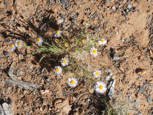
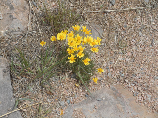
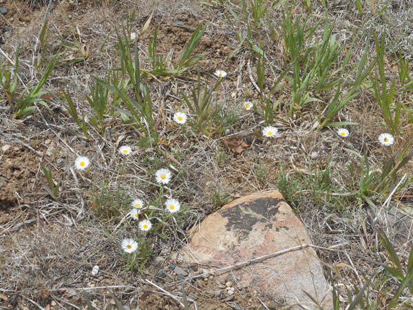
Ooookay ... now we have the "daisy-like" group.
At first we thought these were "Tidy Tips", but they would have to have white tips on the petals. Karen discovered wildflowersearch.org, and it appears to be "Ives' fournerved daisy" ... maybe.
|
 |
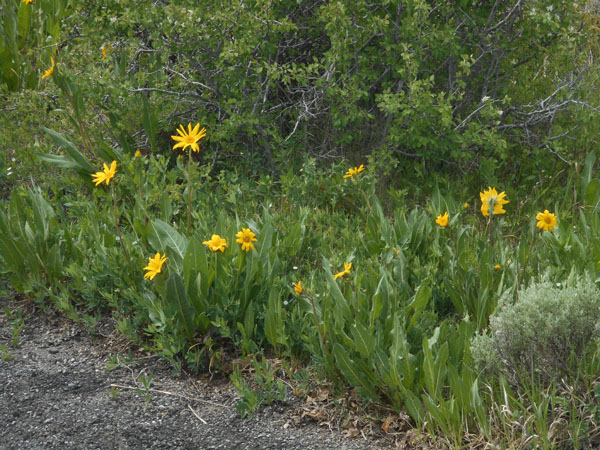
| Karen's voting for "Arizona Mule-ears" |
 |
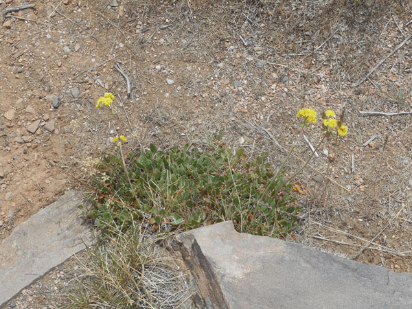
| A buckwheat? (we think we're seeing six petals) |
 |
| Karen says "a daisy of some sort, very small". |
 |
Many many petals... a fleabane of some sort? A cutleaf daisy? Admire the plant, shoot the photo, research later... |
 |
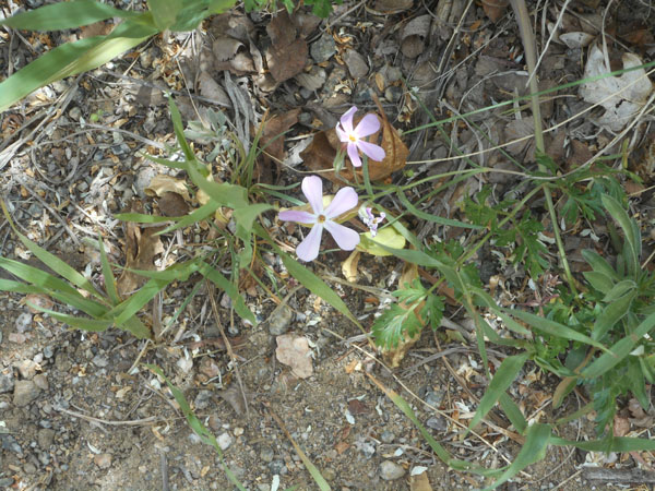
| Spiny Phlox |
 |
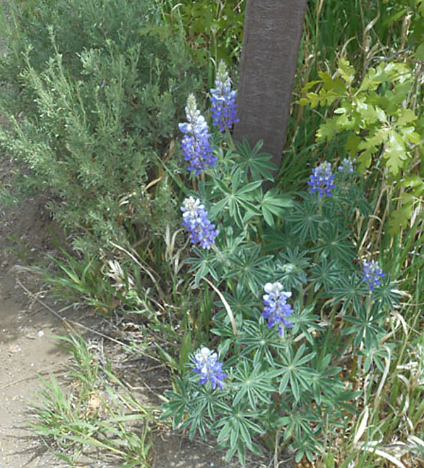
| Lupin |
 |
| "The Other Lupin" |
 |
| Ummmm ... ?? |
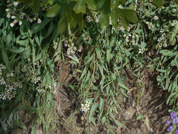 |
| Evening primrose?? |
 |
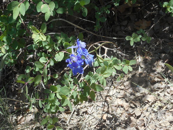
| Larkspur (delphinium) |
 |
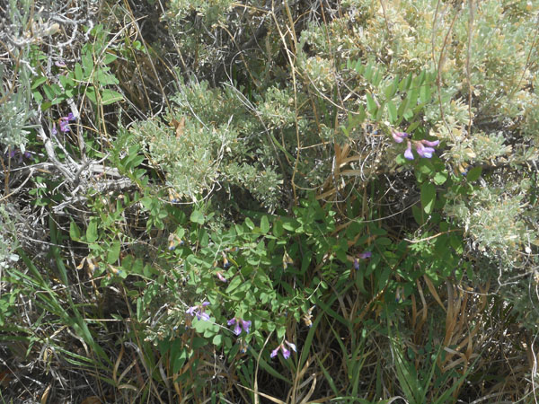
| American Vetch |
 |
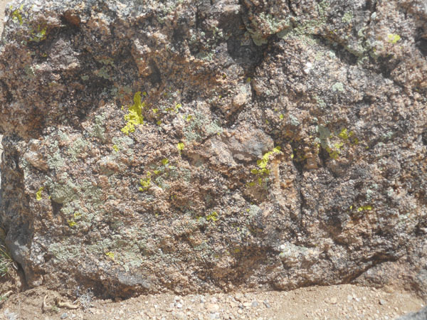
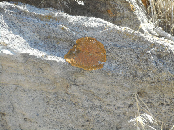
| We like lichen. |
 |
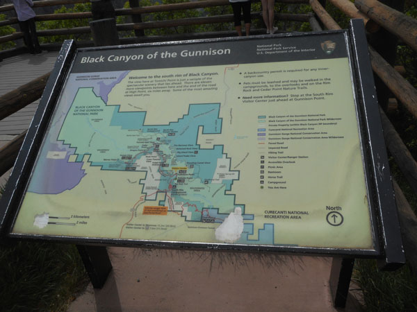
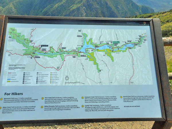
| The eight-mile-long South Rim Road in the park has thirteen established viewpoints. |
 |
| Many with the pegmatite across the way, and almost all with what mountaineers call "exposure". |
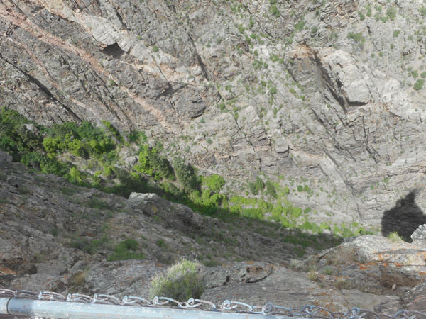 |
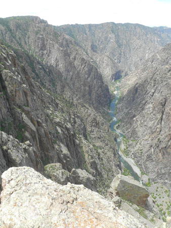
| See the glint of blue water to the east at the far top of the canyon? |
 |
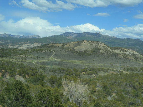
From the South Rim, we drove back south and down to US 50. Then took US 50 east ... it follows along in a broad valley beside Poverty Mesa, then climbs it, weaving through splits in the rocky face. |
 |
| Having now crested the south border of the Gunnison's canyon 20 miles east of the viewpoints, we can clearly see what's east of the canyon ... |
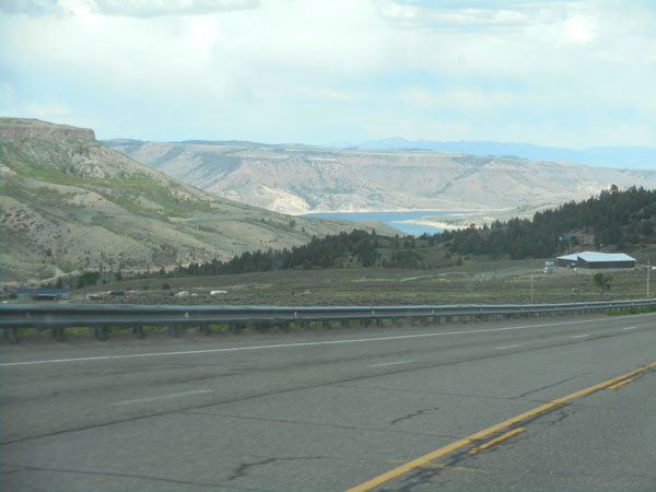 |
| ... the Curecanti dam and Blue Mesa reservoir. |
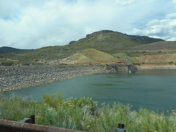 |
| We crossed the dam ... |
 |
| Where the river then flows into the canyon. At one time all this was the height of the top of the canyon. The river just happend to get caught cutting into the hardest rock around and carved a canyon while the surrounding hills eroded down. |
 |
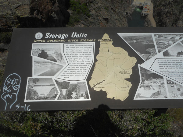
The Gunnison meets the Colorado River in Grand Junction, about 80 miles to the northwest. This reservoir is part of the Colorado River Storage Project.
(Karen didn't notice the local artist's contribution to the sign) |
 |
| We're at the middle of the map, where the red line (Colorado 92) on the north edge of the canyon's western section ends at the dam. Its jagged shape is following ("contouring") high on the sides of the tributary valleys. It's going to be a long, but scenic, drive to go a short distance. |
 |
| The jagged path occasionally returns to the Gunnison for views. |
 |
With name-that-distant-peak explanatory signage.
From the left: Silver Mtn, Sheep Mtn, Uncompahgre, Wetterhorn, Coxcomb, Dunsinane, Engineer, and Courthouse. Storm King far to the right. Unnamed and Cimarron are bordering the Morrow Point Reservoir |
 |
| Definitely scenic, even away from the Gunnison. |
 |
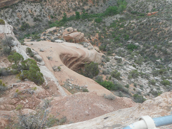
At the town of Hotchkiss, we turn on to Colorado 133 to head for Glenwood Springs, to visit one of Karen's cousins. Twenty miles along, we see signs of mining |
 |
| |
 |
| We camp for the night at Paonia State Park. |
 |
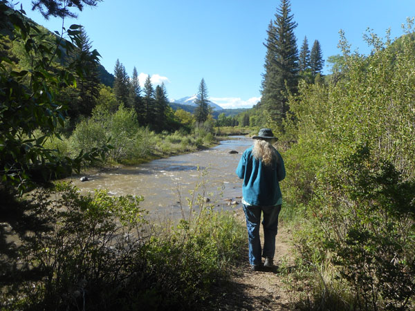
| Along a stream with a nice view. The Paonia reservoir is just a bit south of us. |
 |
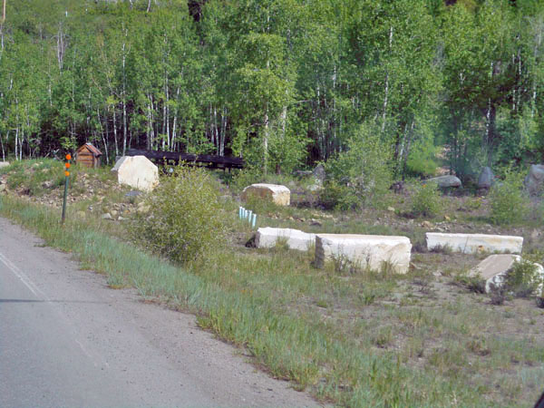
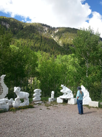
| The next morning, we detour to the town of Marble. Slabs of white stone are just lying around ... and still being actively mined from the side of the adjacent mountain. The quarry is now owned by an Italian company and exports all over the world. |
 |
| One artist has an outdoor gallery, with more white stone beckoning from above. |
 |
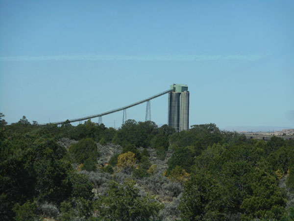
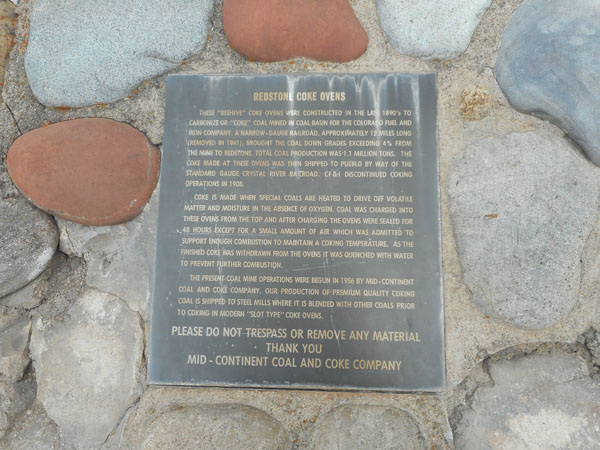
Back out on the highway, we came across (and U-turned for) an unexpected discovery. We investigate a long row of old coke ovens at the town of Redstone. |
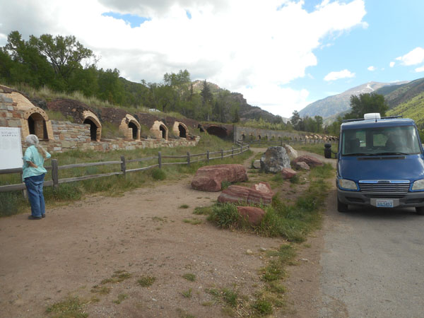 |
The area 12 miles due west is called "Coal Basin". Over a million tons of coal were brought out. Here the coal was burned (destructive distillation in the abscence of oxygen) to remove volatiles and impurities. There are about 90 ovens still here of the original 200. Each load in the oven took 48 hours to process. Coking actives went on for about a decade, from the late 1890's to 1908. The coal mine itself was re-opened in 1956 and the coking is now done elsewhere. Coke is used to purify steel.
(More history from Wikipedia) |
 |
| Here's why they call it "redstone" |
 |
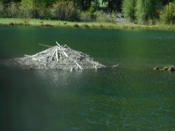
| Colorado has put up wildlife crossings |
 |
| But the beavers probably doesn't use them |
 |
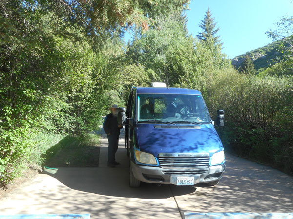
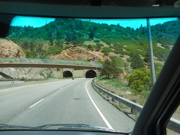
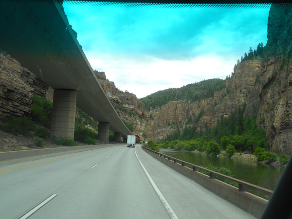
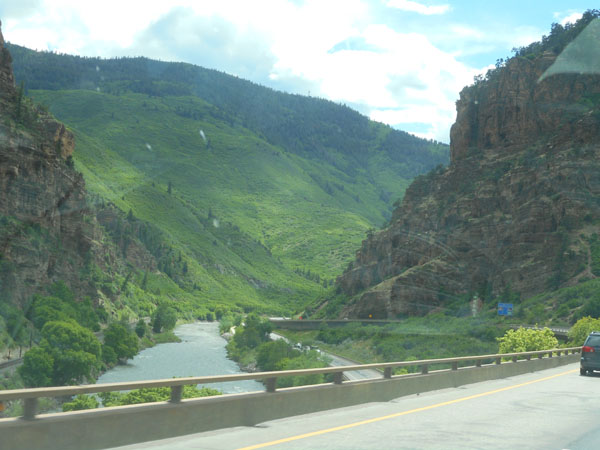
| To pass the time before Karen's cousin gets home we hop onto I-70 to drive about 16 miles up the Glenwood Canyon of the Colorado River and back. |
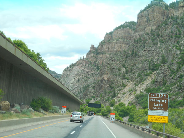 |
| Quite impressive road-engineering in a stunningly scenic gorge |
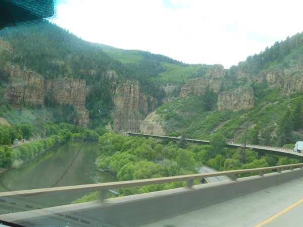 |
| Getting two wide roads to fit where only one went before. |
 |
| With maintenance roadwork. |
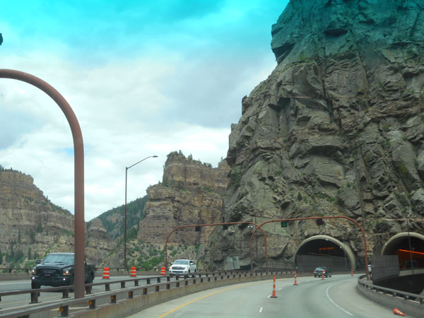 |
| Weaving our way along the Colorado... |
 |
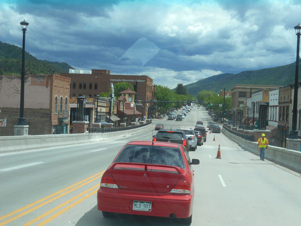
| Then back into Glenwood Springs for lunch (and more roadwork). We stayed with Karen's cousin David and his wife Suzy for the night (so busy talking and enjoying each other's company that we forgot to take pictures). |
 |
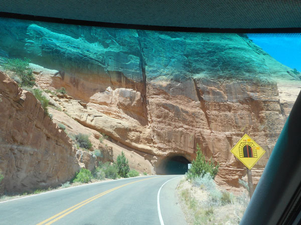
| The next day we're back on I-70, headed west. We leave the tilted layers of the western Rockies |
 |
| ... for the plateaus of far western Colorado. |
 |
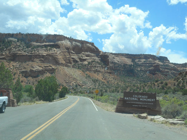
| And another national monument |
 |
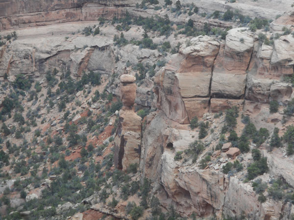
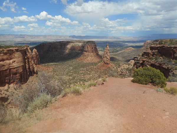
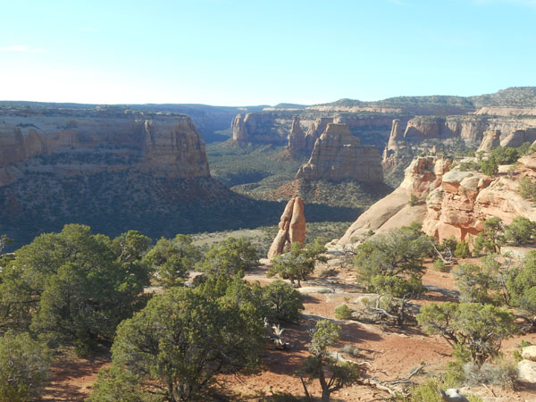
| Colorado's Colorado National Monument is tucked over near the west central edge of the state, just west of Grand Junction. |
 |
| It has an intimate feeling that most of our other stops didn't have. |
 |
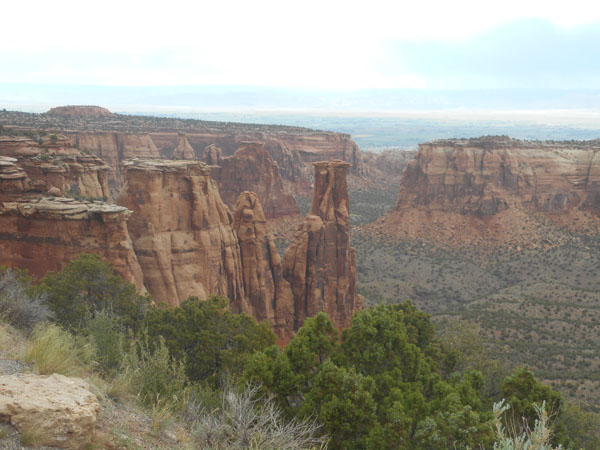
| We were brought up close to (or through) impressive structures and layering. |
 |
| It's quite a drive up to the top of the plateau. The plateau towers 2000 feet above the terrain to the north. It's the northern edge of the Uncompahgre Uplift. |
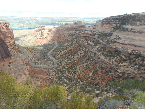 |
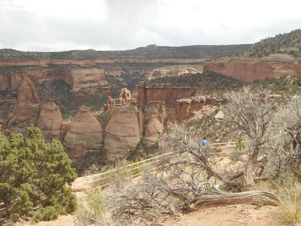
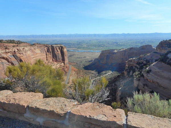
| Along the 19 mile Rim Rock Drive we're brought to the edges of numerous valleys |
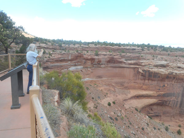 |
| interesting rocks and hoo-doos |
 |
| and canyons |
 |
| and erosion |
 |
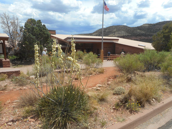
| Four miles in from (and far above) the north Fruita entrance is the campground, their nice visitor's center and nature trails. |
 |
| This time some of the flowers have labels |
 |
| ... but not always ... |
 |
| |
 |
| |
 |
| No labels on the lizards though. |
 |
| Waiting patiently for us to return from a hike. |
 |
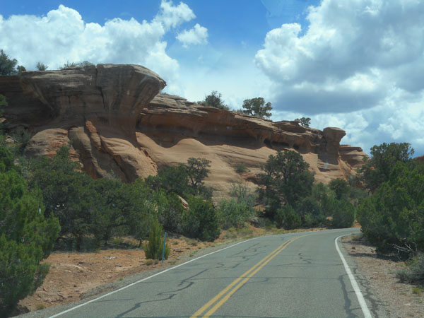
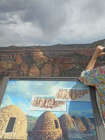
| As the more durable top surface (Kayenta Formation) finally erodes away, the previously-protected understructure (Wingate Formation) erodes in its own special way. |
 |
... which is why they're called Coke Ovens. ... a shape we had been recently reminded of in Redstone. |
 |
| Most of the canyons had well-used hiking trails ... |
 |
| .. which, depending upon your direction, started or ended with an interesting steep segment. |
 |
| In many ways it felt like a mini Bryce Canyon... |
 |
| .. but far more "up close and personal". |
 |
| |
 |
| with the requisite roadwork. |
 |
| We reached the south end of Rim Rock Road, and dropped down to the east Grand Junction entrance ... |
 |
| ... where we made a U-turn and climbed back up... |
 |
| ... to see it all again ... |
 |
| ... as we took the scenic route ... |
 |
| |
 |
| ... the very scenic route ... back to ... |
 |
| ... our campsite. |
 |
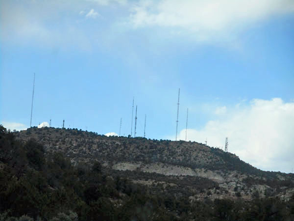
We noticed that unlike most of the parks and monuments, in this one we had cell reception. The towers are located just to the west, outside the monument. Colorado National Monument is small... only 32 square miles (that's less than 6 miles square (if it was square, which it isn't)
(too-much editing rumination: it's really kind'a triangular, so you can think of it as half of an 8.5 mile square square) |
 |
| In the morning the lighting was quite different. |
 |
| The road out was still as squiggly and dramatic. |
 |
| |
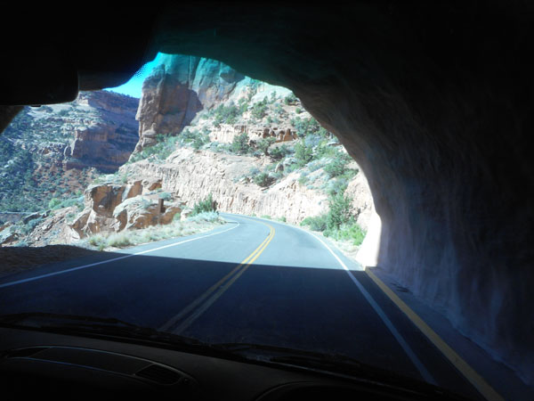 |
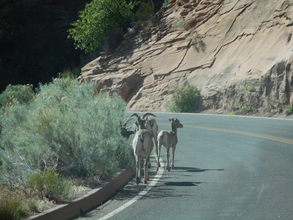
| Just out of the tunnel we came across this big horn sheep family out for a morning stroll. |
 |
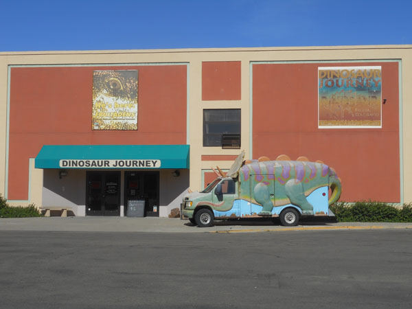
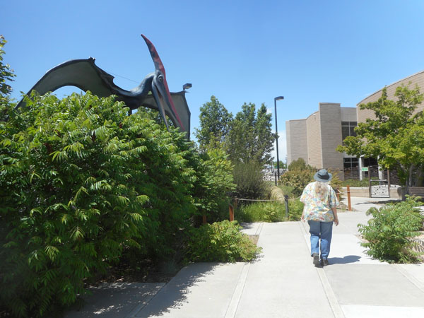
| At the bottom of the entrance road is the dinosaur museum in Fruita Colorado |
 |
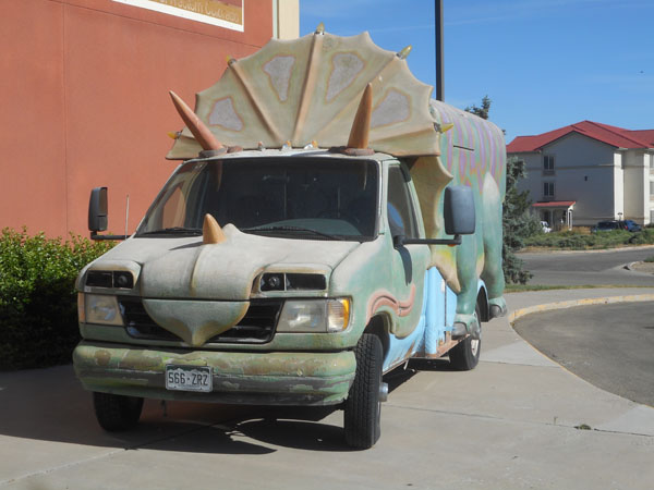
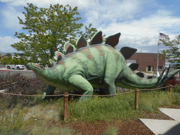
| ... prehistoric trucks apparently had to defend themselves against predators |
 |
| |
 |
| The exhibit on the left was one of the nicest displays of a dino's internal musculature that we've ever seen. |
 |
| As all good research museums do, they had an active fossil extraction laboratory. |
 |
| Most of the samples in the lab at this time are from 145 million year-old long-necked dinosaurs. They came from Rabbit Valley, 15 miles west of Fruita. (Exit 2 on I-70, a 1.5 mile "strenuous hike" interpretive trail) |
 |
"Sooo... what did you do before you decided to try Indoor Sales?" Note the plaster-backed fossils he's guarding. When a fossil is dug up at a site, the fossil and encasing rock is wrapped in a thick plaster-and-burlap "field jacket". Removal of that jacket is the first step in the lab. This museum is the first we've seen that sells the hand-sized scraps of discarded jacket in the Gift Shop. What a wonderful idea (and only $1!) |
 |
| Dioramas and animated dinos lined one wall. |
 |
| Utah and Colorado are prime sites for finding beasties... |
 |
| ... and revealing new puzzles for the paleontologists to haggle over... |
 |
| Pachyrhinosaurus catching up on his latest quandry. |
 |
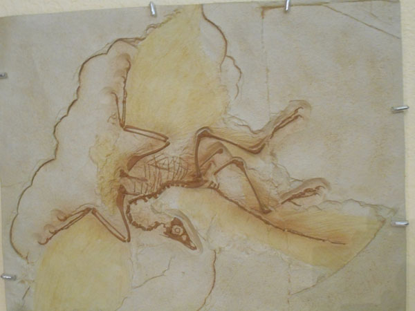
| Archaeopteryx ... only a dozen examples have been found. This cast showing feathers was made from the Berlin specimen. There's one in Thermopolis, Wyoming. |
 |
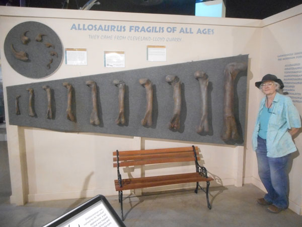
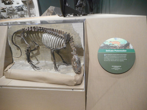
The "Great Wall of Femora"(*) showing how they change as they grow. The younger ones were longer (compared to body size) than the adults' ... meaning they were relatively more agile and faster. The adults appeared to rely on brute-force ambush. (*)(that's what they called it...don't blame us (this time)) |
 |
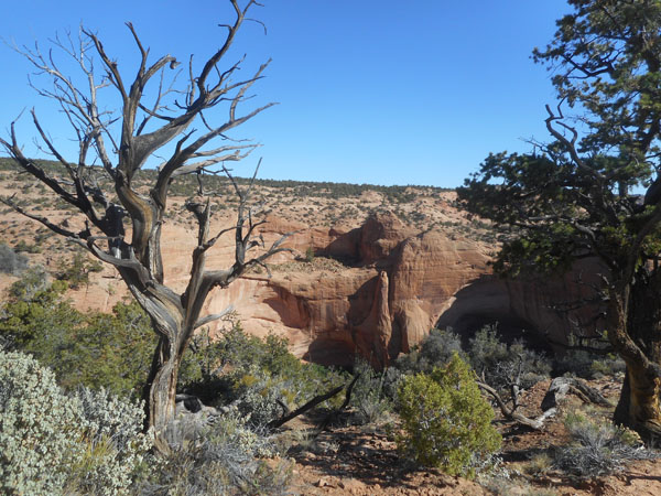
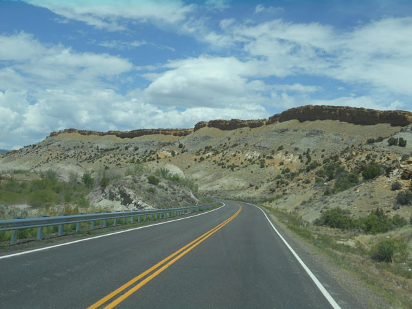
| Back on the road we head north on Colorado 139 heading for the Dinosaur National Monument. Along the scenic way, we encounter... |
 |
| ... a short backup for the most impressive roadwork yet. |
 |
| The front end is chewing up the old surface and the back end is a drivable surface again. |
 |
| Turning left (west) on to US 40 in the town of Dinosaur, Colorado, we soon find ourselves back in Utah. That's the Stuntz Ridge of Blue Mountain in the background. |
 |
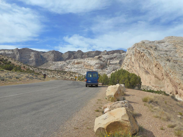
| As we turn north on to Utah 149 at Jensen, Split Mountain becomes the dominating feature. |
 |
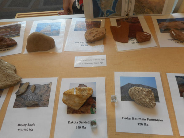
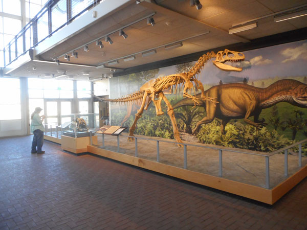
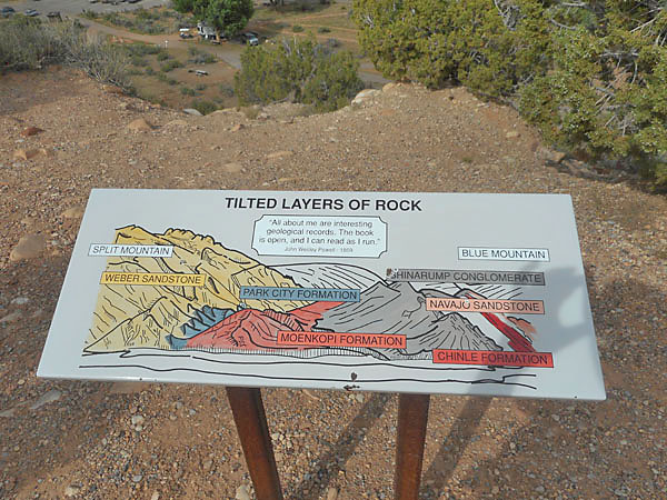
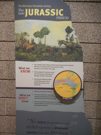
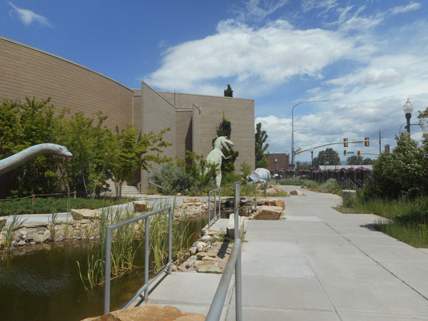
Inviting us to the Dinosaur National Monument and its visitor center. If you wander through all of the monument's areas (including floating down the rivers), you can explore 23 major layers (formations, themselves composed of many embedded thin layers) representing everything from the present to about 540 million years ago. |
 |
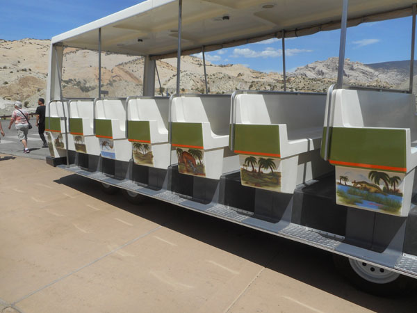
After looking at the small but well-done display in the initial visitor center/gift shop, we board the tram to get to the main display (Truth-in-telling-department: First we drove to the monument's campground and secured a site, then we came back to the center) |
 |
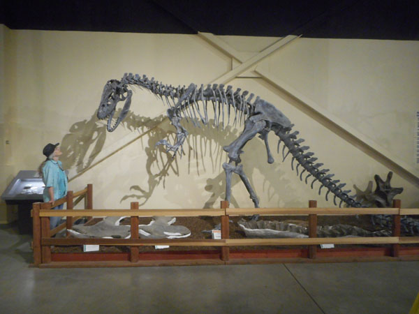
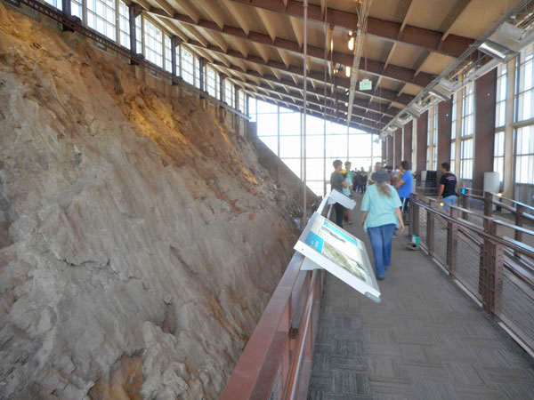
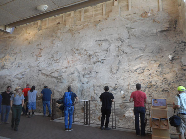
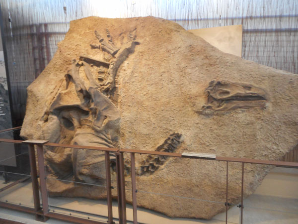
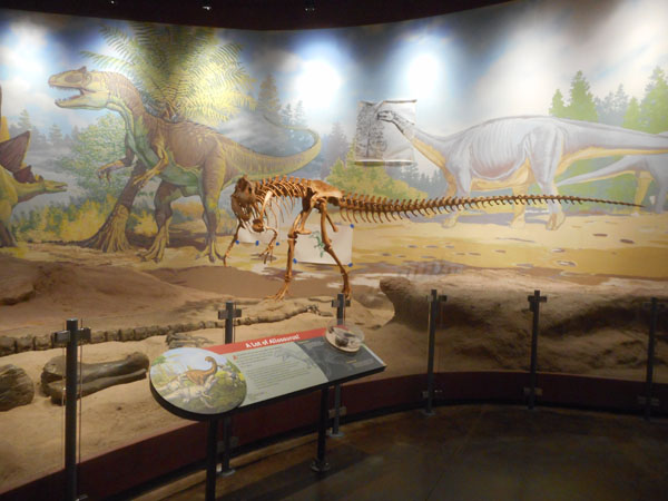
We had been here before, over 20 years ago. In 2006 they closed this building since it was cracking apart due to being built on clay. It reopened in 2011, but vehicle access is now limited. The building covers what's called "The Quarry" ... |
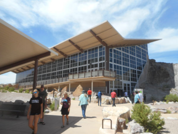 |
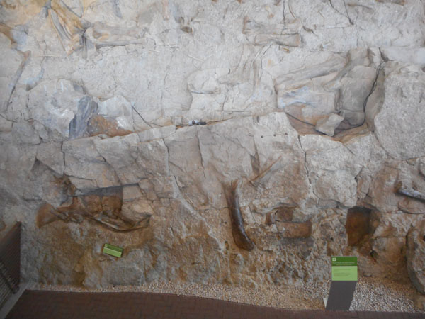
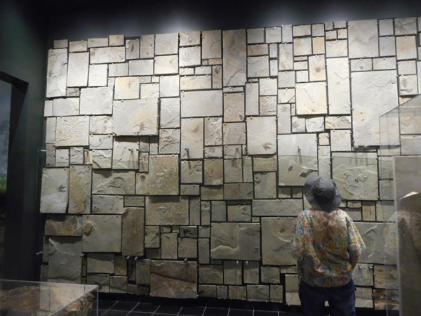
| ... Which is one entire wall consisting of the exposed hillside with its revealed treasure of fossils. |
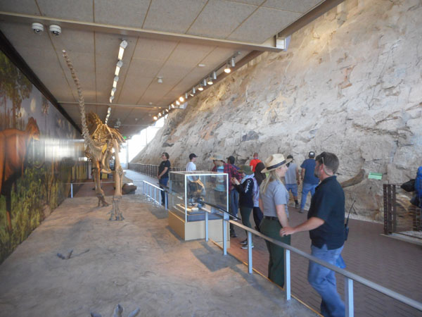 |
| On the outside, a "timeline" walks us back 149 million years as we ascend the ramp to ... |
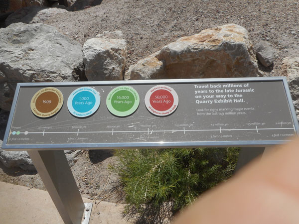 |
| ... the second floor's mezzanine. |
 |
| |
 |
| Our lenses cannot convey the impressive scale of the exposed face and its 1500 "reliefed" fossils still in place. |
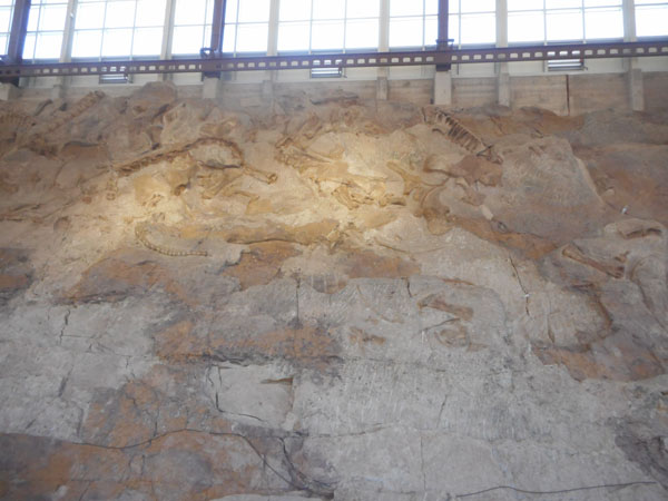 |
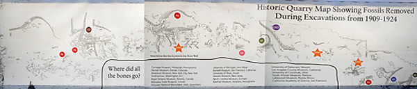
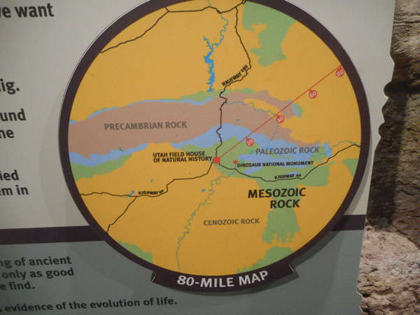
| The brown area on this map is the size of the enclosed wall ... the white is the entire excavated Carnegie Quarry face beyond the building. It yielded "several hundred tons" of fossils that were sent all over the country for studies and museums. Then work on the brown area was stopped to avoid further damaging the original context holding the bones. The Monment was created in 1915, the first protective building in 1936, a rebuild in 1951, and the reliefing was completed in 1991. |
 |
This charts some of the significant removed fossils from outside the enclosure. The modern exhibt has interactive computer screens for zooming in and identifying individual fossils. |
 |
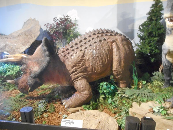
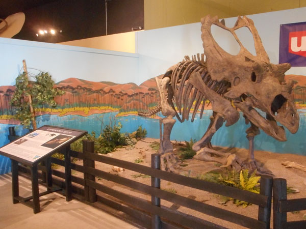
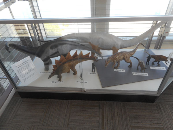
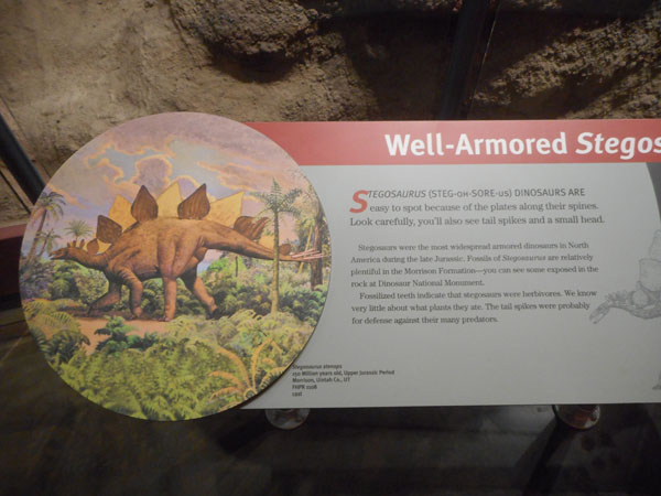
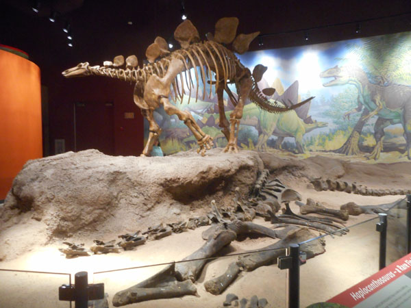
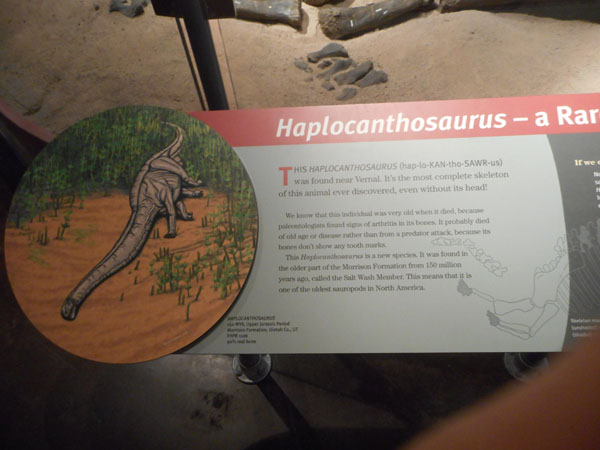
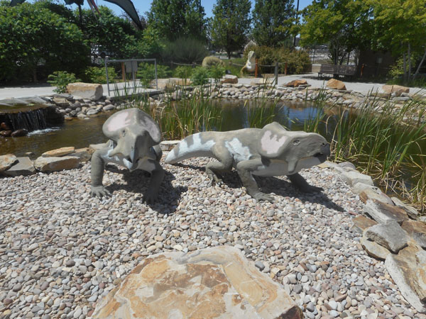
| This display case shows models of the main species found here. The human is only for scale (but far far more modern petroglyphs exist in the Colorado section of the Monument). |
 |
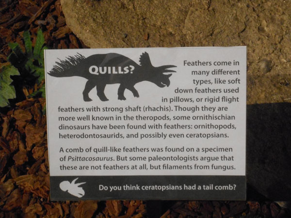
Why are there so many fossils right here?
(and Why pretty much only large animals?) 149 million years ago, this was a bend in a river. Animals that died naturally or in floods tended to be washed up here, where they were quickly buried in mud and sediment. Small animals were washed away. The rest of the monument does yield a far wider variety of plant and animal fossils, but here there are only about 10 species despite the wealth of bones. |
 |
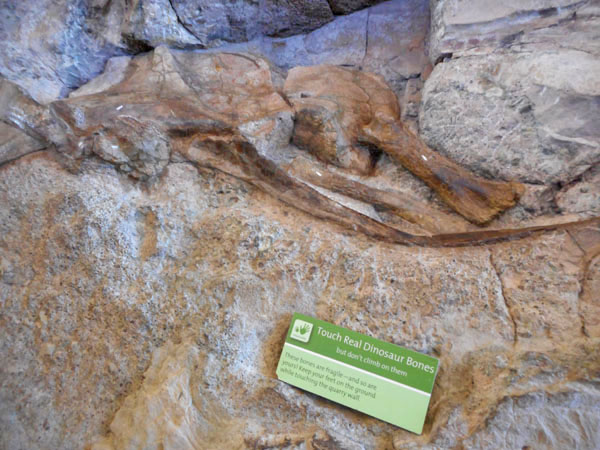
| AND they encourage touching (but not climbing thereon) of a few specific specimens |
 |
| |
 |
| Exhibits on the side include casts from other sites, |
 |
| ... and assembled examples. |
 |
| We are thankful for the tram back downhill as it is very hot out. |
 |
| But tomorrow we'll be back to hike the "Fossil Discovery Trail" in the cool of the morning. |
 |
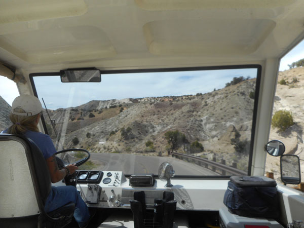
| This afternoon we'll take the park drive... |
 |
| ... in the air-conditioned Sprinter. |
 |
Helpful signs ... (John Wesley Powell quotations appear throughout the monument's signage) |
 |
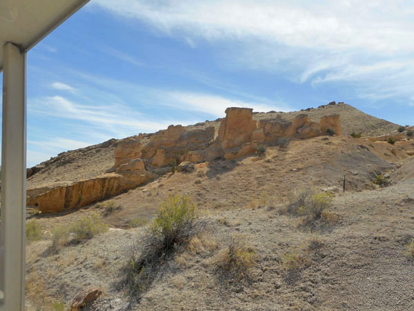
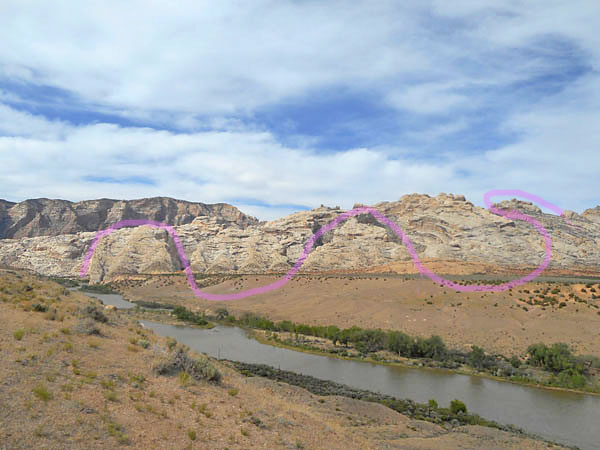
| Like the Gunnison canyon, the Green River started wandering on relatively flat land, then dug itself a trench that it couldn't escape as the land lifted and it encountered harder layers. |
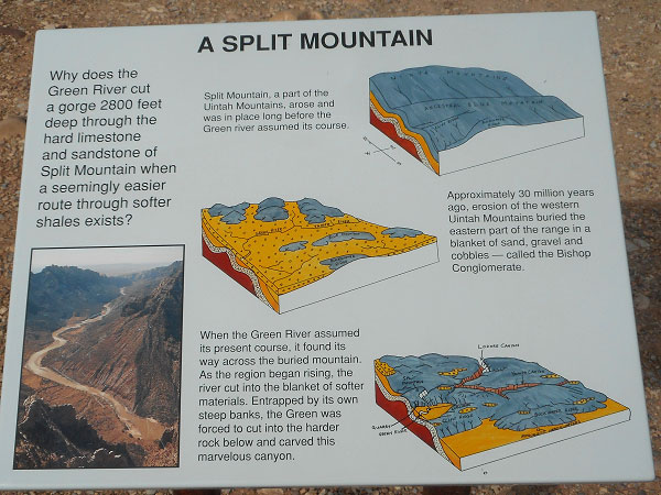 |
| Karen really really likes Split Mountain... |
 |
| In addition to the split talked about above, an earlier river cut meanders before the layers were tilted up, spilling the river out. |
 |
| The Monument's Sprinter-accessible campground. Our campsite is out of view below the close edge of the cliff at our toes (...and first to get shade). |
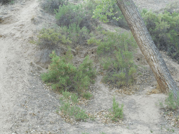
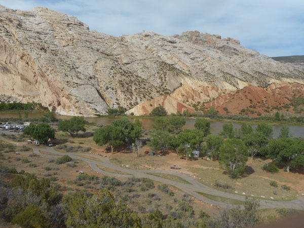 |
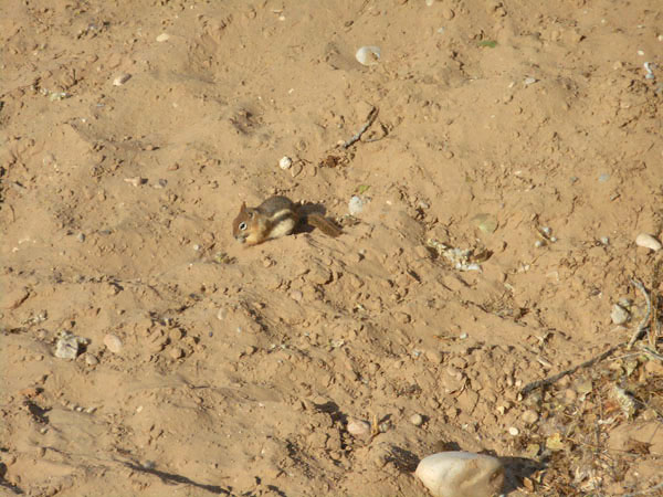
| We raised an eyebrow at the holes in the dirt (like the one under the slanted tree trunk, the three between the shrubs,...). |
 |
| Sure enough, the next morning we were entertained by this ground squirrel (chipmunks have striped faces) |
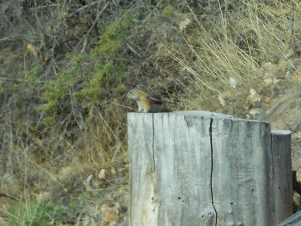
 |
| Taking a commanding view of the area... |
 |
| As planned, after breakfast we hiked the fossil path down from the Quarry building. It doesn't follow the tram road, instead it sweeps out and around the ridge the Quarry is on top of. |
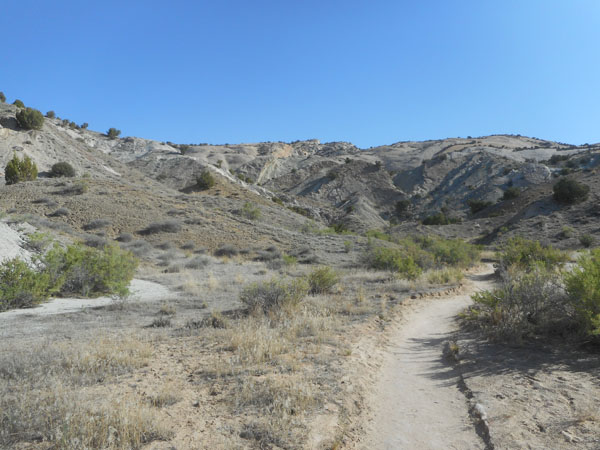 |
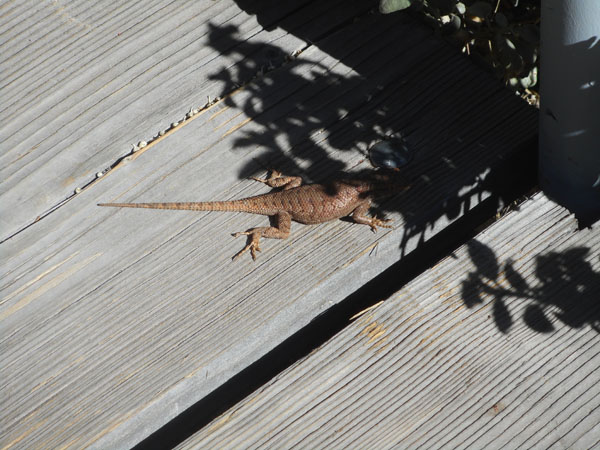
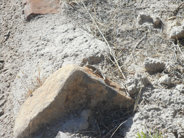
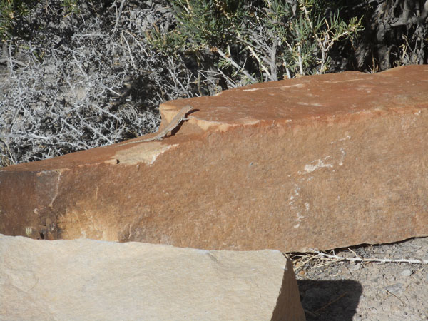
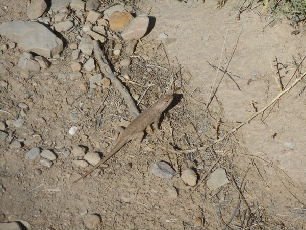
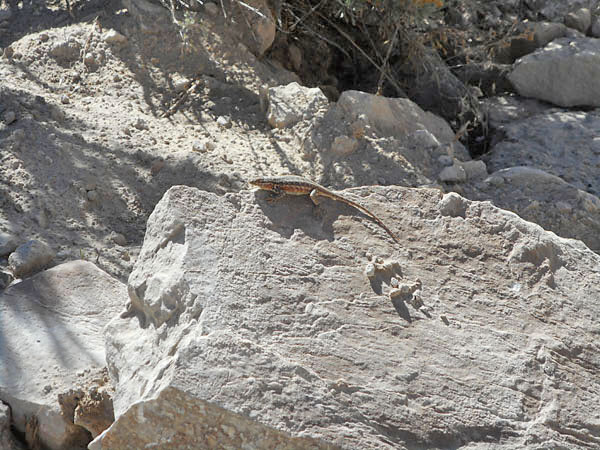
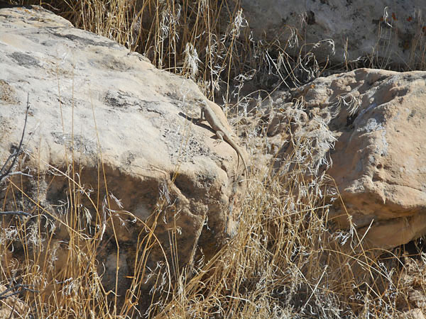
| We're finally up early enough that the lizards are too cold to move. |
 |
| |
 |
| |
 |
| |
 |
| Do lizards dream dinosaur dreams? |
 |
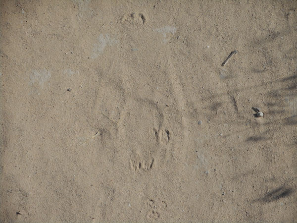
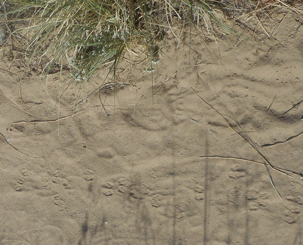
| Several critters had left prints in the sand |
 |
| |
 |
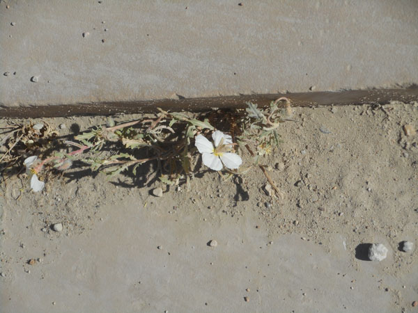
| This primrose was one of the few flowers open this early |
 |
| |
|
| Fourteen million years older than the Quarry's collection, this area was under an inland saline sea. Belemnites are squid-like and leave the equivalent of cuttlefish bones. |
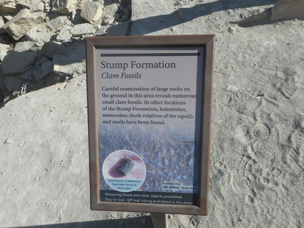 |
| See the lumps in the very center? Those are the clam fossils. |
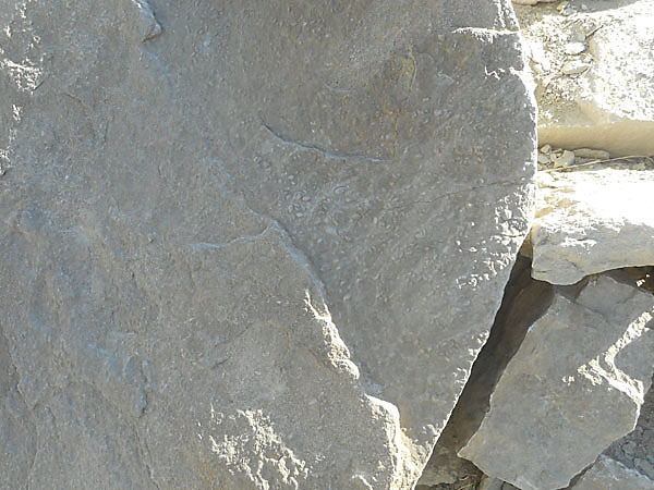 |
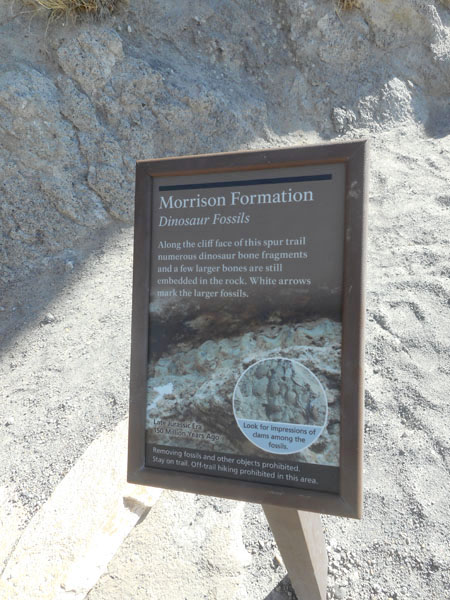
Here we're in the same formation (layers) as the Quarry, but a million years older. According to the trail guide, this cliff has not been worked on to make the fossils easier to see. |
 |
| The holes are casts of clam shells |
 |
| a bit of bone |
 |
| and a much larger one. |
 |
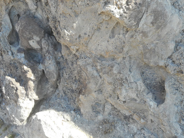
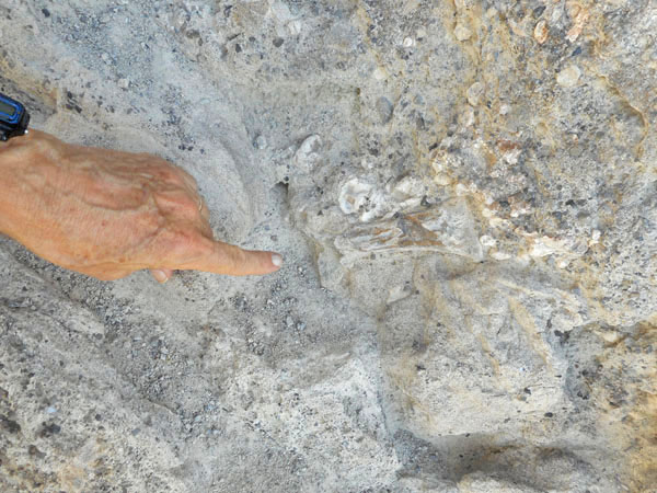
| Only 100 million years ago... these fish are almost fresh! |
 |
| We love the layering... |
 |
| A nice healthy lichen, not a fish scale. |
 |
| No sign on this hole and path so it is probably critter-related, rather than a human artifact. |
 |
| The petroglyphs ... 1000 year old art on 90 million year old beach sand. |
 |
| get a standardized fancy sign which boils down to: Don't Touch! |
 |
| We leave the monument in search of lunch in nearby Vernal, Utah. |
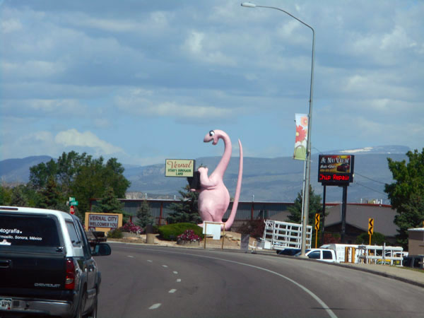 |
And discover another (unexpected) dinosaur museum!
(without blatantly pink ones, we think) |
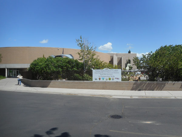 |
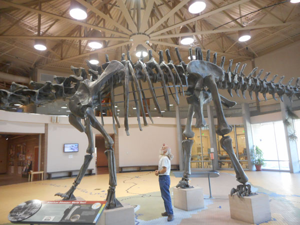
This is the Utah Field House of Natural History State Park Museum.
(and one third of the lobby display... we'll be back) |
 |
| Like the Fruita museum, this one had a number of displays and techniques that we found absolutely charming and informative. |
 |
| Some dinos were presented in a fairly active and lively format.. |
 |
| |
 |
| ...and some were not. (his bones are lying in the foreground of the above photo) |
 |
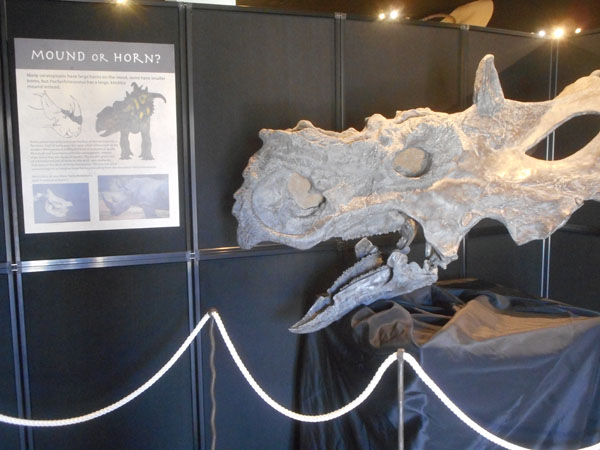
| The sign (and many of the Monument's) says that Allosaurus were very common. |
 |
| This museum did an excellent job of connecting the past to the local area. The map stays the same with the emphasis changing with the era being discussed in that room. They really work at tying what they show to what you can see on your own in the surrounding area. |
 |
| Most fossil finds are fragmentary... usually all you get are single (sometimes chewed and broken) bones. From very scattered clues, and modern animals as examples, entire creatures are described. Until more evidence is found. |
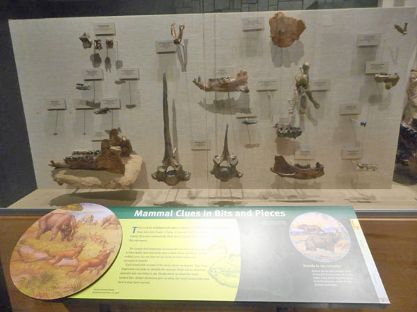 |
Karen being entranced by the fossil plants in slate.
(there's another ten feet off to her right...) |
 |
| These dog-sized plant eaters probably ran in herds, since many speciments are found close together. |
 |
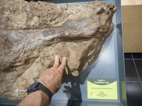
| More touchables... 45 million years ago, so it's a mammal. |
 |
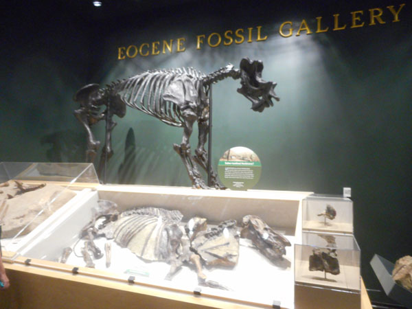
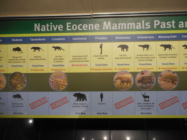
| As mentioned, this museum groups by time ... such as the Eocene (35-55 Mya). |
 |
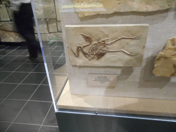
| Gallinuloides Wyomingensis ... yup... an early (49 Mya) chicken from Wyoming. |
 |
| Who and what was around then ... and which examples still exist now. |
 |
| Somebody was looking in from outside the window... |
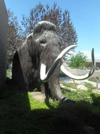 |
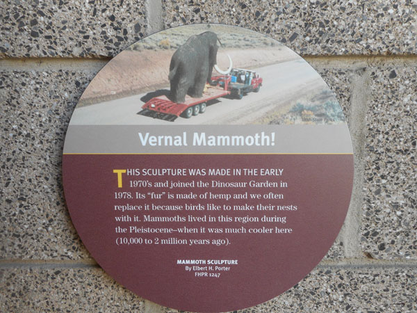
| Even mammoths have bad hair days... |
 |
Time, that's the key... this sign informs us of the fact that US 191 (heading north from Vernal, our planned path) passes up and down through many of the layers presented in the museum... and that the layers are signed along the highway.
But... due to lifting and tilting, Vernal's basin layers are younger than those higher in the mountains.
This sign also introduces us to the quite long hall mural ... the layers of rock (thus time) painted on one side, with many small themed galleries on the other side presenting items and concepts of those time periods. Join us on our walk... (we were getting a bit fried, so it was somewhat of a stagger) |
 |
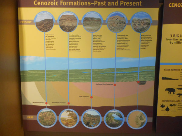
| Cenozoic is recent... (now to 65 Mya) |
 |
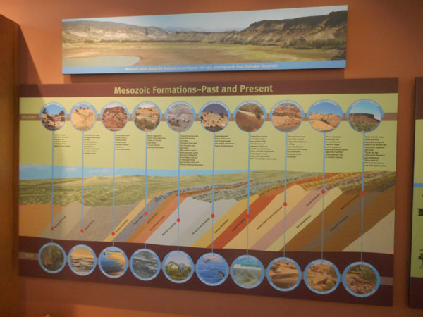
| Mesozoic is middlin'... (65 to 252 Mya) |
 |
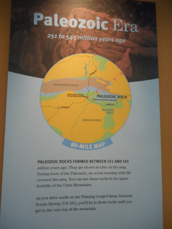
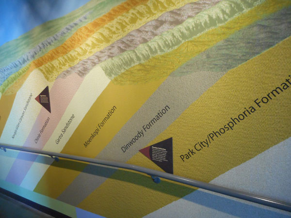
... and Paleozoic is pale in the far past... (252 to 541 Mya)
(the "zoic" in all of those refers to "life", each Era is delineated by a significant change in the life found in the rocks. Mass extinctions.) |
 |
The hallway's mural, with handrail for scale.
The colored bands are the named layers and formations, the triangles point out events (such as extinctions and Era changes) or notable strata (such as the Morrison Formation being what the Quarry at the Monument featured). |
 |
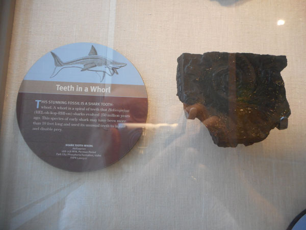
Helicoprion is a (roughly) 260 million year old shark with the weirdest jaw and tooth arrangement that we've ever heard of.
Since sharks are cartilaginous (no bones), these teeth whorls are all the direct evidence we have to go on. Modern (true) sharks are continuously losing their old teeth, which is why individual shark-tooth fossils are very common. Helicoprion appears to have kept his old teeth as the inner part of the whorl, which classes him as a "ghost shark" ( chimaera), not a true shark. There's still quite a debate on where the whorl was (its current popular position is the lower jaw) and what the upper jaw had to match it (grinding teeth are the current thought, in line with its chimaera classification). |
 |
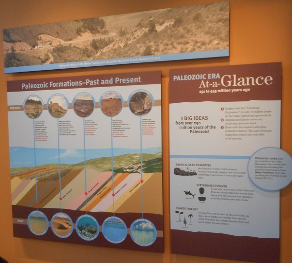
The 3 Big Ideas are:
- It began with the "Cambrian Explosion" ... in only 10 million years all of the basic animal groups evolved.
- Animals and plants moved out of the sea and onto land.
- It ended with the largest extinction in Earth's history: the Late Permian Extinction wiped out over 90% of all species.
290 million years from boom to bust...
(During this time Utah was at the equator, and "mostly" underwater) |
 |
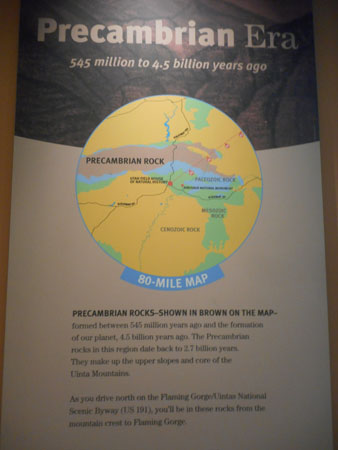
... and before the Cambrian Explosion was the Precambrian era ... taking us all the way back to the formation of the planet 4.5 billion years ago.
The Precambrain rocks we'll meet on US 191 are "only" 2.7 Bya |
 |
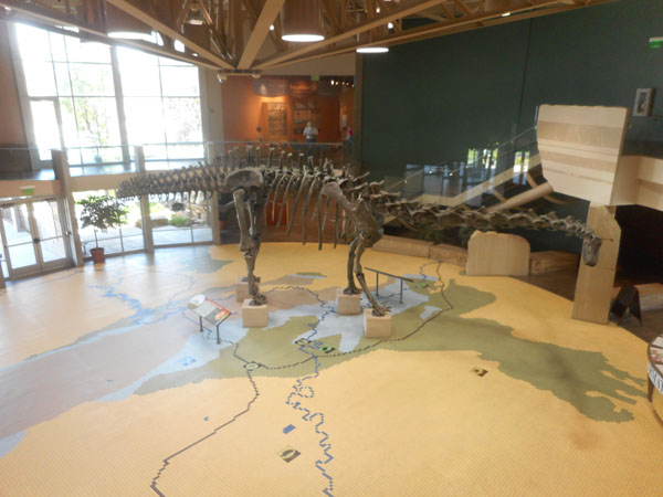
The hallway leads us back to the Diplodocus in the lobby. Under his feet is another rendering of the "80 mile" map as an inlay on the floor. |
 |
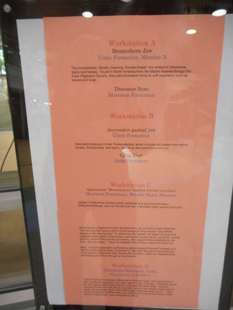
This museum also has a prep lab ... note the field-jacketed specimen to the rear.
The large letter "A" at the window's workstation keys to... |
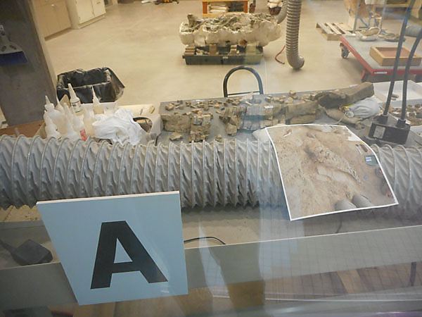 |
.. this "what's being done to whom and where did they come from" list in the window. (the field jacket is "C")
- Brontothere Jaw (Rhino, Uinta Formation)
Dinosaur Bone (Morrison Formation)
- Amynodon partial jaw (Uinta Formation)
Turtle Shell (Uinta Formation)
- Apatosaurus "Bronotosaurus" excelsus cervical vertebrae (Morrison Formation)
- Columbian Mammoth Tusks (Pleistocene (1.8 Mya))(Craig, Colorado)
|
 |
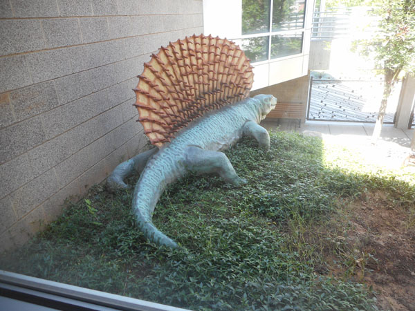
| Outside is a garden full of replicas. |
 |
| and signs ... |
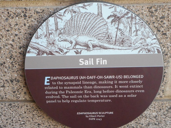 |
| Don't worry, they're plant eaters... |
 |
| Er, he's not... |
 |
| He may know what they did to the Stegosaurus that's inside the building... |
 |
| (we still seem to have avoided any pink ones) |
 |
| ?? What are they both looking at in the parking lot ?? |
 |
| Back on the road we look for the rocks in the "80 mile map" |
 |
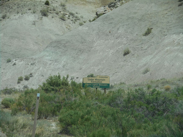
They even have handy signs:
Cretaceous, Cedar Mountain Formation, "Where raptor dinosaurs hunted"
(kind'a hard to catch at 60 mph) |
 |
| A few miles north of Vernal the road steeply climbs via switchbacks in the vicinity of a vast phosphate strip mine operation. |
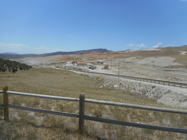 |
| The ore is mixed with water and piped about 60 miles north to Rock Springs Wyoming. |
 |
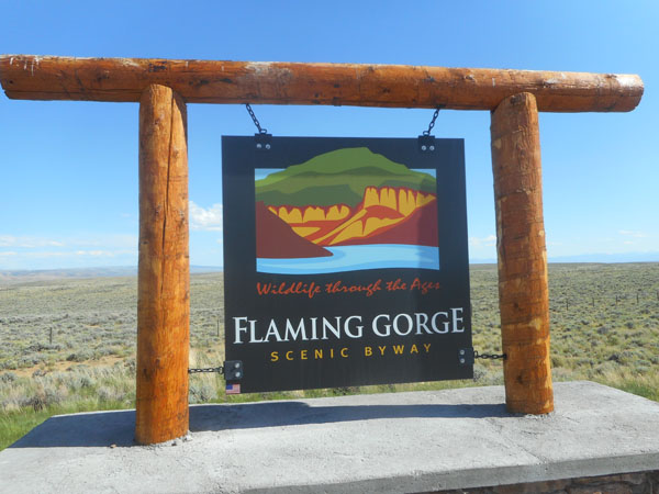
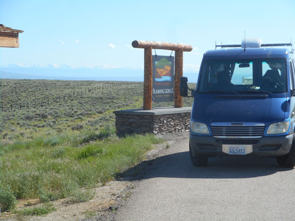
| Heading north, we cross the Uinta Mountain and start to descend. We decide to take (yet another) scenic detour... turning left to head west on Utah 44 and then north on Wyoming 530 ... this will swing us around, and close to the shores of, the Flaming Gorge National Recreation Area. |
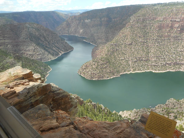 |
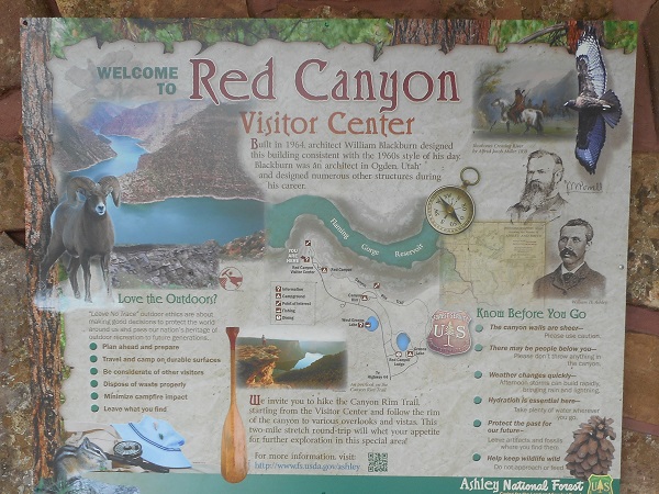
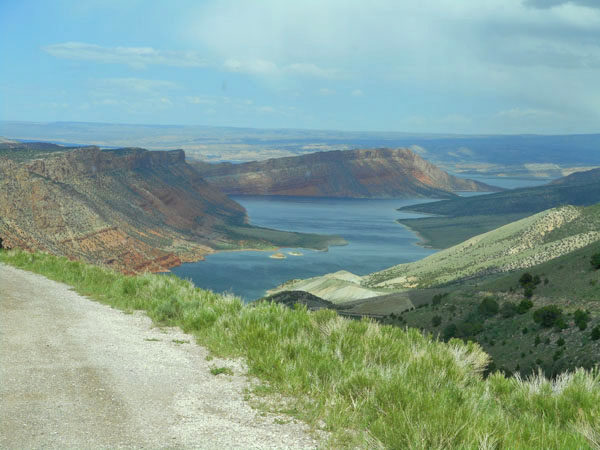
| We drop in at the visitor center for views and information (and use of the toilets). John Wesley Powell, in a typical fit of naming originality, called the southern stretch "Red Canyon". You'll never guess the predominant color of the rocks. |
 |
| Today had been one of contrasts: hot and sunny in Vernal, cool with a tad of drizzle at the forested visitor center, and then this kind of grandeur as we rounded a corner. |
 |
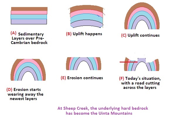
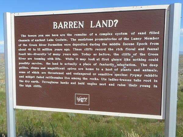
Let's talk about layers... at many of the sites we've visited, the layers of rock are stacked neatly like pancakes. Here they're not. Underlying magma or other processes has pushed up and bent the layers, then erosion took its own sweet time wearing away the less-resistant rocks. The Uinta Mountains were pushed up between 40 and 58 million years ago.
Today the Sheep Creek Geological Area has a 25-mile fairly level road that cuts through many uplifted layers. Our geology guidebooks consider it a must visit!!. |
 |
| So we did ... there's a campground at its southern (paved) entrance. |
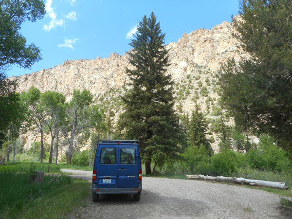 |
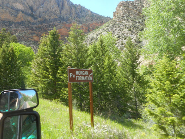
| As we drive along, signs point out the surrounding rocks. |
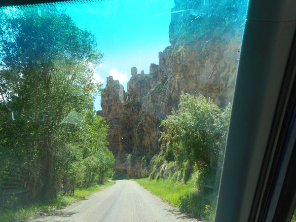
 |
| Scenery intervenes... |
 |
| The funny symbols are what's used on geology maps of the area. |
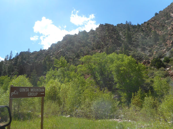 |
"The light-colored swath running across the hillside is the North Uinta Fault Zone, separating Uinta Mountain Group sandstone on the left from Mississippian Madison Limestone on the right. The limestone cliff is called the Palisades."
(we discovered we'd duplicated one of our Roadside Geology book's photos, so we thought we'd duplicate the caption, too) |
 |
| The speed limit is 15 mph ... but we're not in a hurry. |
 |
| |
 |
| |
 |
| (no, the top layers aren't blue... that's the Sprinter's tinted windshield having fun...) |
 |
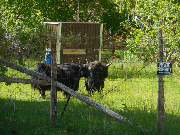
| There are a couple of short incursions of private land (where the pavement was interrupted)... and we noticed that the "Cattle" image was a bit shaggier than usual. |
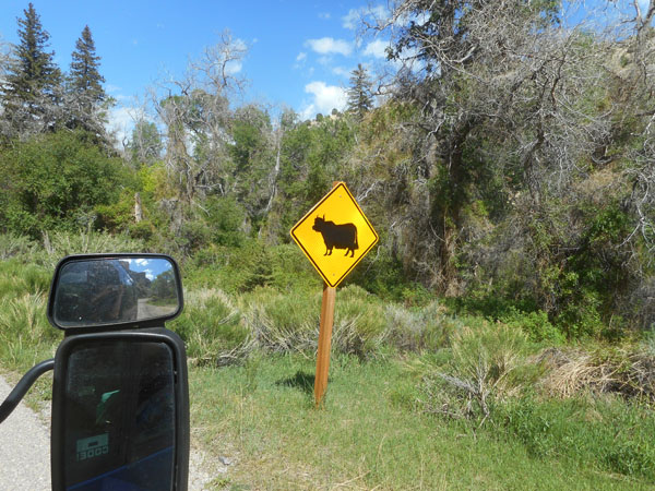 |
| Yup... the Yaks on us... |
 |
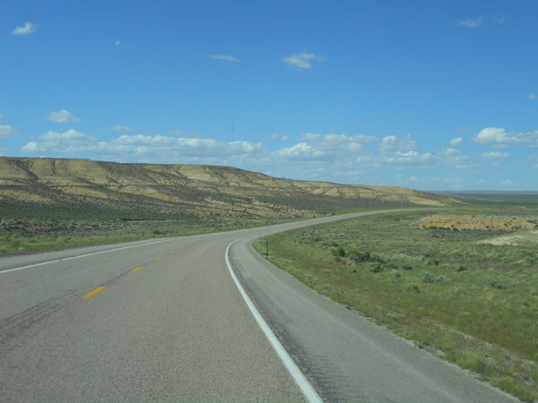
| Passing north into Wyoming, the land gets flat... to our left are Black Mountain and Devil's Playground, to the right are a couple of miles of flat plateau at 6600 feet ... which usually hides the reservoir which is 500 feet below the edge. |
 |
| They did try to reassure us it's out there... |
 |
| ... somewhere ... |
 |
They tried to make it interesting... they really did.
On this 43 mile stretch of road they had this one pull-off, with a bunch of signs (but no toilet). |
 |
| The "towers" were small monuments in the far distance. |
 |
After passing the (we're not kidding) "Greater Green River Intergalactic Spaceport"(*), we dropped off the plateau into the town of Green River.
(*) A 5800 by 130 (more-or-less) gravel airstrip with one fixed item: a windsock. In a year ending in April 2016, it had 300 operations (take-offs or landings), no aircraft (nor spaceships) are based at the airport. Apparently the airstrip is bent (higher in the middle), so you can't clearly see if there are obstructions (animals) when you're at either end preparing for take-off. It went by too quickly (and invisibly) to photograph. AirNav entry. |
 |
| This may look like the frequently-used symbol of Utah, but we're in Wyoming. We turned west for 7 miles to camp in James Town for the night. |
 |