Part 1: Seattle to
the North Rim of the Grand Canyon
A Monumental Tour!
This trip was to be a geology-themed (re)visit to the American Southwest. We had last visited the SW in 2010 but had started three weeks earlier. That trip had snow preventing or impeding access to some areas. We were still trying to "beat the heat" by starting in mid-May. Planned destinations included Cedar Breaks National Monument, the North Rim of the Grand Canyon, the Black Canyon of the Gunnison, the Colorado National Monument, Dinosaur National Monument and a drop-in to Elk, Washington.
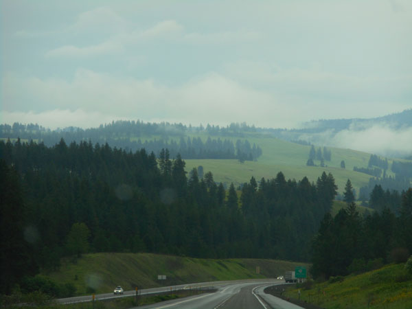
A few days later than planned, we "got out of Dodge" (er, Seattle) with our usual "crack of noon" (11:54am) start. We stayed high and dry by taking I-90 east and I-82 south across Washington.
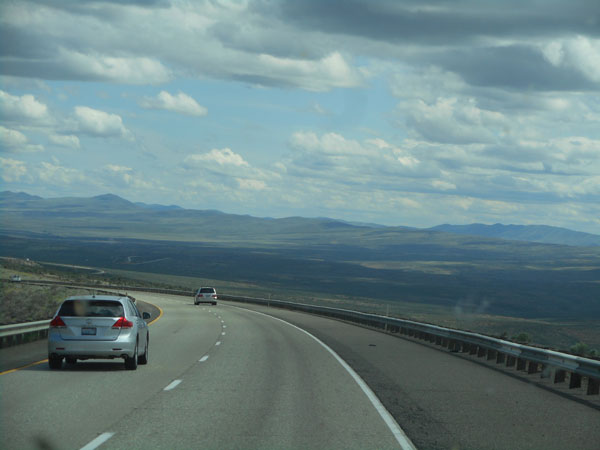
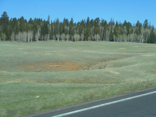
Even though we've done it many times before, this I-82 sweep that brings the Horse Heaven Hills area into view is always breath-taking.
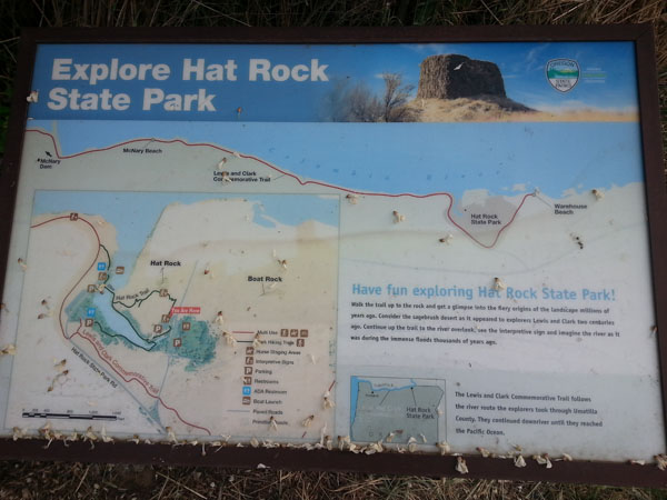
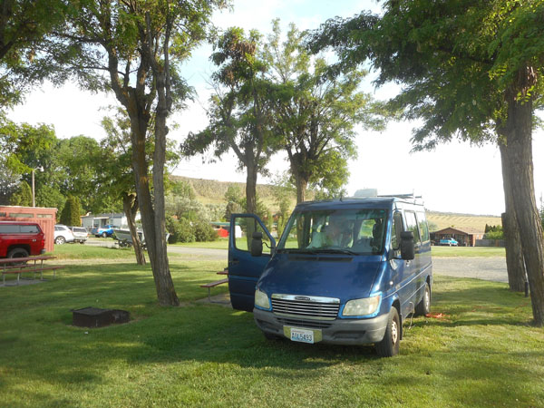
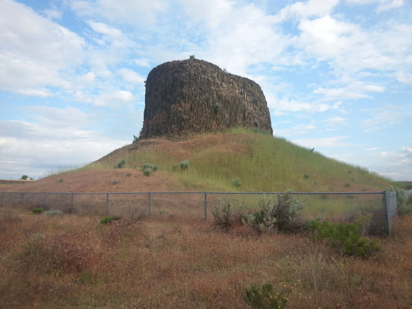
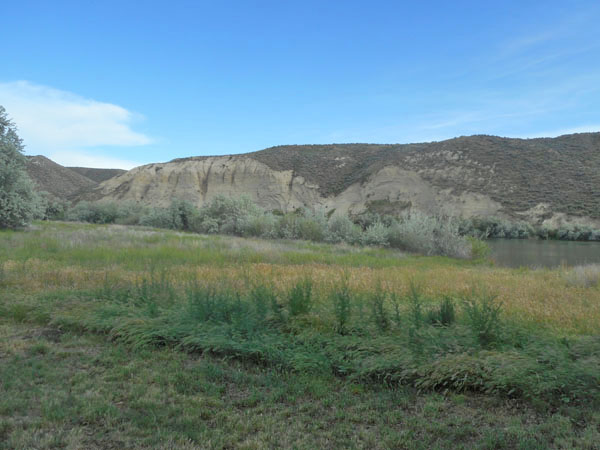
We crossed the Columbia at Umatilla, and immediately turned off the highway to camp our first night next to Oregon's Hat Rock State Park.
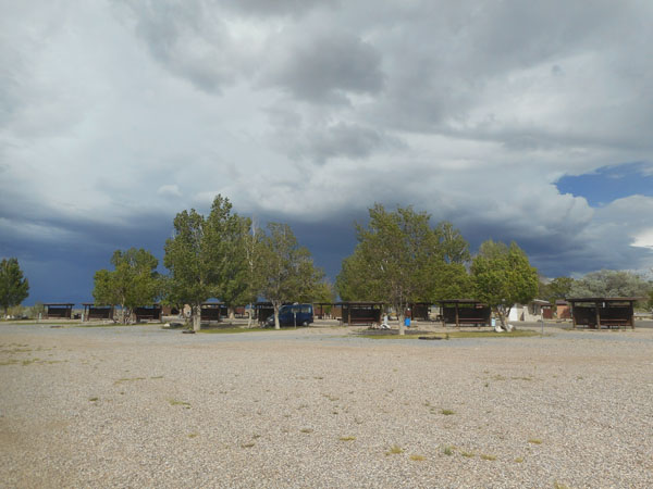
"Hat Rock Campground" was a pleasant commercial campground just across Hat Rock Road from the State Park. The large bluff in the background separated us from a not-very-used highway (US 730).
The next morning we walked across the road and took a walk in the park.
Its hallmark feature was named by the Lewis and Clark expedition.
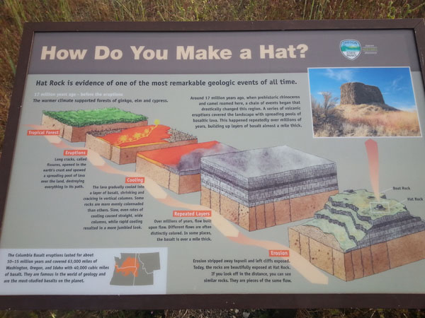
The park provided a helpful recipe for forming such a feature:
17 million years ago:
Start with level land (tropical forest optional)
Open long fissures and flood large areas with lava
Let the lava cool slowly to allow the resulting basalt to crystalize into tall columns
Areas that cool quickly will create a more jumbled appearance
Repeat many times over the course of 10 million years, until the layers of basalt are over a mile thick
Now add water ... and wait for the landscape to erode, leaving some of the more resistant features as monuments.
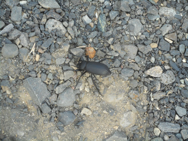
Along the gravel path, a beetle was doing a headstand. He was probably trying to threaten us with a stink rather than the dew gathering we've seen in videos of Namibian beetles. Honoring his threat, we gave him lots of room (after shooting a number of photos)
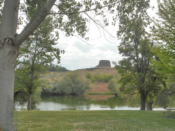
The park included large lawns and a protected bay opening on to the Columbia River.
After refueling at a little station near the park, we zig-zagged through Hermiston to reach I-84. We had our first "GPS Adventure" as it guided us to a dirt road (highly reminiscent of Puerto Rico routing). A quick peek at our paper maps showed the short detour required to remain on pavement.
Now on I-84 and gaining altitude, the morning turned foggy, then misty, and finally a bit rainy as we climbed into Oregon's Blue Mountains.
Thanks to our stop at Hat Rock, we didn't do our "usual" overnighting at Emigrant Springs State Park. I-84 follows the old Oregon Trail.
OK... so we're not too organized about recording precisely where we are when we see something interesting.
As we write up these travelogues, we try to retro-identify such random curiosities (and thus go merrily off on tangents in our references).
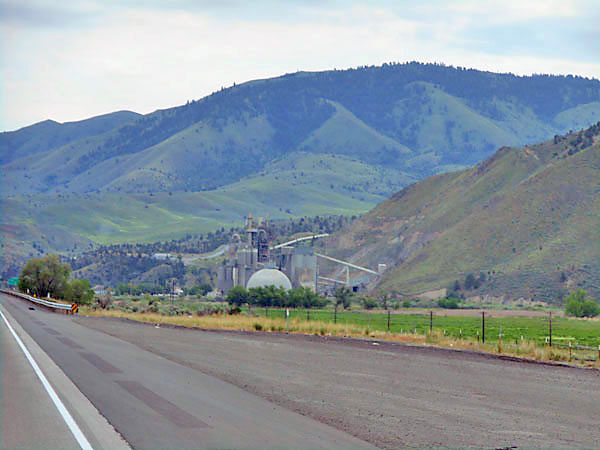
We thought this was "some sort of mine". Our Roadside Geology of Oregon book mentions local mining of marble to create lime near milepost 336. Our Benchmark Maps Oregon Road and Recreation Atlas says there's an "Ash Grove Cement Plant" (another vote for lime), located at milepost 332, ten miles north of the town of Lime (mp 342). A final resorting to Google Maps confirms that it's Ash Grove in Durkee Valley.
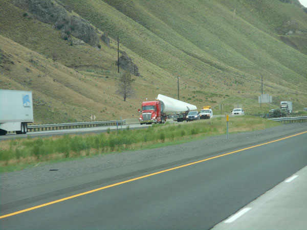
As we headed southeast (to the southwest), we saw a couple of "windmills in the making" heading northwest.
When we go on trips like this, we'll have a list of things we specifically want to visit. We then have lesser agendas of finding new places to visit, finding new facets of places we might have visted before, and trying to not over-extend any day's driving effort (translation: stopping when tired). This second day had the Thousand Springs area near Twin Falls Idaho (a re-visit) as a vague destination. But it was going to require another hour of driving, so we stopped early.
After damp-and-forested Oregon, the southern Idaho drive had been through increasingly dry country. We camped at Idaho's Three Island Crossing State Park near Glenn's Ferry.
Here's where they brought the Oregon-bound wagons down to ford the Snake River before the ferry was put in.
The river is between the line of trees and the base of the cliffs... The Oregon Trail itself ran along the top of the cliff and dropped down to the Three Islands forming the crossing off the right of the photo. Despite the islands, it was still a perilous crossing.
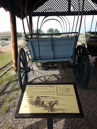
A shed protected a display of two recreated Conestoga Wagons. This wagon was built for a 1975 reverse trip along the Oregon Trail to Valley Forge, arriving on July 4th, 1976. The park also had an extensive museum, but we missed their open hours.
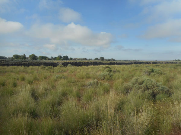
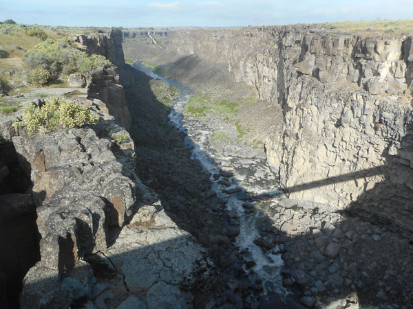
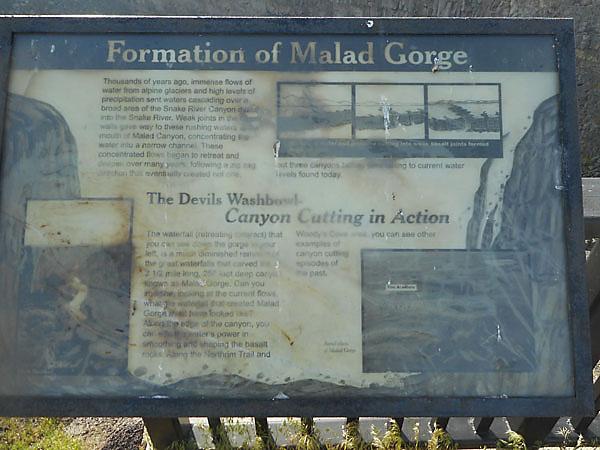
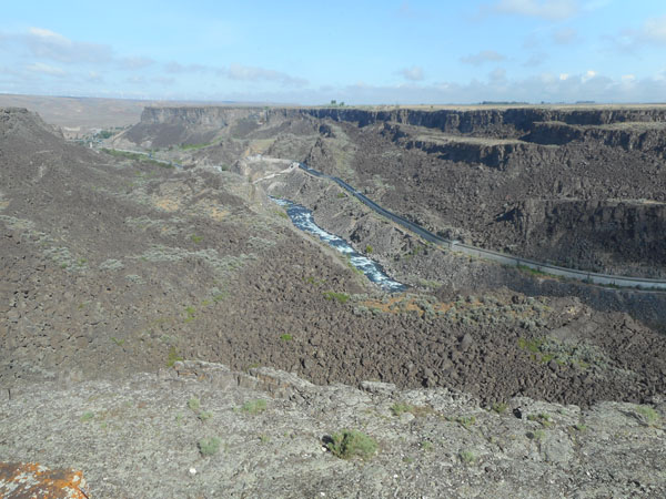
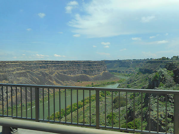
The next morning we drove further along I-84 (through Bliss, how pleasant) to the Malad Gorge unit of Idaho's Thousand Springs state park, a deep cleft in the top of the Snake River Plateau.
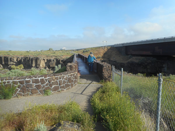
We had our second "GPS Adventure" trying to reach the gorge. That's 80 mph I-84 on the bridge to Karen's right. The GPS led us to that crossing with the final instruction that we had reached our destination and should stop. We opted to continue 1/4 mile to the Tuttle exit and take the park's entry road.
Once on the walkway's bridge ...
We turned to watch the swallows soar around in the 250' deep canyon for a while and enjoyed the morning
The familiar recipe with a slight twist: cover the area with lava, let it cool, and then wander some of the Snake area drainage through the weak points to carve the gorge. The current river is a ghost of the original torrents.
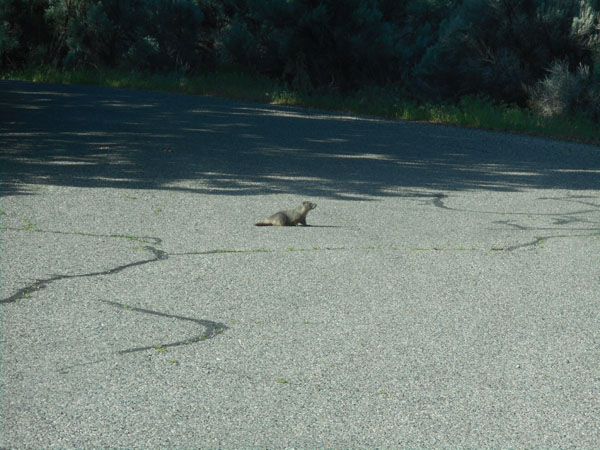
We surprised a ground squirrel (?) in the parking lot. We also saw a marmot-like animal under the I-84 bridge, but couldn't get a good photo (the fuzzy photo sure says marmot).
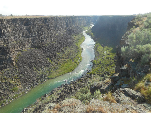
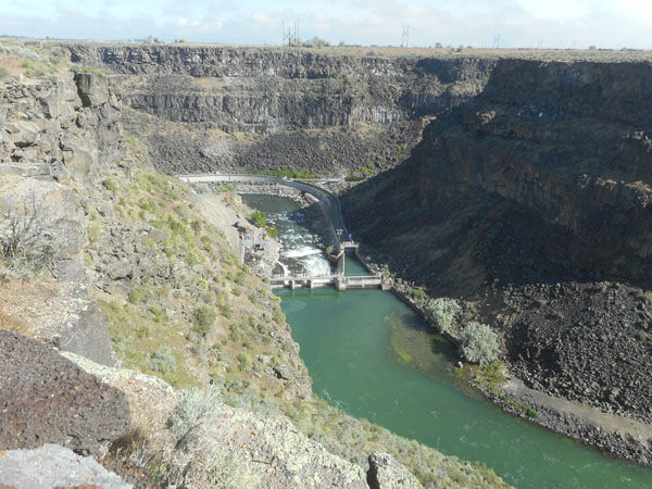
Then we drove a mile to the other end of this segment of the canyon. Note all of the layers of lava.
At this end there is a dam, power plant, fish ladder and ...
a long irrigation canal.
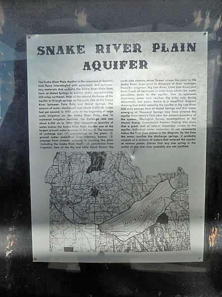
The water from the east feeding the Snake River flows down into the porous lava and mostly disappears (highlighted area on map)
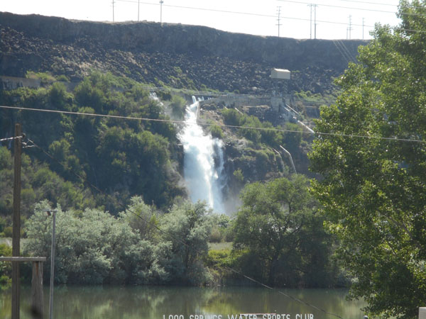
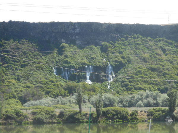
It flows out of the lava along the wall of the Malad Gorge and also along the "Thousand Springs" area, feeding the Snake River here in southern Idaho. We'd been here in the fall of 2015 and were told to come back in the spring because it was much more impressive.
Yes, it was gushing out...
There was more water in a few places but apparently much of it has been siphoned off for irrigation so long-time residents say it isn't anything like what it used to be.
Crossing the Twin Falls bridge, we could see that most of the edge no longer gushes with water.
Onward into Utah!
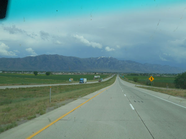
The Wasatch Mountains appeared, looming over Brigham City.
Looming over the mountains was a storm, and our cadence would have had us ending up in campground-less Salt Lake City in rush hour.
Soooo ... we chose to turn off I-15/84 at Brigham City and steeply climb into the Wasatch Mountains to camp at Box Elder, a National Forest campground (NFCG) in Mantua (Exit closed?!? Detour a bit) ... where we hit a downpour that exceeded the Sprinter's defogging abilities. Luckily Manuta's in-town speed limit was 25 mph, and we didn't feel pressed to achieve it. The GPS did its job of getting us through both the detour and the town to reach the CG.
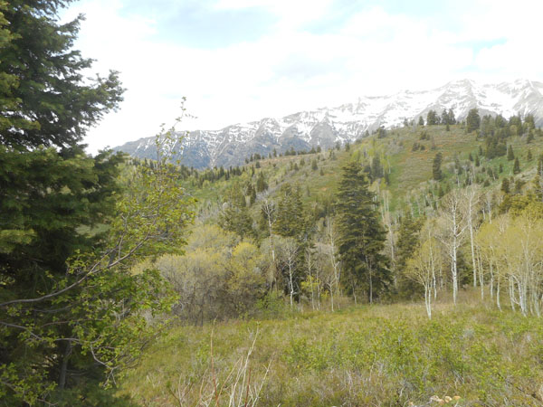
The next morning we blew south through the metroplex of Salt Lake City - Provo, then again abandoned I-15 at Nehpi, turning east to poke our noses into the southern end of the "Nebo Loop", a very scenic squiggly drive. Fresh snow was on the surrounding mountains.
The Nebo Loop featured an area called The Devil's Kitchen. How could we resist?
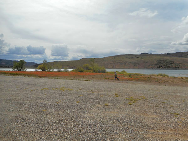
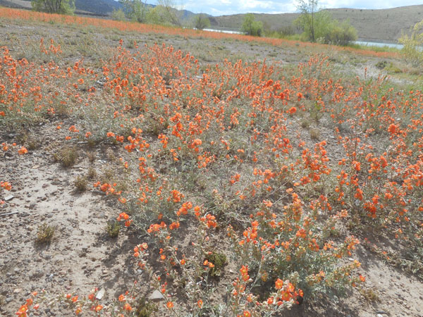
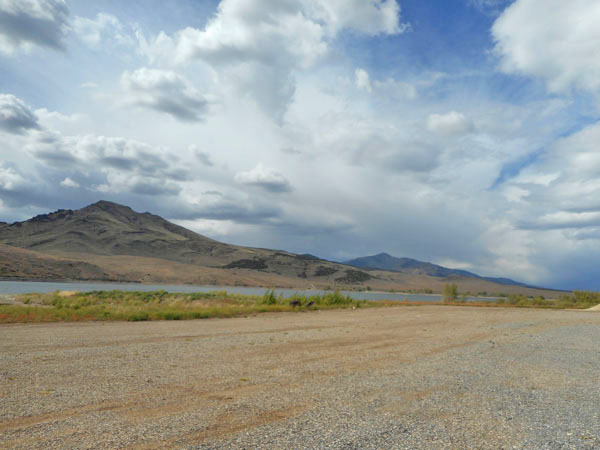
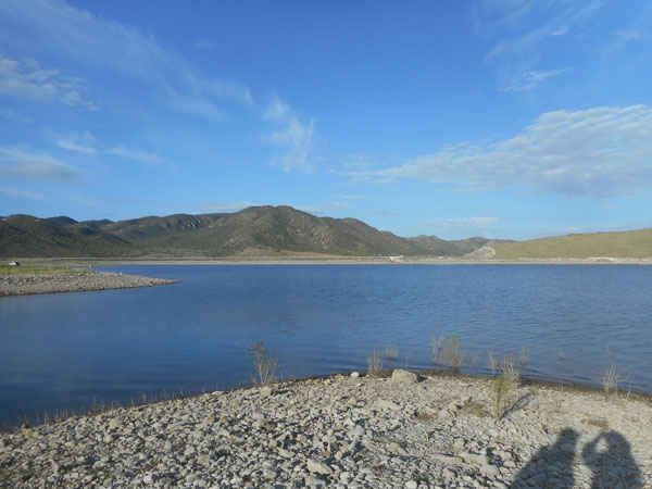
Due to recent fires, the Nebo Loop campgrounds were closed. So we returned to I-15 and drove a bit further south to Beaver. There we turned off towards the flat land on the west to reach Minersville Reservoir, with its State -turned- County Park campground. A very peaceful and pretty space along a reservoir, with only two other parties in the entire facility.
The orange is desert mallow in bloom.
Under threatening skies we bedded down. It poured during the night
The storm has cleared by morning.
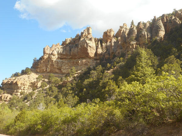
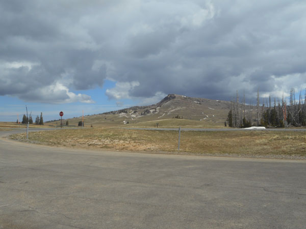
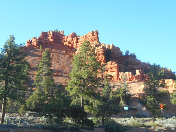
Back to I-15 for just a few more miles. We head south through rolling sage scrub to reach Parowan. There we take Utah 143 to reach our first real "goal" for the trip: Cedar Breaks National Monument.
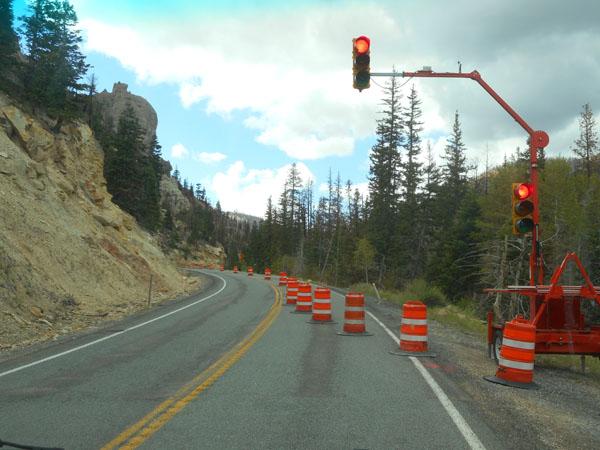
And meet the summer rash of roadwork as we get into the scenic geology Utah is known for.
As we ascend along Hwy 143 towards Brian Head, we pass pale-colored Paleocene sandstone and conglomerate ... dinosaur tracks have been found in the middle layer.
The the reddish and pink Claron Formation ... with a capping layer of lava.
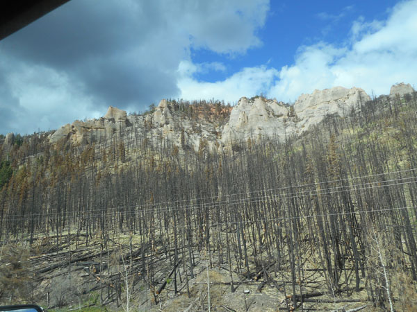
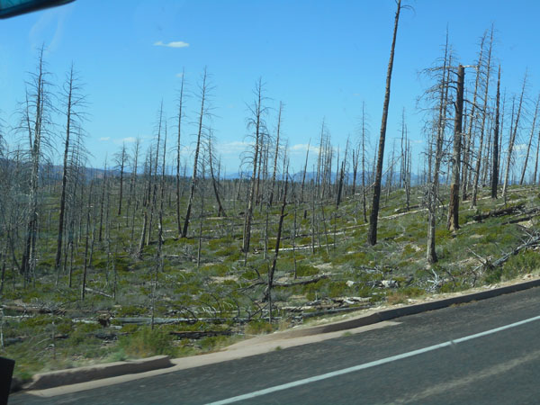
The dry land gets hit with lots of fires.
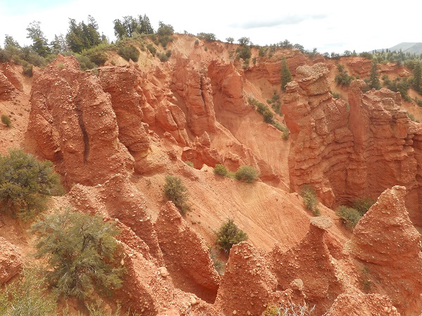
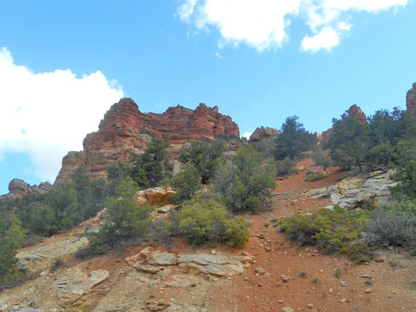
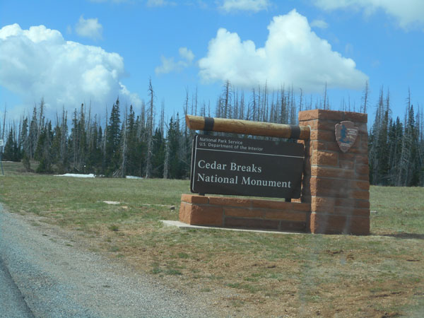
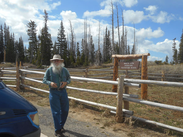
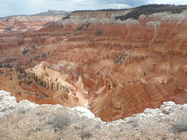
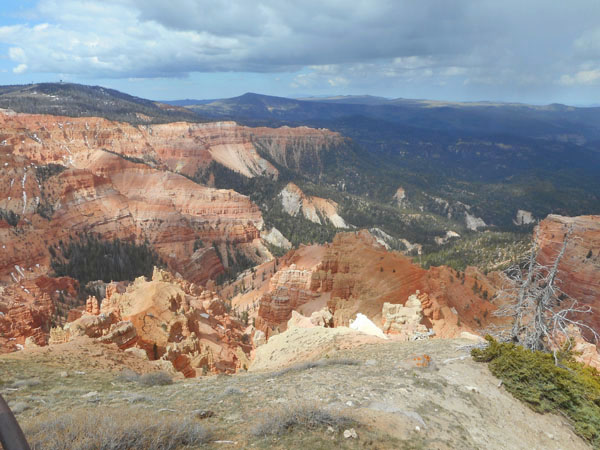
Our first destination: Cedar Breaks National Monument. We couldn't visit it when we toured the SW at the end of April 2010 because it was still snowed in.
It's very high and even at the end of May there are snow banks.
The high rim is at elevation 10,438 feet
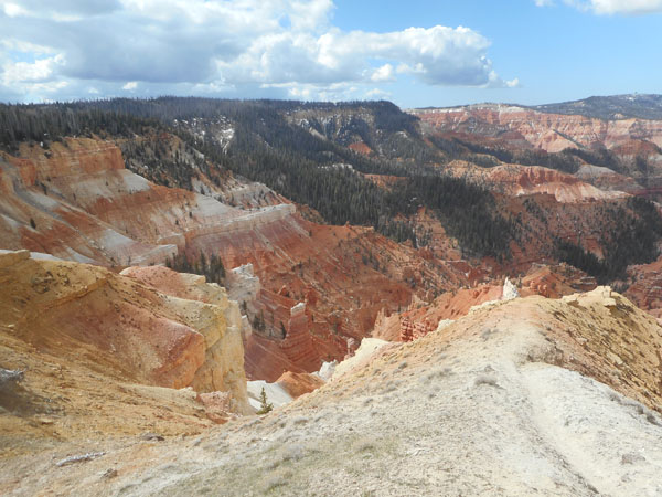
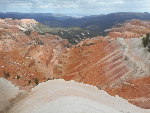
With spectacular views over the edge...
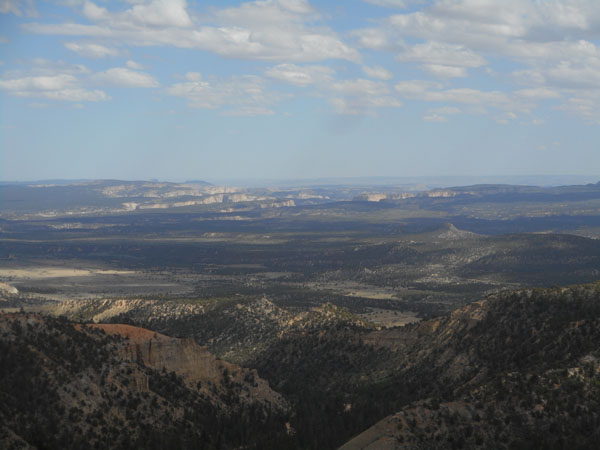
Dick is more familiar with the smoothness of glacially-carved New England. This is "basin and range" country: mountain ranges and plateaus rise up, and some segments of those areas then drop forming the basins. The basin land visible west of these ampitheaters dropped a few thousand feet due to faulting. Those elevation changes helped erosion do its work. These canyons weren't scraped, they were washed.
The moving dappling of the clouds add to the highlighting effects
It was breathtaking ... too much so. We had considered camping up here, but the altitude was bothering us.
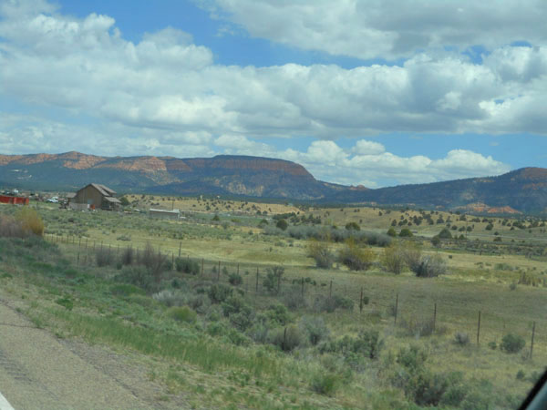
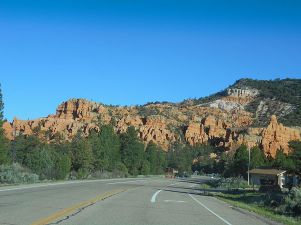
So we headed down ... via Utah 148 and 14 to join US 89 as we aim for Bryce Canyon National Park through rolling countryside. This is the Long Valley basin, between the Markagunt Plateau on the west and the Paunsaugunt Plateau to the east.
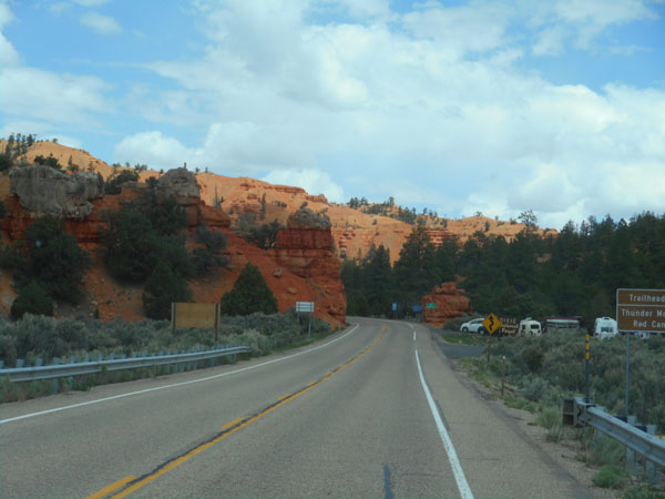
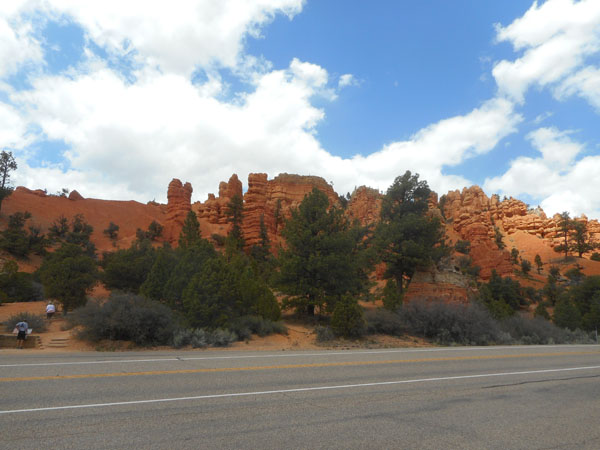
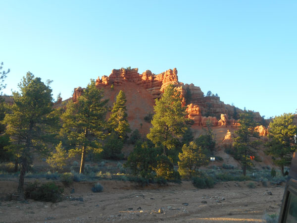
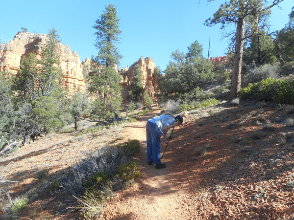
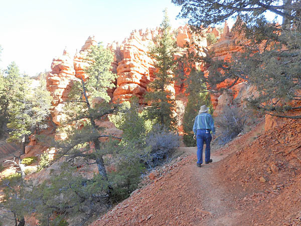
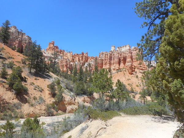
Along the way, Utah 12 takes us into Red Canyon in the Dixie National Forest. Red Canyon is the Paunsaugunt Plateau's exposed face (by the Sevier Fault), and forms the east edge of Long Valley.
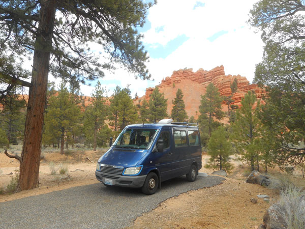
Red Canyon's lower altitude, scenery and available walks through the terrain enticed us...
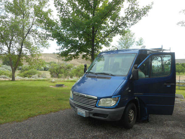
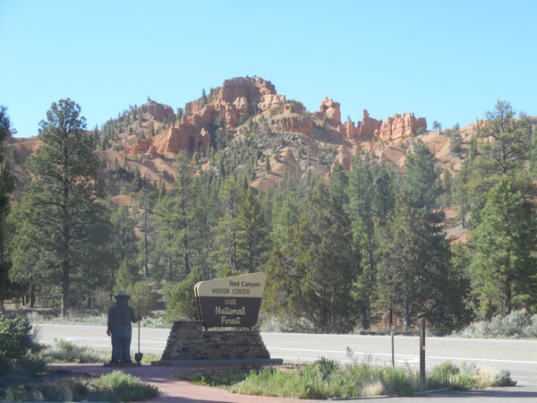
... to camp here instead of up at Bryce itself. As a "concessioned" NFCG, it has the upgrades of flush toilets and hot showers. Our newly installed solar panels are doing a great job of running our Peltier-cooler fridge. We're freed from having to rely on "shore power" hook-ups.
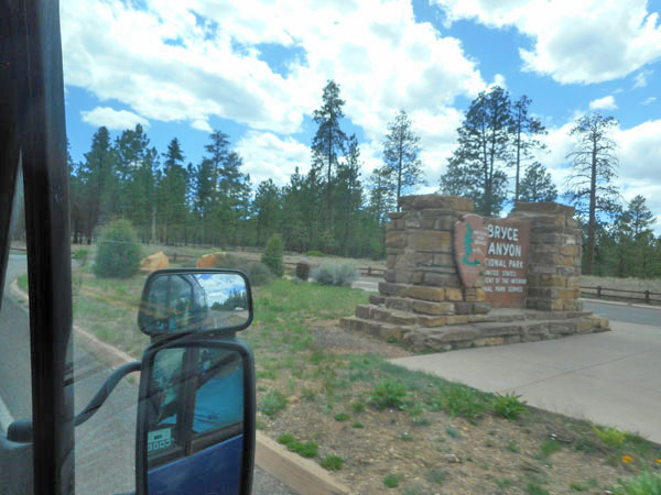
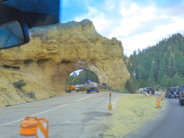
In the morning it's on into Bryce
Where we detour as they repair the iconic entry arch
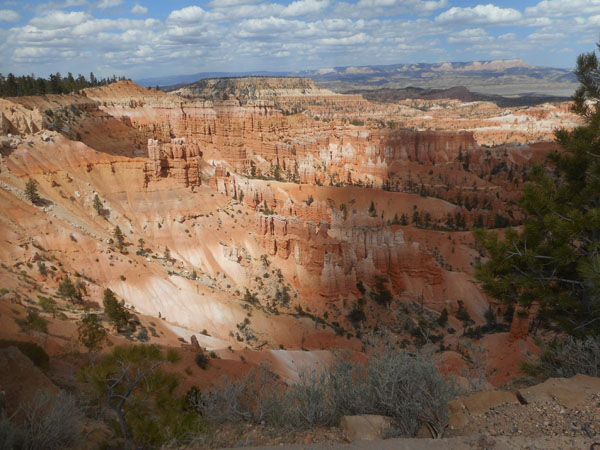
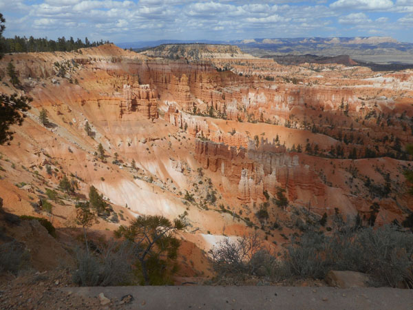
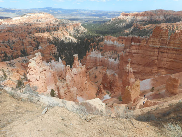
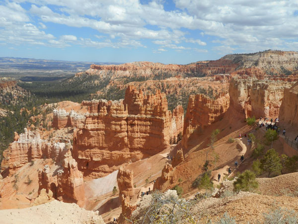
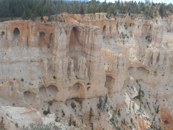
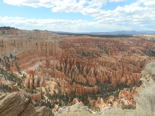
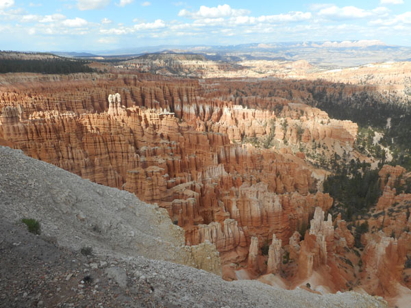
Bryce is definitely worth a second visit: Cedar Breaks was nice but Bryce is an amazing snapshot of erosion.
We dropped in at the visitor center, went to the first overlook....
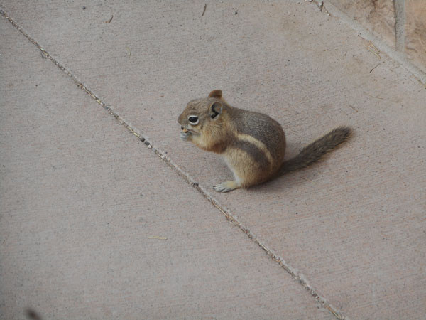
With ground squirrels (Karen's told chipmunks have stripes on their faces instead of just eye rings like this)
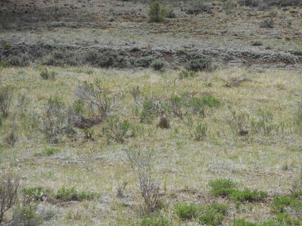
and prarie dogs
This first day we only visited the lower viewpoints: Sunrise, Sunset and Inspiration.
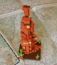
Some (many?) of the features have names... the one with the hikers near its base is "Thor's Hammer", also available as a mini-Lego set:
We can (and would) spend days here...
From the high points you can see other plateaus which are eroding away. As with Cedar Breaks, the low areas between them are basins developed by shifting faults or left behind by the rising plateaus.
Back to the sunset view at our campsite in Red Canyon
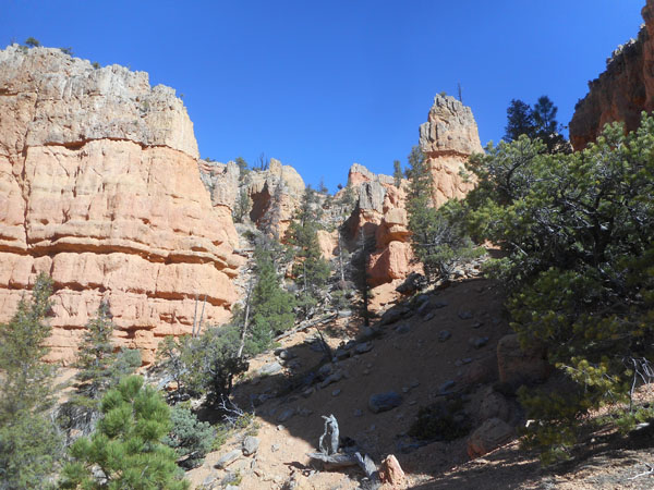
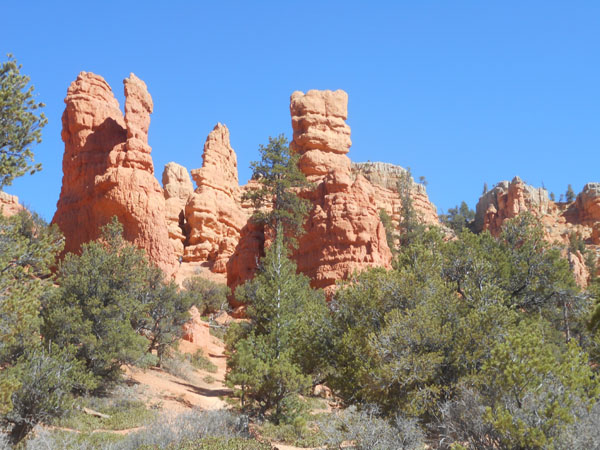
In the morning we visit the Red Canyon visitor center
The Center's parking lot had a rebuilt version of an original building known as the "Podunk Guard Station". Imagine living out here by yourself with all your supplies in this little building all year.
(The actual station's location is 16 dirt-road miles south of here ... that current sleeps-six cabin can be rented for $30 per night.)
The sign at the cabin claims that the name Podunk comes from a Paiute Indian named "Po Dunk", who had become lost in the heavily timbered area near the east fork of the Sevier River. (Wikipedia disagrees...)
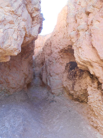
The visitor's center serves as the starting point for a number of short hikes through the formations.
We were doing this early in the morning, before the sun made it blisteringly hot.
From the dark detritus, something looks to be living in the crevice.
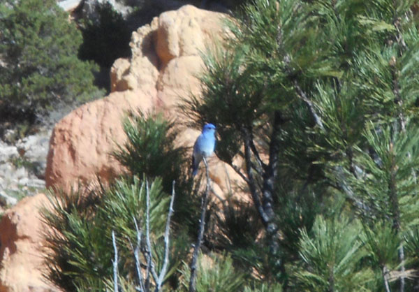
We spot a mountain bluebird -- one of Karen's mother's favorite birds.
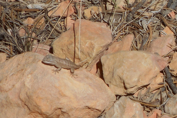
Lots of lizards: but very few stood still for portraits.
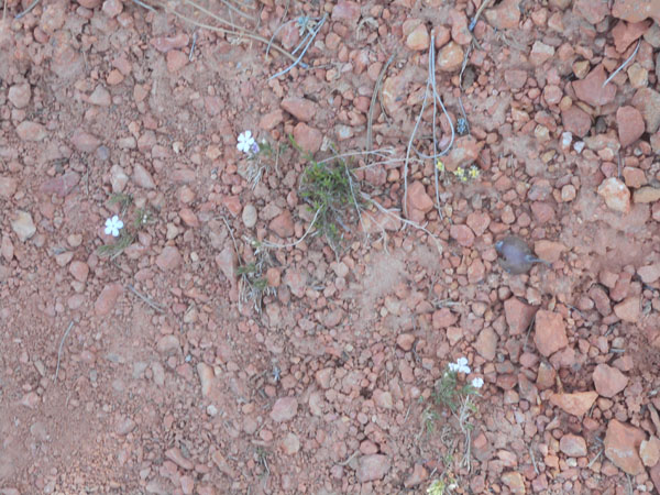
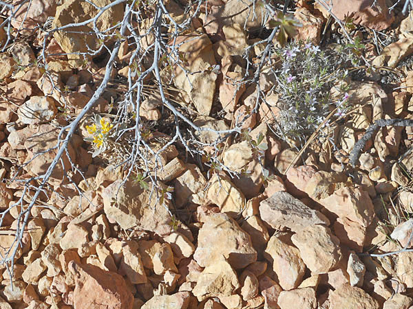
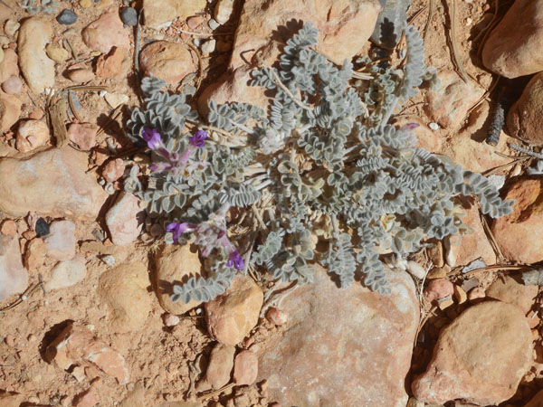
This seemingly harsh soil hosted an amazing range of small flowers
Since there was no sign about this we assumed it to be a relatively modern shelter.
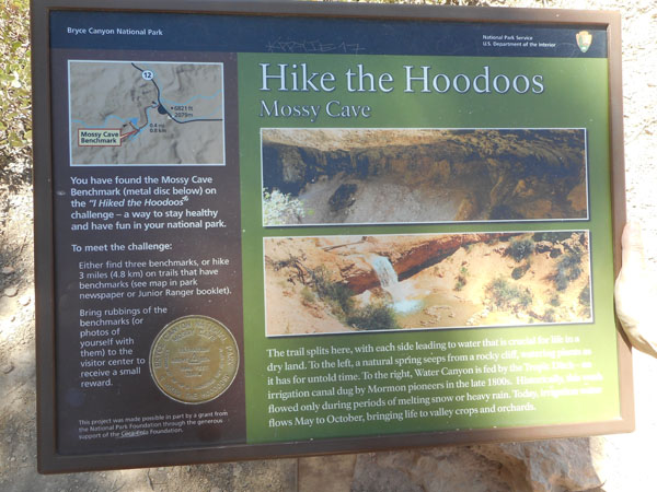
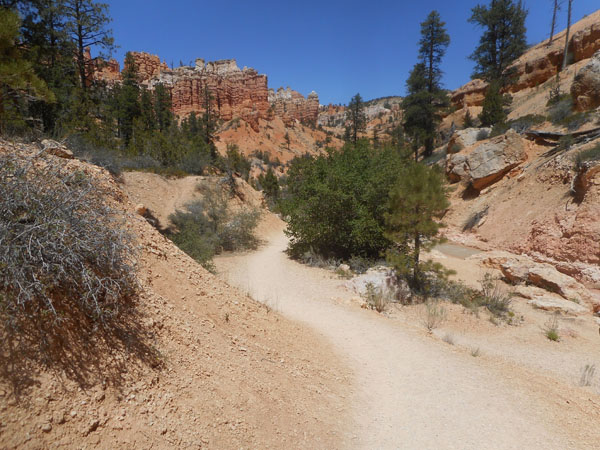
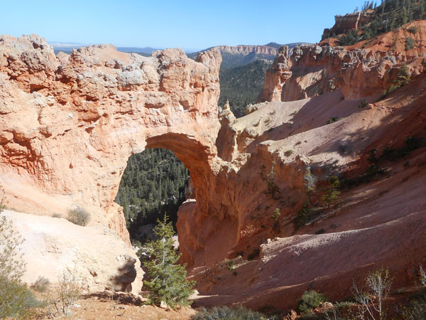
After those Red Canyon "local" hikes, we drive east on Utah 12 past Bryce's formal entry a couple of miles to the "Mossy Cave" trailhead.
The trail follows a stream called the "Tropic Ditch"...
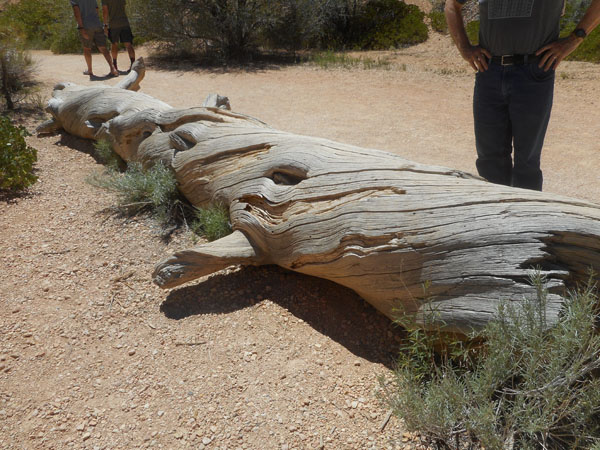
The barkless trees reveal their twisted trunks. This probably makes them less lkely to break in sudden gusts.
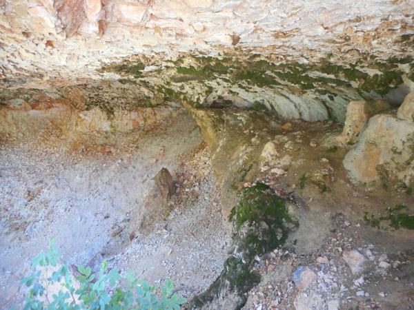
Yes there was moss on the roof of the slight cave where water trickled out.
(The camera makes it look much better-lit than it appeared ... in the noon-time sun the cave seemed dark and dank)
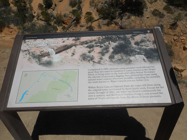
The Tropic ditch was more impressive. Finished in 1892, three years of manual digging rerouted a stream from the other side of the hills to water the local fields in the town of Tropic. A well-done survey job and lots of back-breaking work in a time when dirt was moved by the hand shovel-full.
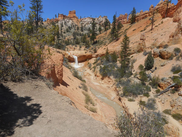
The Tropic Ditch, with the waterfall featured in the previous sign. It's about a 25 foot drop.
A very scenic easy hike.
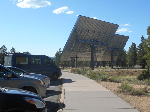
Then it's back into Bryce Park's usual melee ... we stopped to admire the solar panels at the Bryce Visitor Center. All of the hardware on the back allows them to follow the sun during the day.
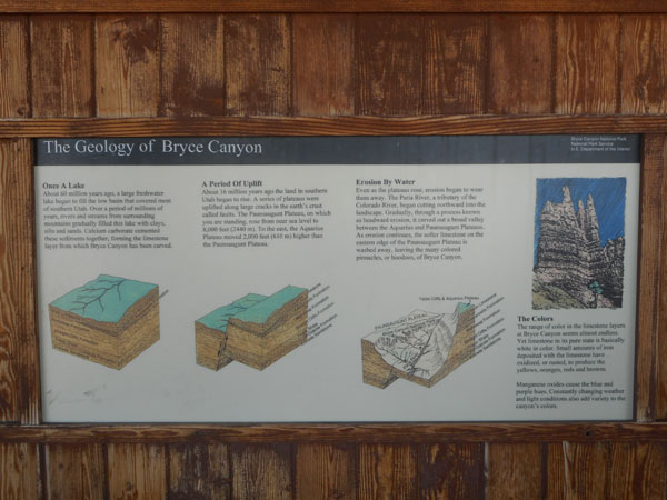
We wandered through the Center's exhibits which did a good job of communicating that the current geology is only a snapshot of the ongoing progression of things eroding down punctuated by upheavals.
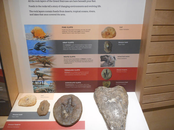
60 million years ago, a lake formed and began collecting sediment. That was cemented into limestone.
16 million years ago, the Plateau began rising. It's currently 8000 feet above sea level. The faults exposed the edges of the sedimentary layers.
As the land rose, the waters began cutting into it.
Limestone is fundamentally white ... the yellows, oranges, reds and browns are traces of iron. Manganese provides the blues and purples.
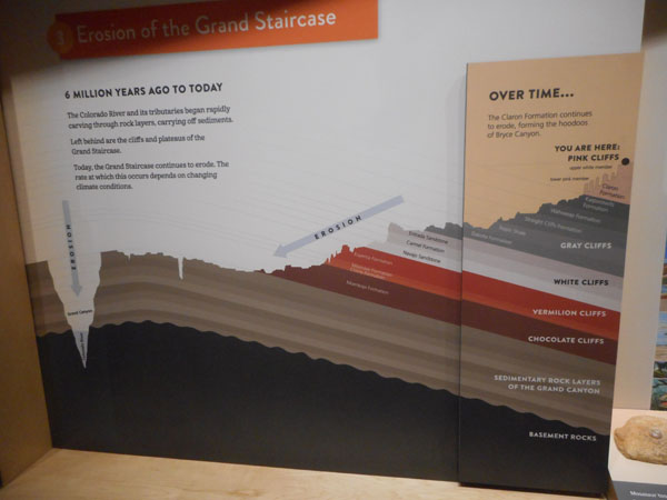
The displays named the layers (groups of adjacent similar deposits are then called Formations), and through multiple panels showed how different sets continued and were visible in the nearby Grand Staircase-Escalante National Monument. This panel is viewing the area from the east, placing Bryce's Pink Cliffs on the right (north) and the Colorado River's eroded groove, the Grand Canyon, on the left (south).
The rock layers are snapshots in time... The cliffs are the signature steps of the Escalante Stairs.
Bryce's topmost pink layers have relatively recent fossils (such as a freshwater snail)
Next down are the grey cliffs, remains of the continent's vast inland sea 90 million years ago(mya)
Then the white cliffs of Navajo Sandstone... sandy desert-like in the time of Jurassic dinosaurs when this area was a the latitude of today's Sahara.
Below that the 245 mya chocolate cliffs with its early alligator-like fossils.
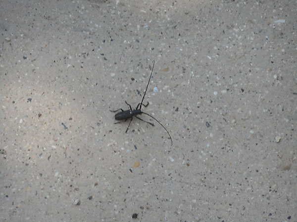
The present-day parking lot had an interesting beetle.
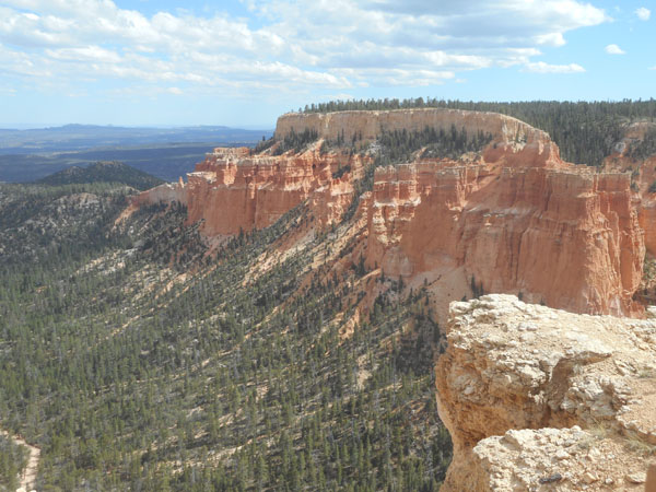
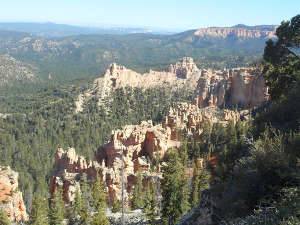
Then we drove off along the Park's main road to see the more distant formations we hadn't had time for on yesterday's visit ... Here too there is fire. This area probably burned in 2010.
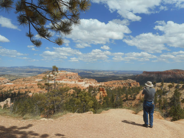
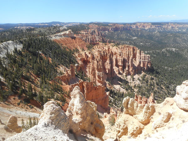
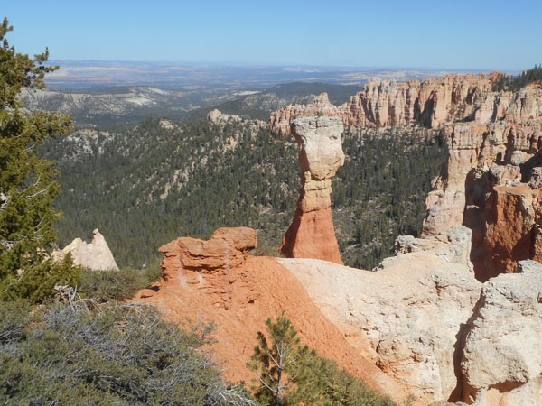
This afternoon's plan was "start at the most distant viewpoint, and then work back". Thus Rainbow Point was the first, farthest and highest. It looks north along the entire eastern rim of Bryce's plateau.
A reminder about why we're having to concentrate on breathing...
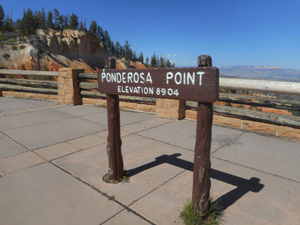
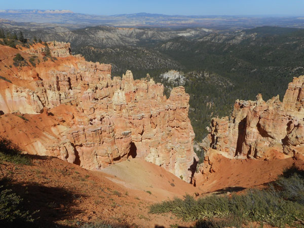
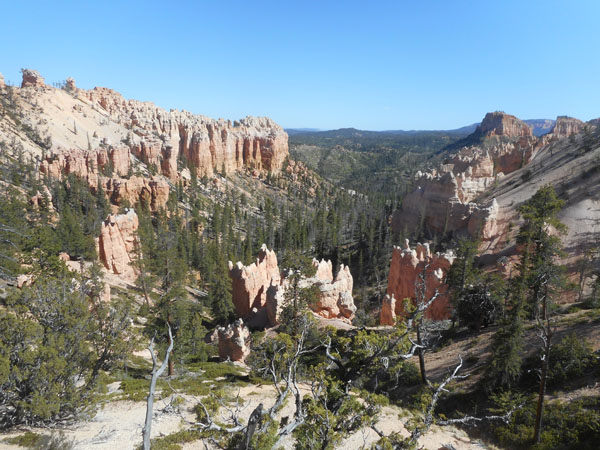
Ponderosa Canyon
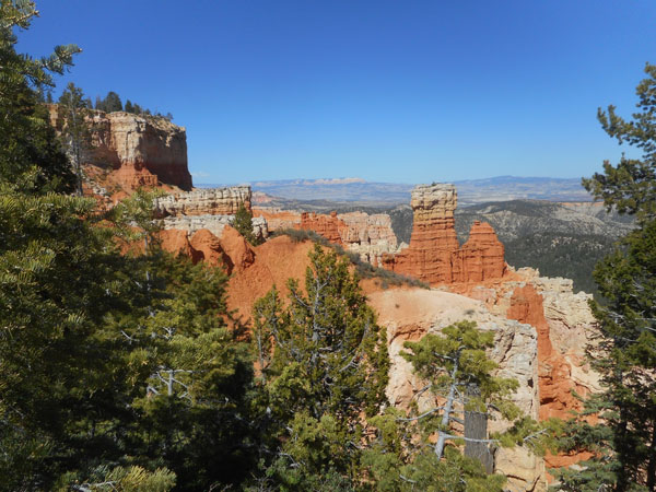
Aqua Canyon, looking to the right
Aqua Canyon, looking to the left
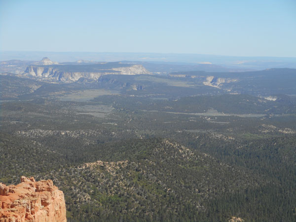
Natural Bridge viewpoint
In the far distance... looking over the tops of the descending staircase towards the Colorado River.
Back to another sunset at Red Canyon.
In the morning we bid adieu to Red Canyon and hurried south to see if we could get a campsite at the North Rim of the Grand Canyon.
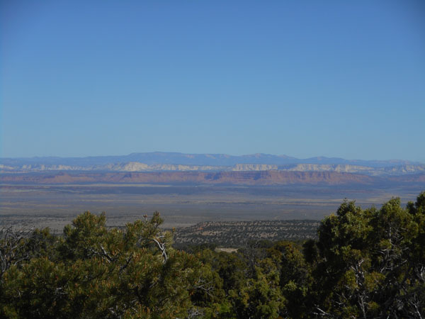
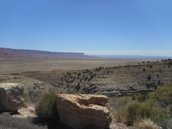
Somewhere along Alt 89, after Fredonia, looking southwest towards the Kanab Plateau. We're "back in time", since Arizona doesn't do Daylight Savings Time.
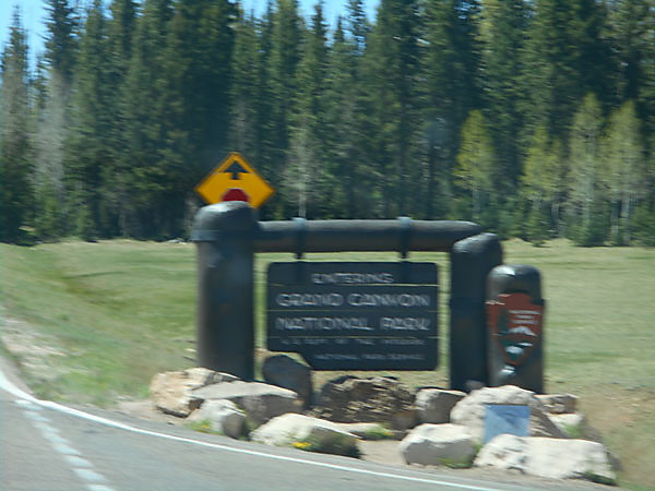
Three hours and twenty minutes after starting out, the sign looked that fuzzy to the driver, too...
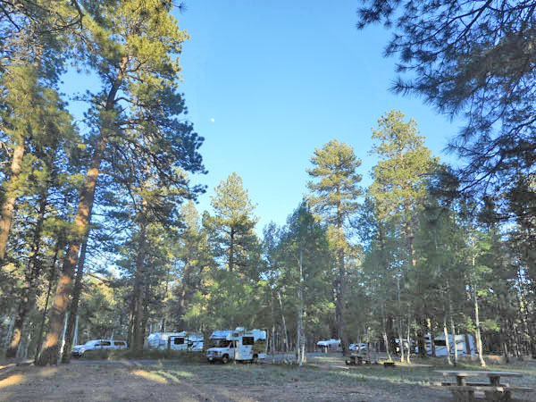
Yes! Thanks to the time zone shift, we arrived early enough to get one of the few spaces available.
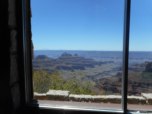
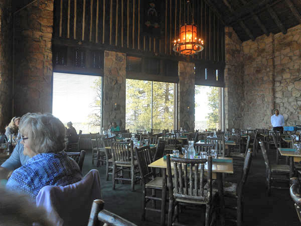
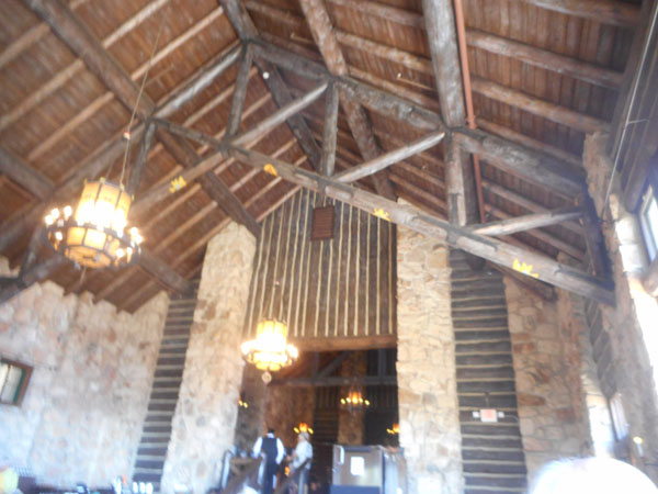
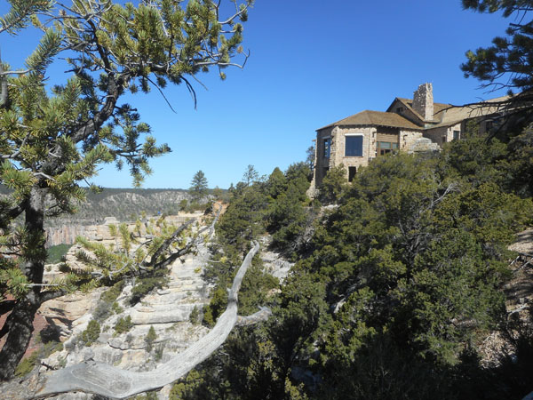
Then we had lunch at the ...
... grand old North Rim Lodge
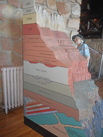
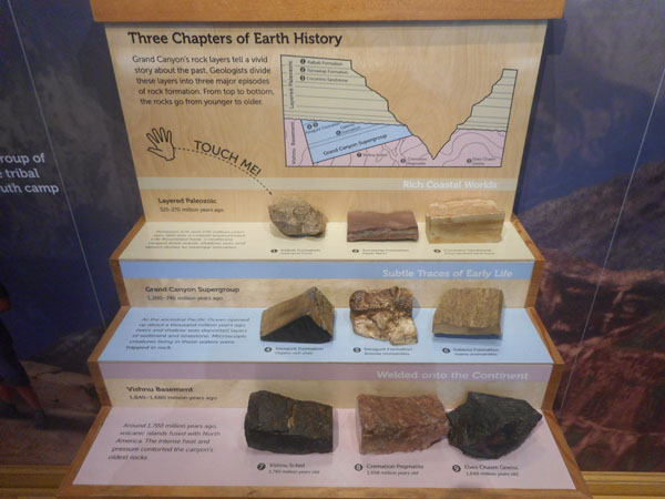
The downstairs sitting room had a 3-d display of the layers of time the river had cut through. All of these layers are down in the "groove" at the left of the earlier Bryce Canyon diagram.
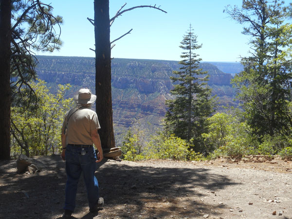
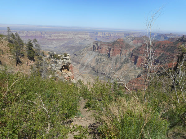
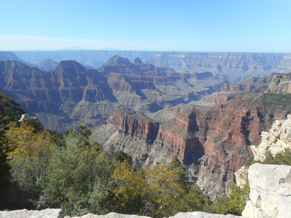
Out the Lodge's back door to wander on a chunk of the Transept Trail. The ridge across the Bright Angel Canyon is Walhalla Plateau's Komo Point.
Note that Karen is --not-- standing near the edge.
The signage makes a point of telling you the the first breathtaking views are of a feeder canyon, not the Grand Canyon itself.
After that short walk around the Lodge, we took the 23 mile drive out over the Walhalla Plateau to Cape Royal. When we were here in 2010, that road was still closed due to snow. Ten days later in a different year found it fully open with only rare touches of snow in shaded areas.
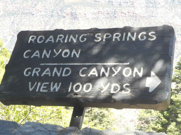
First we came to the Ken Patrick trailhead.
The next stop along the way is Vista Encantada ..
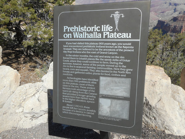
The people who lived here used to farm the bottom in the winter. When it got hot in the summer they'd walk up to farm on the rim where it was cooler.
Their trail is still a popular approach to the canyon.
Note how flat the surrounding land's plateaus are.
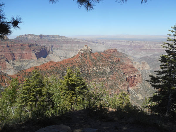
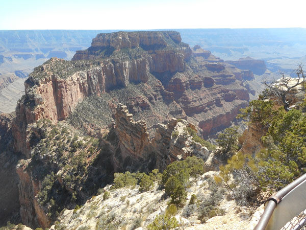
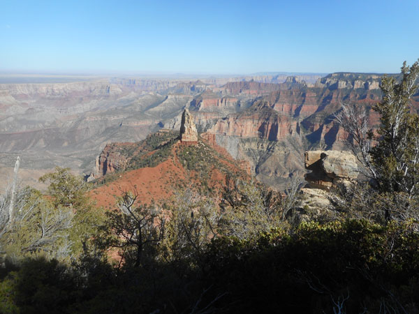
This is Wotan's Throne viewed from Cape Royal.
We then drove to the other, northern, arm of this Y-shaped road.
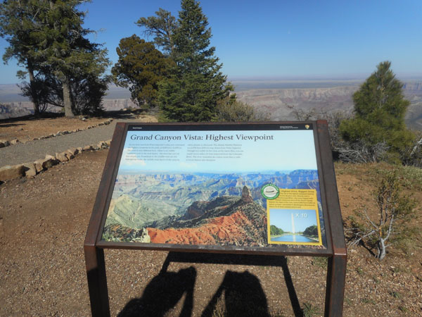
Yes, the shadows reveal that we both take pictures of the signage ...
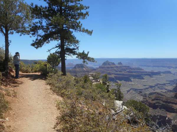
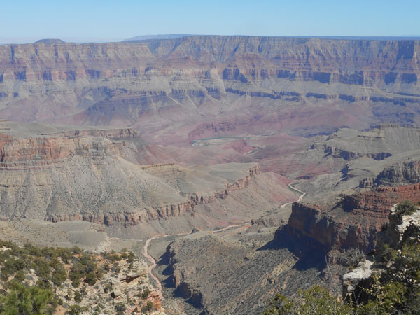
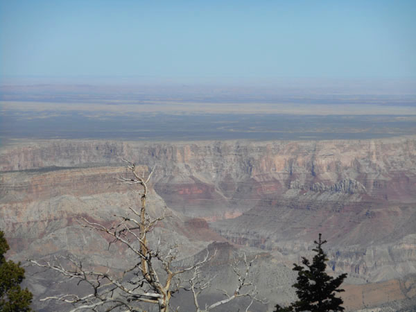
... here at Point Imperial, the highest point in the park at 8803 feet, with a view of the Colorado River and eastern Grand Canyon.
Here you can see even better the power of water to cut back through time.
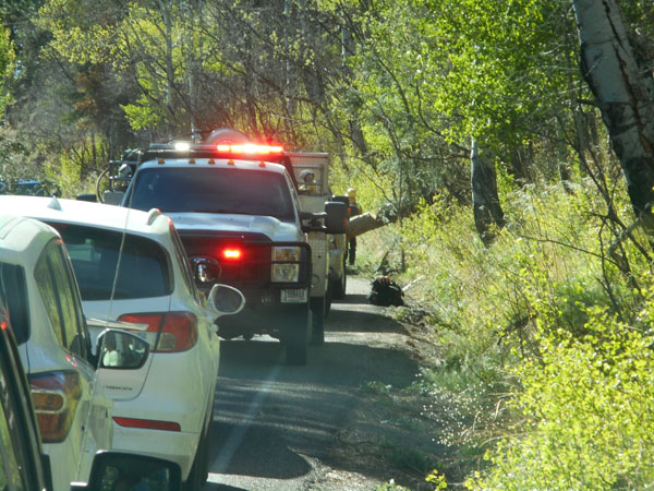
After Point Imperial, we headed back to the campground. We came across stopped traffic that wasn't due to wildlife. A tree had fallen across the road. We waited 15 minutes while it was cleared. Traffic resumed...
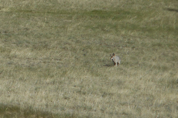
Then eagle-eyed Karen spotted a grey shape in a meadow. We turned around and watched as a coyote was getting ready to pounce on something.
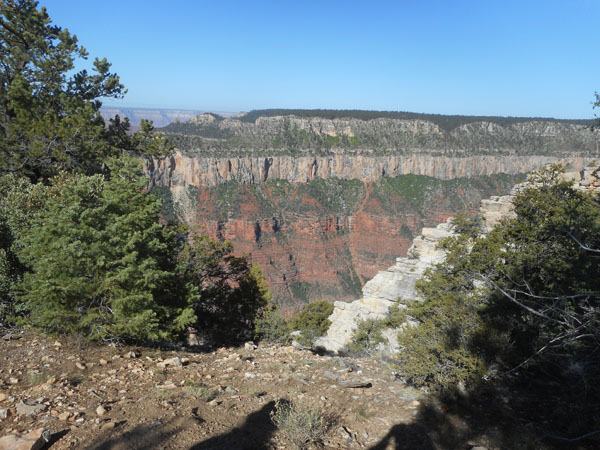
In the morning we walked the area around the lodge ...
... went to the visitor center ...
... enjoyed the morning light on the surrounding strata ...
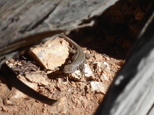
... and got glared at by a lizard.
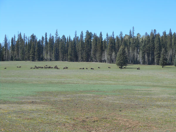
We drove out past the local bison herd ...
... and a (far) future grand canyon?
Leaving the North Rim, we turned eastward at Jacob Lake and crossed the top of the Kaibab Plateau towards Glen Canyon and Lake Powell.