Travels with Dick and Karen
Britain Part 2
Wells to Wales to Hadrian's Wall |
 |
|
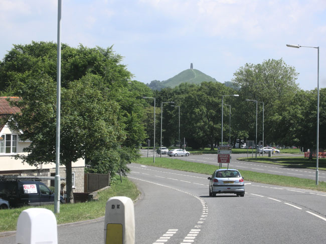
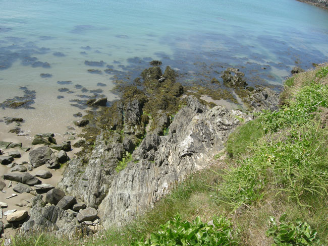
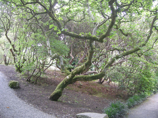
We drove around Glastonbury, past the Tor (the hill, note the tower). It was close to solstice which this town celebrates in a big way. We couldn't find any parking so we went on to ... |
 |
the lovely town of Wells just down the road. |
 |
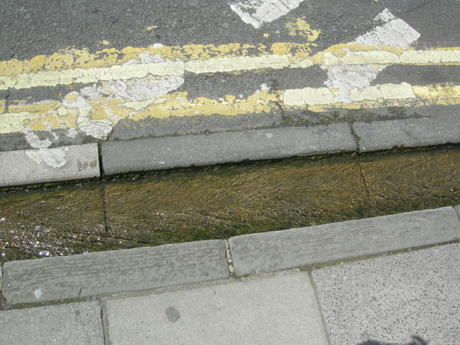
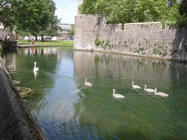
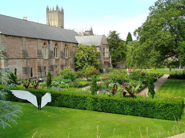
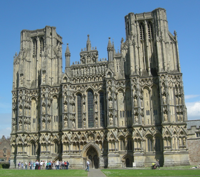
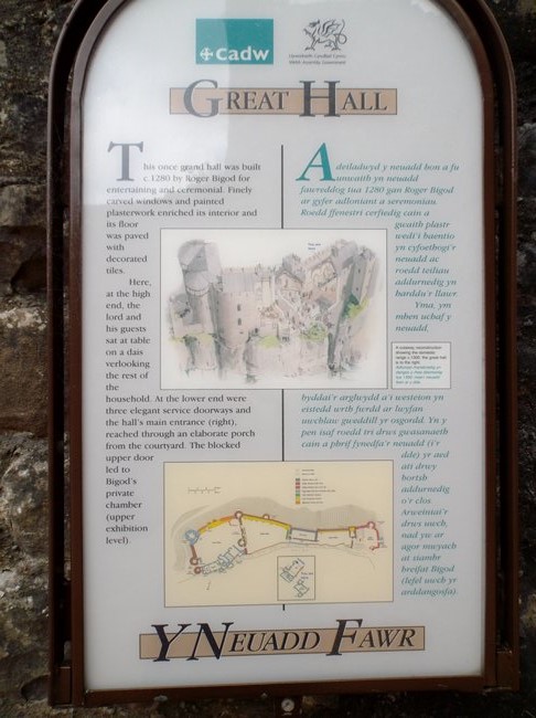
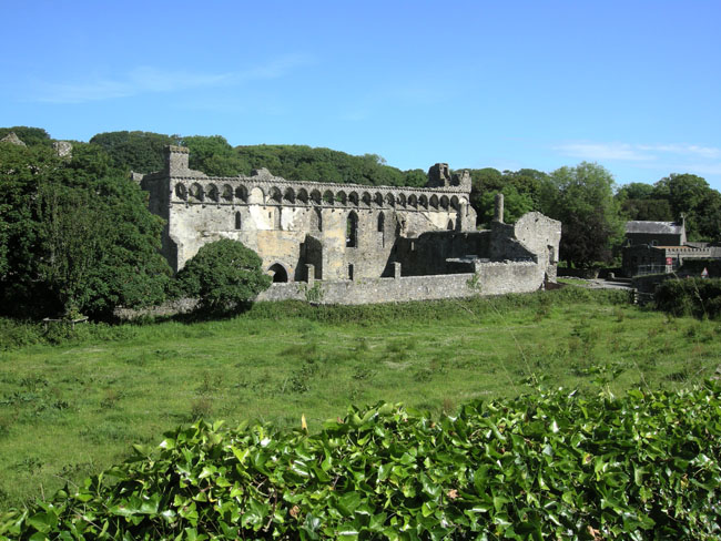
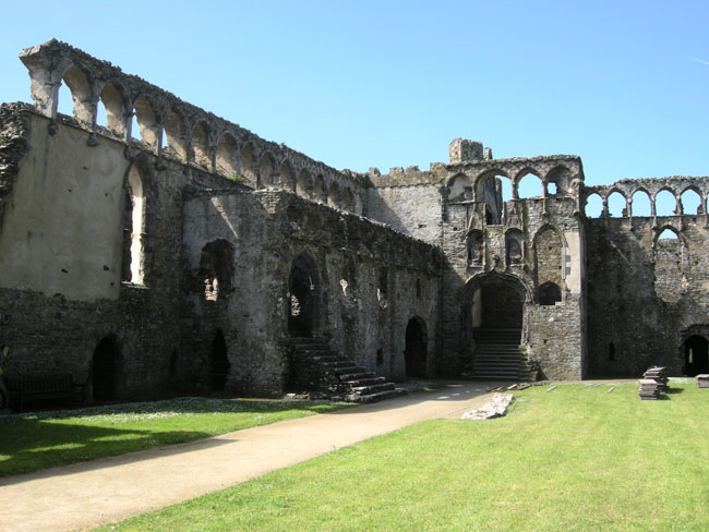
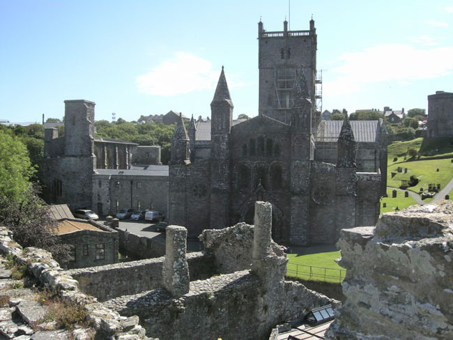
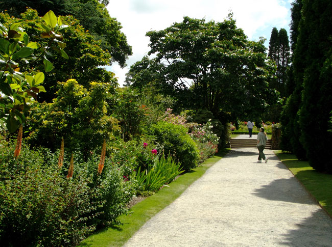
Wells has that name since it has three reliable fresh water springs. In truth, it's a city, not a town, since it was granted that status in 1205 due to having a cathedral. Alongside the cathedral is the bishop's residence, which (like many across the years) has grown to the status of "palace".
The springs at the Bishop's Palace overflow and run down the gutters of the town. In the middle ages such access to water was a big deal. |
 |
| The Bishop's Palace has a moat and wall so it could stand off a siege. |
 |
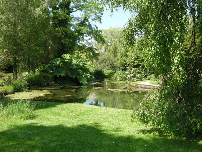
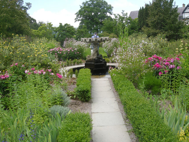
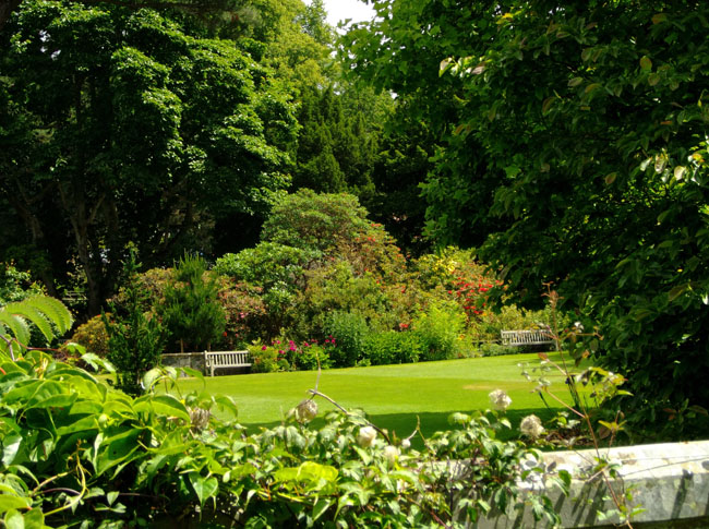
| The gardens were serene and peaceful. |
 |
| With lots of pools |
 |
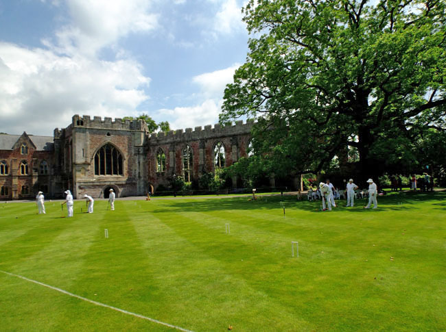
And a lawn for croquet |
 |
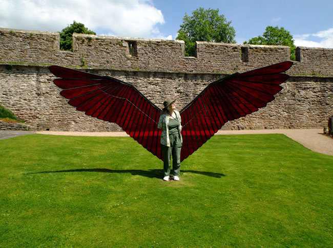
There were some modern stained glass sculptures scattered throughout the Bishop's Palace gardens |
 |
| if you wanted to see what you'd look like with wings |
 |
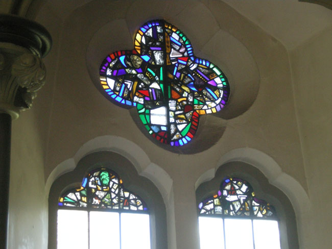
The inside of the Bishop's Palace was not very spectacular. This is another example of shards of glass pieced back together after being broken in the civil war of the 1600's. |
 |
| Of course, the palace had a chapel. |
 |
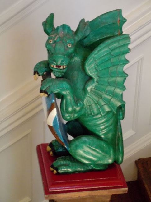
| The Bishop's Palace did have several of these charming dragons ornamenting the stairs up to the small museum. |
 |
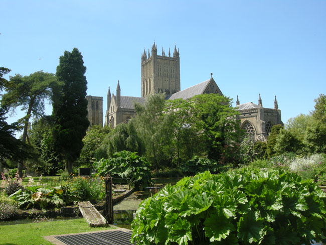
We'd been kind'a "cathedraled out", so we didn't tour the adjacent Wells cathedral. Among the things we missed seeing was the oldest piece of wooden furniture in England ... the 1200 year old (i.e. installed in 800, in the Saxon chruch that predated the cathedral) "cope chest", used to store the clergy's vestments.
Like Salisbury, the outside has hundreds of statues. Unlike Salisbury, many of these have survived since the 13th century, except for the bottom row which Cromwell's men could easily reach.
|
 |
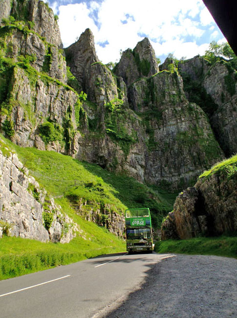
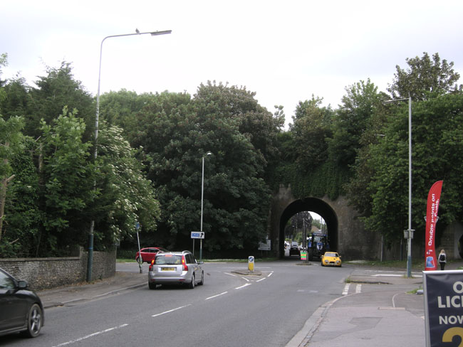
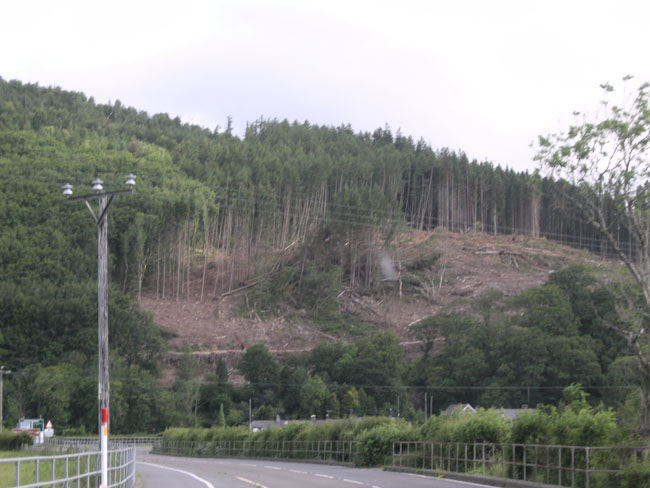
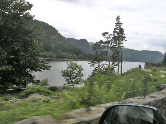
From Wells we drove a short distance northwest to arrive at Cheddar Gorge.
The base of the gorge is pretty but very touristy. We chose to forgo the opportunity to pay to go into the caves that had been used to age the well-known cheese.
Instead, we drove up through the very scenic gorge, with rock walls rising steeply above us.
(for a near-similar experience in the US, we can recommend Smuggler's Notch near Vermont's Stowe ski area) |
 |
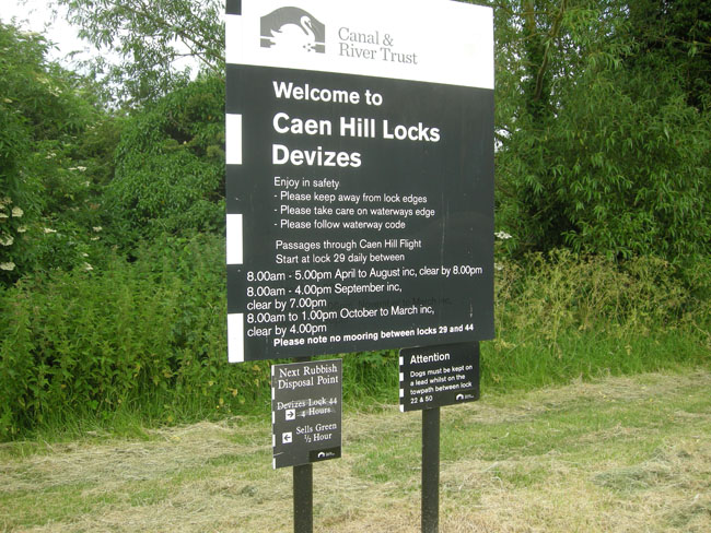
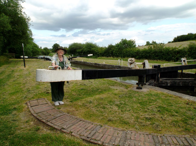
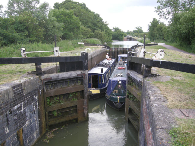
| That evening we camped in the town of Devizes. The campground turned out to be very near a restored canal, now used for pleasure boating. And where you have canals in hilly England, you have locks. |
 |
| We assisted a pair of boats doing their last two locks in the series of 27. |
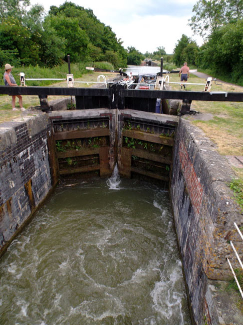 |
The boats enter the lock stage, the rear gates are closed, sluice gates are opened in the end in the direction you're traveling, and you wait for the boats to rise (or drop) to the level of the exit gates' section of river ("pound").
Then the two sides of the gates are pushed open by passengers or willing passer-bys. |
 |
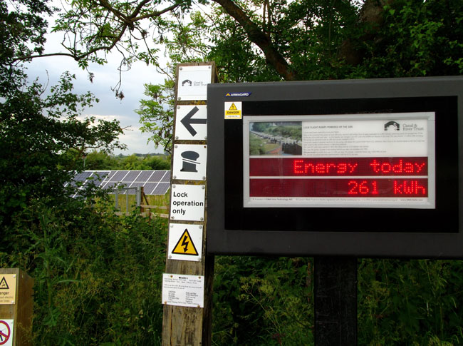
All told, there are 27 locks in a series which raise the canal over 200 feet in two miles.
One slight bit of formality is that the boats carry the handles which operate the sluice gate winches. An idle (or nefarious) passer-by cannot (easily) confuse the system by opening a sluice to drain (or flood) an inter-lock segment.
|
 |
The locks work by the simple means of letting water flow downhill.
The system uses solar power to pump "refill" water back up hill.
Oodles of details: Caen Hill Locks |
 |
The next morning we drove off into the mists to visit the Avebury stone circle.
Unlike Stonehenge, this circle is huge ... large enough that it surrounds the tiny town. |
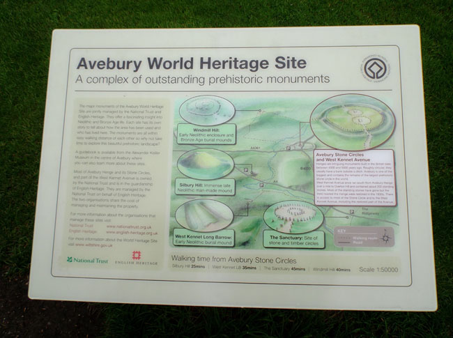 |
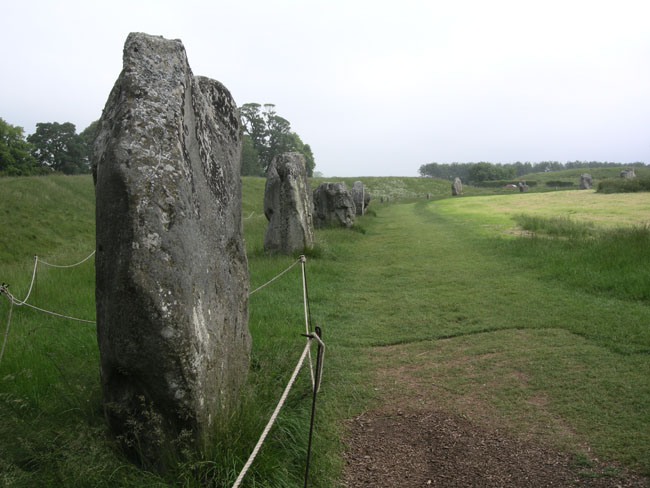
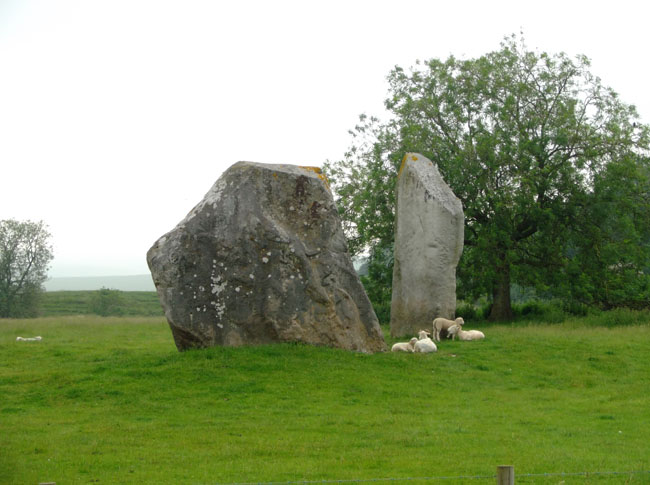
We hiked through 4 pastures to see the full circle.
Another difference from Stonehenge is that this does not have an "erected" structure (horizontal stones laid atop vertical stones), it's "merely" large stones placed in the desired pattern. |
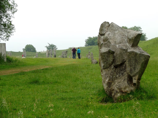 |
| It does feel like it goes on for miles. |
 |
| Some pastures have sheep. |
 |
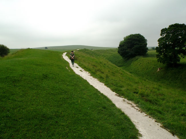
The path on the outer dike has worn down into the chalk
Atypically for us, we got there before the visitor center opened ... thus avoiding any feeling of crowding. |
 |
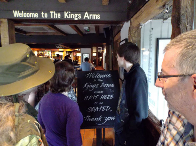
| From Avebury we continued on to Abingdon, the home of Karen's niece Abbi, her husband Dave and his parents, Valerie and Clive. It was fun getting to know the new arm of the family. We had lunch at the King's Arms in Sandford-on-Thames, which let us walk along the Thames and talk afterwards. And totally forgot to take photos. |
 |
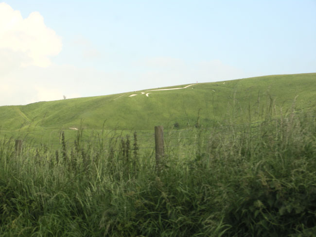
| On the way to that night's camping we detoured to catch a glimpse of one of the oldest chalk hill figures, the Uffington horse. It is thought to be paleolithic. The plants have to be removed fairly frequently to keep it visible. It boggles my mind that the community has been maintaining it for that long. |
 |
The next morning we stopped in Marlborough for coffee and then noticed the building we'd parked in front of. Our Hobbit fan side is showing.
(this won't be the last time...) |
 |
| Departing Marlborough required passing through the city wall's narrow gate. |
 |
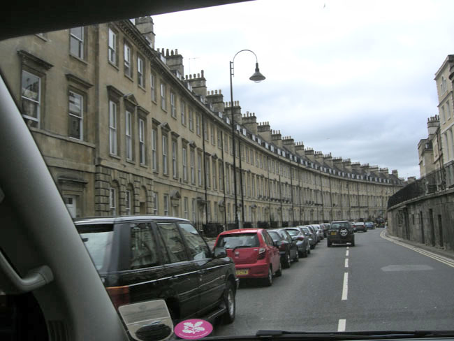
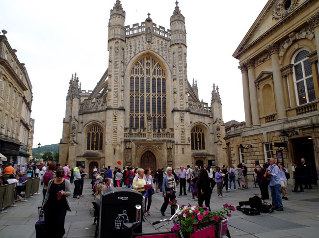
Thence to Bath.
The buildings are 17oo's trendy, all of the local gold Bath limestone. |
 |
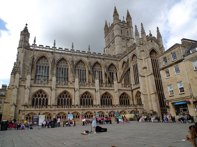
| ... including the Abbey. |
 |
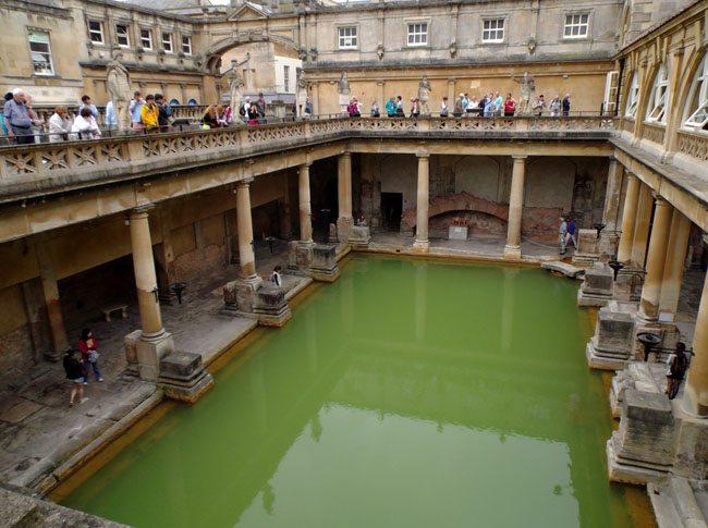
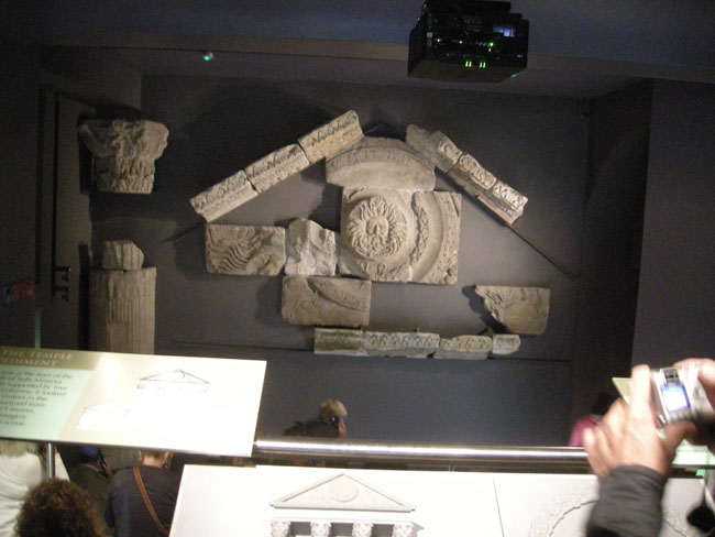
Bath's claim to fame is its hot springs... which the Romans made use of by creating an extensive bathing complex. Over the centuries, the Roman buildings were forgotten and buried as the fortunes of the town rose and fell.
Rediscovered and excavated in the late 19th century, the Roman baths have been restored but only for looking at, not for bathing.
If you want to bathe in the waters of Bath, you'll need to visit the Thermae Bath Spa a block away. |
 |
Although the entry and first few displays of the museum are at street level, the bulk of the excavations and displays are located 18 feet deeper.
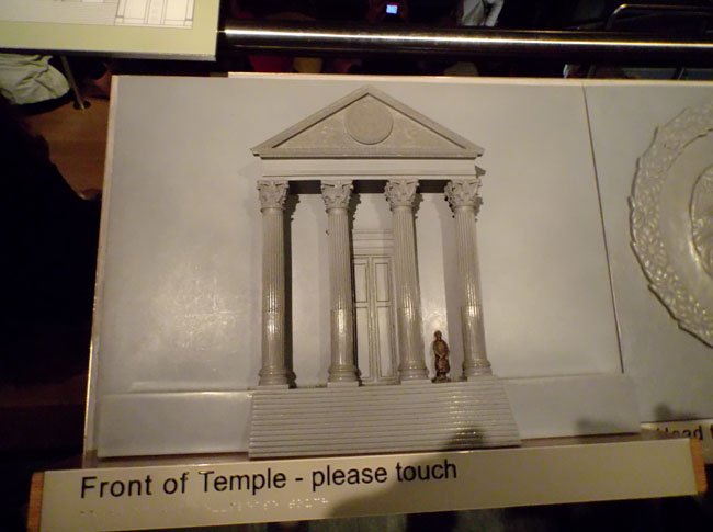
As we prepare to descend, we're shown that the front of the old temple had what the description called a Celtic face rather than a Roman face. |
 |
| There were very good displays, combining tactile and active (turn the crank) models, paintings, signage, movies and computer displays. The admission included use of quite flexible audio guides... each exhibit station would have three or four numeric codes to bring up kid-friendly, humorous, serious and/or dry-as-dust explanatory segments. |
 |
| Maps and models presented the stages of the bath's construction and their placement in the surrounding town's development across the 500 years of Roman Imperial presence. |
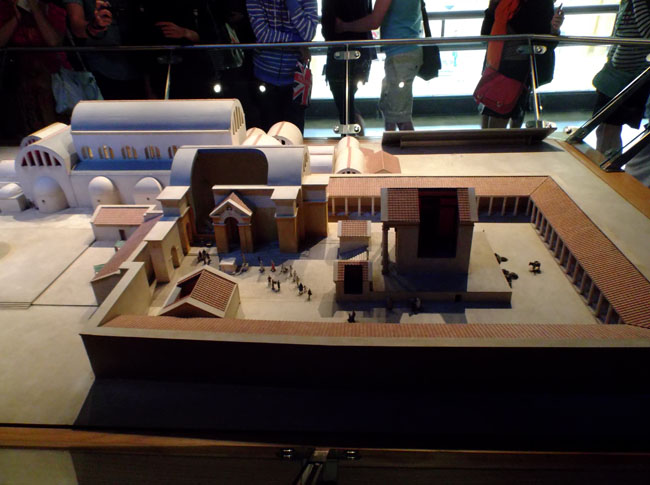 |
The large pool was merely one section of the compound. There were separate heated rooms for preparation, message and after-dip drying off.
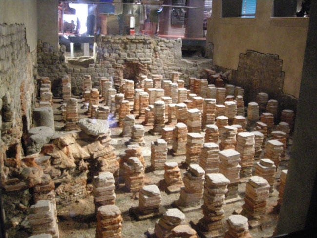
These are the supports for a heated floor: fires would be lit in another room and the warm air channeled under the floor. |
 |
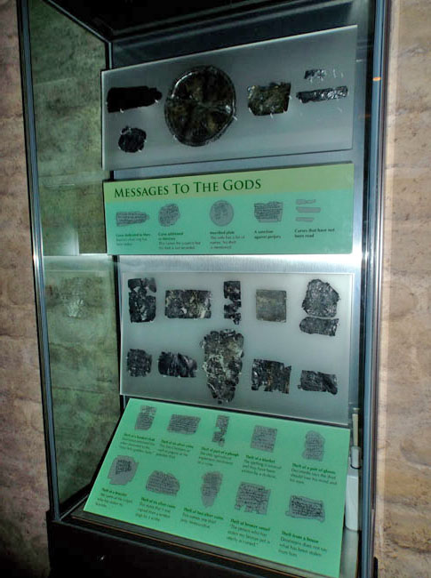
| Pieces of lead with prayers (and curses) were found in the pools. |
 |
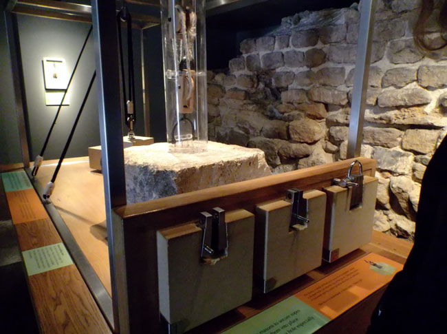
Among the active exhibits was this great demonstration of how to move large rocks into place using "primitive" techniques.
The three blocks facing us demonstrate various ways of using keyed blocks to securely connect the hoisting cables to the stones being lifted. |
 |
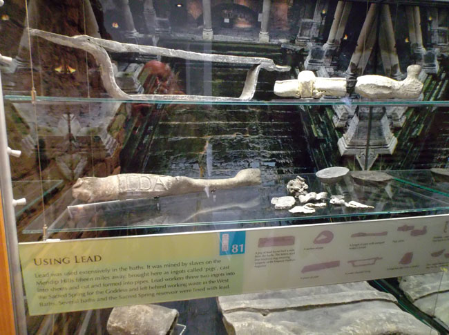
| Lead pipes... tons of them. |
 |
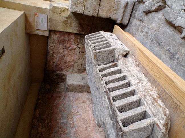
| They may have been living two thousand years ago, but they had developed sophisticated practices, such as forming complex hollow bricks to make the roof lighter. |
 |
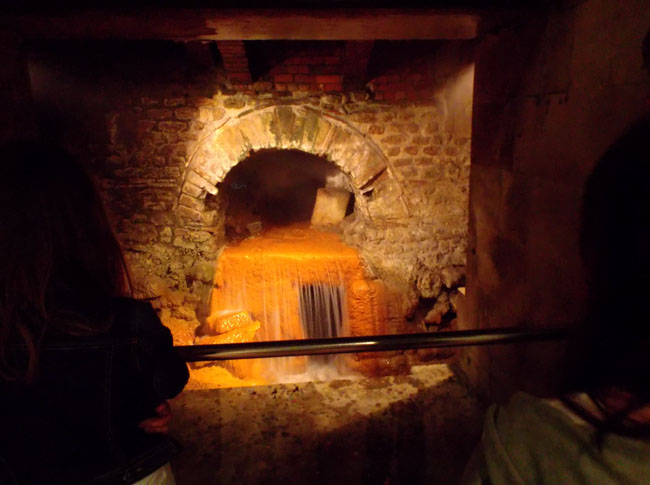
| Finally, the still-flowing mouth of the springs. |
 |
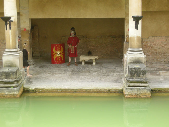
| The guides are costumed and stay in character... although they would willingly accept tips in pounds and pence instead of insisting upon denarii. |
 |
| Back out and up at street level we walked around the Abbey. |
 |
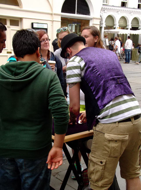
| Along the way we found a "find the lady" man shuffling walnut shells just like in times of old. |
 |
| We spent the rest of the day exploring Bath... certain shops always caught our attention... |
 |
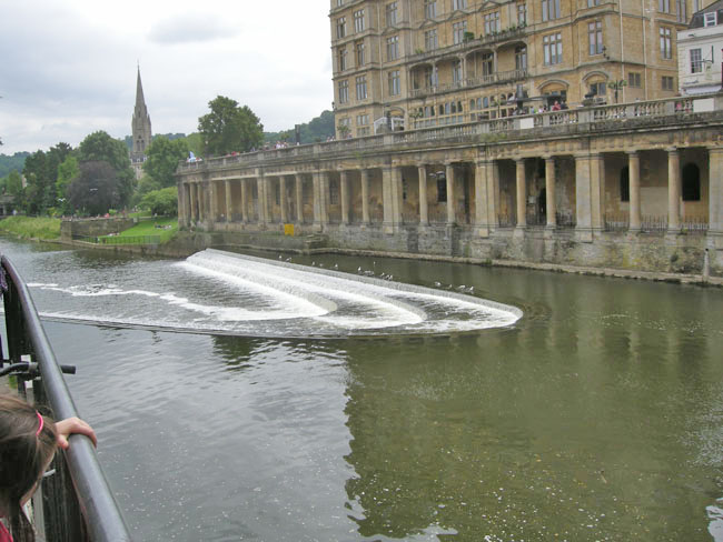
Bath is surrounded on three sides by an oxbow of the River Avon.
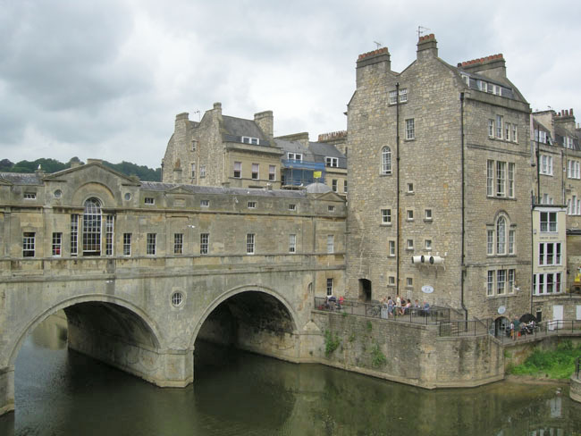
This weir is just below the Pultney Bridge (one of only four bridges in the world with shops across the full span on both sides). |
 |
Looking upstream at the backs of the shops on Pultney Bridge.
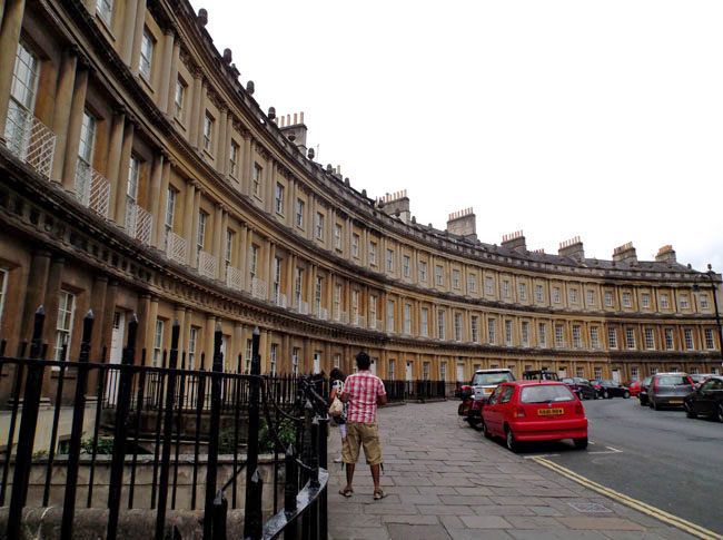
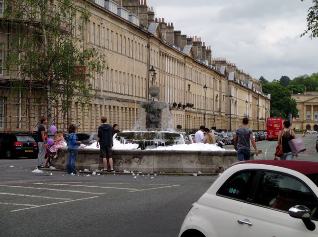
The next spread of photos shows two quarters of a full circle of Georgian-era (mid 17oo's) "condos" forming "The Circus". Nearby is a half-circle known as "The Crescent". The height of snobbish living, with servants' quarters on the topmost floors (squint to see the round windows). |
 |
 |
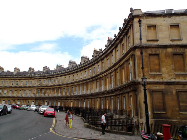 |
Not all of the dense housing was formed in arcs, not all of the fountains were filled with soap suds...
(... a digression: consider the number of chimneys shown in this (and the previous) shot... "back in the day" the only way to heat a room was with a fireplace in the room(*). Each fireplace had its own flue to the roof. Thus the forest of chimney pots towering above the roofs (and the employment available for chimney sweeps (cue: Chim-Chim Cher-ee))).
((*) ... well ... yes, the Romans had had hot-air heating from a central plant. But that had been over 1000 years before and individual thermostats probably hadn't been (re-?)invented yet) |
 |
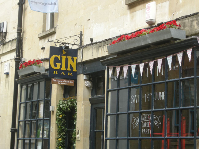
| We wondered if the Bath Gin company used tubs. |
 |
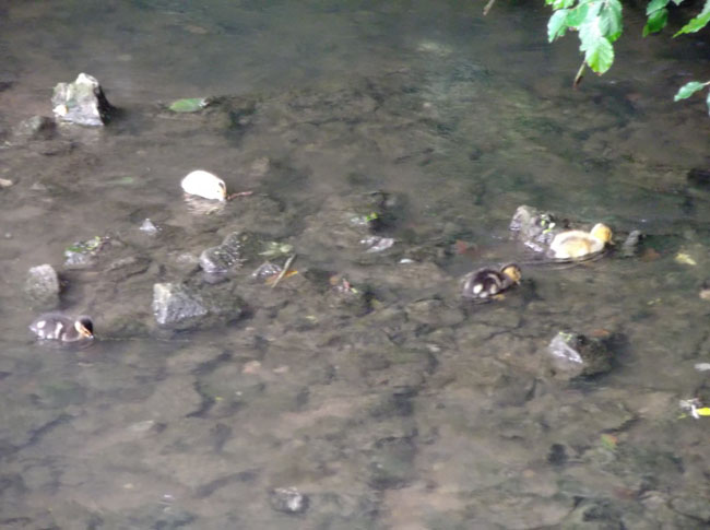
| Our campsite that night on the outskirts of Bath backed onto... |
 |
| ... a stream ... |
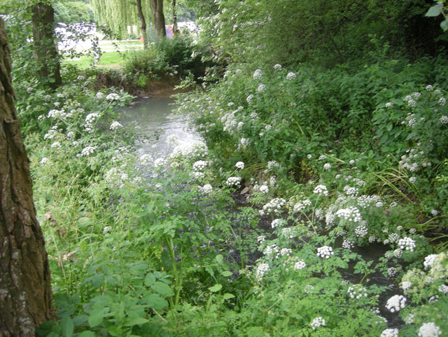 |
... where we watched ducklings learn to feed.
(whilst our laundry was tumbling away) |
 |
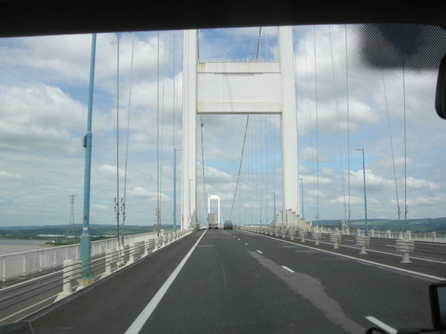
| The next day we were up (fairly) early and headed over the Severn Bridge to enter Wales. |
 |
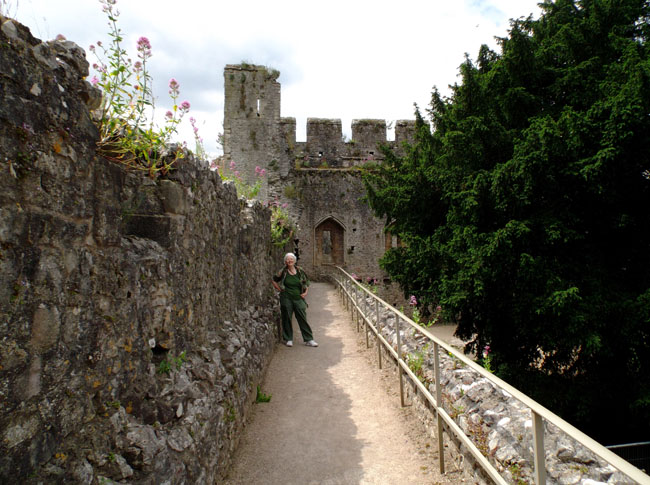
| Our first stop in Wales: Chepstow castle. |
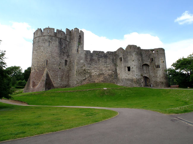 |
| Dual-language displays showed the castle's development over the centuries: from the central Great Tower in the Norman period (1067-1115) to the final touches in the 17oo's. |
 |
| The slot in the floor is where the Portcullis would drop to seal the gateway below. |
 |
| Cambering over the battlements gave impressive views of the stonework and scenic glimpses of the River Wye below. |
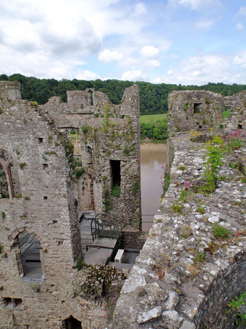 |
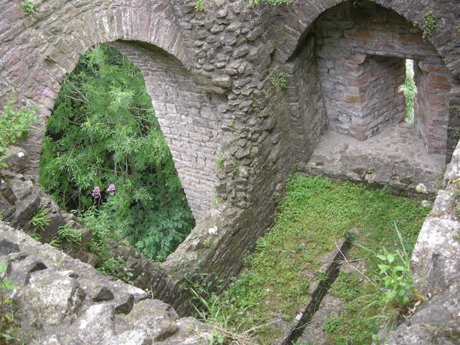
| Despite the appearance, Chepstow was in many ways in less ruinous shape than those we had visited to this point. It's the oldest surviving post-Roman stone fortress in Britain. Unlike many of the castles, it was not destroyed as a direct consequence of the English Civil War ... instead it survived for a while as an artillery fort, barracks and political prison. |
 |
| Following 1685, its garrison was disbanded, and the castle fell to a long period of gradual decay and plundering for its stones. So it is still a ruin. |
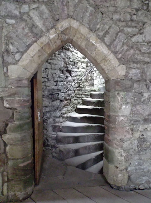 |
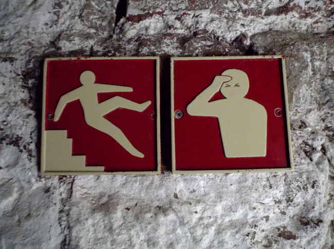
| ... and you used the stairs at your own risk. |
 |
| |
|
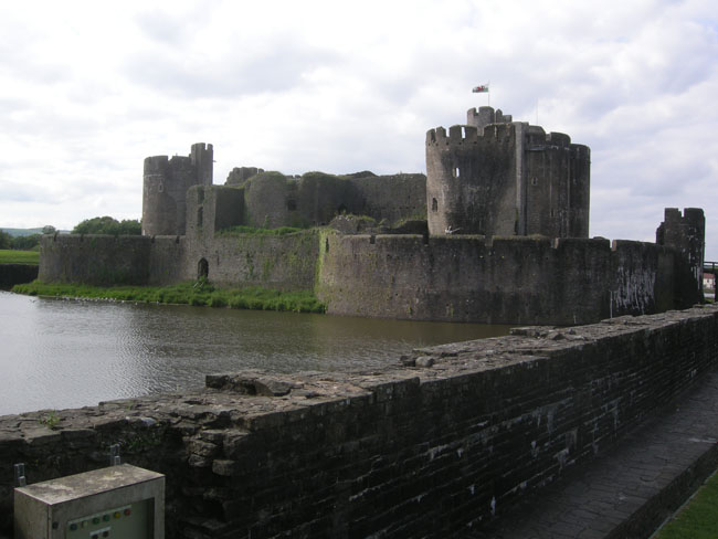
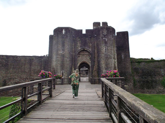
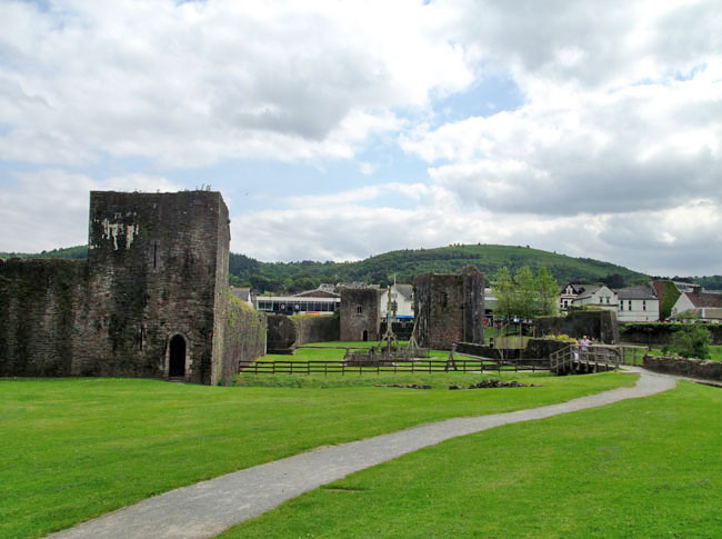
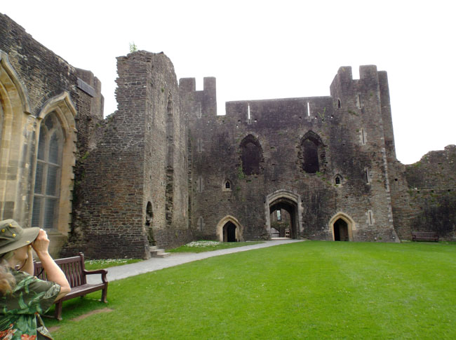
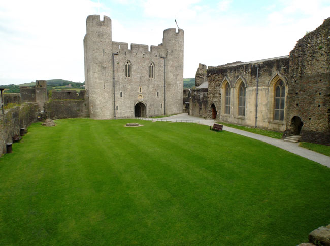
| On to Caerphilly castle. Well moated and in even better repair. |
 |
| Caerphilly marked a major advance in British castle design... surrounded by multiple moats and lakes, it also introduced planned concentric defenses. |
 |
| Its apparent "better condition" was due to its history ... started in the late 12oo's , it fell into disuse by the 16th century. Like so many castles, its walls were robbed of their stone for building the adjacent town. But, unlike so many, it was privately acquired in the 17oo's and restoration began in the late 18oo's. |
 |
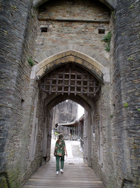
| Whereas before we'd only seen slots, we now had the chance to walk underneath the hanging portcullises. |
 |
| |
 |
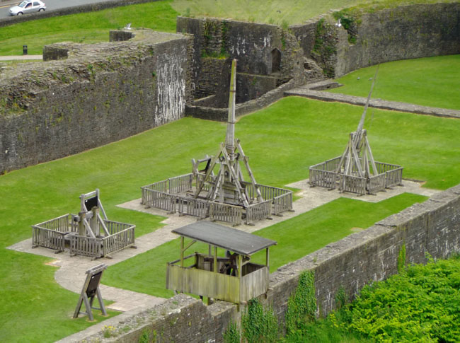
Various siege engines were on display in the outer yard.
(we were a bit late in the day to see demonstration firings ... er, flingings) |
 |
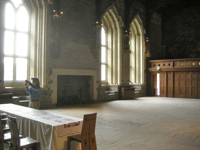
| Although some sections were in glassless decay ... |
 |
| ... other sections were in better shape ... |
 |
| ... including the Lesser ... |
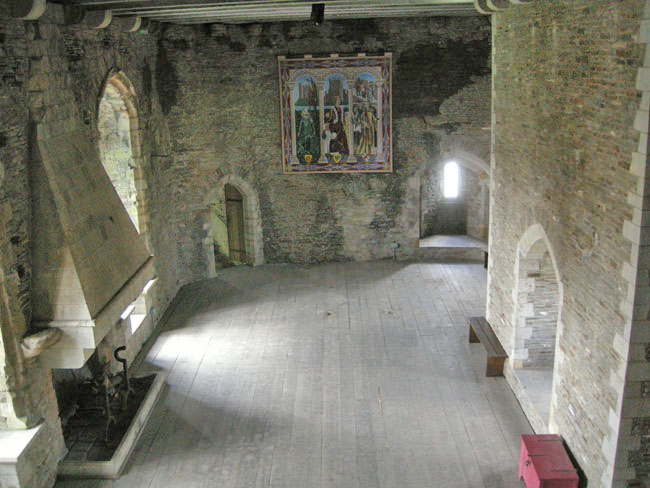 |
| ... and Great Hall, which can be rented for Grand Occasions. |
 |
| The circular interior of the base of one of the towers had a running dual-language film describing the castle and area's history. |
 |
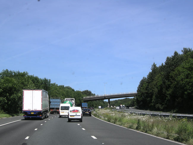
| The next morning we put the pedal to the metal and made use of better (i.e. wider) roads (for two hours) until we got further west in Wales. |
 |
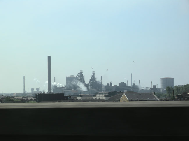
| Passing bastions of sea-side industry (probably Port Talbot or Swansea). |
 |
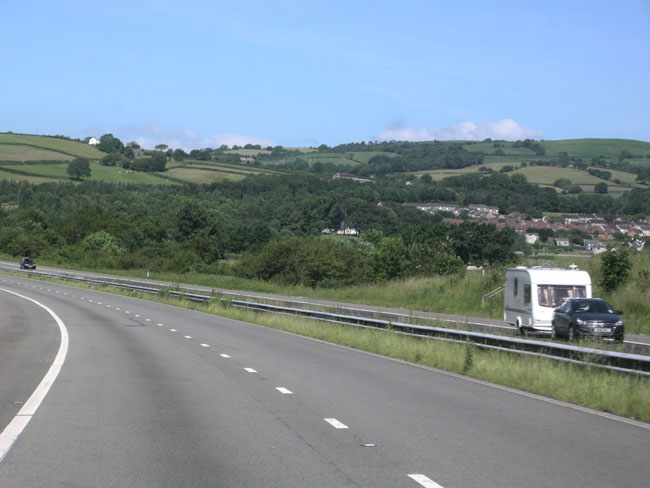
| But it was still mostly tight villages with hedgerows as we arced inland a bit. |
 |
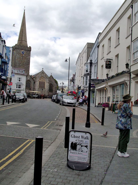
We stopped at the delightful seaside town of Tenby for lunch and spent most of the day.
First off, it had easy-to-find parking. |
 |
| ... and a beach ... |
 |
... and walking paths ...
(that's tidally-accessible St Catherine's Island ... we were at the wrong point in the cycle) |
 |
| ... and interesting going's on ... |
 |
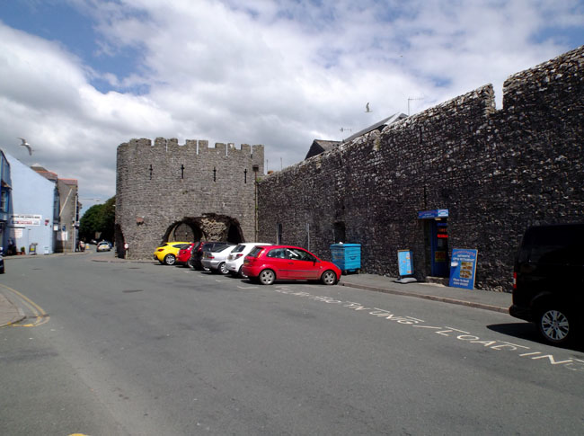
| ... and a 13th century town wall with the Five Arches Barbican Gate. |
 |
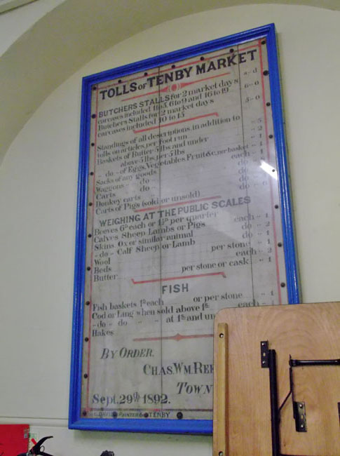
We walked through the town produce, fish and butchers' market.
Stall prices and services have probably gone up a bit since this 1892 posting. |
 |
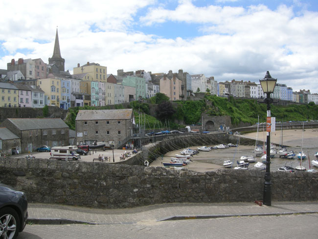
The wall-encircled old town, crammed against its sea-side cliffs.
The boats in the harbor are in their "low tide" repose. |
 |
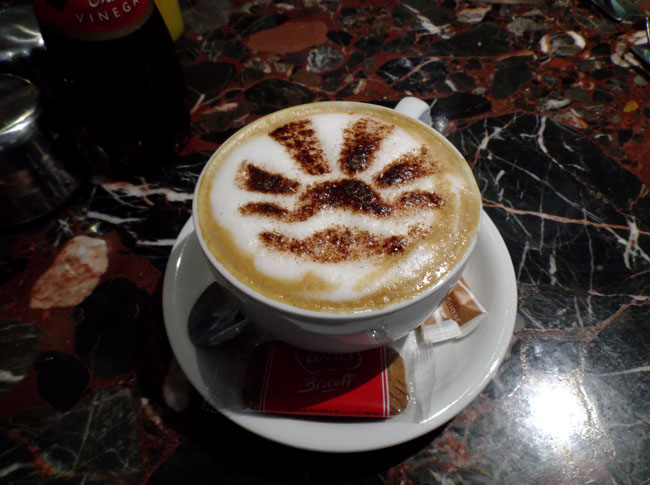
| A beautiful cappucino for Dick. What he ordered as his drink to accompany lunch depended upon the amount of driving that remained in the day. |
 |
| ... and Karen got a treat too. |
 |
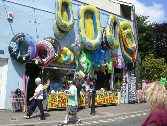
Tenby is a beach town, after all.
(this shop was across the street from the small glass-worker's shop where Karen bought a small red Welsh dragon) |
 |
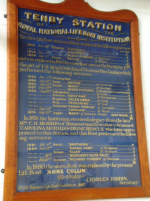
| Tenby, being on the shore, has a lifeboat station. Which is open for visitors. The rescue boats are on high (to keep them above the tides) angled ramps to allow boarding in the station before launching them a bit offshore into the (most likely during storms) surf. |
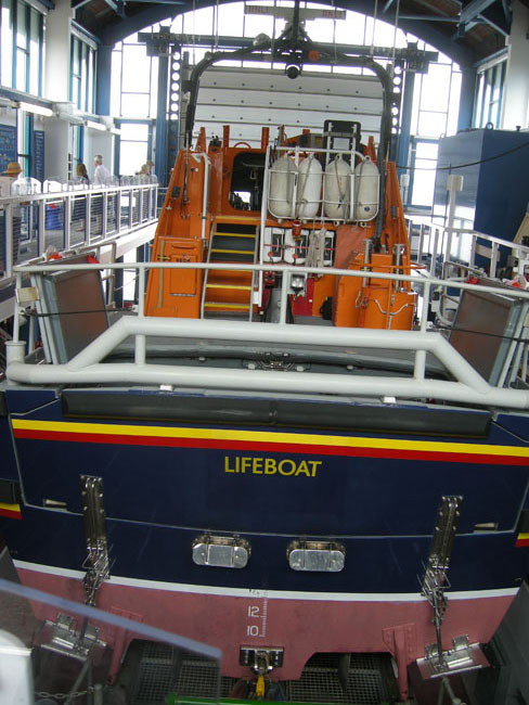 |
| The lifeboat system in Britain is a private non-profit volunteer organization. Tenby has a small but informative presentation staffed by very helpful volunteers. |
 |
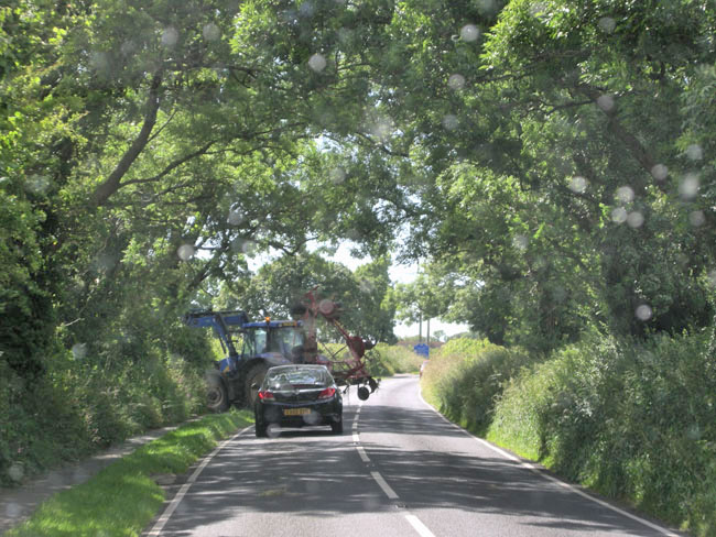
On the road again (remember the coffee?), we managed to avoid being caught by the farm equipment lurking in the hedgerows. This time.
(one was almost successful the next morning, but we dodged into a parking lot to escape) |
 |
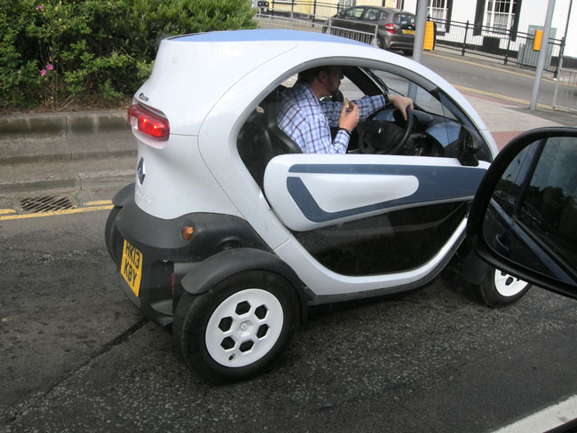
| A more properly sized vehicle for British roads. Difficult to sleep two, however. |
 |
| Just shy of Pembroke, the Windmill Hill Caravan Park... a repurposed field on a farm. With a rooster. And early evening shade. |
 |
| In the morning we reached St. David's ... the western-most point in Wales. |
 |
| It has the ruins of an expansive Bishop's Palace. |
 |
| And the fully-functional cathedral beside it. |
 |
Sometimes the roads get a bit much, even for the British ...
(note the continuing messages on the post hinting that it's passable for bicycles) |
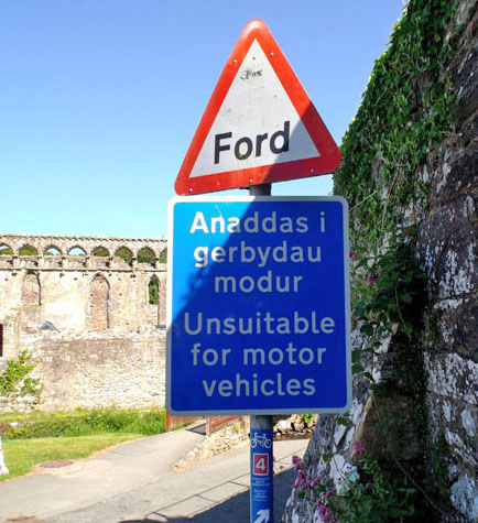 |
| ... if they don't mind getting wet crossing through the stream. |
 |
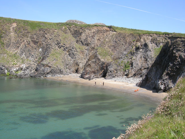
| After touring the Palace and Cathedral, and having lunch in the Rectory (a restaurant suspended at a mezzanine level in one of the cathedral's halls), we continued on towards St David's Head and hiked a bit of the Pembrokeshire Coastal Path to reach the rocky shore. |
 |
| ...and secluded inlets ... |
 |
| ... with clear skies (and contrails) |
 |
| ... and nearby rocky hills. |
 |
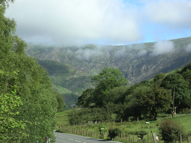
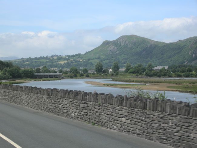
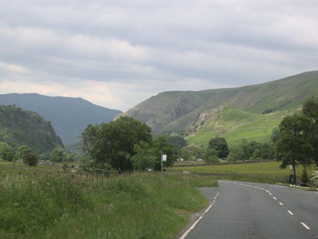
Then it was back in the VW to continue northward, following the western coast of Wales.
Near the town of Fishguard we watched the ferry to Rosslare Harbour in Ireland sail away.
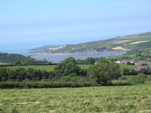
The next spread is lovely Cardigan Bay, the estuary that is at the mouth of the Afon (river) Teifi, and the town of Cardigan. |
 |
 |
 |
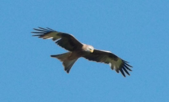
| That evening's campsite at Aberystwyth had red kites flying overhead. |
 |
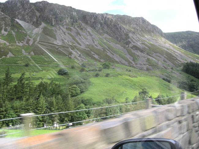
| We now left the coast and turned inland. Now we were into an area where the crop is trees. |
 |
| As we approached Snowdonia National Park the land began to get more rugged. Most of the less-steep land is kept clear by grazing. |
 |
| The barren hills rising beside us were slate rather than limestone |
 |
| And then we reached... |
 |
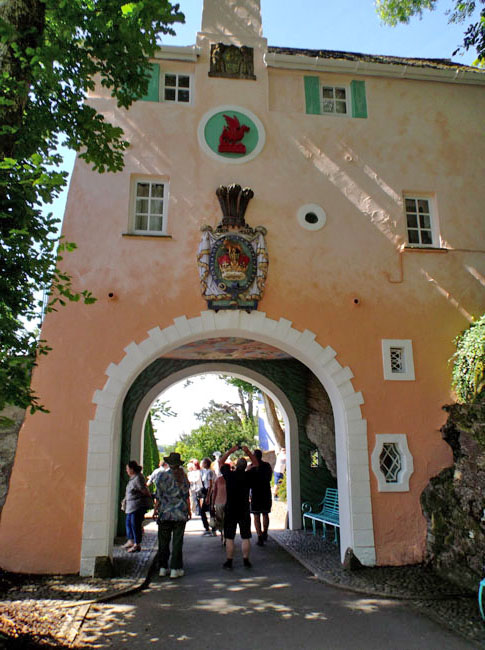
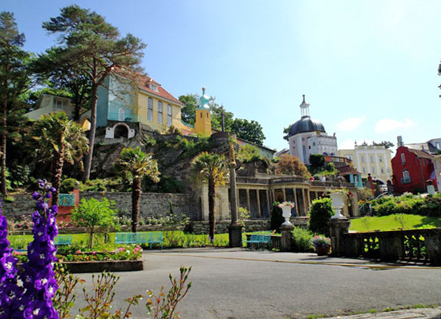
| Both of us have long wanted to visit Portmereion ... |
 |
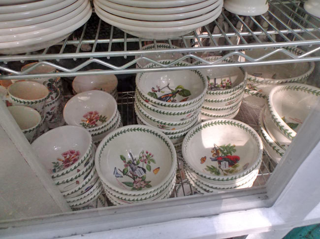
| Karen because of the ceramics that used to be made there. They are now mass-produced elsewhere in England, but seconds are sold at the shop in Portmereion |
 |
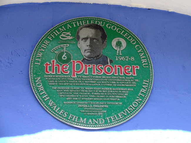
| And Dick because of Patrick McGoohan's The Prisoner TV series which was filmed here. |
 |
What Portmerion is is a delightfully bizarre pistache of a Welsh architect's creation of an Italianate village on the northwest Welsh coast.
It was a fifty year project he started in 1925.
Many of the structures are real: the multi-columned structure was imported from Italy.
Many are "in the style" recreations (most of the buildings).
Some of the details are outright fakery (many of the top-floor windows are skilfully painted ... no glass, no frames, just paint). |
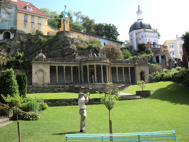 |
| But the gardens are real. |
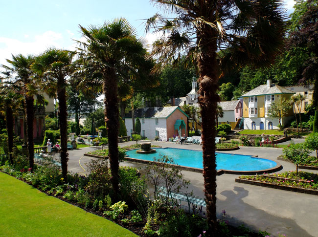 |
The buildings are rented out as hotel rooms, and it's simply a popular tourist destination for its sheer amusement value ... there are hiking trails through an adjacent forested headland and point.
The grounds include a castle (now hotel) higher up on the hill. |
 |
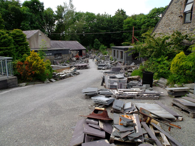
| Heading northwest from Portmerion, we again venture inland to cut across a peninsula. Instead of hedgerows, we now hemmed in by walls made of slate. |
 |
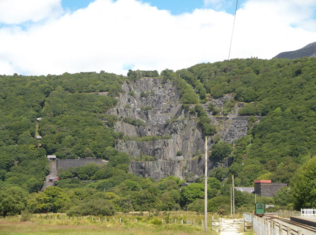
| Quarries dot the hills |
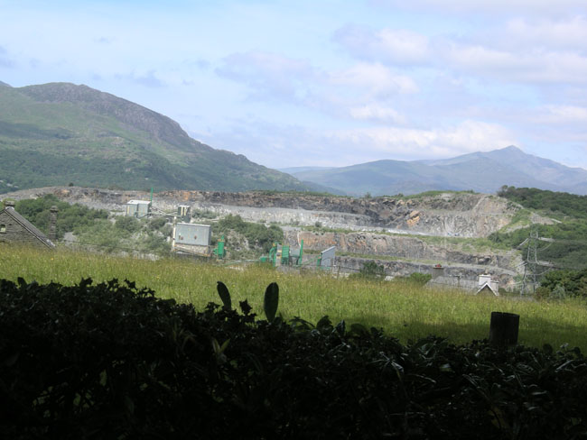 |
| We stopped at a famous slate company. |
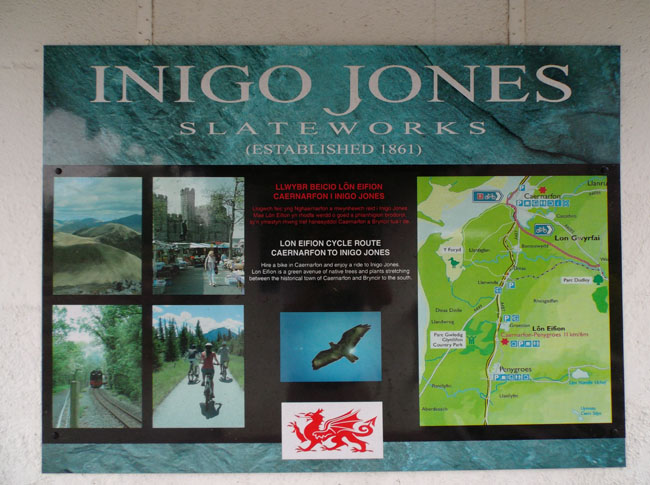 |
To admire the stone, the craftsmanship and buy some samples.
Slate as a medium for art... |
 |
271-2834
| Slate as functional items ... |
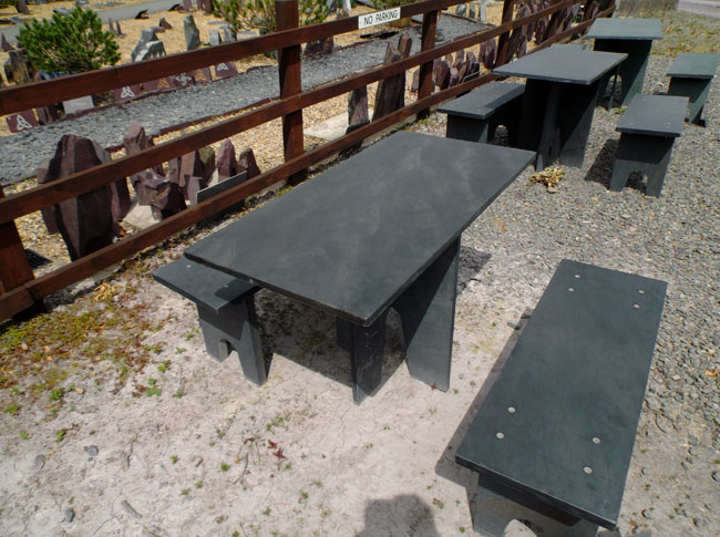 |
| And slate as ... well ... slate. |
 |
| Completing one of our most eclectic days (Italianate through stone age to medieval) we ended that day exploring Caernarfon castle. |
 |
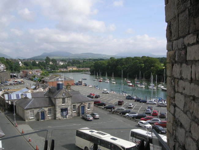
The battlements command the harbor area.
That parking lot used to be a major slate-exporting port in the 18oo's. |
 |
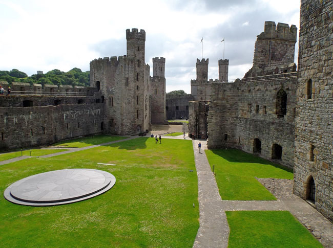
Edward I built Caernarfon as one of his bastions to control North Wales.
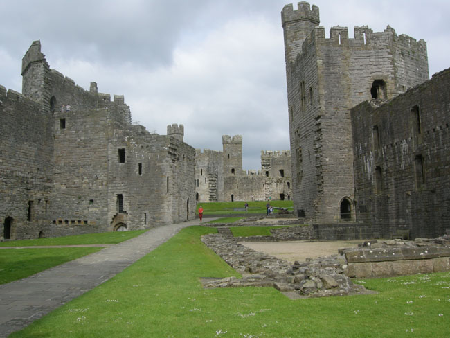
It is a vast expanse surrounded by battlements, buildings and towers. |
 |
| Caernarfon Castle is the site where the current Prince of Wales received his investiture. |
 |
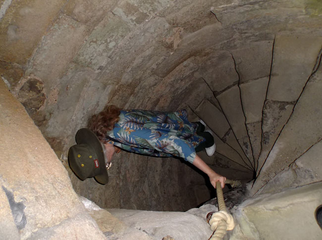
| And where there are towers, there are tight spiral staircases for exercise. |
 |
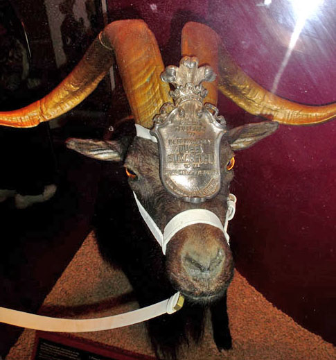
| There was a multi-storey military museum honoring the Royal Welsh Fusiliers. And their goat. |
 |
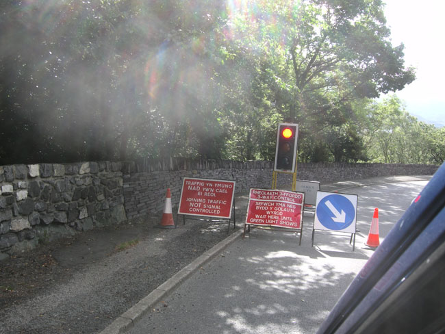
| Enroute the next morning, this Stop-and-Go demonstrated the signage: Welsh first, English below. Hard to catch it all at speed. |
 |
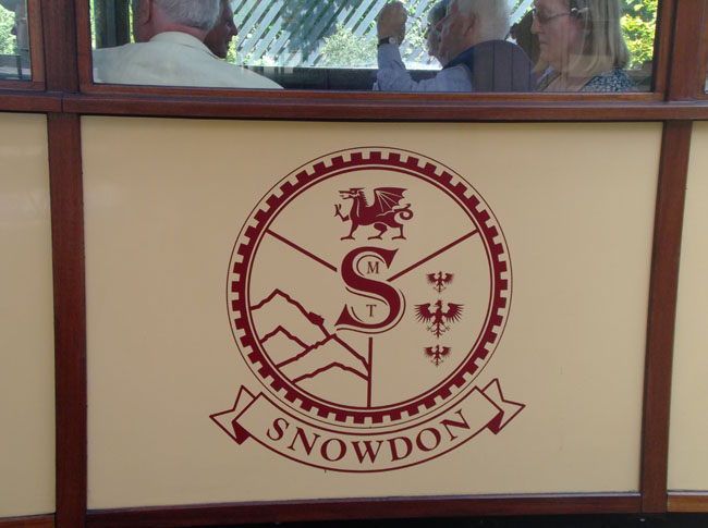
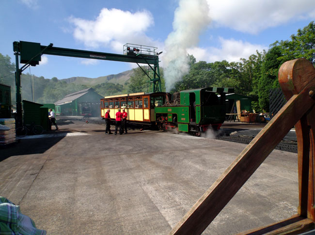
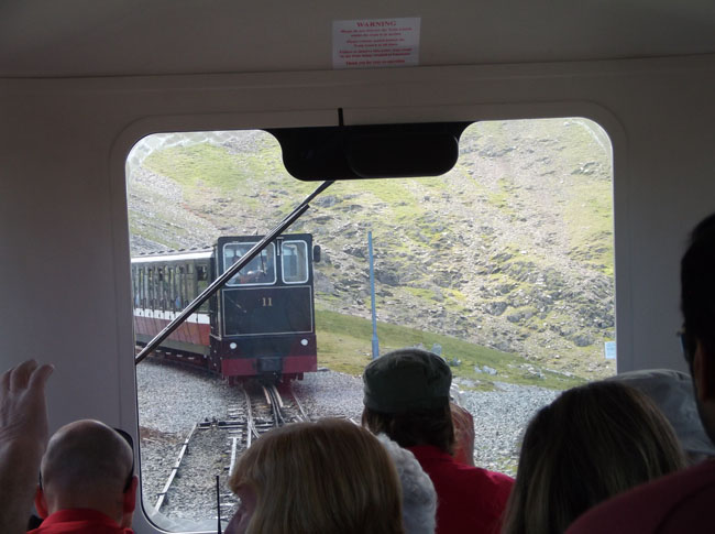
| This morning we took the cogged railway train up Mt Snowdon.
|
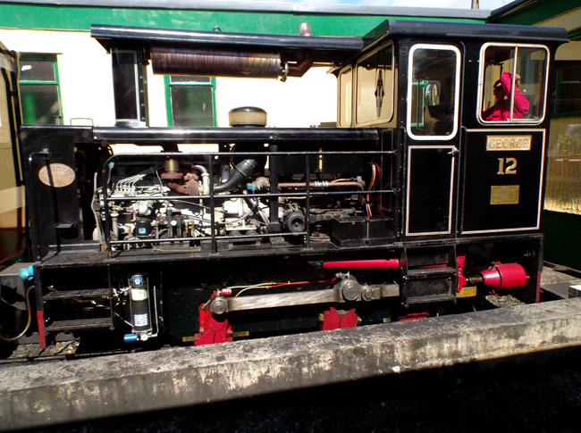 |
| (Idiomatic item: The Brits do not put the "Mt" in the name. To them it's just "Snowdon".) |
 |
| The train starts in the small town of Llanberis. Across the lake is a large slate quarry which is now the site for the National Slate Museum. |
 |
| The railway's yard is bustling activity as passenger trains arrive and depart half-hourly, interspersed with the same small engines shuttling freight and water cars servicing the visitor center at the summit. |
 |
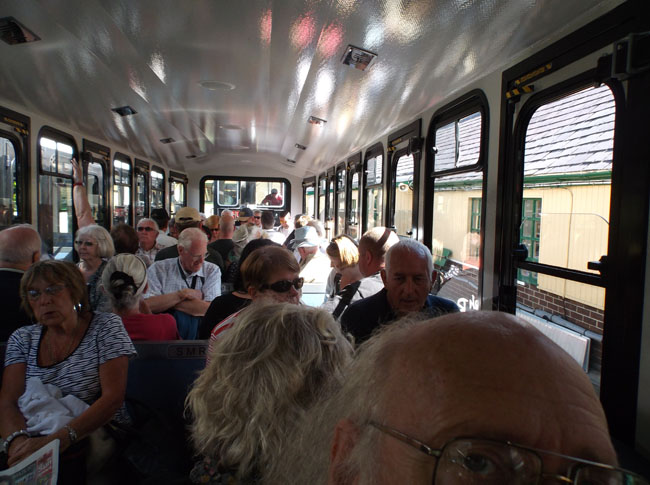
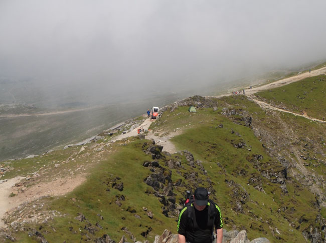
| The train ride is a popular attraction. Same-day booking requires arriving early and expecting an hour or more wait before departure. |
 |
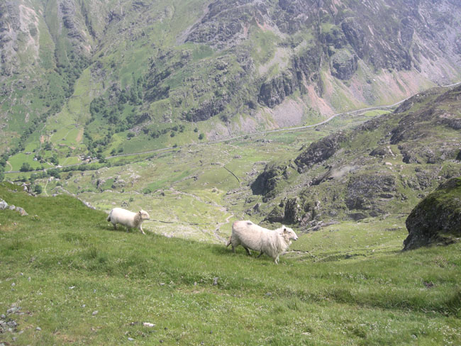
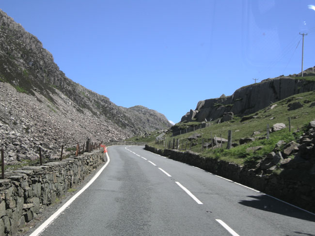
| So some locals prefer to walk. The road in the distance leads to Llanbereis Pass. |
 |
| At two spots along the single-rail route, there are switches and a short length of parallel rails. This is there the up-trains and down-train pass each other. The length of these passing zones limits the trains to a single passenger car. |
 |
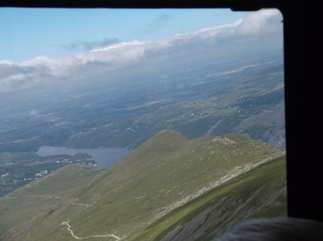
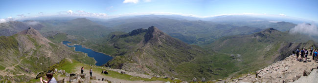
| The hour-long climb keeps revealing better and better views. That's the town of Llanberis and its lake. This also shows the five mile hiking trail. |
 |
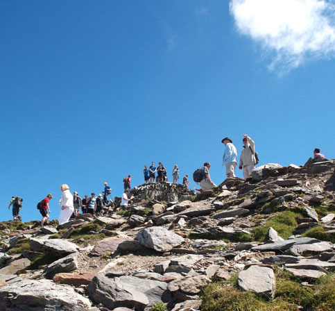
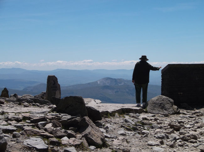
| Finally: the summit. |
 |
| During the climb small clouds would threaten to sock us in ... |
 |
| ... but then they'd clear away revealing this panoramic view.
|
 |
| Karen's leaning on the roof of the railway terminals visitor center (and tea shop). |
 |
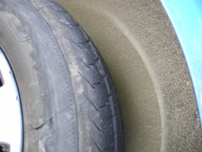
| Remember those slate walls? Here on the Llanberis Pass road one had tumbled into the road and we ran over it instead of swerving into the path of a Coach coming the other way. |
 |
| A few miles later we had a flat from the slate damage and changed the rear tire (English: tyre) at the side of the road. |
 |
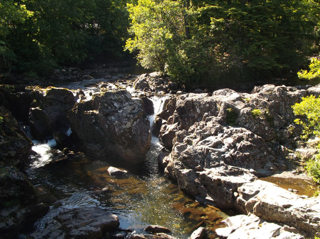
| We traveled blithely on to the town of Betws-y-coed and these lovely falls. |
 |
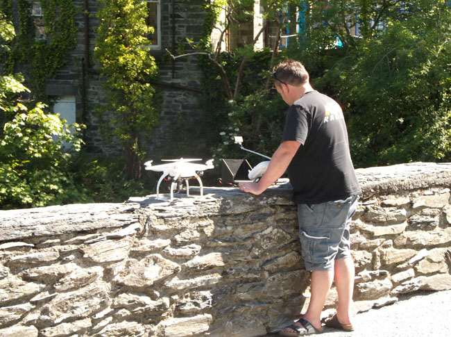
| With interesting tourists flying a camera-quipped quad-copter over the folks swimming in the river beside the bridge. |
 |
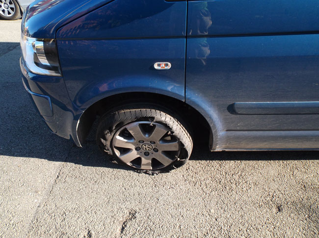
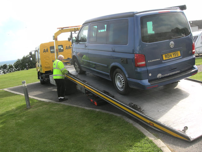
| 30 miles later the slate wall's further damage cropped up as a flat on the front wheel on the same side. |
 |
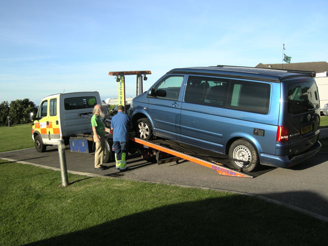
| Since we had already used our spare, we required a tow to the campsite (cost covered by Kamperhire's assurance scheme). |
 |
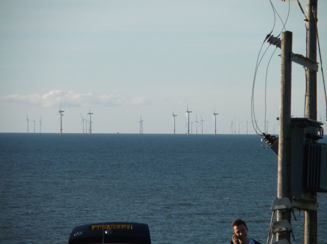
| The campsite was on the shore facing north into Colwyn Bay in Llanddulas. |
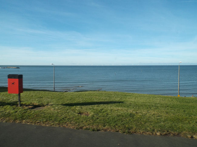 |
| Where there's a 25-square-mile off-shore wind farm. |
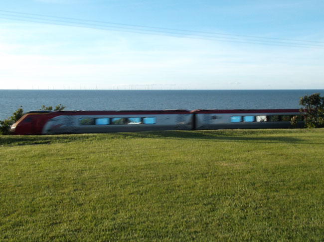
 |
| And fast trains during rush hour (surprisingly quiet). |
 |
| The next morning it was back onto a tow truck to head off to the tire shop ... |
 |
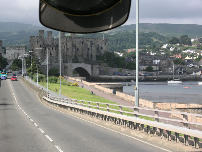
Which everyone (including their SatNav) thought was back in Conwy.
We had a fascinating tour of Conwy and its Castle
(stopping prior to passing through a stone gateway to measure the height of camper-on-flatbed. Proceed. Note only one inch clearance on each side of the tow truck's wing mirrors. Exhale.) |
 |
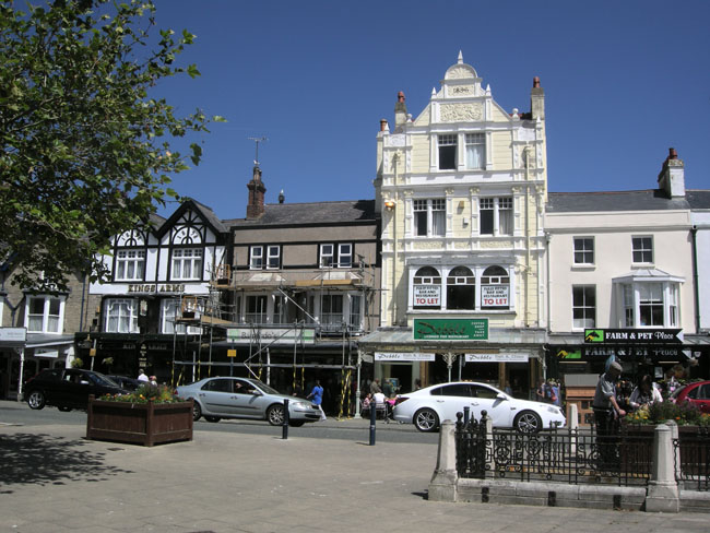
To the tire shop which was actually in Llandudno (out on Great Ormes Head).
After the VW was re-tyred, we walked the town and had a lovely lunch. |
 |
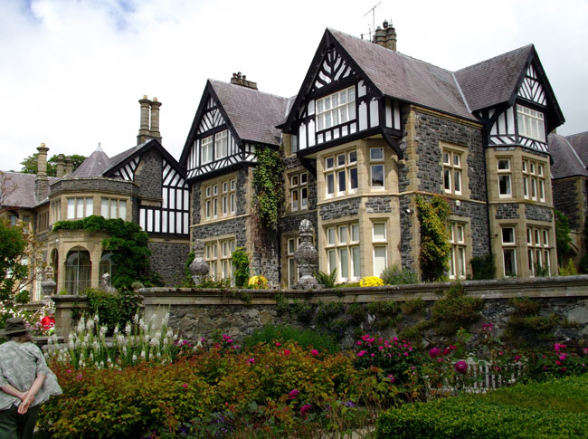
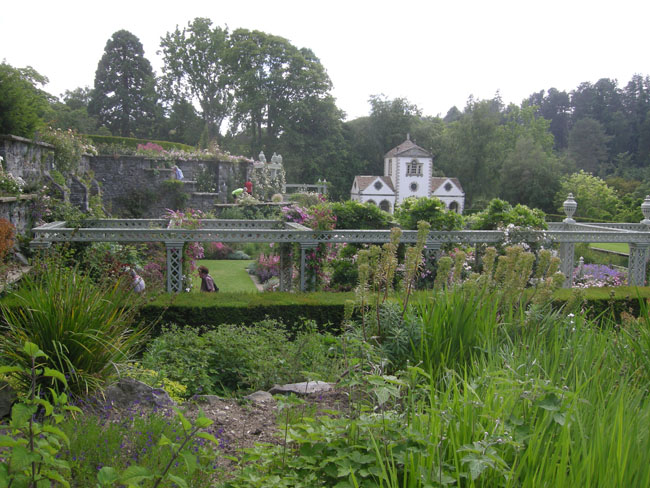
| The afternoon was spent in the spectacular Bodnant Garden. |
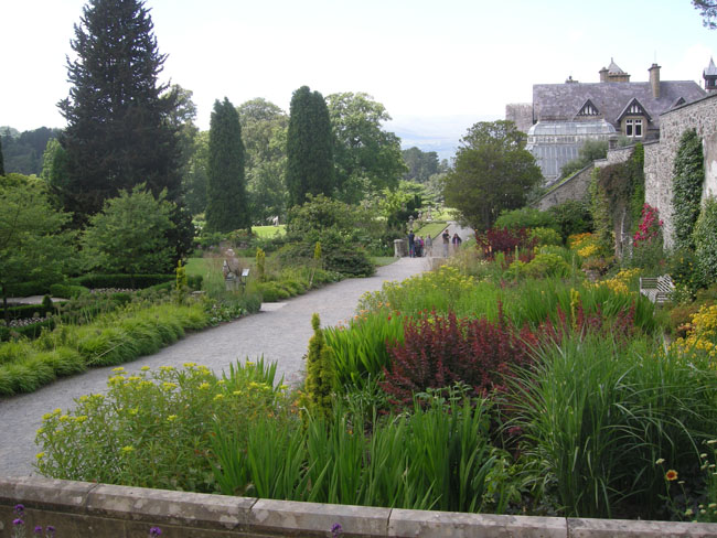 |
| Bodnant is another instance where the lands and garden have been given to the National Trust, but the house remains in use by, and as the property of, the original family. In this case the family also actively manages the garden, tea pavilion and parking lots on behalf of the National Trust. |
 |
| |
 |
| Following the previous tire-driven stressful 24 hours, giving ourselves over to simply wandering the flower-filled estate was a delight. |
 |
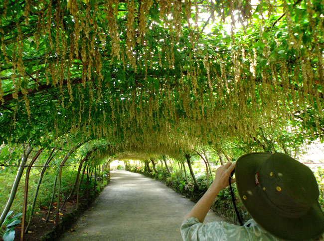
| We were a bit late to catch the laburnum archway in bloom, but it was still downright fun. |
 |
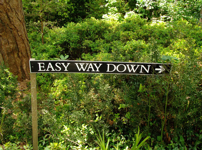
| The formal gardens led on to a much wilder ravine (the "Dell") that led down to the River Hiraethlyn. |
 |
| ... or there's the hard way... (we followed the sign) |
 |
| Even the trees occasionally made use of the benches. |
 |
| At the bottom is the river, |
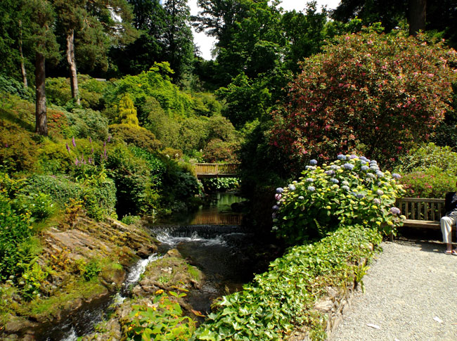 |
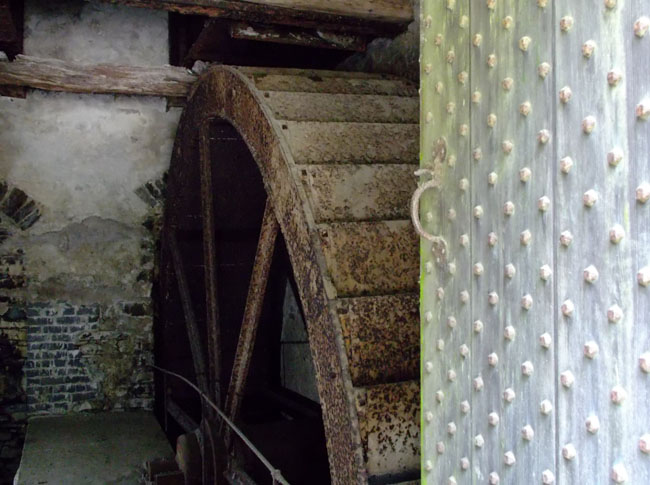
| and where there's a river there's a mill. |
 |
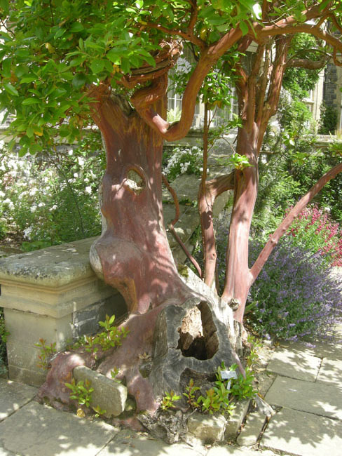
| A small forest of gnarly trees... |
 |
..and back up through the formal gardens..
(Typical English Garden Folly story: the building in the background started life in 1730 as a gazebo at Woodchester Mansion, 200 road miles to the south. Then it was used as a pin mill, then moved here in 1930 (probably by sea)) |
 |
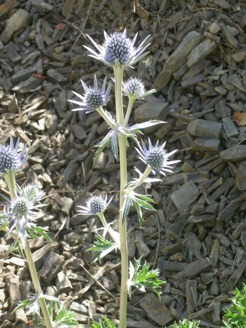
| A sea holly caught Karen's eye. |
 |
| On the road again, we passed a quarry that had a conveyor belt running under the freeway |
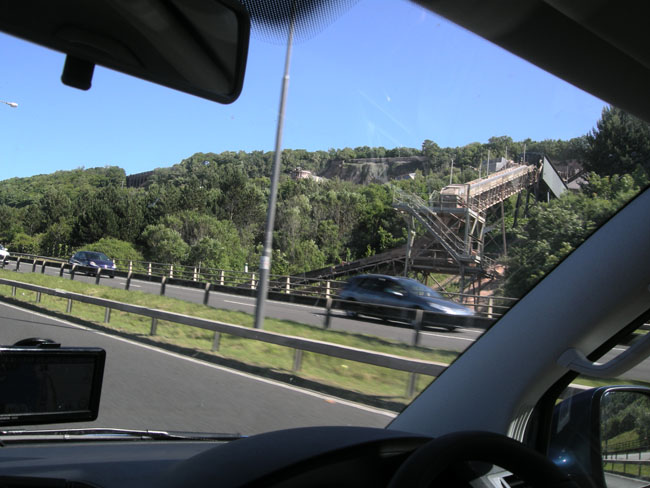 |
| to docks on the other side. |
 |
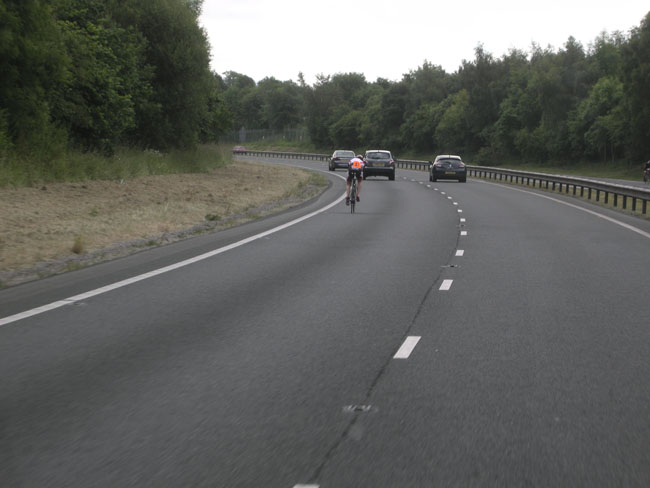
| The next morning we passed a cycle race. On the 70 mph motorway! |
 |
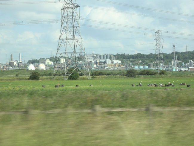
| We were heading for the Lakes District, but to get there we were skirting the industrial heartland of England near Liverpool. |
 |
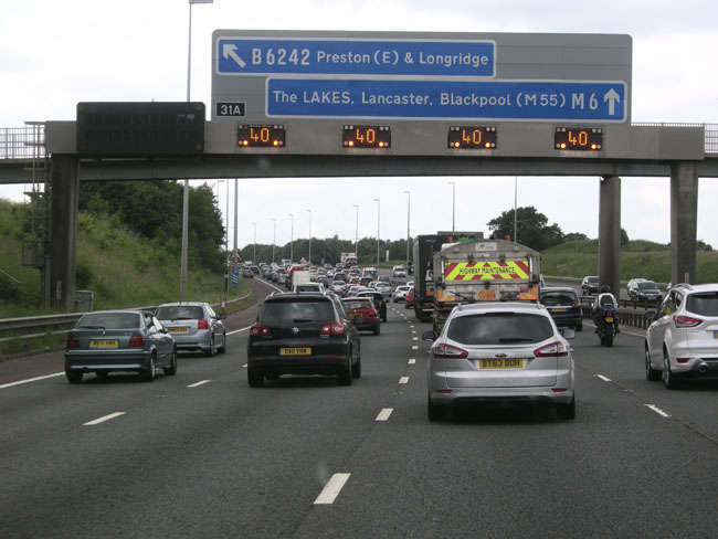
| ... with occasional "tailbacks" ... |
 |
| Motorways have Service Plazas... there are fast-food restaurants located in the bridge between the two sides. |
 |
| After a couple of hours of Motorway driving, we drifted off into the alternate world of short stone walls slightly separating sheep. |
 |
| Arriving for lunch in the lakeside town of Windermere |
 |
| Which was heavily touristed |
 |
| But beautiful |
 |
| |
 |
| A couple of hours later, we fetched up on the shores of Derwent Water, in the town of Keswick. |
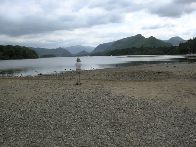 |
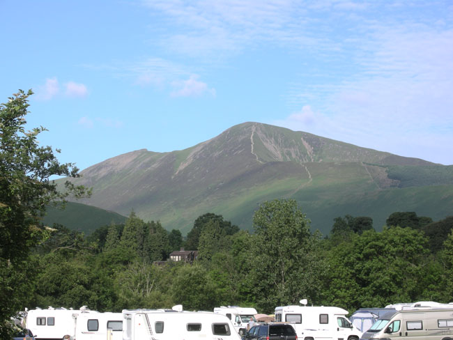
| We lucked out in getting the last open site in the campground, surrounded by stunning scenery. The hills had trails worn by centuries of tourists. |
 |
| The campsite's groundskeeprs were hard at work. |
 |
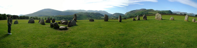
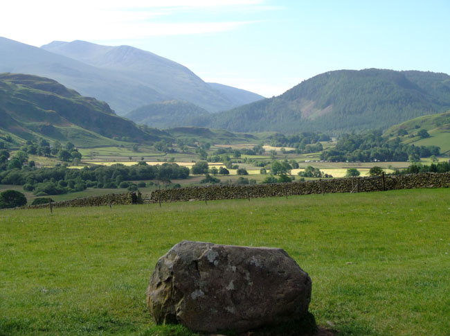
| The next morning we were early at the Castlerigg Stone Circle. This was Karen's favorite circle. |
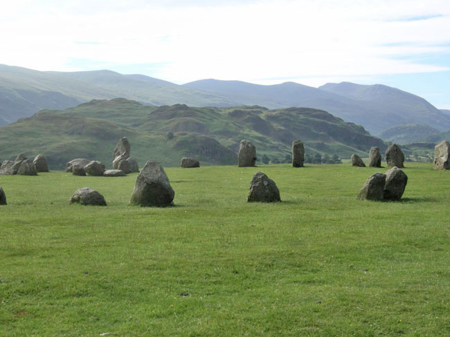 |
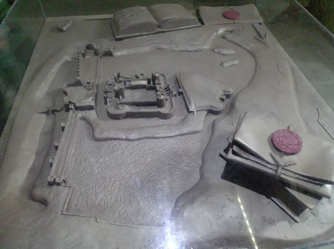
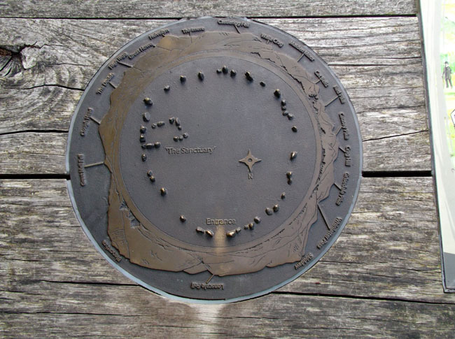
A National Trust staff person was cleaning up the final bits of blown paper after the weekend's solstice celebration but we were otherwise nearly alone. The signage included this tactile model of the site. |
 |
The stones weren't very large, but the solitude and the site's location on a hilltop provided a totally different experience than the crowded village of Keswick merely 2 miles away.
(clicking on this picture will open a new window with the full panorama) |
 |
| Goodbye to the Lakes... |
 |
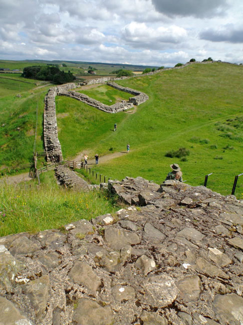
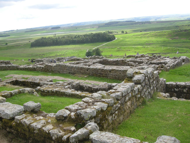
Hello to Hadrian's wall
This was the Roman Army's method of dealing with the feisty Scots (then Picts) who lived to the north.
Build a 20-foot-high stone wall that ran the entire 75 mile width of the Isle of Brittannia.
Follow ridgelines to give a strong defensive position.
Put manned "milecastles" every mile (that square structure is number 42), and major forts (with 500 to 1000 soldiers) every fifth mile.
If nothing else, it was Rome's way of Making A Statement of the Empire's power.
Here we're taking in the view near Cawfield's Quarry... one of the reasons the wall is no longer 20 feet high is that it was "mined" as a handy source of building materials. The local sheep and cattle are hemmed in with bits and pieces of liberated history.
|
 |
| A few miles further east we came to one of the better-preserved major forts. |
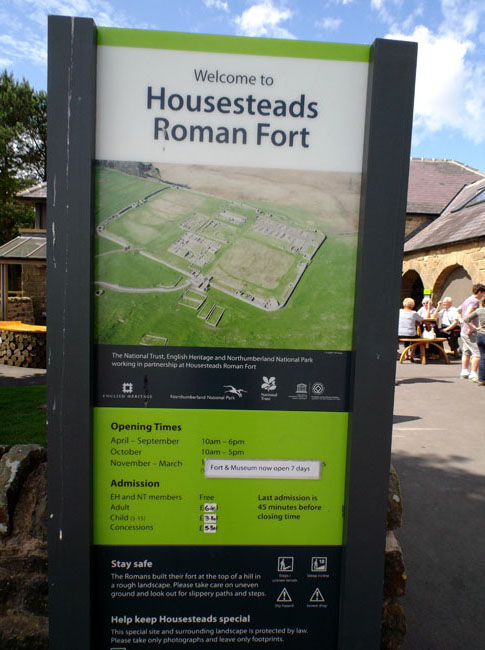 |
| It was a vast expanse... |
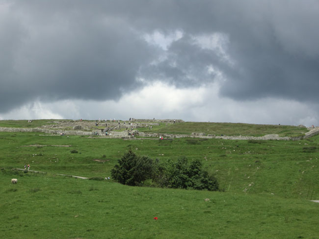 |
| ... with building footprints ... |
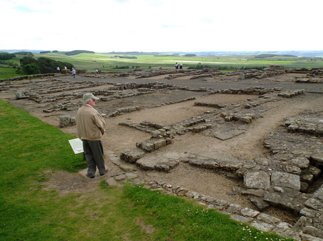 |
| ...and details. There was a museum and tea shop just to the side, with the parking lot and visitors center hidden down behind that forest. |
 |
| Following the SatNav and a faint-but-there trace on the map led us (almost) directly to lunch at a nice little village pub. |
 |
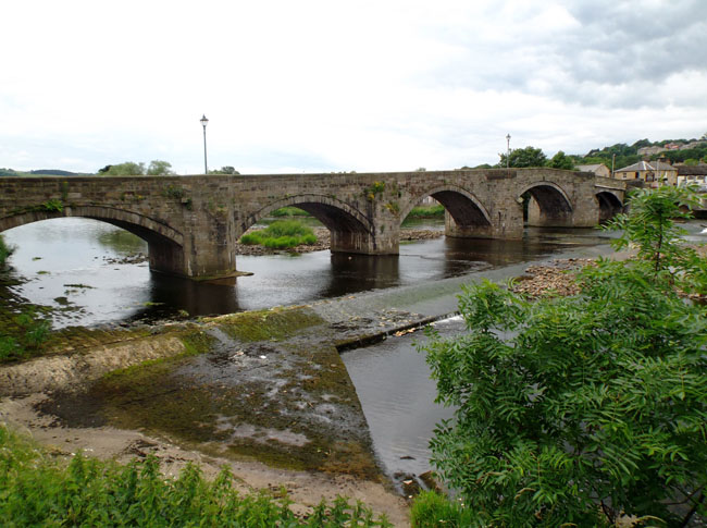
| With a great view of the town's namesake: Haydon Bridge. |
 |
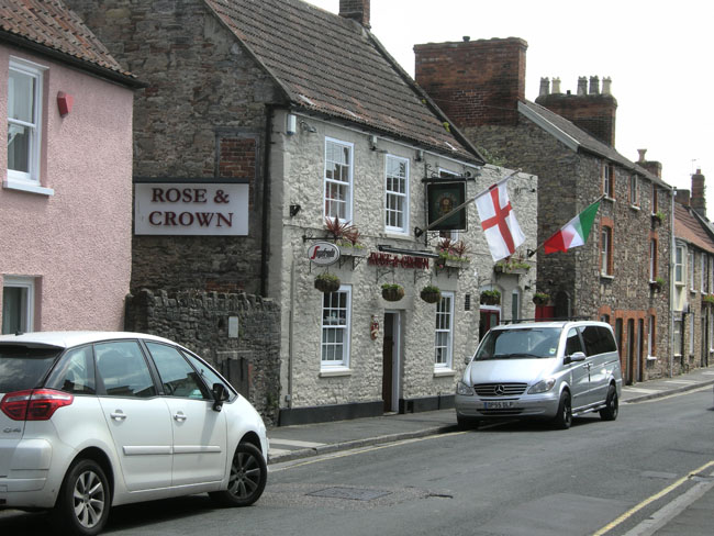
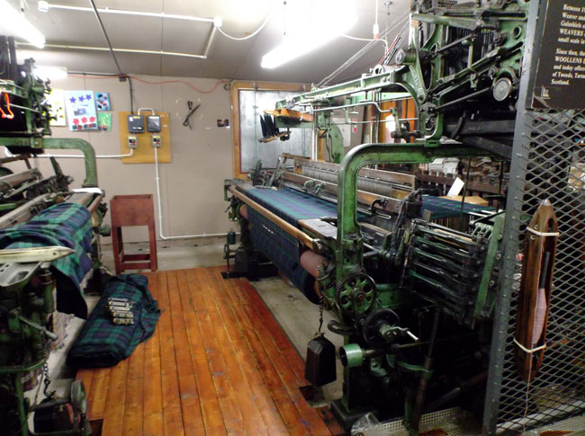
| Crossing into Scotland, we dropped into Moffat for camping. In trying to find the campground the GPS guided us to a Weaving "mill" parking lot. Mostly a sales outlet for goods now made in China but there was a demonstration of weaving in the back room. |
 |
| After a bit of research we made it safely to the campground around the back. |
 |