Travels with Dick and Karen
Florida, Part 1
Rockets and Manatees
(blue line on map) |
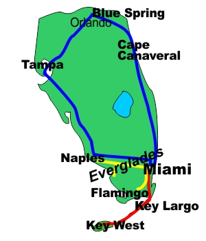 |
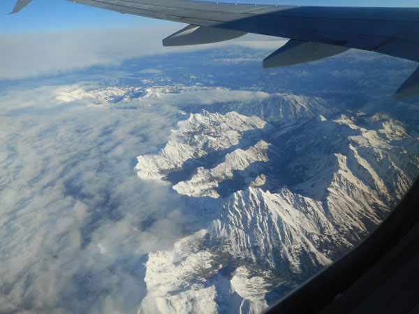
| From Seattle's Jan 31st overcast morning we finally escaped the clouds when we reached the Cascades, near Mount Stuart. |
 |
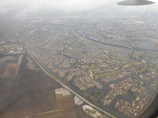
Thence to arrive on a not-so-sunny late afternoon in southern Florida. |
 |
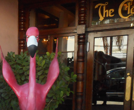
We stayed over the rainy night in Miami's South Beach neighborhood at the Clay Hotel. It's a funky "botique hotel" spread across five old buildings. We were greeted at the door by a 6 foot high plaster(ed) flamingo. |
 |
He had friends hidden elsewhere on the property |
 |
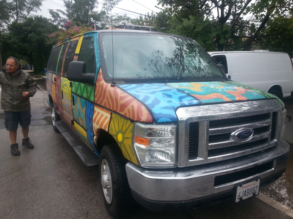
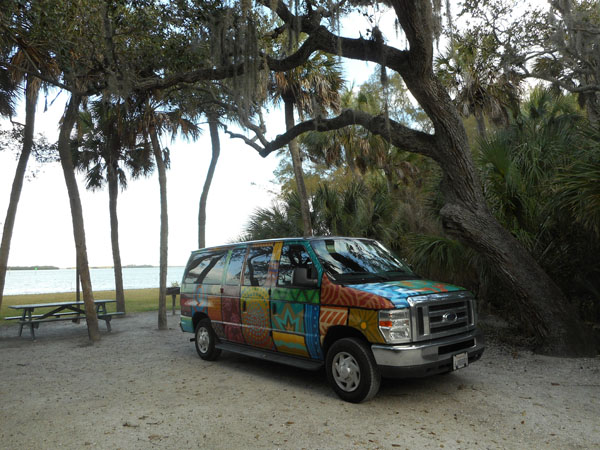
The next morning we walked over and met "Quilt", our home on wheels for the next month. Introductions were capably performed by Leon of Escape Campervans. |
 |
| We were on the road by 11am and drove through the horrendous Miami-area traffic. We saw (and were delayed by) more fender-benders and worse than we've seen in over a decade in Seattle. We went north up along the coast to Manatee Hammock County Park in Bellwood, just south of Titusville, near Cape Canaveral National Seashore. (planning notes: it looked short on the map. The web said 3 hours. It took 5 so poor jet-lagged Dick was fried by the time we got there). |
 |
| The next morning we found it was a very pretty park, bordering on the Indian River which separates it from the barrier islands which form Cape Canaveral itself. |
 |
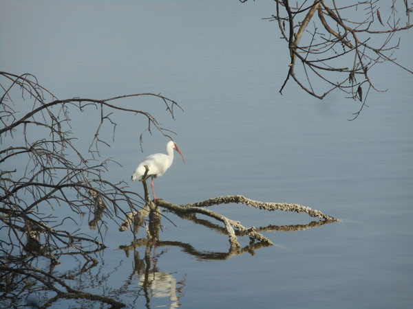
| With white ibis |
 |
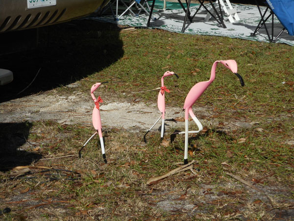
and flamingos (ok, ok... yes, they're from plastic pipe: we never did see any real flamingos on this trip). |
 |
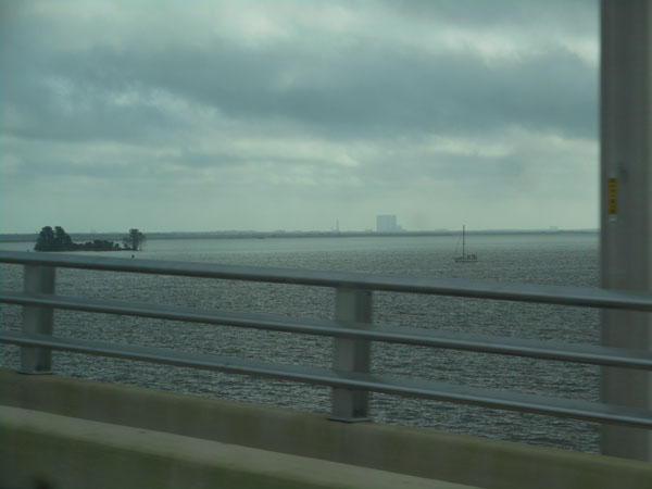
| Eastward across the bay-like Indian River were gantries and large buildings. We timed this portion of the trip to try to catch a scheduled satellite's launch on the 3rd of February. |
 |
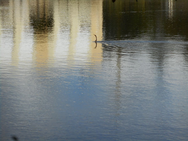
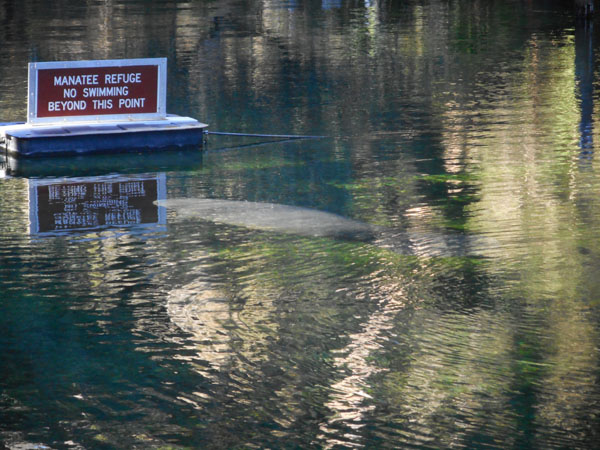
The first day (Feb 2nd) was spent recovering from jet lag and the drive. We also hit WalMart and Target to stock up on food and camping supplies. While shopping for supplies we investigated the pond behind Target's parking lot. |
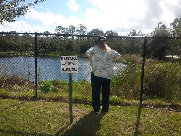 |
The sign inspired us to get on the other side of the fence.
We saw an odd creature moving in the pond... it looked like a strange snake swimming with its head high above the water. We later found out it was an Ahinga, also called a "snake bird". We understood the appellation.
|
 |
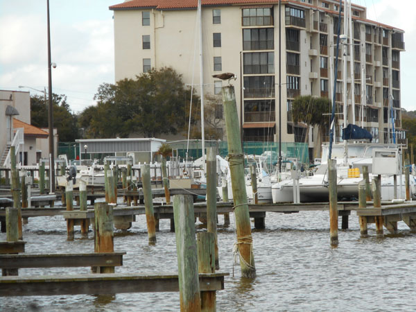
| Returning to the campground, we stopped at a shore-side park in Titusville and spied an osprey on a piling, consuming its lunch. |
 |
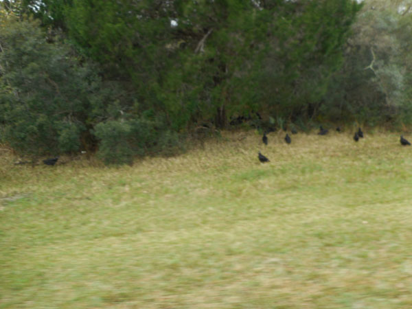
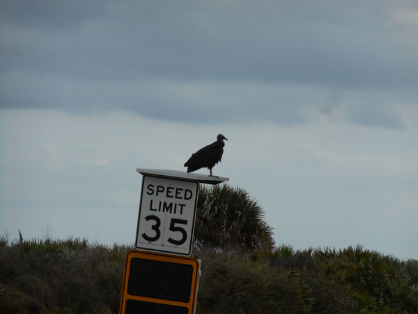
| From Titusville we crossed a bridge to reach Merritt Island and its National Wildlife Refuge. A gathering of vultures (and strong smell) met us as we drove over to the visitor's center. The rangers guessed they were dining on a road-kill wild pig. |
 |
| The eastern shore of the island is a part of the Cape Canaveral National Seashore. Boardwalks keep you off the delicate dunes, |
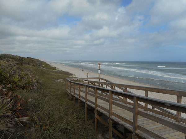 |
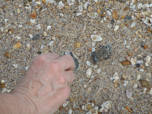
| but you can walk the beach ... |
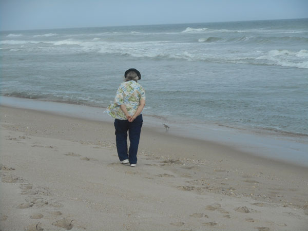 |
| and pick up shells |
 |
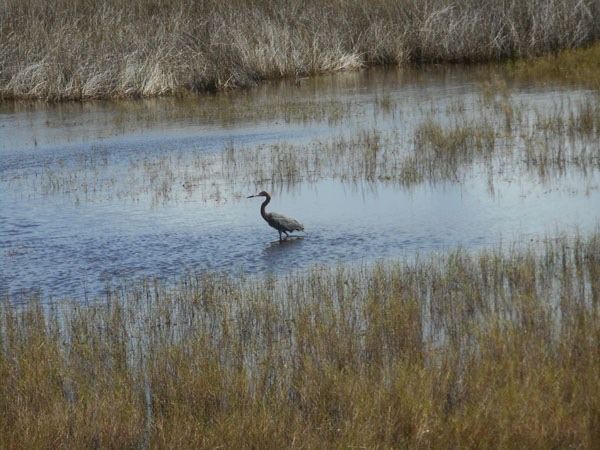
| The back side of the dunes is an estuary with lots of birds. Such as this Reddish Egret... |
 |
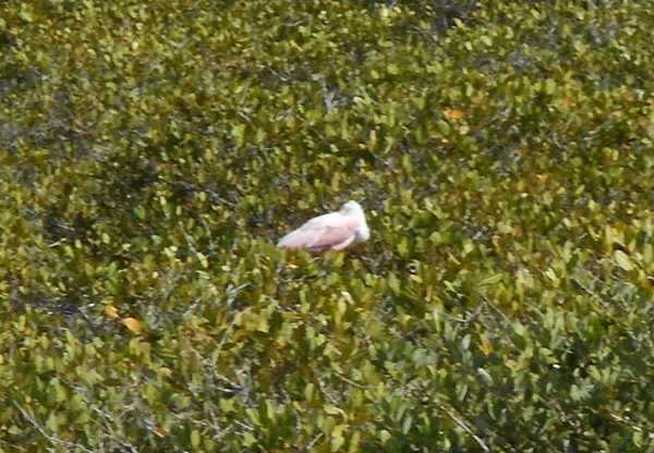
| and roseate spoonbills: this is the only area we saw them. |
 |
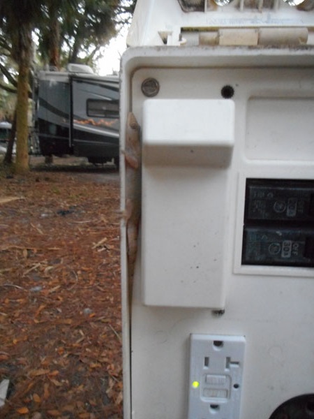
| Plugging in at the campsite for the night Dick inadvertently disturbed a couple of lizards who had made it their home. |
 |
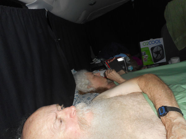
| In the early evening we experimented with a fan to cool the space down. By dawn we resolved to buy another layer of blankets. |
 |
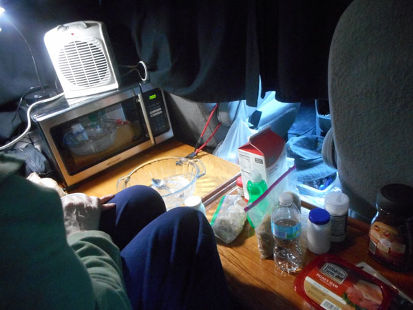
The van had a rear bench seat that could be turned into quite a long bed running fore-and-aft. We're both short enough that we could comfortably sleep sideways, across the vehicle. That allowed us to keep a footwell and wooden storage bench/shelf accessible at all times.
Most mornings we microwaved oatmeal for breakfast just like at home. The van's small electric refrigerator made it easy to keep the milk, OJ, ham and cheese. |
 |
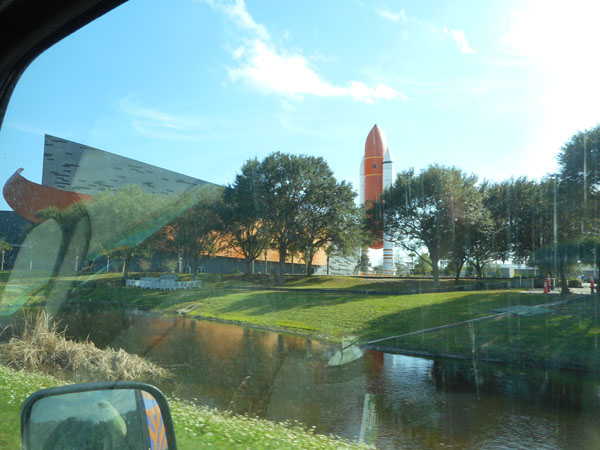
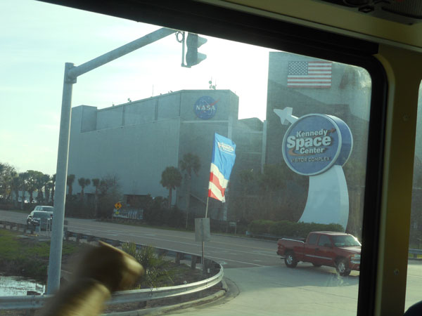
| The satellite launch we had aimed for was posponed for two days. We'd allotted an extra day for a one-day shift, but two thwarted us. We consoled ourselves on the 3rd by spending the morning with more cavorting in the wildlife refuge and national seashore. That afternoon we went over to NASA's Kennedy Space Center to see the sights. |
 |
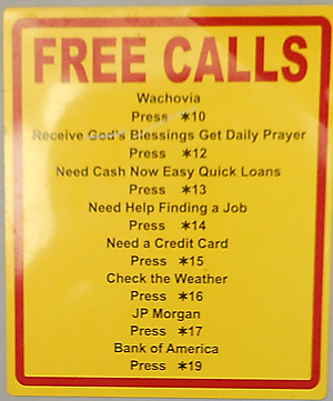
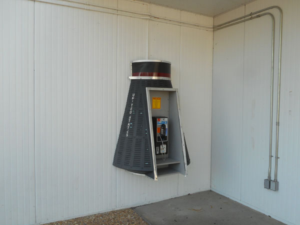
This phone booth is in the shape of John Glenn's Mercury capsule. Its placard reads:
 |
 |
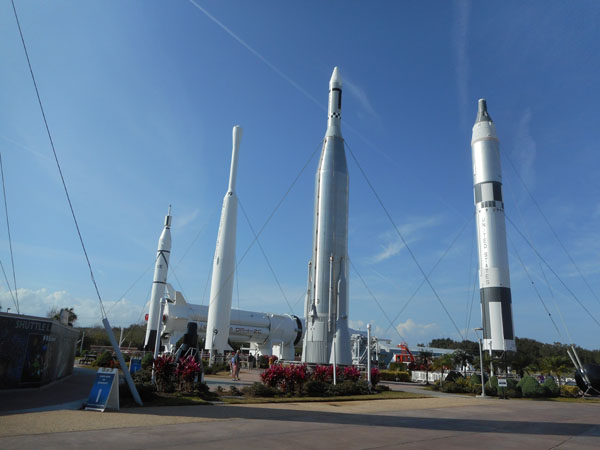
| The "Rocket Garden". |
 |
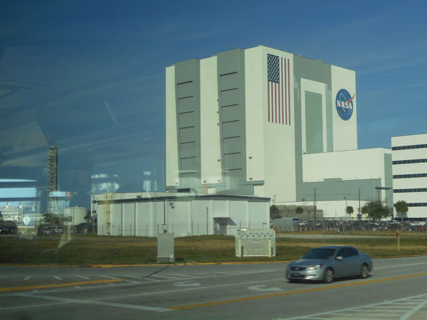
The visitor center's $50 per person entry fee includes a bus ride out to the Apollo complex. Sights along the way include the massive vertical assembly building, |
 |
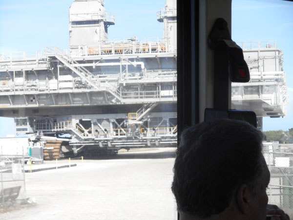
| ... two of the mobile launch platforms ... the Saturn rocket or space shuttle stands on this. Then this is picked up and carried out to the launch pad by... |
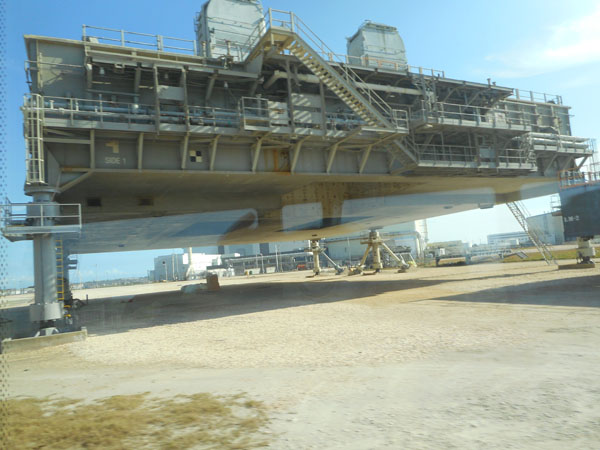 |
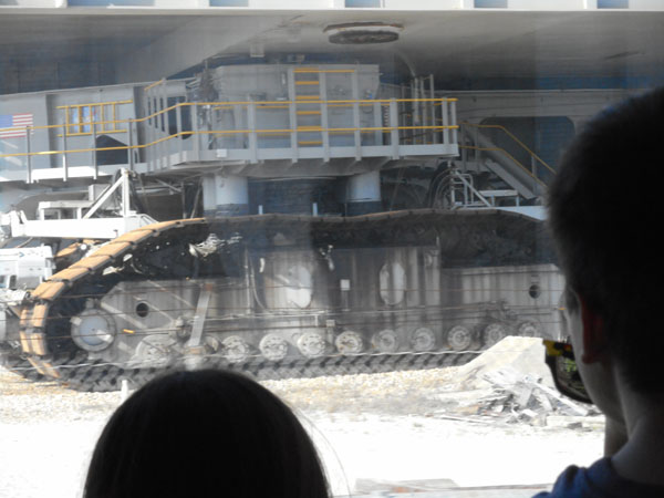
| ...the crawler-transporter, here underneath another launch platform. |
 |
| One of the crawler's eight tread assemblies. This puppy weighs six million pounds and gets about forty-two feet per gallon... before adding the rocket as payload. |
 |
| Moving down the 3.5 mile crawlway at a blistering 1 mile per hour, it reaches launch pad 39. It carries the launch platform and rocket up this hill, deposits it on the top, then scurries (at 1 mph?) back to safety before the actual launch. |
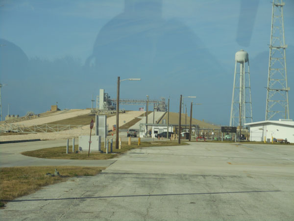 |
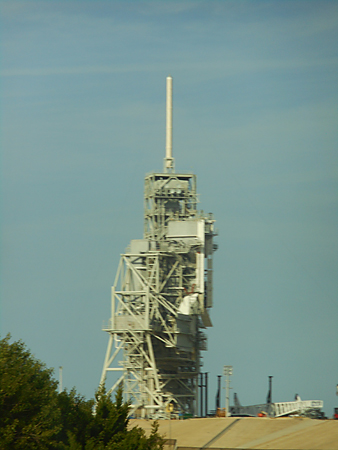
| The access gantry is being reworked to handle the future Orion launch system. |
 |
45 minutes after leaving the gate, the bus arrives at the Apollo/Saturn V visitor center.
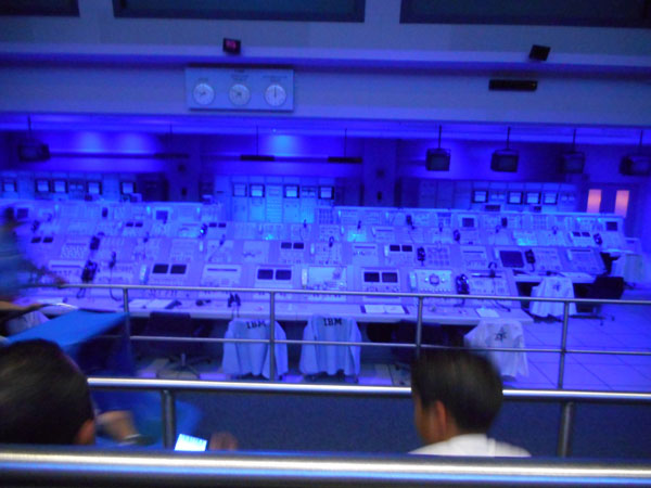
We're first trapped in a (seatless) room for a short film recounting the historical aspects of the 1950s and '60s cold-war-driven "space race". Then we're funneled into a recreation of the Apollo launch control room. The consoles are the real units from the Apollo era. A sound-and-light show recreates the launch of Apollo 8. Apollo 8 was both the first manned flight of the Saturn V rocket and the first manned orbital trip around the Moon. |
 |
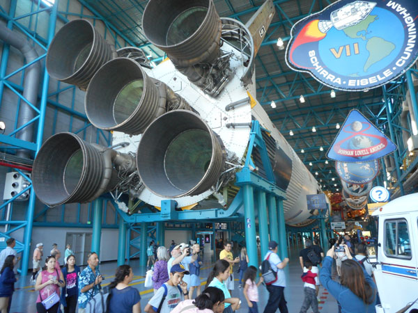
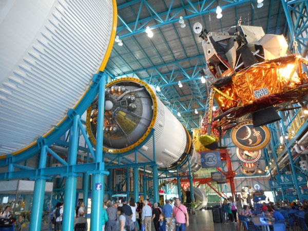
Finally, bladders near to bursting, we're released to roam freely through the rest of the visitor center. Its central showpiece is the 363-foot-long (well: tall) Saturn V rocket suspended above us, separated into its stages (less interstage connecting rings). |
 |
| Also sprinkled above and around us are momentos of the lunar missions... a gold-leaf-covered lander above, a "moon buggy" in a nearby glass case. |
 |
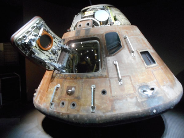
| Elsewhere in the museum is Apollo 14's command module. Out There and Back Again (slightly scorched). |
 |
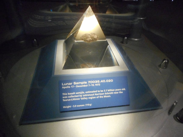
| There are samples of moon rocks encased in plastic... |
 |
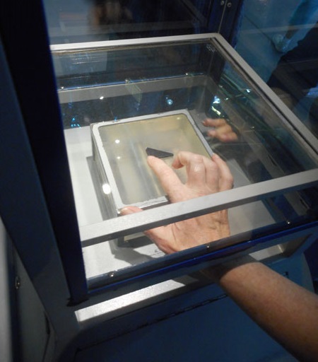
| But there's also one (from Apollo 17, the last manned moon landing) that we can touch. |
 |
| After 45 minutes of milling about, we're herded back onto our bus and quickly brought back to the primary visitor center. |
 |
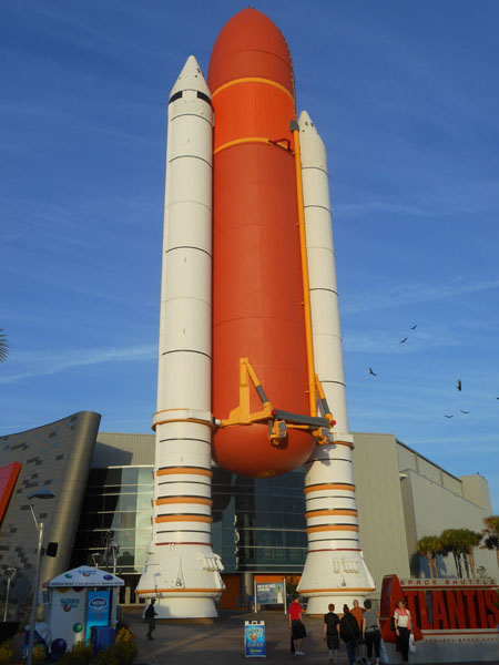
| Here we're free to roam the grounds and exhibits. The Space Shuttle's solid-fuel boosters holding the shuttle's external fuel tank heralded the entrance to the shuttle display hall. |
 |
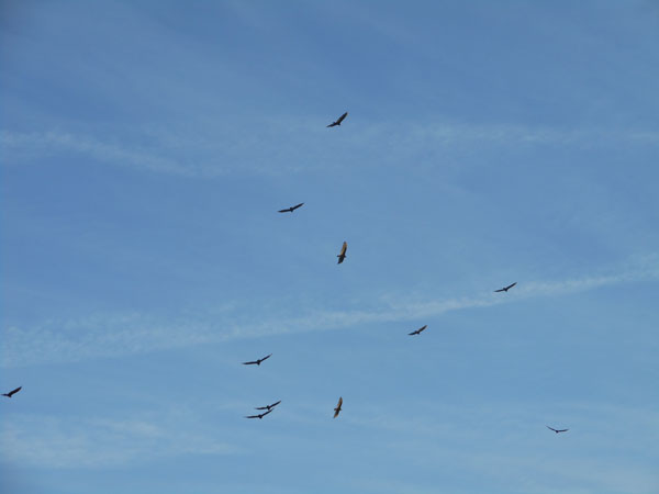
| But first, we were (as usual) totally distracted by the circling turkey buzzards. |
 |
Inside the Shuttle hall is the shuttle Atlantis. |
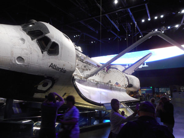 |
| Displayed surrounded by a ascending spiral ramp. The last time we met this arrangement, the central item was a collection of musical instruments at Paris' Quai Branly. |
 |
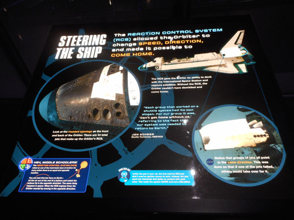
| There were perky displays explaining some of the spaceship's systems. |
 |
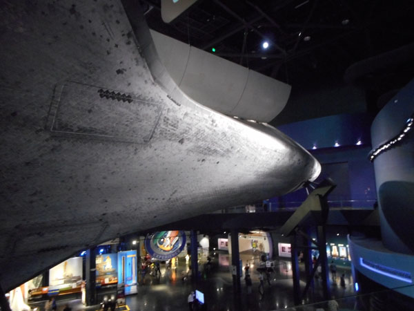
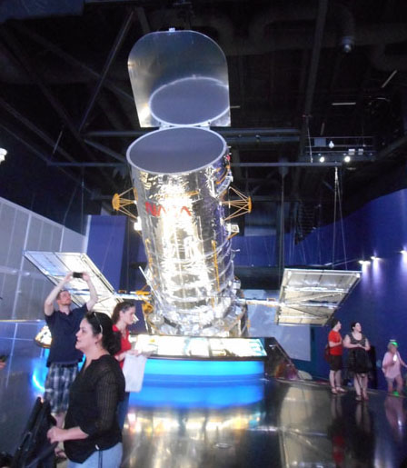
| Something the photos don't convey well is how large the Shuttle really is. One of the design criteria for the Hubble Telescope was that it fit inside the shuttle's cargo bay. Hence Hubble is here, too. Not seen in this shot is that the "back end" (optical and electronics bays) continue on down the same distance to the floor below. |
 |
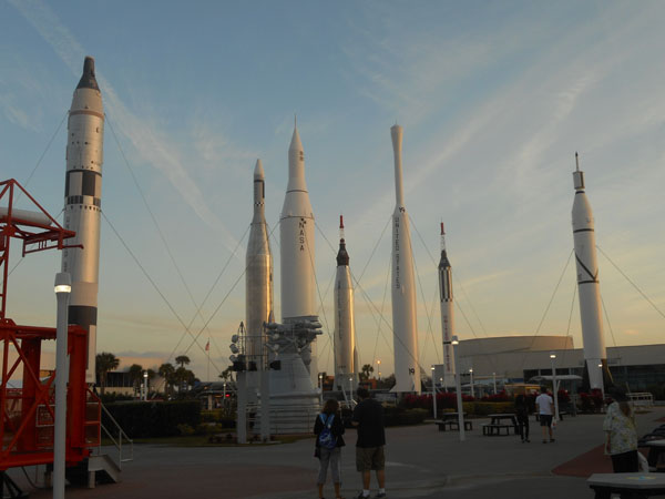
| Then we went out and strolled through the Rocket Garden until sunset. |
 |
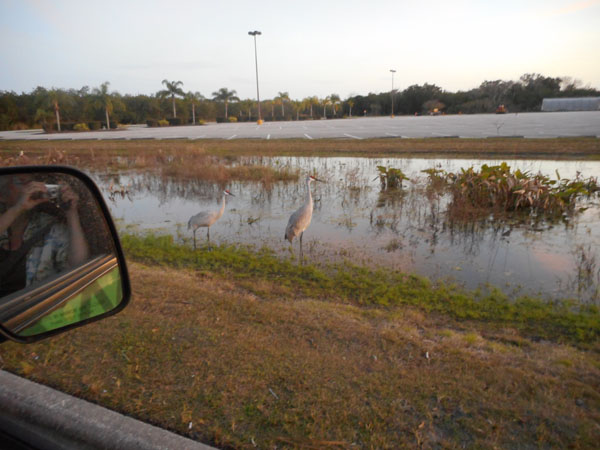
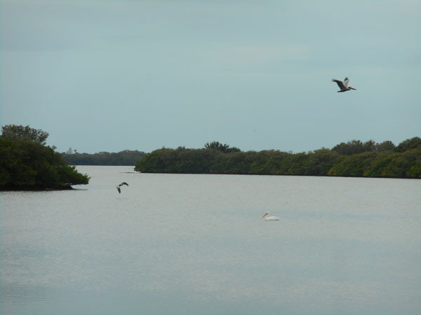
| Since access is restricted and Kennedy Space Center has lots of open area between the pads and the buildings, the area is quite a nature preserve. We saw lots of birds including Bald Eagles throughout the bus tour. As we were leaving the parking lot we came across a pair of sandhill cranes at the side of the road. We caused a short traffic jam as we took pictures. |
 |
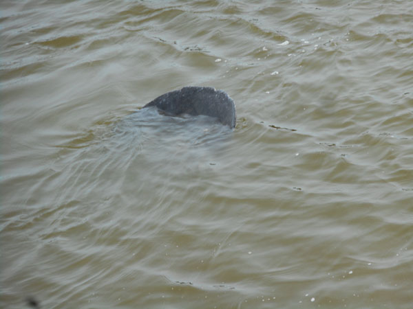
The next day we returned to Merritt Island and stopped at its "Haulover Bridge" canal crossing, where there were reported to be manatees. And saw this.
It's the tail of a creature eating on the bottom |
 |
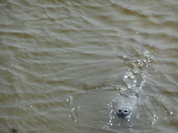
About every 2 or 3 minutes it would tip right-side-up to breathe. We spent a happy half hour staring at the silty water seeing alternating "nose, tail, nose, tail..." (and taking over 40 photos). |
 |
| Then we drove back to the mainland, up the coast a bit, then back out to Smyrna Beach by its northmost access. Our goal was to reach "Turtle Mound", one of the highest hills in the area, about 50 feet high. |
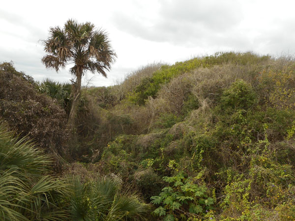 |
Turtle Mound's height put it on early sailors' charts as a navigation point. It's not a natural hill, it's a "shell midden". The accumulated result of thousands of years of native Americans harvesting primarily oysters from the sea. Before being mined in the 1800s for "shell rock", it was 75 feet high and spread out to 600 feet wide.
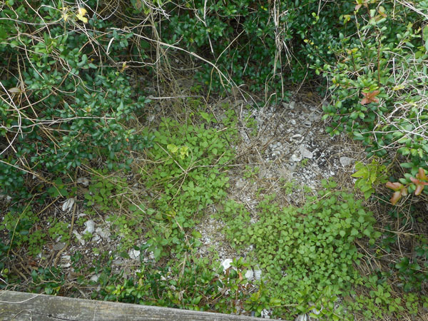
The white objects on the ground are oyster shells. |
 |
| Now a part of the National Park Service, it features a boardwalk climbing up through an intentionally wild landscape. |
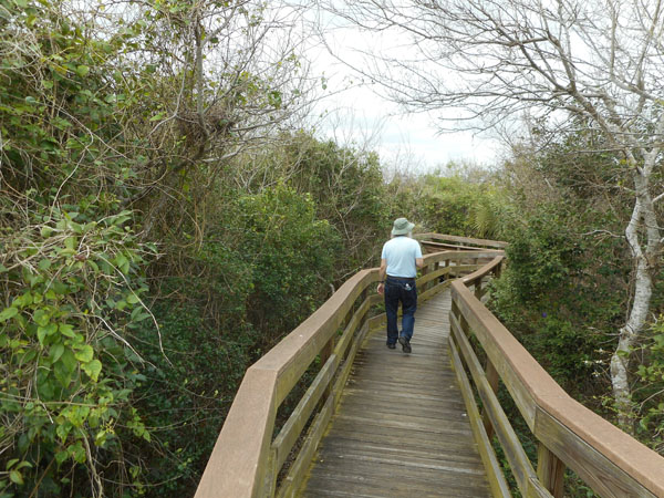 |
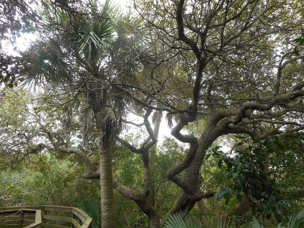
| ... with marvelous trees |
 |
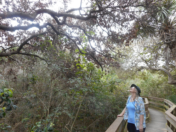
| (spellbound) |
 |
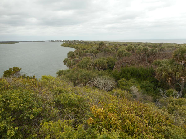
| Quite a view. (Looking north with built-up New Smyrna Beach in the far distance). The land continues southward to become the barrier dunes and beach of the Canaveral National Seashore, eastward of Kennedy's Merritt Island. |
 |
| A vulture hoping we'll ignore the sign and become lunch. |
 |
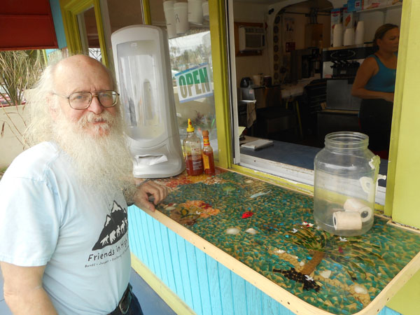
| We stopped at the edge of New Smyrna Beach for ice cream at place with a very Florida mosaic: bits of dyed shell in resin. The distinctive Sriracha Sauce bottle tells us that this is a Tacos and ice cream stand. |
 |
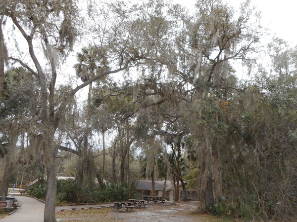
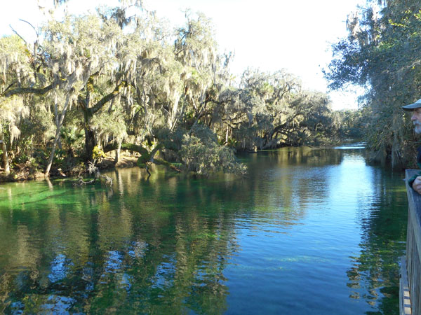
| We now crossed inland towards Orlando, but detoured north a bit to Orange City. Our next camping spot was Blue Spring Florida State Park. |
 |
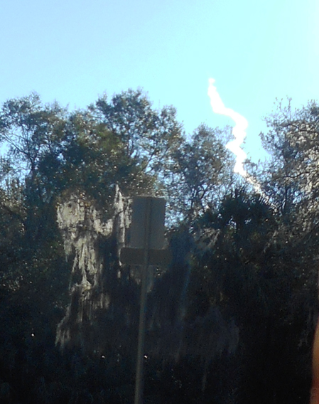
The next morning we turned to the east at 8:27am ... and suddenly THERE IT WAS!
The exhaust trail of the launch we'd missed at Kennedy.
(but without the bone-shaking sounds) |
 |
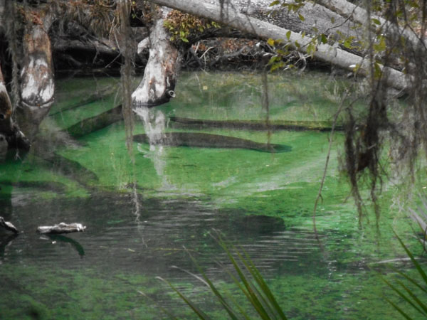
| Blue Spring is named for its warm-water spring. Very clear water |
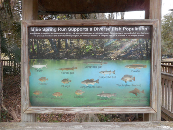
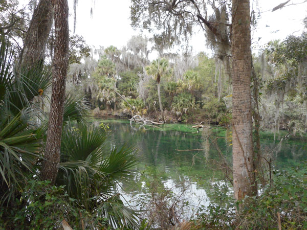 |
| in which you could see lots of fish |
 |
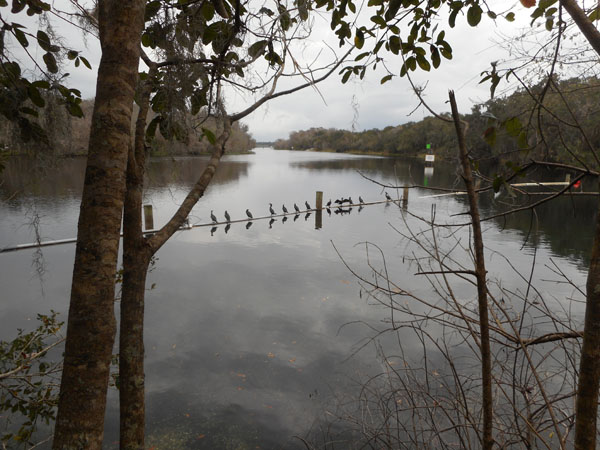
| so could these cormorants. |
 |
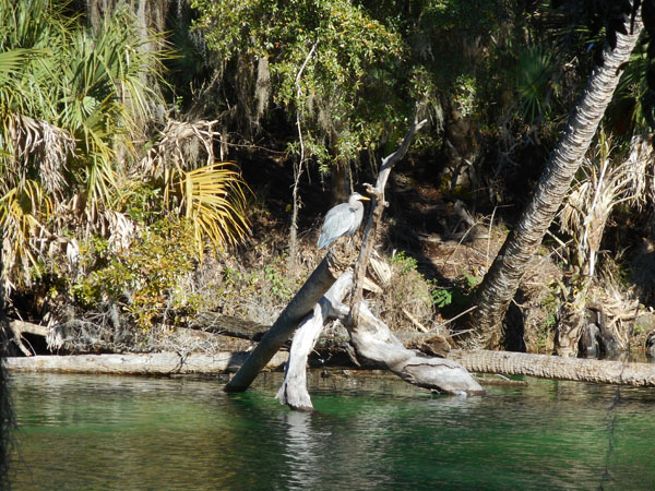
| A great blue heron flew in for lunch |
 |
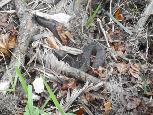
A fellow tourist-photographer pointed out a snake which he saw shedding its skin on the previous day: he said it hadn't moved much. (But it was gone the next day) |
 |
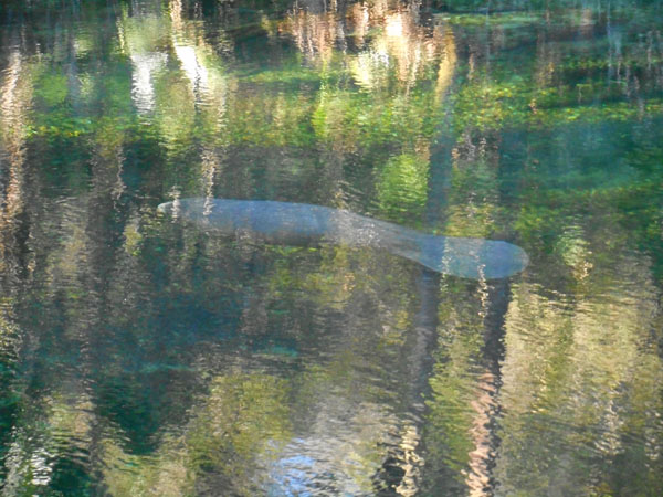
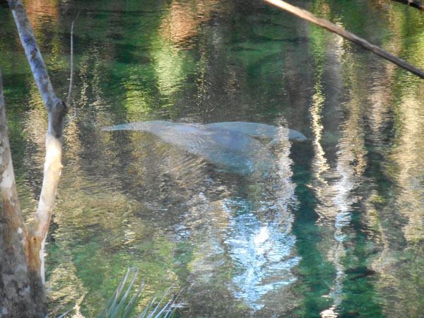
| But the area's main attraction for us was Manatees! During the winter they swim more than 100 miles up the St. Johns River from its mouth near Jacksonville to enjoy the warm (72 F) spring water. Due to the water's clarity, they were much more visible than our previous Merritt Island meeting. |
 |
| This one is easily ten feet long. |
 |
| Mother and pup. |
 |
| |
 |
| We left this peaceful and pretty park the next morning |
 |
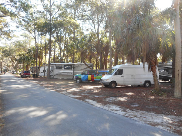
| ... and drove to Florida's west coast, near Tampa, to see our nieces. We ended up at St Pete's Beach and stayed at Fort De Soto County Park which some folks say is one of the prettiest in Florida. It certainly has large private camping spots. |
 |
| lots of birds: pelicans |
 |
| a woodpecker |
 |
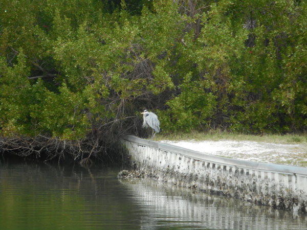
| great blue heron |
 |
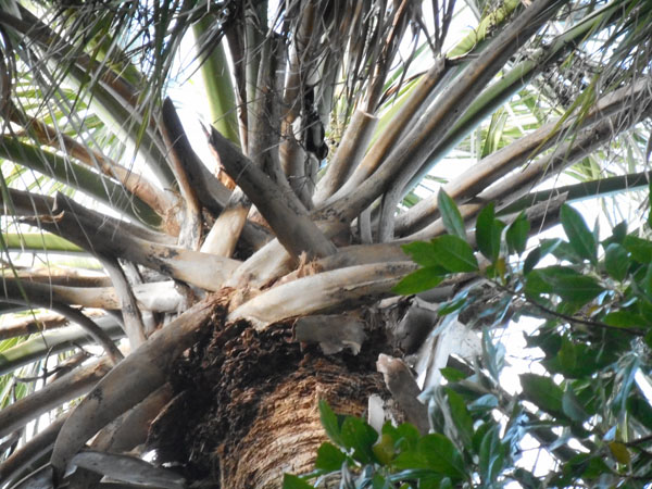
| fantastic trees |
 |
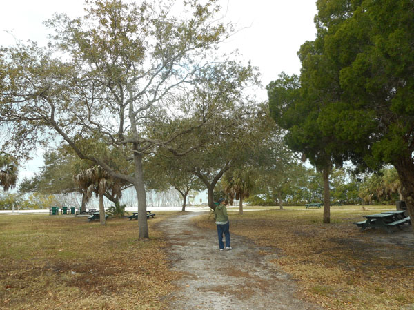
| (aforementioned child) |
 |
| and a fine beach for walking |
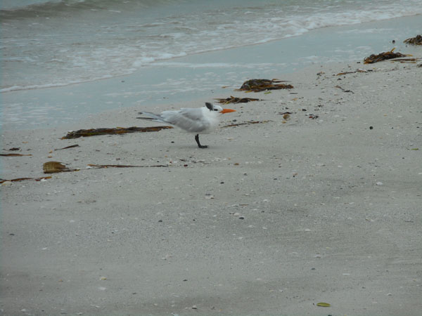
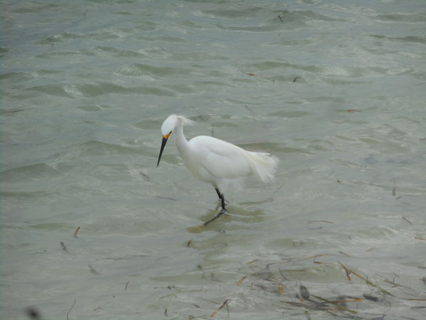
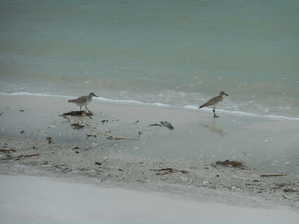
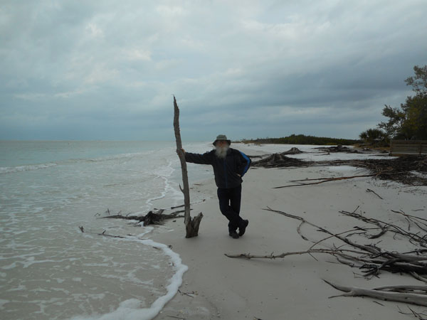 |
| with terns |
 |
| snowy egrets |
 |
| and other shorebirds |
 |
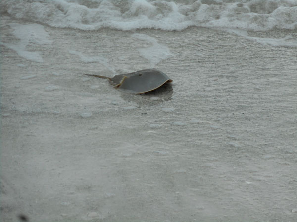
| even a horseshoe crab! |
 |
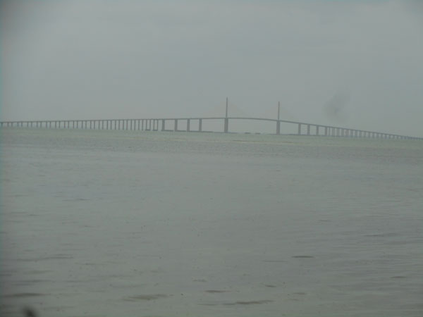
| In the morning we drove south across this bridge and took Interstate 75 back across the state towards Miami. |
 |
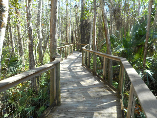
| Halfway across the state, we turned left onto state route 833 and took it into the Big Cypress Indian Reservation. We stopped at Ah-Tah-Thi-Ki, the Seminole Indian museum and nature walk for our first glimpse of the Everglades. The boardwalk was well signed with the name of the plants in Seminole and in English plus giving ethnobotanical info (i.e. how they fit into the native culture). |
 |
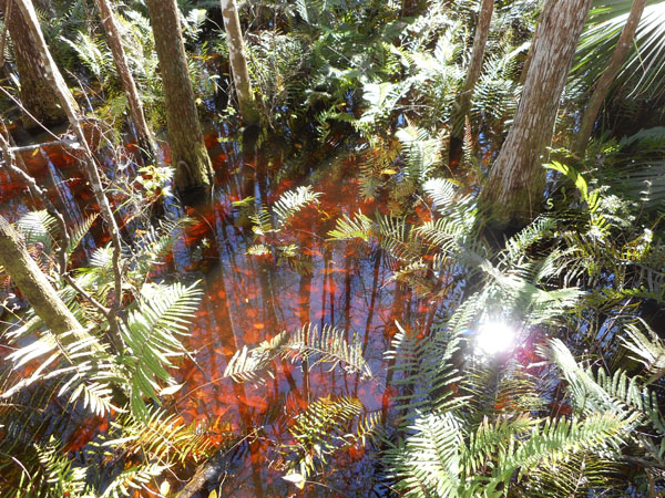
| The tannin-colored water contrasted very well with the diverse plant life. |
 |
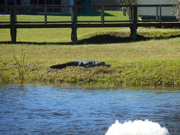
| As we left the museum we saw our first alligator lying next to this pond. He wasn't there when we'd gone in an hour earlier. |
 |